Mote of Mark, Dumfries
Glossaries
Glossaries [su_button url="https://brigantesnation.com/latin-roman-terms"]Latin (Roman) Terms[/su_button] [su_button url="https://brigantesnation.com/technical-terms"]Technical Terms[/su_button] [su_button url="https://brigantesnation.com/archaeological-terms"]Archaeological Glossary[/su_button]
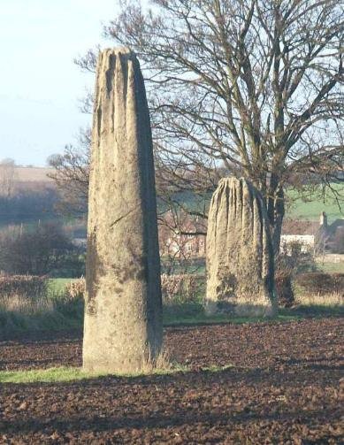
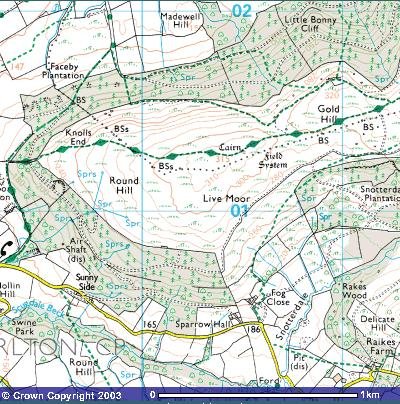
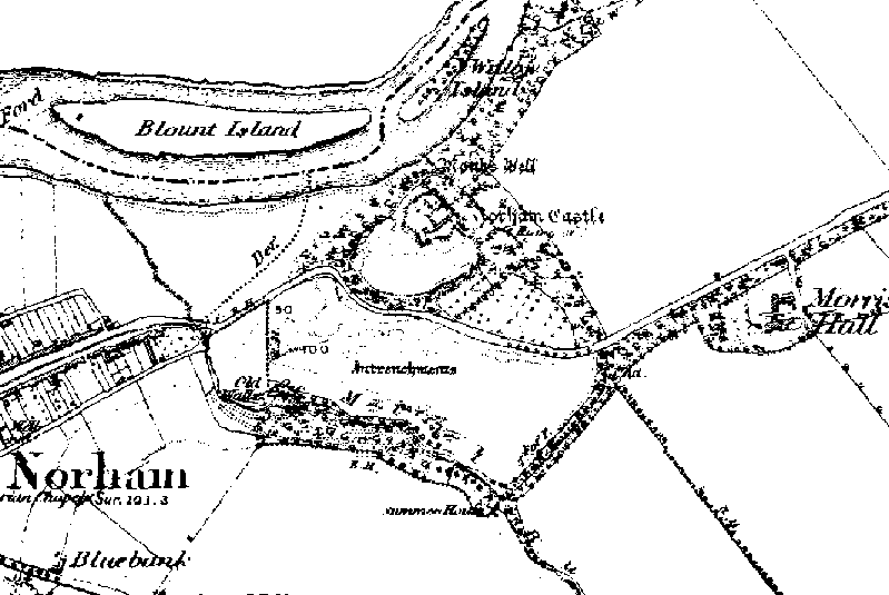
Norham, Northumberland
Norham Fort - Northumberland 1850 map showing the entrenchments recently 'discovered'. Iron Age ramparts unearthed Aug 7 2002 By The Read more
[caption id="" align="aligncenter" width="1024"]
“
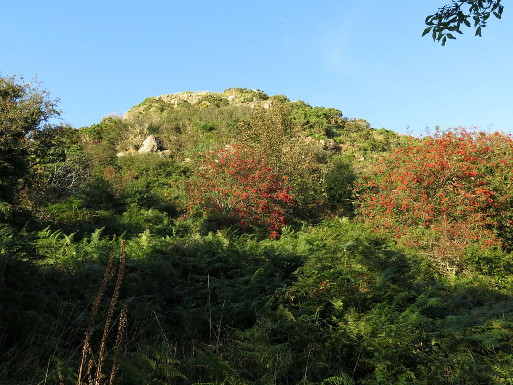
Mote of Mark from sea shore path – geograph.org.uk – 6273954” by
Andrew Curtis is licensed under
CC BY-SA 2.0
Mote of Mark – a Dark-Age citadel above Rough Firth
Setting & basic layout
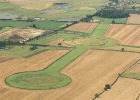
Located on a granite knoll (45 m OD) on the east shore of Rough Firth between Rockcliffe and Kippford, Dumfries-and-Galloway (NGR NX 845 540). The west and south faces drop almost sheer to the estuary; access is by a narrow neck on the north-east. (hillforts.arch.ox.ac.uk, Britain Express)
Defences – A single timber-laced stone rampart, c. 4 m thick, once ringed the 0.14 ha summit; most blocks were tumbled downslope after a fierce burning that fused parts of the core into green-black glass. A slighter outer bank and ditch skirt the easier north-east approach. No definite entrance has been located. (Canmore)
Chronicle of investigation
| Date |
Investigators & method |
What they added |
| 1755–1893 |
Roy’s Military Map, R. Riddell (1790) & J. Coles (1893) sketch-survey |
First published notice of a “vitrified fort”; rough plan and section. (hillforts.arch.ox.ac.uk) |
| 1913 |
Alexander O. Curle cut 13 trenches across rampart and interior |
Proved timber-lacing + vitrification; recovered continental glass, E-ware pottery, 400+ clay mould fragments, crucibles and high-status metalwork, revealing industrial activity. (journals.socantscot.org) |
| 1973 & 1979 |
Lloyd Laing & David Longley reopened Curle’s area and trenched the N & S walls |
Produced a full stratigraphic sequence, mapped rampart faces, identified five structural/occupational phases and sampled vitrified slag. (books.casematepublishing.com, hillforts.arch.ox.ac.uk) |
| 2006-13 |
Watching briefs, bracken-die-back surveys & UAV imagery (HES) |
Monitored erosion, located terrace platforms below the summit. (Canmore) |
| 2022 |
Publication of The Mote of Mark monograph |
Synthesised all finds, provided new scientific dating and specialist analyses. (books.casematepublishing.com) |
Key finds & specialist results
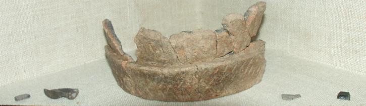
Imported table-wares – 55 sherds of Gaulish E-ware and two Late-Roman (LR 2) amphora fragments place peak occupation in the mid-6th century AD. (books.casematepublishing.com, Canmore)
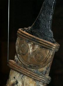
High-status craft debris – 482 clay mould fragments (Penannular brooches, enamel studs), crucible slag and bronze/iron off-cuts indicate on-site non-ferrous metal-working aimed at élite goods. (books.casematepublishing.com)
Glass & gaming pieces – Vessel shards from Frankish glass beakers and a bossed glass gaming counter underscore long-distance connections. (books.casematepublishing.com)
Animal bone & food waste – Dominance of cattle and high proportions of red-deer venison fit a short-lived, high-status residence rather than a farming hamlet. (books.casematepublishing.com)
Dating & historical horizon
Radiocarbon assays on rampart charcoal and occupation layers converge on c. AD 550–700; artefact typology agrees, framing the fort within the post-Roman kingdom of Rheged and the wider Irish-Sea trading zone. (hillforts.arch.ox.ac.uk, books.casematepublishing.com)
Why the Mote matters
 Classic vitrified wall south of the Clyde/Forth line – a laboratory for studying firing techniques beyond the better-known Highland forts. (Canmore)
Industrial powerhouse – unparalleled quantity of moulds and crucibles shows that prestigious metal-working was embedded inside a royal seat, not farmed out to satellite workshops. (journals.socantscot.org, books.casematepublishing.com)
Trade cross-roads – Imported wine amphorae, fine pottery and glass prove direct contact with Atlantic Gaul and the Mediterranean during Britain’s so-called “Dark Ages”. (Canmore, books.casematepublishing.com)
Tightly dated destruction – Coherent 6th-century radiocarbon suite plus vitrification raise the prospect that the fort was deliberately torched during early Northumbrian expansion. (hillforts.arch.ox.ac.uk)
Outstanding questions & research potential
| Issue |
Why it matters |
Next step |
| Who burned the rampart? |
Could link the fire to named conflicts in Historia Brittonum. |
Pair archaeomagnetic & micro-CT slag studies to refine burn episode. |
| Extent of craft zoning |
Interior still partly unexcavated. |
Targeted geophysics and micro-excavations in central hollow. |
| Outer terrace platforms |
Possible worker huts or later reuse? |
Coring & OSL dating of terrace fills. |
| Landscape integration |
How did the fort control estuary traffic? |
Viewshed & catchment modelling tied to LiDAR. |
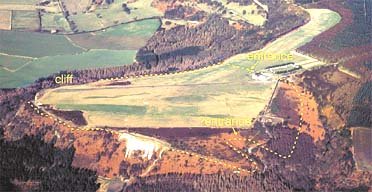
Vitrified Fort
The Mote of Mark is a defended hilltop overlooking the Urr estuary. It was the court or citadel of a powerful Dark Age chieftain, possibly one of the princes of Rheged. The site was occupied during the 6th century and appears to have been destroyed by fire in the 7th century.
The top of the hill was enclosed by a massive stone and timber rampart. Inside was a timber hall surrounded by a huddle of workshops and stables. This was a wealthy site with trading contacts across Europe. Finds from the excavations include glass beads and wine jars from central France and glassware from Germany. Local craftsmen produced elegant bronze jewellery in a distinctive Celtic style.
The tumbled remains of the ramparts can still be seen, and an on-site interpretation panel has an atmospheric reconstruction of the fort.
size: 8 ha (20a)
Legendary and Literary Background – https://panther.bsc.edu/~arthur/others.html
This fort was occupied from the 5th to 7th centuries, smack dab in the Arthurian time frame. At the pinnacle of its prominence, it was a well-fortified trading and manufacturing center. Excavations in 1913 and 1973 unearthed a large, circular timber hut and evidence of metalworking. These people seemed to have imported raw materials–iron from the Lake District and jet from York–to produce interlaced jewelry, brooches, and sundry metalwork. They imported luxuries as well–pottery from Bordeaux and glass from the Rhineland were found. Such prosperity suggests that this fort may have been the stronghold of a smaller British subkingdom.
The primary defences consisted of stone and timber walls, and there was a timber gate for the main entrance on the southern slopes. In the 7th century, though, these defences failed. The outer wall shows evidence of vitrification, a condition when extreme heat causes stones to fuse together. Many believe that this was the result of an attack by the Angles–Anglian runic inscriptions were found at the site–though some say that the walls were purposely vitrified to strengthen them.
The only thing truly connecting this fort with the Arthurian legend is the name, its period of occupation, and its proximity to Trusty’s Hill.