
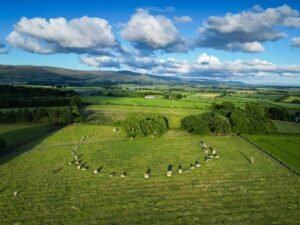
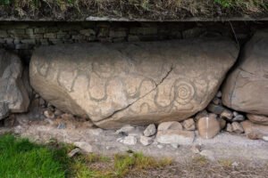
Long Meg and her Daughters is a remarkable Neolithic monument located near Penrith in Cumbria, England.
Long Meg and her Daughters is a remarkable Neolithic monument located near Penrith in Cumbria, England.
Jul 21
Syncretism through the ages Syncretism, the amalgamation of different religions, cultures, or schools of thought, has its roots in the ancient world. Thoughts on Celtic Religion – Raimund, Karl To begin with, lets first look at the sources available to us: There are quite numerous sources available, contrary to Read more Hillforts: Defence or Ritual? …
Jun 27

A gazetteer of probable prehistoric mounds, cairns and boundary earthworks in Coverdale. It is not complete and is still being researched.
Jun 16
Over the last five years Iron-Age specialists have been re-examining what British hillforts were really for. The question is no longer just “fortress or farm?” but whether many of them were built first and foremost as places of gathering, display and ritual.
Castle dykes it is a small class one henge, 90m across, perched on the high ground up in the North Yorkshire dales. The bank survives up to 1.5 m high in places, and the ditch up to 3 m deep. Early 20th-century reports (1908) noted its intact form, and recent LiDAR-based surveys have confirmed its classic henge profile with minimal later disturbance.
Jun 11
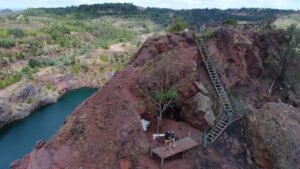
These are artificial hills made from the unwanted rock, shale and tailings that come up with coal, metal ore, stone or clay when it is being mined or quarried. Because extractive industry is both deep and long-lived, single collieries or pits can generate tens of millions of cubic metres of spoil; pushed out by locomotive, conveyor or tippler wagon and dumped in successive layers, the piles quickly become a distinctive landform.
Jun 10

Guide: Common Features of Iron Age Hillforts This article attempts to serve as a guide for many of the features of the hillforts found in Britain, in Read more Guide: Iron-Age minting: Ceramic Pellet-mould trays This article explores the most tangible evidence we possess for indigenous minting north of the Humber: the smashed ceramic “pellet-mould” …
Jun 10
A barrow is a mound of earth and/or stones raised over a grave or group of graves. Used from the Neolithic through to the Iron Age (roughly 4000 BCE to 500 CE), barrows were often constructed to honour elite individuals, such as tribal leaders, warriors, or chieftains. They are frequently found singly or in cemeteries known as barrow fields.
Jun 07
Synthetic-aperture radar (SAR) already relies on Doppler shifts: echoes from scatterers in a side-looking radar beam have slightly different frequencies as the platform flies past, and focusing those micro-shifts yields a two-dimensional image.
Jun 05

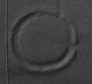
Archaeologists use the word “henge” for later-Neolithic and earliest Bronze-Age earthen rings whose ditch lies inside the bank, creating a deliberately bounded interior. The term itself was coined in 1932 by Kendrick; it was refined in the 1950s by Richard Atkinson, whose system still frames most discussion.
 NLS Map Explorer
 Google Earth
 Google Maps
 Lidar Finder
 TMA
TMA
 Megalithic Portal
 Yorkshire Arch. Air Mapping
 ADS
ADS
 Brigantian Adventure FB Group
Stone Bothering FB Group
Stone Faces FB Group
Brigantian Adventure FB Group
Stone Bothering FB Group
Stone Faces FB Group
 Heritage Gateway
 ARCHI® MAPS: UK
 Atlas of Hillforts
 Portable Antiquities
 British History Online
Brigantes Nation FB Group
British History Online
Brigantes Nation FB Group

