Contents
- 1 Hidden Remains
- 1.1 Introduction to Geophysics in Archaeology
- 1.2 Common Geophysical Methods Used in Archaeology
- 1.3 Advantages of Geophysics in Archaeology
- 1.4 Limitations of Geophysics
- 1.5 Key Resources and Further Reading
- 1.6 Field Markings
- 1.7 Crop marks
- 1.8 Soil marks
- 1.9 Shadow marks
- 1.10 Snow and frost marks
- 1.11 Parch marks
- 1.12 Wind marks
- 1.13 Spurious marks
Hidden Remains
Identification of features is simplified when the full extent of remains such as Earthworks, can be easily seen. However, once the roof has gone, the walls perished or robbed, the interior burnt and the wreck left to perish for hundreds of years, the remainder flattened and used as a field for crops, the job of recognition is made all the more difficult. Fortunately, even without specialist equipment, there are a number of techniques that can be used to shed further light on features under investigation.
Introduction to Geophysics in Archaeology
Geophysics in archaeology refers to the use of various non-invasive techniques to study the subsurface of archaeological sites. These techniques allow archaeologists to detect and map buried features, structures, and materials without the need for excavation. Geophysics is a vital tool for modern archaeological research as it helps create detailed maps of sites, offering insights into the layout and extent of buried remains.
Geophysical surveys have become increasingly important in recent years, with advancements in technology enabling more accurate and detailed surveys. The most commonly used methods include magnetometry, ground-penetrating radar (GPR), and resistivity surveys, each of which is best suited to different types of archaeological sites and objectives.
Common Geophysical Methods Used in Archaeology
- Magnetometry: This method measures variations in the Earth’s magnetic field caused by buried materials like iron-rich soils or fired clay. It’s particularly useful for locating features like kilns, hearths, or defensive ditches. Magnetometry can detect disturbances in the magnetic properties of soil, which often indicates human activity.
- Ground-Penetrating Radar (GPR): As described in detail on our GPR page, GPR is used to send high-frequency electromagnetic waves into the ground. The waves are reflected back to the surface by subsurface features, providing detailed images of the underground structure. This method is invaluable for identifying walls, caves, burials, and other structures.
- Resistivity: Resistivity surveys measure the electrical resistance of the soil, which can vary depending on the moisture content, soil type, and the presence of materials such as stone or wood. This method is particularly useful for detecting features like buried foundations, pits, and walls.
Advantages of Geophysics in Archaeology
- Non-invasive: Geophysical methods allow researchers to map archaeological features without disturbing the site, ensuring that no physical evidence is lost in the process.
- Cost-effective: Compared to excavation, geophysics is a more affordable way to survey large areas and gain detailed insights.
- Time-efficient: It allows for the rapid identification of areas worth excavating, helping to prioritize efforts and avoid unnecessary excavation of areas that are not archaeologically significant.
- High-resolution data: Geophysics provides high-quality, detailed information about buried structures, making it easier to understand the layout of ancient sites and the spatial relationships between features.
Limitations of Geophysics
- Soil conditions: The success of geophysical surveys can be affected by soil conditions. Very wet or very dry soil can reduce the accuracy of some methods, especially resistivity and magnetometry.
- Depth limitations: While geophysical methods can provide detailed surface data, they can struggle to detect deeper features or those buried under very thick deposits of soil.
- Interpretation: While geophysics can help identify features, the data is not always conclusive. The interpretation of results often requires experience and knowledge of the local context to avoid false positives.
Key Resources and Further Reading
- Geophysical Survey Methods in Archaeology
- Magnetometry and Its Use in Archaeology
- Ground-Penetrating Radar in Archaeology: Case Studies
Field Markings
Ray Selkirk
Old foundations of walls are often found buried, gods creatures as well as the elements can accumulate a lot of soil, given the right ground conditions. The rate of burial will differ in open country to that in towns, where each generation flattens buildings and starts again on top of the rubble, the ancient habitation-layers can be twenty or thirty feet below the modem surface.
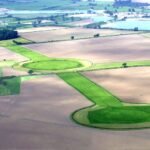
It is well known that under certain conditions, tell-tale marks manifest themselves in open country and if viewed from above, the shapes of these marks often reveal the location and identity of buried features. These give-away marks can be seen as differential colouring of vegetation above buried features (crop marks); white-outlined shapes produced by a thin dusting of snow collecting in slight hollows, or drifting along ridges (Snow marks); shapes visible in bare ground where the farmer has filled in an old ditch with a different coloured soil (soil marks); and shadowy shapes produced by low angle sunlight outlining undulations almost imperceptible at ground level (shadow marks).
These manifestations were observed long before the development of aeroplanes: about 1740, the antiquarian, William Stukeley was ridiculed when he said that from a hilltop, he could see the distinctive shape of a Roman temple in a field of corn. Pioneer balloonists also reported similar sightings but it was not until the tremendous expansion of aviation in the 1914-18 World War that serious notice was taken of the phenomena. The various types of marks are explained as follows:
Crop marks
For crop marks to show, two conditions must be met. Firstly, the right type of crop must be planted in the field which contains the hidden archaeological site (cereal crops give the best results by far), and secondly, a drought or period of dry weather be experienced. The ancient peoples were enthusiastic ditch-diggers and even though infilled, these deep cuttings in the subsoil retain water, and during dry weather, the roots of a cereal easily penetrate the loose infill with the result that the crop over the ditch grows taller, thicker and of a deeper shade of green. This is known as a “positive crop mark.” Where the hard subsoil has not been disturbed, the crop’s roots reach the level of the subsoil and stop, resulting in a uniform shade of medium green.
Over old foundations or road metalling, the crop grows stunted and of a yellow-
green colour. This is a “negative crop mark.” When a cereal crop is ripe, the positive crop mark is still visible as a deeper gold colour and the negative mark as a more watery yellow.
What Stukeley had seen from his hilltop was the crop mark of a Roman temple. About the same period, negative crop marks were reported in France over the ploughed-out remains of circular burial mounds. On these, plant growth was sparse and they were known locally in northern France as danses defees (fairy dances).
Even after the crop is harvested, the thick growth over the infilled ditch can be seen as a deeper colour in the remaining stubble and a suitable name for this would be a “stubble mark.” Crop marks can show up in plants other than cereals, such as peas and beans or sugar beet, but the contrasting marks in these, and other crops are much inferior to those produced by wheat, oats and barley.
Soil marks
These marks are useful in winter and do not rely on a combination of cereal crops and a drought. Quite often, when a farmer has infilled an old ditch, the soil he has used is of a different colour and is easily visible from an elevated position. Sites which show-up as soil marks in bare fields in winter invariably produce crop marks in the other seasons if the right conditions are met.
Shadow marks
Many fields are in permanent pasture and have not been cultivated for hundreds of years or even longer. If the surface of such a field contains very slight undulations such as the last remnants of ancient earthworks and ditches, these may be invisible to the observer at ground level, but when viewed from an aircraft in low-angle sunlight in early morning or late evening and especially in winter and spring when the grass is short and the Sun’s altitude small, the shape of the whole habitation appears as if by magic. One side of the almost flattened Earthwork is highlighted and the other is in shadow. The almost invisible ditch likewise has one side highlighted with the other in shadow. Thus the whole shape of the site is revealed.
The marks show best when viewed from above, down-sun of the site, so surrounding hills would be an advantage, more determined searches for shadow marks done by air should be conducted with the aircraft being flown in a series of advancing circles.
The British archaeologist Sir Leonard Woolley (1880-1960), who excavated Ur in 1922-9 had been attempting earlier to locate an ancient Egyptian cemetery below the Second Cataract of the Nile near Wadi Haifa. This site had eluded Sir Leonard and the expedition leader, D R Maclver. but one evening, after a hard day’s search, the two men climbed a hill to view the sunset. In the low-angled sunlight, strange circles, invisible at ground level, appeared at the base of the hill. As Sir Leonard descended, the circles disappeared, but Maclver, who had remained behind was able to direct him to the positions with hand signals. Sir Leonard marked them with small Cairns. Next day, workers excavated the marked positions and found a tomb at every one.
When crop mark conditions are present, the corn or barley grows higher over the infilled ditch and in low-angle sunlight, this casts a shadow, and an excellent combination of crop marks and shadow marks is obtained.
During the nineteenth century, soldiers who had served at Gibraltar said that when they looked from the top of the rock, towards the Spanish border to the north, they could see the remains of the old Spanish lines which were invisible at ground level.
Snow and frost marks
Snow marks are rather like shadow marks etched with a white paint brush. Faint traces of earthworks are necessary, and in a light dusting of snow, the ditch is painted with a bright white band. A bank, even a slight one, causes drifting, and a combination of snow marks and low-angle-sun shadow marks can produce a most striking result.
Heavy snow obliterates all signs of the site. During the thaw, the snow remains in the ditch long after the remainder of the field is clear. Possibly the latter would be better called “melt marks.” Closely related to melt marks are “frost marks”: when a field is covered with frost, ancient stonework below ground level retains heat better than the surrounding soil and the line of the foundation is revealed by the absence of frost, and shows as a dark line.
Parch marks
Crop marks do not normally show up in grassland, but during a period of hot dry weather, lawns and pastures which hide buried roads or stone foundations, reveal their secrets when the grass above the stonework or metalling becomes scorched and turns brown.
Plant marks
Some wild flowers and weeds like to grow over old stonework, and quite often, a field with a buried line of stone develops a prominent line of flowering weeds above invisible foundations. Poppies have an affinity for wetter infilled ditches outside the ramparts of Iron Age British hillforts.
Similarly, nettles like highly fertile, deep soil and have a tendency to cluster in ditch fillings and locations rich in nutrients, such as waste sites and areas with large amounts of buried decaying wood. In moorland areas the difference in soil depth can be easily seen as heather gives way to ferns.
Trees can also be good indicators, many boundaries have been lined with thorn trees since Iron Age times, the presence of these can sometimes help confirm earlier boundaries, in some cases, the enclosure walls of hillforts may have been lined with thorn. One tree – the Yew can be particularly useful in dating a site, this is an extremely long lived tree, which also has highly poisonous leaves. It is reckoned that for every foot around it’s girth a Yew may have lived 30-40 years. Another adage is that it grows a bough for every thousand years.
Wind marks
When positive crop marks are present, the cereal growth above the ditch is higher than that over the rest of the field. Strong winds can strike the projecting tops, and the end result is that the corn is flattened along the lines of the ditches.
Spurious marks
Where horses or goats have been tethered, they may have grazed circles of grass which can look like the marks of Iron Age huts when viewed from an aircraft.
Circular bands of dark grass caused by fungi (fairy rings) can also look like the marks left by ancient rondavels.
A straight track of stunted grass across a field need not be evidence of an ancient road. It may be an animal path, the cattle having been kept in a straight line by a thin electrified wire, invisible to the airborne searcher.


