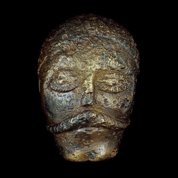
Many Celtic deities seem to have been associated with aspects of nature and worshipped in sacred groves. Some appear in Read more
Archaeology Techniques
Ground Penetrating Radar (GPR)
Ground Penetrating Radar (GPR) is a variation on conventional radar, rather than into the air, a radio signal is directed into the soil and this is reflected by underground structural variations. It can be very good at detecting the structures of buried masonry structures as well as pits and in some cases artefacts.
Radar was famously developed for military purposes during world war two, and has been adapted for a variety of other purposes, including location of defects in concrete structures. GPR has proven very useful to archaeology where there are voids and substantial deeply-stratified masonry remains. It is particularly valuable on urban sites, ditches, cave structures, ancient mines or large landscape features such as dry river channels, but it is generally of less use in the softer and more finely-differentiated types of deposit encountered on many rural archaeological sites.
Description
High frequency pulsed electromagnetic waves (generally 10 MHz to 2,000 MHz) are used to provide information on buried features and remains. The wave energy is directed into the ground is reflected back to the surface from the edges of the features being scanned. The echoed signals are collected by the GPR equipment and the resulting data can be interpreted to show a map of the buried features and artefacts. The resolution of the scan and the depth of penetration vary depending on the wavelength used.
Integration of the GPR data with other surface geophysical methods, such as seismic, resistivity, or electromagnetic methods can provide a detailed map of the buried features, and a skilled interpreter can often conclude the exact size, nature and composition of the archaeological feature prior to excavation.
Increasingly, archaeological investigations use a combination of geophysical methods to improve the overall accuracy of the survey. Ground penetrating radar is a widely accepted technology for characterizing and imaging subsurface conditions.
Operation
A GPR survey is carried out by pulling a radar scanner across the ground, typically on a wheeled trolley. Readings are taken across a survey grid and then downloaded and plotted.
GPR uses high frequency pulsed electromagnetic waves typically from 10 MHz to 2,000 MHz. The electromagnetic wave is radiated from a transmitting antenna which is generally placed in direct contact with the ground and is designed to focus all the waves into the ground. The waves travel through earth at a rate which is determined by its electrical properties. The wave spreads out and travels downward, if it hits a buried object or change in soil composition, then part of the wave is reflected back to the surface, the extent of the reflection is proportional to the change in electrical characteristics of the buried materials. The rest and the wave energy continues to travel downward, further reflections may be generated as other objects or boundaries are passed through.
The wave reflection is captured by the GPS antenna, and can be recorded on a storage device for later interpretation. Often, the GPR data is one shown as signal versus amplitude, and is referred to as a trace. A single GPR trace consists of the transmitted energy pulse followed by pulses that are received from reflected waves, these are known as layers. A scan is a trace where a colour or grey scale has been applied to the amplitude. As the antenna(s) are moved along the survey line, a series of traces or scans are collected at discrete points along the line. These scans are positioned side by side to form an underground display profile.
GPR Components
GPR equipment consists of a radar control unit, transmit and receive antennas, and a suitable data storage device. The radar control unit generates trigger pulses to the transmitter and receiver electronics in the antennas. These pulses allow the antenna electronics to generate a sampled waveform of the reflected radar pulses.
The transmit antenna generates the pulsed wave and directs it into the ground, the receive antenna picks up the reflected pulses and passes these back to the control unit, which converts this information into signals suitable for logging.
Use of a specific antenna is determined by the required results. A GPR will normally come with a range of antenna, which allow for a range of frequencies to be used, typically these will range from 10 to 2000 MHz. Higher frequency means better resolution, but with more significant electromagnetic wave attenuation in the environment, resulting in lower sounding depth; and vice versa – lower frequency may lead to a larger Penetration Depth at the sacrifice of poorer resolution. Lower frequency operation produces larger initial insensitivity area (“blind” zone) of a GPS.
Comparison of frequencies used and typical responses
Frequency range
2 GHz
900 MHz
500 MHz
300 MHz
150 MHz
75 MHz
38 MHz
Resolution, m
0.06-0.1
0.2
0.5
1.0
1.0
2.0
4.0
“Blind” zone, m
0.08
0.1-0.2
0.25-0.5
0.5-1.0
1.0
2.0
4.0
Depth, m
1.5-2
3-5
7-10
10-15
7-10
10-15
15-30
GPR systems are digital devices and logging is done with digital devices for post survey analysis. Many data loggers also come with display electronics and allow in the field data manipulation. Often this is done with a laptop computer. In order to display the data for interpretation, it must first be filtered to remove noise, it is normal to store the raw data so that a variety of filter options can be tried later.
Operating Modes
The most common way of using a GPR as the reflection profiling method. Here, a radar wave is transmitted, received and recorded each time the antenna has been moved a fixed distance across the ground. It should be noted that GPR can also be used on other surfaces such as water.
Another way of using GPR is in three-dimensional operation, which collects data samples at closer intervals of less than 1 meter. This result in very large amounts of data which can be manipulated to three dimensional model of the survey area.
Transillumination is a rare but sometimes effective way of using GPR, it involves placing the transmitter and receiver on opposite sides of the material to be surveyed and can provide very accurate measurements of mines and other shafts.
Data Display and Interpretation
Three buried objects in a two dimensional display
In order for the correct interpretation of underground features it is essential that the data is displayed in a way that easily facilitates this. There are three of displaying the results of a GPR survey – 1) a one-dimensional trace, 2) a two dimensional cross-section, and 3) a three-dimensional display.
One-dimensional traces
The wiggle trace (or scan) is the building block of all GPR survey data. A single trace can be used to detect objects (and determine their depth) underground. By moving the GPR antenna over the ground and recording traces at a fixed spacing, a recording of several sections is obtained.
Two-dimensional cross sections
Wiggle trace displays are often impractical to display due to the number of traces required to make up meaningful data and scan displays have become the standard form of two dimensional display of GPR data. A scan display is created by assigning a colour to amplitudes displayed on the trace.
Three-dimensional displays
Three dimensional displays are created when the GPR traces are recorded at different positions ground surface. Data can be recorded along profile lines, in the case of continuous recording, or at discrete points along the surface in fixed-mode recording. Once 3D block views have been produced, they can be observed from a variety of viewpoints and ways, including solid block or block slices.
Creating a good three dimensional view is a very useful way of analysing the results of a GPR survey, but takes the most processing power and time. Careful choice of colour coding scheme and noise filtering is an important part of the image generation process.
A Late Medieval cast copper-alloy casket key dating to c.1200-1500.Sub-circular bow with a circular 7.4mm aperture, integral with an oval cross-section stem. The stem is solid apart from the tip that is hollow to a depth [...]
A Roman silver siliqua of Constantius II dating to AD 355-364 (Reece period 18). VOTIS XXX MVLTIS XXXX reverse type depicting the legend within a wreath, Mint of Arelatum. As Hoxne 84; RIC VIII 261/91. [...]
A silver threepence of Elizabeth I (1558 to 1603), second coinage and dated to 157(8?), with plain cross initial mark. London Tower mint. As North vol2, (1991) No. 1998. [...]
A silver medieval halfgroat of Henry VII (1485-1509), martlet initial mark dating to 1501-1509. Archiepiscopal mint of Archbishop Savage at York. As North 1714. [...]
A Iron Age silver "concave square" minim of the Regini and Atrebates / Southern region, possibly attributable to Tincomarus and dating to 50-20 BC. Obverse: square with concave sides, central pellet in ring. Reverse: annulet horse [...]
A probably Late Medieval to Post Medieval copper-alloy dagger or sword scabbard chape probably dating to c.1400-1650. Fabricated from copper-alloy 0.6mm sheet, rolled into a cone shape with an untidy/irregular seam at the rear, and an [...]
A post Medieval cast copper alloy discoidal 1/4oz trade weight. The weight has a upstanding rim enclosing a recessed upper surface bearing stamps of a crowned W for William III (1694-1702). [...]
A post-Medieval silver threepence of Elizabeth I (1558-1603). Second issue (1561-1582), probably portcullis initial mark and dated 1566 on the coin. London Tower mint. As North (1991) no. 1998. [...]
A complete silver Scottish twelve shillings coin of James VI of Scotland and I of England, eighth coinage post-dating accession to English throne, dating to 1603-1625, Lys initial mark. Reverse has a shield with arms of [...]
A silver Post-Medieval shilling of Elizabeth I, third issue with ‘A’ initial mark dating to 1583-1585. Mint of London. As North Vol 2, p.136, no.2014. [...]
A lead alloy pipe tamper dating to the 17th century. The plate has moulded decoration to both sides depicting Charles I (facing right) and Henrietta Maria of France (facing left). Both images are contained in [...]
A damaged lead-alloy Medieval pilgrim's ampulla, 50mm in length and 35mm wide, with a round bodied flask with a flaring open top which is partially complete. One side of the flask body has traces of moulded [...]
An incomplete Medieval cast copper alloy buckle plate, dating to c. AD 1100-1400. The plate is missing its buckle and part of its sprues. The buckle plate is sub-rectangular in plan. Projecting from one long edge [...]
A Roman copper-alloy nummus of the House of Valentinian , dating to AD 364-7 (Reece Period 19), GLORIA RO-MANORVM reverse type depicting the emperor with right hand dragging captive right and holding a labarum in left hand. Mint of [...]
A Post-Medieval copper alloy farthing of Charles I (AD 1625-1649), dating to AD 1636-1644. Rose type 2, with sceptres in saltire through single crown. Mint of London. Unclear initial mark. North (1991: 165) no. 2291. [...]
A clipped and heavily worn Roman copper alloy nummus of Gratian (AD 367-383) dating to the period AD 367-378 (Reece period 19). SECURITAS REI PUBLICAE reverse type depicting Victory advancing left, holding a wreath and palm. Unknown mint. [...]
A silver Roman siliqua of Honorius (AD 393-423) dating to the period AD 397-402 (Reece Period 21) minted in Milan VIRTVS ROMANORVM reverse type depicting Roma seated left on cuirass, holding Victory on globe and spear. Hoxne, p. 145, no. [...]
Fragment from a rectangular or trapezoidal buckle frame dating to the Post Medieval period (c.AD 1350-1700). The fragment consists of a corner and a short section of one side of the frame and a short section of [...]


")


