Roulston Scar, North Yorkshire
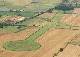
Handout photo of Roulston Scar Fort, North Yorkshire, one of the biggest prehistoric hillforts ever found in Britain, which was unearthed by archaeologists at a popular beauty spot. The defences surround the entire promontory (some 24 hectares or 60 acres) making it the largest and strongest prehistoric enclosure in Yorkshire. The monument at Sutton Bank, near Thirsk, North Yorkshire, is thought to have been surrounded by 1.3 mile long rampart, topped with a walkway and to date back to about 400BC. The fort, which is built against a steep escarpment giving it views for miles across the Vale of York, was discovered by English Heritage archaeologists who spent this summer surveying the site. See PA story HERITAGE Fort. Photo: Crown Copyright
Glossaries
Glossaries [su_button url="https://brigantesnation.com/latin-roman-terms"]Latin (Roman) Terms[/su_button] [su_button url="https://brigantesnation.com/technical-terms"]Technical Terms[/su_button] [su_button url="https://brigantesnation.com/archaeological-terms"]Archaeological Glossary[/su_button]
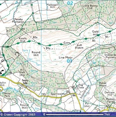
Mote of Mark, Dumfries
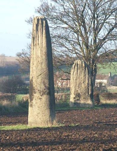
The Devil's Arrows - BoroughBridge Introduction This Bronze Age site comprises of three large standing stones, it is thought originally Read more
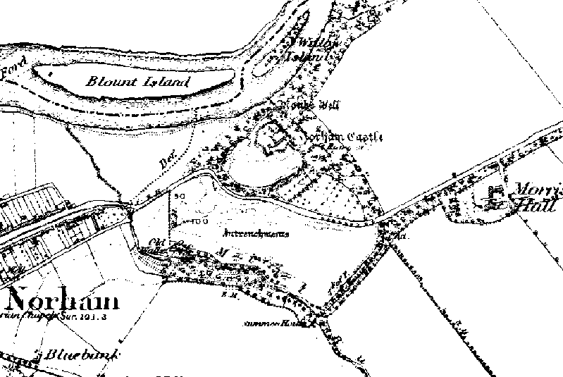
Norham, Northumberland
Norham Fort - Northumberland 1850 map showing the entrenchments recently 'discovered'. Iron Age ramparts unearthed Aug 7 2002 By The Read more
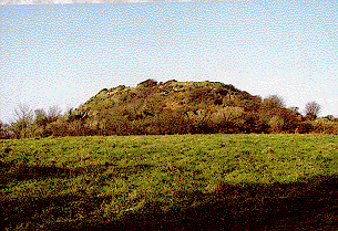
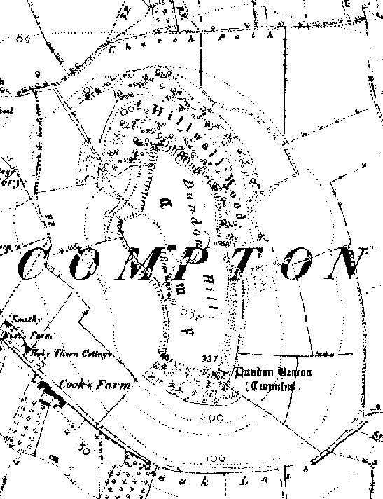
Roulston Scar – Thirsk
[caption id="attachment_1150" align="aligncenter" width="372"]
Handout photo of Roulston Scar Fort, North Yorkshire, one of the biggest prehistoric hillforts ever found in Britain, which was unearthed by archaeologists at a popular beauty spot. The defences surround the entire promontory (some 24 hectares or 60 acres) making it the largest and strongest prehistoric enclosure in Yorkshire. The monument at Sutton Bank, near Thirsk, North Yorkshire, is thought to have been surrounded by 1.3 mile long rampart, topped with a walkway and to date back to about 400BC. The fort, which is built against a steep escarpment giving it views for miles across the Vale of York, was discovered by English Heritage archaeologists who spent this summer surveying the site. See PA story HERITAGE Fort. Photo: Crown Copyright
“”We were shocked to discover such a huge complex,” said Alastair Oswald, archaeological field investigator for English Heritage. Preliminary examinations of the remains suggest it was more than twice the size of most other prehistoric strongholds. Built of Timber palisades and girdled by a 1.3 mile circuit of ramparts, 60 per cent of which are cut out of solid Limestone, the fort has been provisionally dated at 400BC.
As well as its defensive function, archaeologists think it may have been a “statement of power”, possibly housing the Iron Age equivalent of a regional assembly. “Such a large fort would have taken a vast amount of timber and labour to build, which poses many more intriguing questions,” said Mr Oswald. The fortress must have taken several years – and more than 10,000 cubic metres of earth and rock, and 3,000 trees – to build, but nobody seems to have lived there for any length of time. Most hillforts were more akin to fortified villages or walled towns, often with substantial permanent populations.

The evidence so far from Roulston Scar suggest it never was a permanent settlement.
Roulston’s colourful history has been one reason for the fort’s elusiveness; the famous White Horse of Kilburn, carved in the chalk, obliterated a stretch of rampart with its head.” – English Heritage press statement 2000.

Roulston Scar hill fort was ‘lost’ temporarily by an error on an OS map, here is the 1850’s map entry.
Roulston Scar is of a size almost comparable to Stanwick. Its apparent short period of use also adds to the notion that it was built by Venutius as part of his anti Roman defences. If this were to be assumed then the possibility that it served a part of an overall defensive system in conjuction with Cleave Dyke and possibly Boltby Scar would immediately spring to mind.
However, the cleave dyke system is complex and definately multi-period. There is immediately another explanation for this fort if it is taken in relationship with Casten Dykes and Double Dykes, which oppose each other and tend to suggest a localised tribal conflict, especially with the fort of Studford Ring – immediately to the south east of the Double Dykes.
Giant Prehistoric Hillfort Discovered at Sutton Bank
A chance discovery by the National Park has led to a major archaeological investigation in partnership with English Heritage: the new research and fieldwork have revealed that the whole plateau at Roulston Scar was once occupied by a massive hillfort believed to date back to around 400BC. Covering an area of 60 acres and defended by a perimeter 1.3 miles long, this is the largest Iron Age fort of its kind in the north of England and one of the top 20 in size in the whole country.
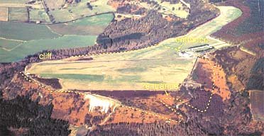
Located on the western boundary of the North York Moors National Park, near Thirsk, the site occupies a naturally strong position, defended to the west, south-west and south-east by cliffs or steep valley sides and commands breathtaking views over the Vale of York and further afield to the Yorkshire Dales. The fort encloses much of the promontory currently occupied by the Yorkshire Gliding Club. Part of its southern defences were unknowingly cut through in 1857 by construction of the famous Kilburn White Horse.
Suspicions that a hill fort existed on the site date back to the mid-19thcentury, when the Ordnance Survey mapped a short stretch of Earthworks. These came to be understood as a defence which cut off the promontory of land to the south but interpretation was confused by their supposed association with a nearby boundary (Casten Dyke South), now thought likely to be of much later origin.
Detailed examination by English Heritage field investigators of the humps and bumps visible to the naked eye on the surface identified a series of ancient ditches and banks, together with an artificial steepening of the natural Scarp, extending much further than anyone had previously thought, around the full circuit of the promontory. Some stretches of the defences survive to a height of nearly three metres. The team from English Heritage have used Global Positioning equipment to map the traces they have found.
Hill forts are uncommon in Yorkshire, so it was a particular surprise to discover such a huge complex. Over the years there had been tantalising clues that such a monument existed but until recently no-one had carried out a comprehensive survey to settle the question. It is thought possible that the fort was constructed by the Brigantes or Parisi tribes, perhaps as much as a statement of power than as a defensive bastion or temporary refuge in times of trouble. Such a large fort would have taken a vast amount of labour to build, together with vast quantities of timber, which poses further intriguing questions about social organisation as well as purpose.
Excavations in 1969 and 1970 had previously indicated that the main northern Earthwork comprised a two metre deep trench and a “box rampart” – fronted by a timber palisade, thought to be up to four metres high, and topped by a defended walkway. The survey has now traced the full extent of the remainder of the defensive circuit which consists of scarps, created by steepening the natural slope around the edge of the promontory, fronted by a ditch with a low outer bank. Originally it is thought that this perimeter would have been surmounted by a timber palisade. Entrances are thought to have existed in the centre of the main northern rampart and also in the south-eastern corner of the fort, where the defences turn in on themselves – a place marked by a series of later trackways and close to the line of the present road.

Roulston Scar Ramparts
“The largest and strongest of NE Yorks. Promontory forts, Roulston Scar enclosed about 53 acres. In places its rampart, which cuts of the spur to the SW, still stands 11ft. high. There is a ditch on the NE side. Air photo’s show that the E end of the rampart continues SE, along the side of the valley in the quarter. This appears, on the ground, as a terrace. Not dated.” Guide to Prehistoric England, Nicholas Thomas, 1960.