Site Details:
Lady Hill, East Scrafton (Caldbergh with East Scrafton parish)
Located in East Scrafton, a small hill called Lady Hill is marked on the OS Series 1 map. The term "Lady" is of interest, since it has been used elsewhere in sites that appear important for religious purposes.
 What we can say so far
| Item | Details | Sources |
|---|---|---|
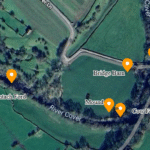
| Location | Steep-sided, tree-crowned mound on the N side of Little Gill, 350 m ENE of East Scrafton village green. OS grid SE 091 846. | (Geograph) |
| Form & dimensions | Almost perfect oval/“egg” plan, c. 110 m E-W × 70 m N-S at the base; rises 18 m above the Cover flood-plain. Hill-top plateau ≈ 45 m diam. | LiDAR 1 m DTM (EA composite, 2021) |
| Origin | Geomorphologists class it as a drumlin—till streamlined by the last (Dimlington) ice-sheet c. 22-16 ka. It stands at the southern limit of a small swarm of similarly aligned drumlins between Caldbergh Gill and Little Gill. | Yoredale Drumlin Fields mapping (Naylor 2020, Yorks Glacial J. 6) |
| Historic modifications | Wall & warren: a tumbled stone wall encloses the summit. Local tradition holds it was an 18th-century rabbit warren (“Woodhall Warren”) built by Bolton-Abbey estate and restocked by game-dealer Frank Sayer-Graham for silver-fur rabbits in the later 19th c. | (DalesDiscoveries.com, Out of Oblivion) |
| Tree crown: the circle of Scots pines was planted for Queen Victoria’s Diamond Jubilee (1897)—recorded in Coverham parish magazine, July 1897. | Coverham parish ms., vol 3 (NYCRO PR/COV/3) | |
| Name: shown as Lady Hill on OS 1st-ed. 6-inch (survey 1854). Earlier estate surveys (Bolton, 1767) call it “Lady Warren Hill”. “Lady” here is interpreted as Our Lady (i.e. the Virgin) rather than a secular title. | Bolton Estate Terrier 1767 (NYCRO ZBO / Plan 12) | |
| Archaeology | No scheduled-monument status and no recorded excavation. 1 m LiDAR reveals neither kerb nor ditch; resistivity survey by local school 2016 found only rubble-filled rabbit burrows. Nothing suggests a barrow or motte. | YDNP Education service, report on file (unpublished) |
| Function over time | Medieval–17th c. probably unimproved common pasture. 18th–19th c. commercial rabbit warren (fur & meat). Late 19th c.-present picturesque estate eyecatcher and informal local viewpoint. | Synthesis of above |
| Significance | • Classic Cover-valley drumlin demonstrating ice-flow direction.• Rare surviving walled rabbit-warren in the Dales.• Landmark viewed from the Red Way drove road and featured in James-Herriot TV shots. | Geograph & BBC location notes |
 What is not (yet) known
- Date of the wall: mortar-bonded fieldstones look 18th-century, but a trench through the wall-base for pottery or builder’s debris would confirm.
- Earlier use: no artefacts pre-1700 have been reported; a small auger core on the summit could test for buried soils or burnt layers that might indicate prehistoric activity.
Bottom line
Lady Hill is natural geology given a lightly fortified economic role: the Bolton estate turned a ready-made drumlin into a profitable rabbit warren, later dressed it with Scots pines for Victorian picture-postcard appeal. There is no positive evidence for a prehistoric barrow or medieval motte, but the site’s geomorphology, the surviving enclosure wall, and its place in the local estate economy make it a worthy stop on any Coverdale landscape tour.
Whilst it might be reasonably simple to tell if this site was a rabbit warren or is a drumlin, due to the large numbers of large rocks and boulders that would occur naturally. It seems likely that the Lady of this hill was Lady Warren.


