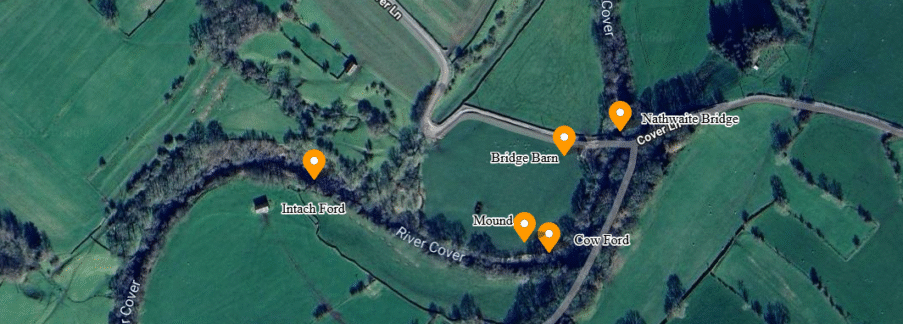
Nathwaite Bridge, over the river Cover in Coverdale, is just about the only way any heavy traffic can easily cross between the key villages of Carltonand West Scrafton. The importance of the location is perhaps underlined as the last place down the river Cover where it remains reasonably ford-able, and therefore crossable in past times when no closer bridge existed.
The purpose of this article is to expand on this observation, and understand more about how this location was used in past times, as we try to shed some light on Coverdale’s past.
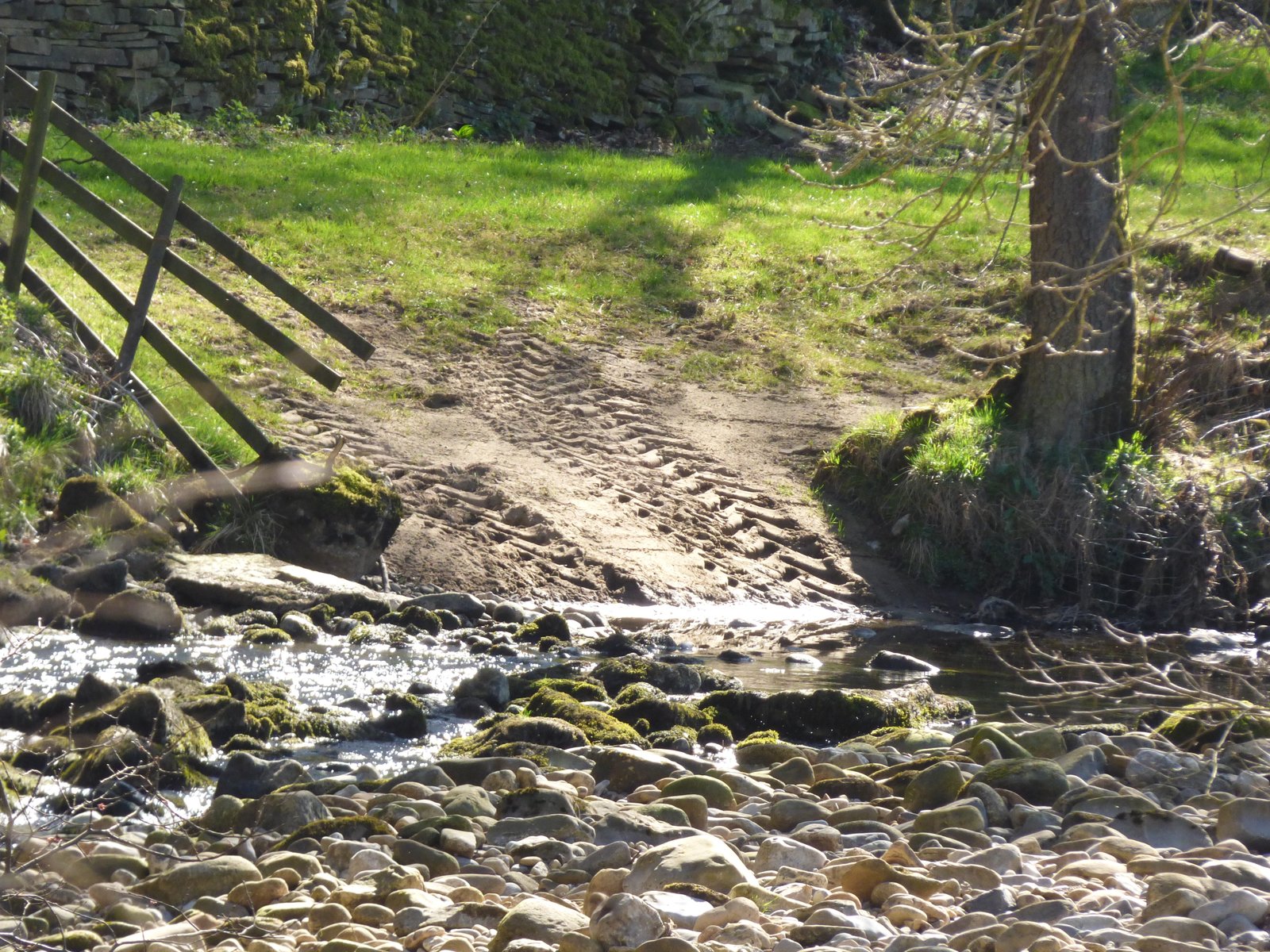
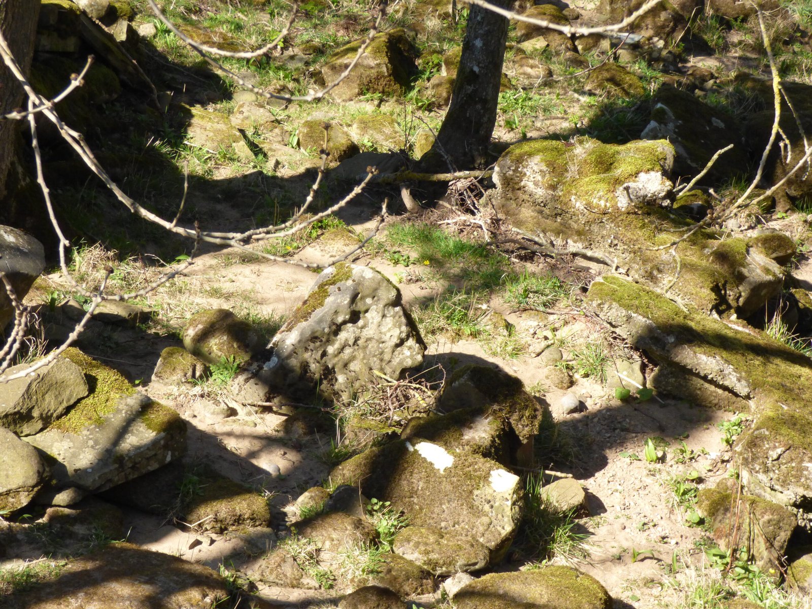
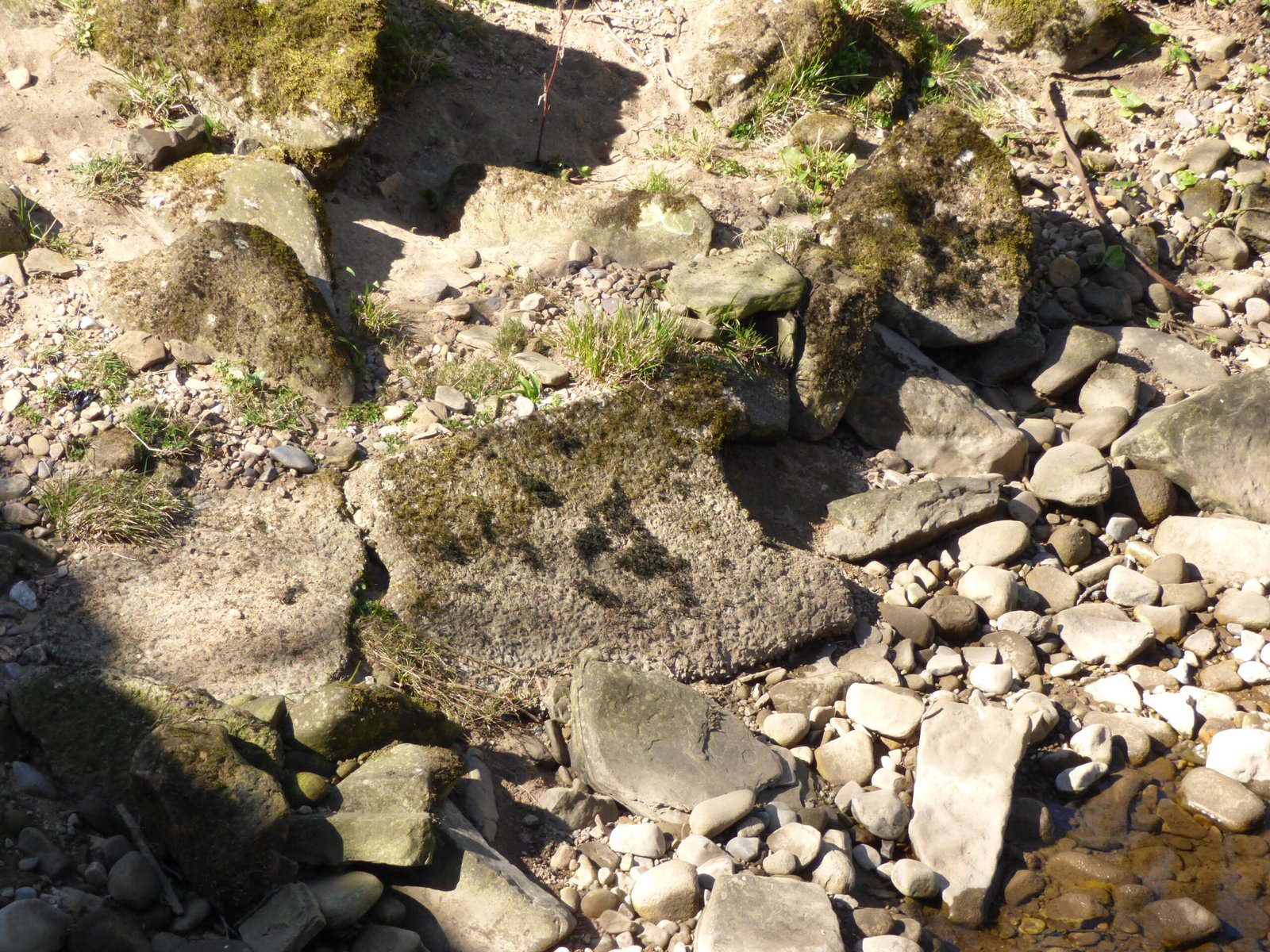
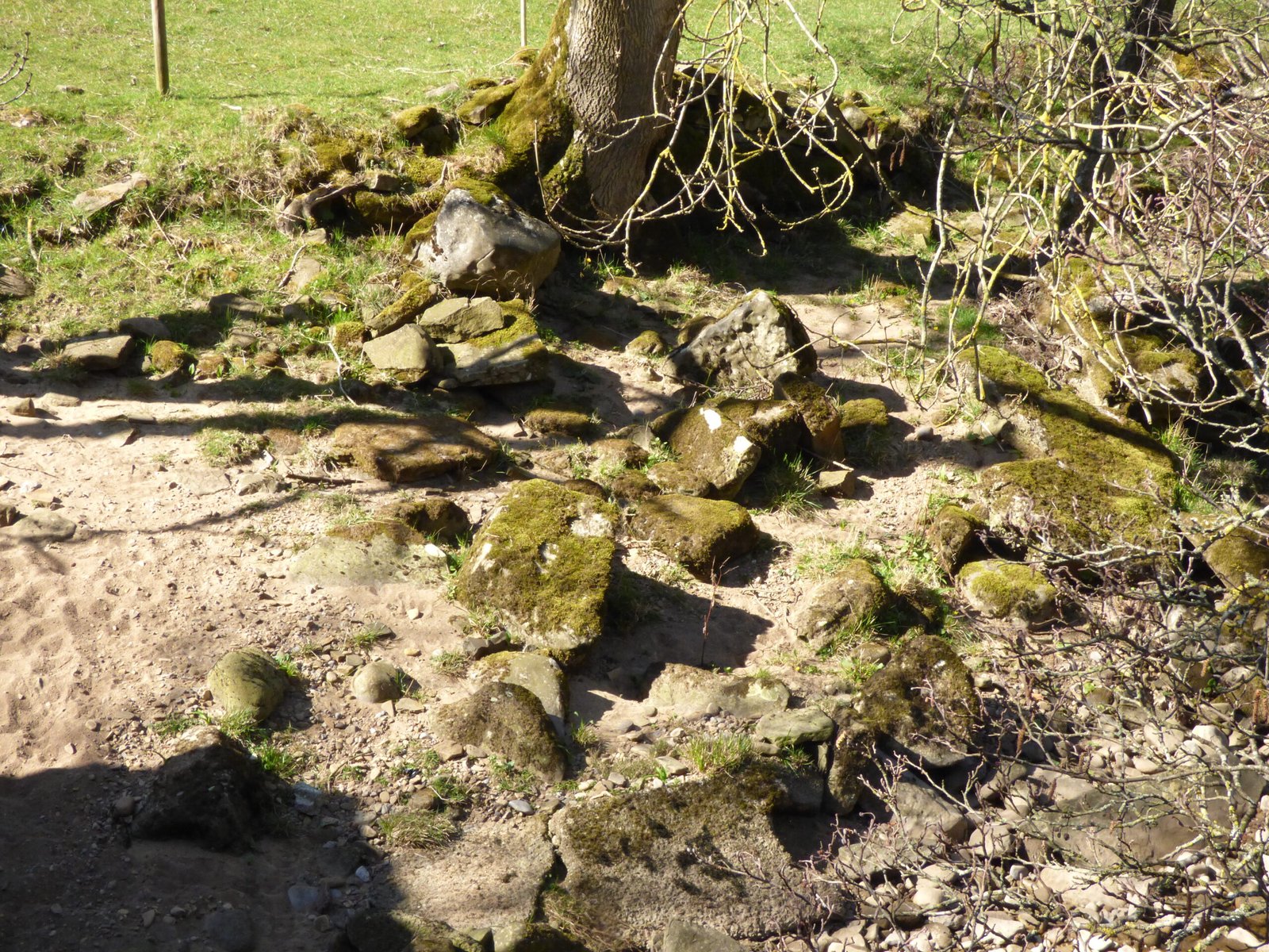
Cow Ford
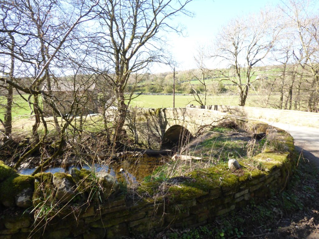
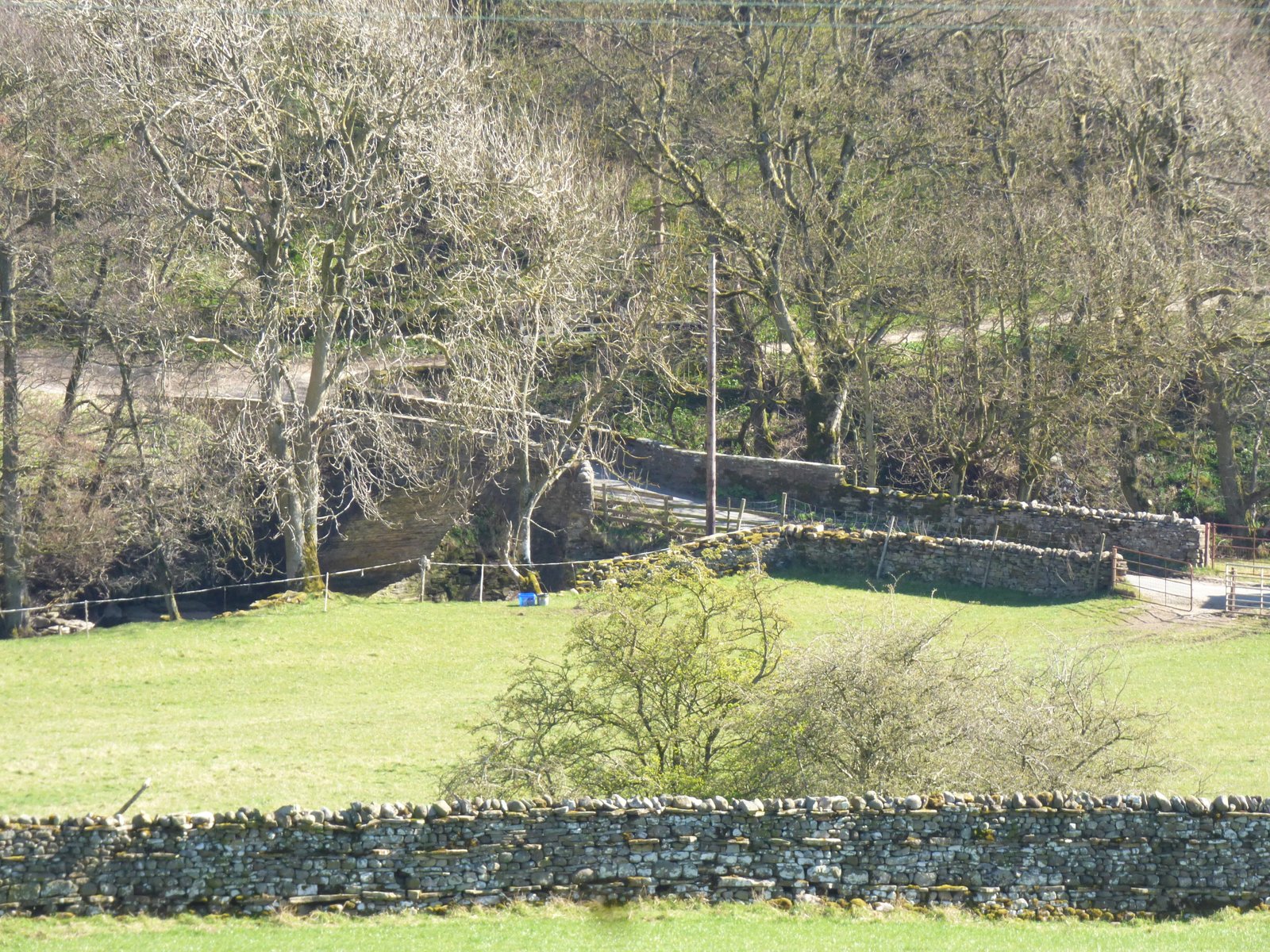
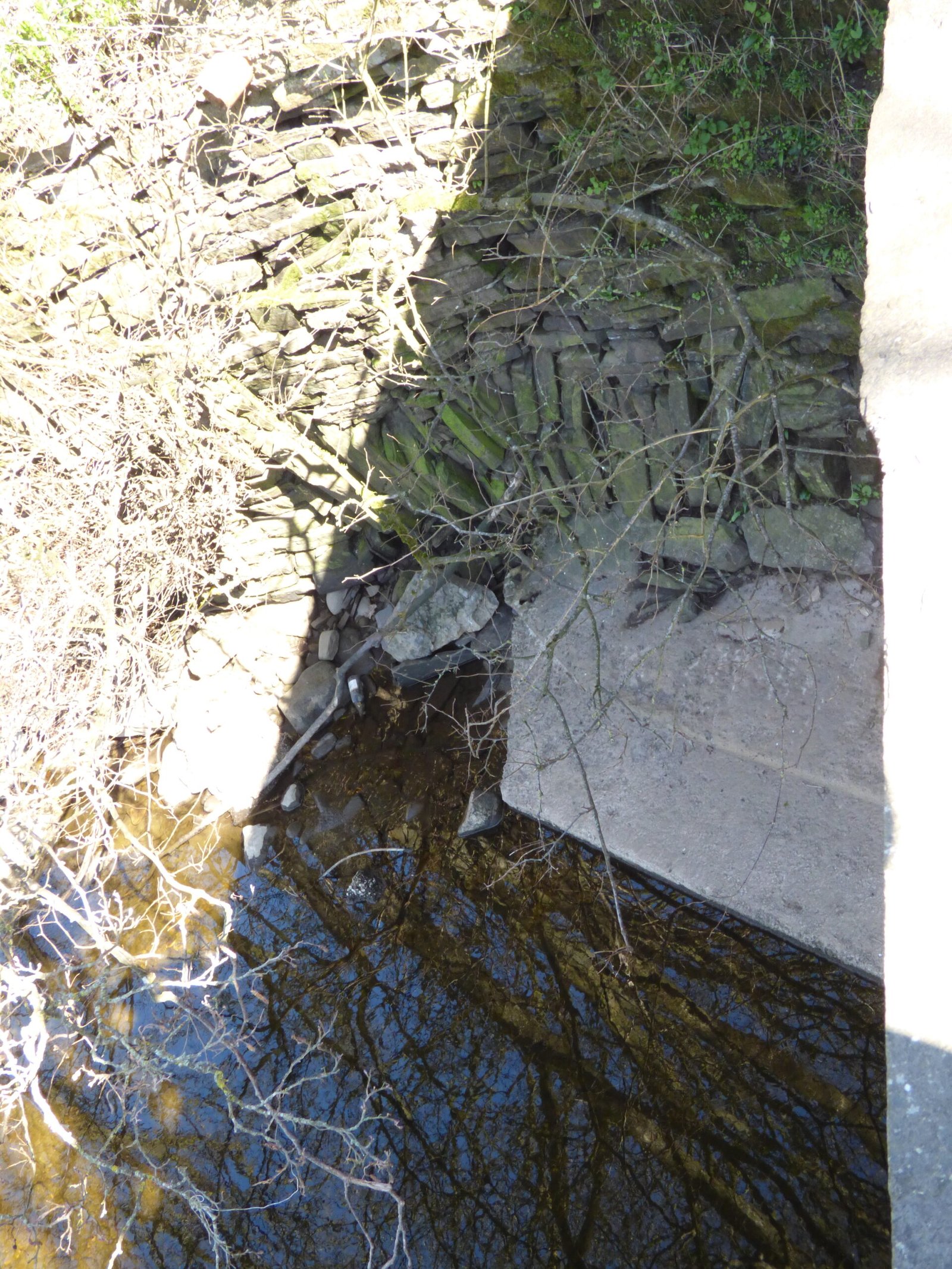
Nathwaite Bridge
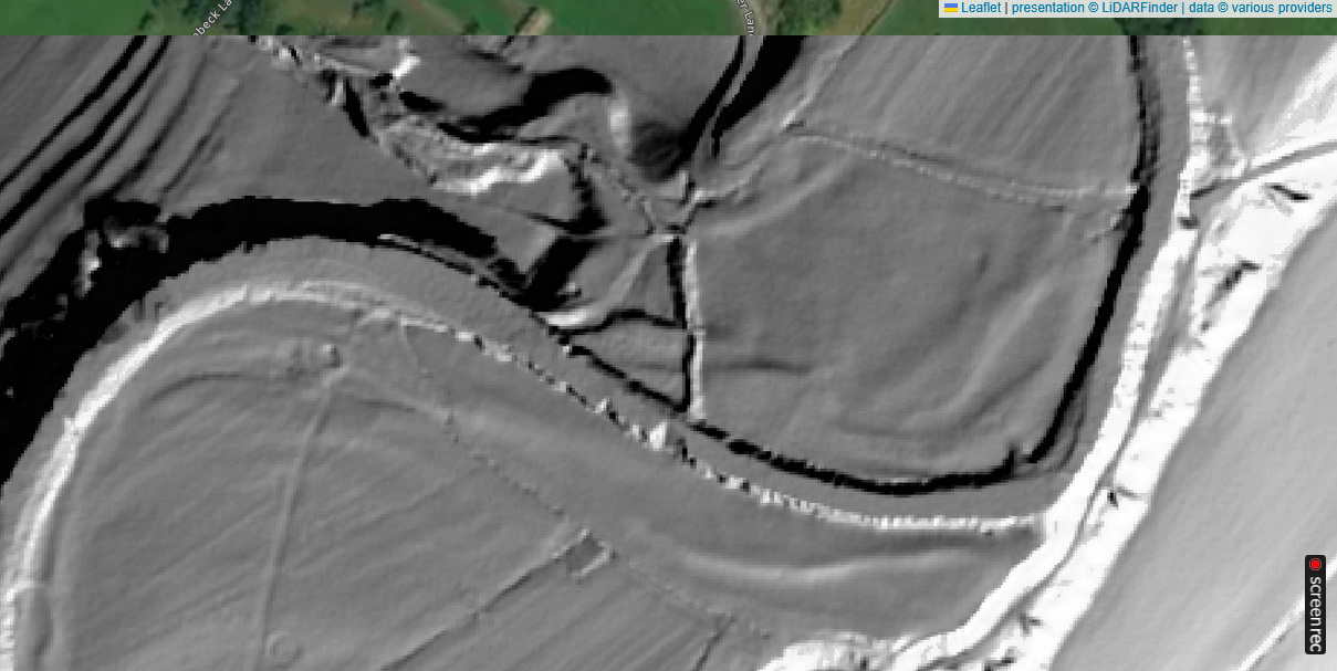
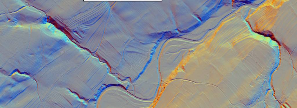
Fords and River crossings at Nathwaite Bridge Coverdale – LiDARFinder
Do two neighbouring fords make sense on the River Cover?
On a small, fast-rising moorland river such as the Cover, usable fords are rare, seasonal and highly localised. Having two riffle-crossings within a single hay-meadow actually follows the logic of dale hydrology and land-use.
Hydrological factor
Coverdale reality
Consequence for ford siting
Bedrock & riffle formation
The Cover cuts down through gently dipping Yoredale limestones and Shales. Where a tough Grit or Limestone band outcrops, the river develops a shallow “riffle” with a stony pavement only 10–30 cm deep in moderate flow.
Fords can be opened only where such natural steps occur; in the kilometre around Nathwaite Bridge there are just two continuous Limestone pavements, hence two viable fords.
Flash-flood regime
Winter Spate flows (> 25 m³ s⁻¹) after snow-melt or frontal rain make the river waist-deep and unfordable for days. Base-flow in late spring–summer drops below 1 m³ s⁻¹, exposing the riffles.
Fording season naturally shrinks to late April – early November in an average year. Once frosts return, cattle are yarded and coal is sledged or carted over the bridge instead.
Flood-plain topography
The north bank carries a relict terrace; south bank meadows are flatter and liable to winter inundation. A ford must start and end on ground high enough to stay above moderate Spates.
Only the two riffles near Bridge Barn have compatible landing slopes on both banks; elsewhere, steep or marshy banks prohibit exit.
Human routing logic
Medieval Pack-horse routes aimed for the straightest line up-dale, accepting a seasonal ford rather than detouring for a bridge. Once a masonry bridge was funded (late 18th c.), carts used it year-round, but the fords still served livestock and, briefly, mining spoil-carts (upper ford).
The coexistence of a bridge and two “legacy” fords reflects different traffic classes and seasons, rather than redundant duplication.
River Crossings at Nathwaite Bridge. LiDAR image showing wider area. – National Library of Scotland
Seasonality in practice
Pack-horse era (pre-c. 1800) – Coal or wool trains timed river crossings for late spring through early autumn; in winter the same goods were sledged along frost-hardened field lanes or stored until levels fell.
Bridge era (post-1800) – Wheeled lime, coal and produce carts concentrated on Nathwaite Bridge, but stock still used the fords when drifting between intakes or when a swollen beck made the bridge approaches boggy.
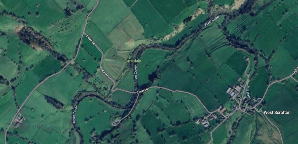
Nathwaite Bridge – Wider Satellite view – Google Maps
Why no more fords upstream or downstream?
Upstream, the valley narrows, and bedrock steps are buried beneath deeper pools—no suitable pavement for fording until Arkleside (4 km west).
Downstream, the Cover enters confined, limestone-gorge sections where banks are 3–4 m high; the next natural crossing is Cover Bridge (mason-arch, 17th c.).
Bottom line
In upland dales, a ford is a singular hydrological gift—a shallow, stony riffle aligned with firm banks on both sides. If two such spots lie within the same meadow, people will exploit both: one may specialise for livestock or ad-hoc industrial haulage (the “cow ford”), the other evolve into a permanent bridge once year-round wheeled traffic demands it. Outside those sweet-spots the Cover is either too deep, too fast, or bordered by soft alluvium, explaining the long gap to the next crossing upstream or downstream.
Questions regarding the age of Nathwaite Bridge
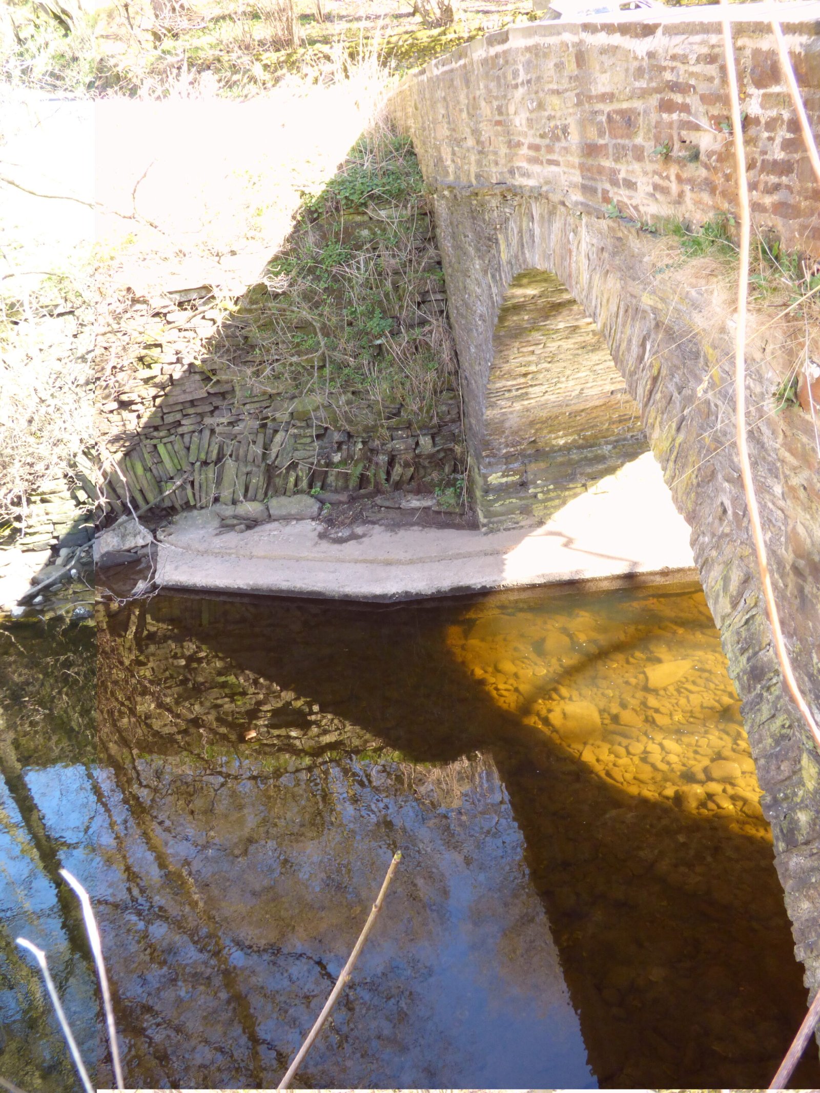
In regard to Nathwaite bridge, we have visited it, and can see the site is quite complex, with signs of earlier construction, some of which seems to be older than the current build date for the bridge. That needs to be proven, of course. But, given the seasonality of fords, there is still the possibility of an earlier, now forgotten bridge here. Given the presumed need for communications between Carlton and West Scrafton, it makes sense that there would be at least one permanent river crossing between the two villages.
Could Nathwaite have hosted an earlier bridge?
Everything we can see on the ground—and what is not on the early maps—keeps that option alive:
Field observation (2025 visit)
What it may mean
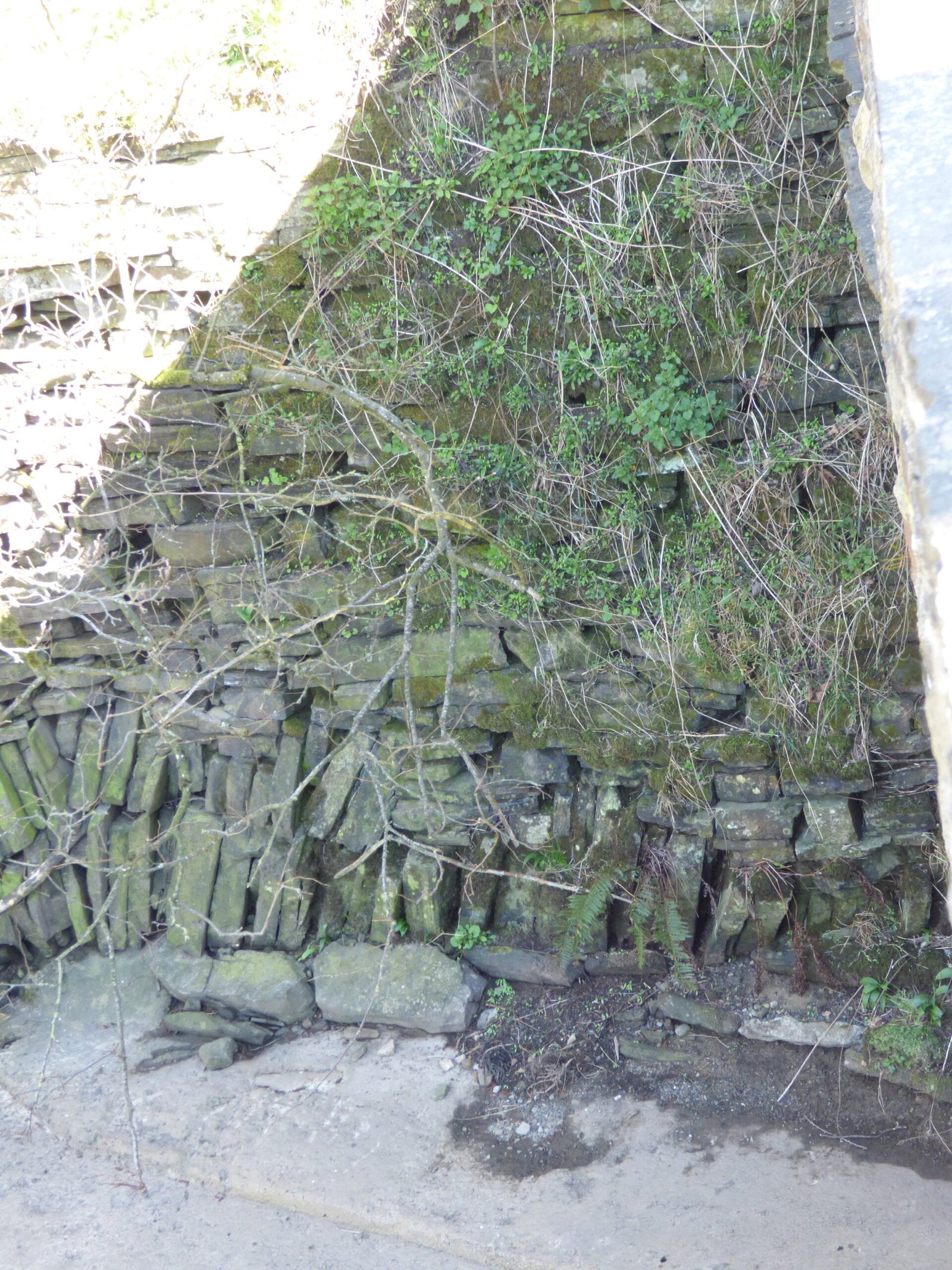
A second masonry footing 0.8 m upstream of the present arch, built of roughly tooled blocks markedly darker than the main bridge fabric.
Could be the south-west abutment of an earlier span robbed for stone when the extant bridge went up c. 1790–1800. Its coursing and tooling look more 17th-century than late-Georgian.
A flat, rubble-packed causeway (now grassed) leading from the north bank directly to that footing, not to the modern arch.
Suggests a historic approach road on a slightly different line—more consistent with pack-horse or footbridge alignment.
Rounded orthostats lying in the riverbed 3–4 m downstream.
These water-worn slabs could be the kerb stones of a timber trestle or clapper bridge that collapsed and was swept just downstream.
No obvious full-height wing walls on the modern bridge; instead a butt-return of older fabric keyed in behind the later parapet.
Builders of the late-Georgian bridge may have tied into an existing medieval/post-medieval abutment rather than starting from scratch.
Why a bridge here makes historical sense
Cross-dale traffic nexus – Carlton (monastic grange, later Bolton Abbey estate centre) and West Scrafton (copyhold township) exchanged stock, cheese and coal daily. A permanent crossing would shorten the 5 km detour via Cover Bridge.
Seasonal unreliability of fords – The Cover’s winter spates regularly exceed 0.8 m depth; anything more than knee-deep is unsafe for laden pack animals. Medieval estate accounts for many Yorkshire dales show timber footbridges erected on primary routes decades—even centuries—before stone arches were affordable.
Parish boundary quirks – The field south of Nathwaite is in Carlton township; just across the bridge you are already in West Scrafton. Parish vestry minutes often note joint responsibility for “wood briggs” at township boundaries—exactly what might once have stood here.
What would prove (or disprove) an earlier bridge?
Line of enquiry
Specific steps
Archival
Search Coverham Priory cartularies and Bolton estate survey (1606, 1633) for “wooden brig” / “Carlton brig” / repair payments.
Inspect Carlton & West Scrafton vestry minutes (NYCRO PR/CAR 1; PR/SCF 2) for bridge levies before c. 1790.– Check Quarter-Sessions road orders (Q/SR and Q/RUM series) for petitions to replace a decayed timber bridge with stone.
Map regression
Bolster the OS chain with the 1766 Jeffrey’s county map (lacks bridge symbol) and the 1771 Richard Davis map (sometimes notes “wooden bridge”).
Compare tithe sketches (1845) to identify approach-road realignments.
Fabric analysis
Record masonry breaks, tooling styles, mortar types; sample the darker “older” blocks for lime-mortar dating (optical-stimulated luminescence or radiocarbon on charcoal inclusions).
Where river scour allows, lift one of the slab “orthostats” and saw a thin section: saw-marks vs. axe-dressing will indicate early post-medieval stone-masonry.
Sub-surface survey
Two or three hand-auger transects on the north approach causeway: if a timber still lies buried, oak posts can be dendro-dated.
Side-scan sonar or dredging transect in the shallow riffle: look for iron dogs, wrought clamps or mortised sill beams.
Place-name & field-name evidence
“Bridge close,” “Briggs Gill,” or “Wood brig Meadow” in estate rentals would pre-date the masonry arch.
Carlton tithe already calls the parcel Ford Intack; earlier rentals might call it Bridge Intack if a timber foot-bridge stood there first.
Precedents elsewhere in the Dales
Lost timber bridge, later replaced by stone
Documentary & field evidence
Crackpot Footbridge (Swaledale)
Lease of 1601 mentions “wood brigge” at Rake’s Dyke ford; stone arch built 1814; LiDAR revealed embanked track to earlier footing.
Kettlewell Upper Bridge (Wharfedale)
1625 verdict for sharing repair of “woode brig”; OS 1st-ed shows stone arch (still standing); downstream spoil reveals oak sill beam tree-ring dated to 1582 ± 10 yrs.
These parallels strengthen the hypothesis that Nathwaite once hosted a timber foot- or pack-bridge, later upgraded when estate and Turnpike capital converged in the late 18th century.
Working conclusion
Yes, a forgotten bridge is plausible: the non-aligned causeway, older masonry fabric and seasonal logic all point toward an earlier timber structure.
Proving it will require a blend of map regression, archival trawl, mortar dating, dendrochronology and sub-river probing—feasible, low-budget techniques that have paid off elsewhere in the Dales.
Whatever the result, that enquiry will refine your traffic-flow model and help explain why two seasonal fords and a late-Georgian arch coexist within a single hay-meadow bend of the River Cover.
A complete silver Scottish twelve shillings coin of James VI of Scotland and I of England, eighth coinage post-dating accession to English throne, dating to 1603-1625, Lys initial mark. Reverse has a shield with arms of [...]
A silver Post-Medieval shilling of Elizabeth I, third issue with ‘A’ initial mark dating to 1583-1585. Mint of London. As North Vol 2, p.136, no.2014. [...]
A lead alloy pipe tamper dating to the 17th century. The plate has moulded decoration to both sides depicting Charles I (facing right) and Henrietta Maria of France (facing left). Both images are contained in [...]
A damaged lead-alloy Medieval pilgrim's ampulla, 50mm in length and 35mm wide, with a round bodied flask with a flaring open top which is partially complete. One side of the flask body has traces of moulded [...]
An incomplete Medieval cast copper alloy buckle plate, dating to c. AD 1100-1400. The plate is missing its buckle and part of its sprues. The buckle plate is sub-rectangular in plan. Projecting from one long edge [...]
A Roman copper-alloy nummus of the House of Valentinian , dating to AD 364-7 (Reece Period 19), GLORIA RO-MANORVM reverse type depicting the emperor with right hand dragging captive right and holding a labarum in left hand. Mint of [...]
A Post-Medieval copper alloy farthing of Charles I (AD 1625-1649), dating to AD 1636-1644. Rose type 2, with sceptres in saltire through single crown. Mint of London. Unclear initial mark. North (1991: 165) no. 2291. [...]
A clipped and heavily worn Roman copper alloy nummus of Gratian (AD 367-383) dating to the period AD 367-378 (Reece period 19). SECURITAS REI PUBLICAE reverse type depicting Victory advancing left, holding a wreath and palm. Unknown mint. [...]
A silver Roman siliqua of Honorius (AD 393-423) dating to the period AD 397-402 (Reece Period 21) minted in Milan VIRTVS ROMANORVM reverse type depicting Roma seated left on cuirass, holding Victory on globe and spear. Hoxne, p. 145, no. [...]
An incomplete Roman composite plate brooch probably dating to AD 100-200. The brooch is missing it's pin and part of the top and bottom circles. The brooch is flat in cross section and probably originally consisted of [...]
Fragment from a probable buckle frame dating to the Post Medieval period (c.AD 1720-1790). The fragment is broadly rectangular in plan and includes a short section of the corner of the buckle frame. The fragment includes the [...]
Fragment from a buckle frame dating to the Post Medieval period (c.AD 1720-1790). The fragment is broadly C shaped in plan and D shaped in profile. It consists of two corners and one side of a sub-rectangular [...]
A complete copper alloy bovine (bull's head) vessel / bucket mount, dating to the Roman period (c. AD 50-200).The cast copper alloy mount is a sub-inverted triangle with a pointed lower tip and slightly waisted sides to form the nose.The [...]
An incomplete copper-alloy early Medieval stirrup strap mount of uncertain or unclassified type, dating to c.AD 1050-1150. The central part of the object survives with parts of the open work broken off on all sides except [...]
A near complete Medieval-Post Medieval cast copper alloy buckle with integrated plate dating to the period c.AD 1250-1500. The buckle is missing its pin.It has a rectangular frame, which has a sub rectangular cross-section. The integral plate has [...]
A very worn copper-alloy Roman radiate or nummus of unclear ruler dating to AD 260-402. Unclear reverse type, unclear mint.The coin is chipped around its circumference. [...]
A very worn Roman copper alloy radiate of uncertain emperor dating to the period AD 260-275 (Reece period 13). Unclear reverse type depicting. Unclear mint. [...]
An incomplete Medieval cast copper-alloy rectangular buckle with integral looped plate, dating to c. AD 1200-1400. The buckle is missing its pin. The buckle comprises a rectangular loop and an integral plate. The plate is made [...]