
Contents
- 1 Swaledale – The northernmost dale of the Yorkshire Dales National Park
- 2 Setting and boundaries
- 3 Geology and geomorphology
- 4 A Natural environment shaped by geology
- 5 Outstanding natural and geological highlights
- 6 Human footprints across Swaledale – from first hunters to industrial hushes
- 6.1 Late-glacial hunters (c. 9000–7000 BC)
- 6.2 The Early farmers and Cairn-builders (4000–1500 BC)
- 6.3 Iron-Age defended farmsteads (c. 700 BC – AD 100)
- 6.4 Why the Romans seem to vanish inside Swaledale
- 6.5 Clues that a Roman trace is still out there
- 6.6 Major influences of the medieval period
- 6.7 Post-medieval lead-mining landscape (17th–19th c.)
- 6.8 The Enclosure Acts, and the Parliamentary-walls
- 6.9 Twentieth-century military & modern conservation
Recorded in the Domesday Book and believed to be the oldest church in Wensleydale, this has been a place of Read more
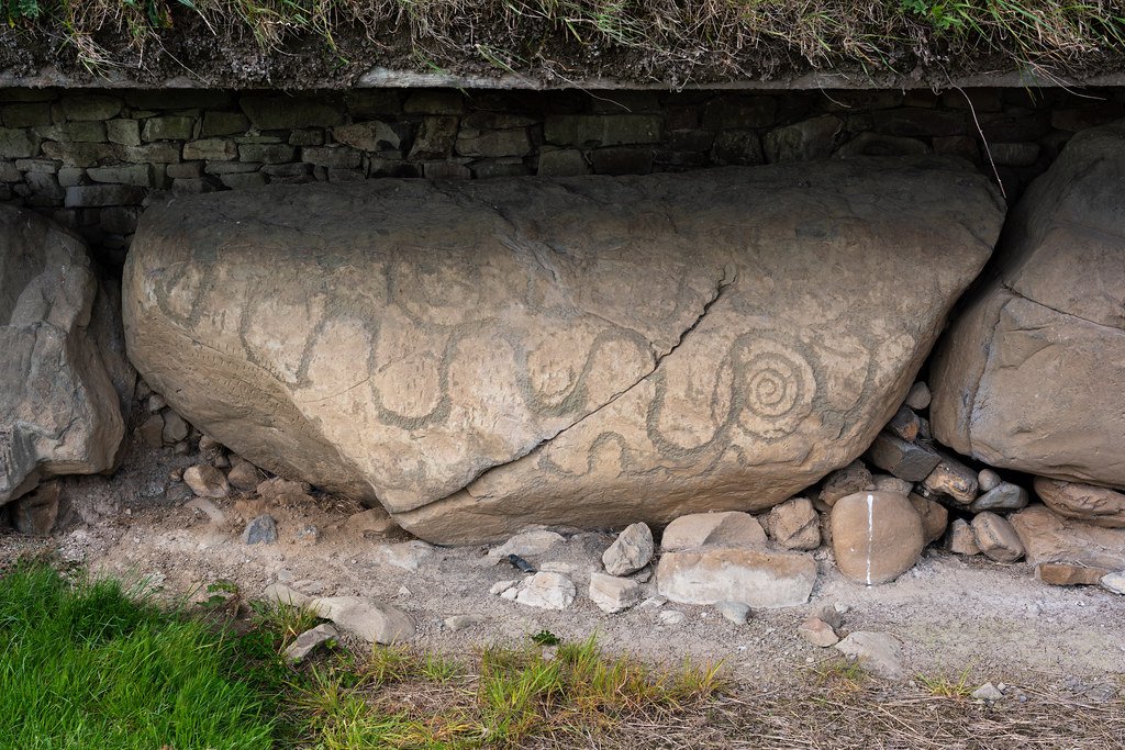
"Knowth, Brú na Bóinne (Boyne Valley), Ireland" by profzucker is licensed under CC BY-NC-SA 2.0 Snake Read more

Even in a rural community of mainly farmers, there are often reasons to wish to build or create a structure Read more

These are artificial hills made from the unwanted rock, Shale and tailings that come up with coal, metal ore, stone Read more

This section illustrates the history of mining and aims to give sufficient information for a researcher to be able to Read more
Over the last five years Iron-Age specialists have been re-examining what British hillforts were really for. The question is no Read more
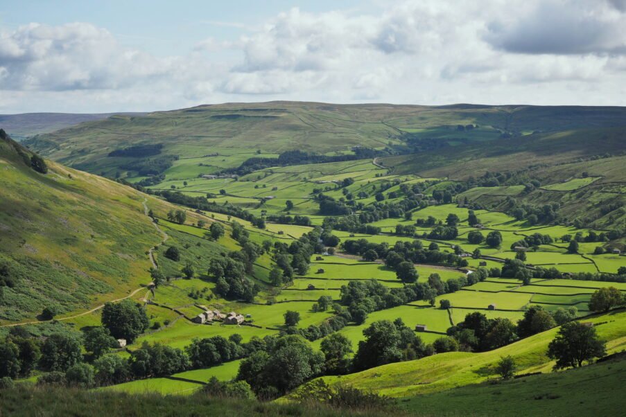
Swaledale – The northernmost dale of the Yorkshire Dales National Park

"River Swale" by colgregg is licensed under CC BY 2.0
Setting and boundaries
Swaledale occupies the long, sinuous valley carved by the River Swale on its 45-kilometre descent from Nine Standards Rigg (662 m) on the Pennine watershed to Richmond in lower Teesdale. The dale narrows between rough Gritstone scarps near Keld, broadens to a patchwork of hay-meadows around Muker and Gunnerside, then opens into a tree-fringed flood-plain west of Reeth before the river cuts through the Carboniferous escarpment to meet the Vale of Mowbray.
North rim: the Stainmore watershed and Arkengarthdale, separated from Swaledale by boggy moorland carrying the B6270 at Tan Hill (the highest inn in Britain).
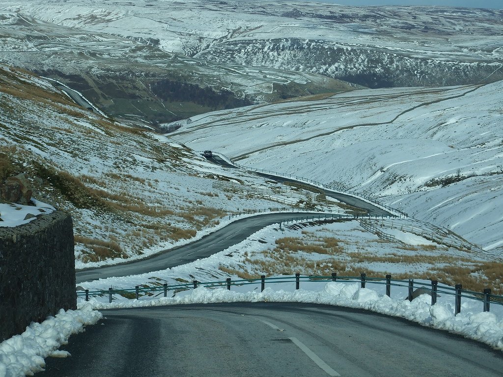
South rim: the Limestone terrace of Great Shunner Fell and its tributary dale of Wensleydale; Buttertubs Pass (the B6270) provides the dramatic high-level link between the two valleys.
Key settlements: Muker and Gunnerside, the archetypal stone-barn villages of the mid-dale; Reeth, a green-fronted market centre where Arkengarthdale joins; and Richmond, the historic gateway town at the dale foot. Smaller hamlets such as Keld, Healaugh and Grinton punctuate the route along the Swale and its tributaries. All are connected by the B6270, the single dale-road threaded by characteristic hump-back bridges and unfenced pasture stretches.
"Gunnerside Gill" by WhiteGoldWielder is licensed under CC BY-NC-ND 2.0
Geology and geomorphology
Swaledale is a lesson in classic three-tier Pennine geology.
Basement: a tilted block of Lower Palaeozoic slates and volcanics forms a subdued core beneath the western moors.
‘Yoredale Series’ staircase: alternating limestones, sandstones and Shales of the Carboniferous dip gently eastward, producing a stepped side-slope profile: limestone terraces punctuated by sandstone scars (notably the Gunnerside and Fremington Edges).

"Kisdon Force" by Bods is licensed under CC BY-SA 2.0
Great Scar Limestone: at Kisdon Hill a fault has dropped the massive limestone down to valley floor level; glacial meltwater abandoned the original Swale course, leaving Kisdon isolated and forcing the river to incise the narrow gorges now spanned by the famed Buttertubs potholes and the river-cut Kisdon Force.
Lead-veins and hushes: mineralising fluids exploited north-west-trending faults to deposit galena. Eighteenth–nineteenth-century ‘hushing’ (releasing stored water to strip soil) sculpted the distinctive spoil-scarred gullies at Gunnerside Gill and Old Gang, now prized as SSSI geological monuments.
Landscape evolution: Pleistocene ice flowing east along Stainmore buried upper Swaledale; its retreat left erratic's, till sheets and the meltwater-cut gorges that divert the Swale around Kisdon. Post-glacial incision produced hanging tributary becks such as Skeb Skeugh, whose waterfalls drop directly onto valley-floor meadows; active lateral erosion on the softer shale reaches below Reeth continues to shift the river south-eastward, undercutting pasture banks and exposing fresh fossil beds.
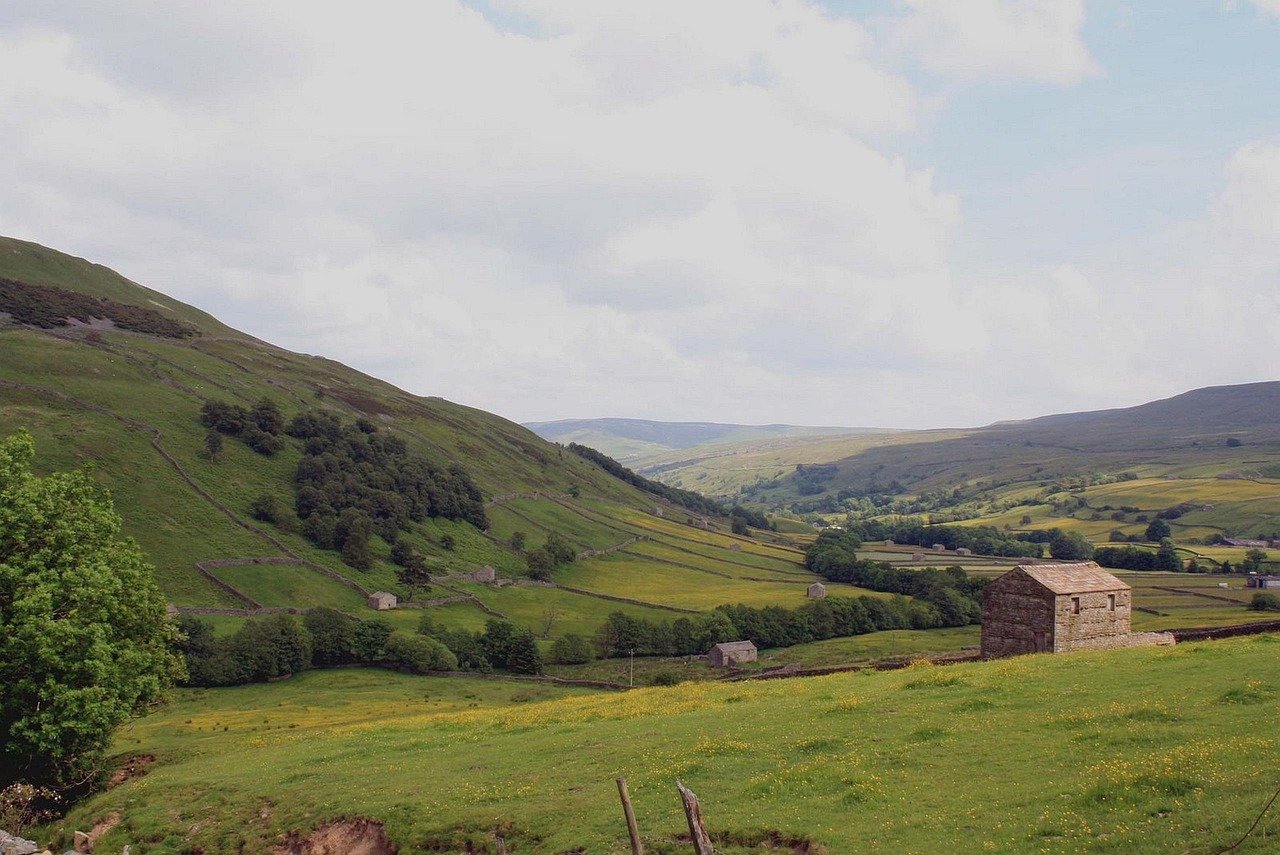
Photo by olleaugust on Pixabay
A Natural environment shaped by geology
The stepped Yoredale profile supports a tight mosaic of habitats:
Hay-meadows on the limestone strips – nutrient-poor, late-cut fields blaze with globe-flower, wood crane’s-bill and melancholy thistle in June.
Species-rich rough pasture on sandstone scars – bilberry, crowberry and purple moor-grass withstand the thin acidic soils.
Lead-rakes and spoil-heaps – metal-tolerant plants such as alpine penny-cress and spring sandwort colonise the zinc-rich gravels, giving Swaledale one of Britain’s best examples of metallophyte flora. Curlews, redshank and black grouse use the upper dale’s wet flushes and heather moor, while dippers and goosanders patrol the Swale’s limestone rapids.
"Buttertubs Pass, Swaledale, North Yorkshire" by dan_a is licensed under CC BY-NC 2.0
Outstanding natural and geological highlights
Kisdon Force & East Gill Force: twin waterfalls where gritty sandstone caps a limestone lip, compressing the Swale into frothing chutes framed by hazel and ash woodland.
Buttertubs Pass: 30-metre-deep vertical potholes dissolved in the Great Scar Limestone, visible right beside the summit lay-bys – textbook solution-Shaft formation.
Gunnerside Gill hushes: a moonscape of barren gullies and spoil fans, each face revealing mineral veins and illustrating human–geology interaction. The moorland path climbs past Blakethwaite Smelt Mill ruins to Old Gang Flats.
Muker hay-meadows: a living botanical museum – the traditional grazing regime, coupled with limestone-derived soils, produces one of the UK’s richest native-meadow assemblages.
Reeth low-river terraces: braided channels, point bars and under-cut shale cliffs demonstrate an actively migrating gravel-bed river; after Spates, new cross-sections show cycads and goniatites in situ.
Human footprints across Swaledale – from first hunters to industrial hushes
The dale’s thin soils, mineral seams and high Pennine climate have never allowed dense settlement, but 10 000 years of intermittent use have etched a clear, cumulative story into its slopes. Moving downstream, time-slice by time-slice, the pattern is:
Late-glacial hunters (c. 9000–7000 BC)
Upland flint scatters on the broad moor‐tops above Healaugh and Crackpot reveal visits by post-Ice-Age hunter-gatherers: small bladelets and microliths dropped beside spring heads on Harkerside Moor and Great Pinseat.
The choice of high, open ground rather than valley-floor terraces suggests summer stalking of red-deer herds that favoured new birch scrub.
Best field evidence: thin flint spreads at Harkerside Heights (HER 1839, 1840).
The Early farmers and cairn-builders (4000–1500 BC)
Clearance Cairns and low ring-cairns on Keldside, Bratches Hill and the summit of Harkerside show that small plots were hacked out of heather to plant the first barley.
A cup-and-ring marked sandstone block at White Rigg, above Gunnerside, ties Swaledale into the wider north-east rock-art province.
Sites to visit: Cairnfield and ring cairn on Harkerside Moor (Scheduled Monument 1021088). Cup-marked rock at White Rigg (HER 3791).

"Maiden Castle, Swaledale (1) - geograph.org.uk - 7554070" by Stephen Craven is licensed under CC BY-SA 2.0
Iron-Age defended farmsteads (c. 700 BC – AD 100)
Swaledale possesses two discrete Iron-Age defended sites: Maiden Castle guarding the river gorge a little east of Grinton, and How Hill commanding the Walburn–Downholme pass. Both sit well inside Brigantian territory, their strategic placement – one over the river, one over the moor-road – hints at a network of small, kin-based strongholds rather than a single central fort.
| Attribute | Maiden Castle (Harkerside Moor) | How Hill (Downholme) |
|---|---|---|
| National Grid Ref. & SM no. | SE 0199 9820 (Scheduled Monument 1012609) | SE 1129 9721 (Scheduled Monument 1004080) |
| Topographic setting | Narrow promontory on the steep southern slope of Swaledale; river now skirts N & W flanks. | Limestone knoll that dominates the Walburn gap where the old moor-road drops from Wensleydale into lower Swaledale. |
| Size & plan | c. 80 m × 60 m internal, pear-shaped. One massive rampart across the neck plus a slighter counterscarp; natural scarps on other sides. | c. 95 m × 70 m internal. Single stone-cored bank with outer ditch around most of the circuit; original entrances on E and SW. |
| Defensive Earthworks | Ditch up to 3 m deep on the neck; inner bank 1–2 m high. No sign of unfinished works. | Rock-cut ditch 4 m wide; bank up to 1.5 m. Eastern side partly unfinished, suggesting construction may have stalled. |
| Excavation / finds | No modern excavation; surface finds limited to a scatter of undecorated Iron-Age coarseware sherds. | Small 1937 sondage recovered a rim of cord-impressed pottery and an iron nail; LiDAR & walk-over survey (SWAA 2018) show slight house-platforms. |
| Character & date range | Typical Promontory fort of the northern Pennines; likely late Bronze – early Iron Age (c. 800–400 BC). | Defended enclosed farmstead; artefacts suggest mid–late Iron Age (c. 400–100 BC). |
| Current access | Open-access land; approach on footpath from Harkerside Place. | Visible from the bridleway above Downholme; summit itself on access land. |
How Hill Fort - Downholme
Why the Romans seem to vanish inside Swaledale
Walk the dale today and you meet Iron-Age forts, cross-dale dykes, and a Victorian moonscape of hushes—but almost nothing stone-built that carries a Roman imperial stamp. The absence has puzzled archaeologists for a century.
What the records actually show
A near-pass with a Road, and no sign of a fort. A metalled agger (Margary 82a) crosses the far southern edge of Grinton and Harkerside moors, linking Virosidum in Wensleydale to Cataractonium on Dere Street, but no fortlet or mansio on the road line has produced Roman finds in situ. The “earthworks” behind Grinton Lodge once touted as a camp are now recognised as 18th-century sheep-folds. (new-swaag.org)
Within the dale itself, there is precious little firm evidence of any Roman activity at all. Contrast this with Wensleydale, and the fort at Bainbridge paints a very different picture. We therefore have two parallel dales, one with the Romans where very much interested in having control, and one, where, the evidence found so far seems to suggest, they had little interest, or need, for that level of control and oversight.
Given the proximity to the Catterick road, we can assume that an administrative centre for Swaledale would in all probability be via Cataractonium, with closer support available from Bainbridge fort, indicating that the Grinton Moor road will most likely have seen Roman use and maintenance.
Scattered mining clues. A few hob-nails, coarseware sherds and 2nd-century Slag flecks have come from surface rakes on Hind Rake and Arkengarthdale; one Trajanic lead pig from County Durham matches Swaledale isotopes. But the great hushes at Gunnerside/Old Gang post-date 1650. (mylearning.org, Yorkshire Dales)
Linear dykes. Six cross-dale ramparts—the Grinton-Fremington dykes—run from scar to riverbank and back. Stratigraphy and L-shaped corners mark them as later prehistoric; none has yielded Roman artefacts in primary context. (Swaledale history)
Have later activities erased the evidence?
Mining destruction: 17th–19th-century hushes sliced through earlier rakes, so any shallow Roman galleries or timber washing floors are likely lost beneath later spoil fans. The Old Gang complex alone shifted >1 million m³ of overburden.
Meadow creation: Parliamentary walling and field-barn building after 1790 sealed valley-floor palaeo-soils under stone-cleared lynchets, masking small Roman farmsteads if they ever existed.
Dyke re-use: Some Grinton-Fremington dyke sections became post-medieval head-ditches; turf-stripping for lead-wash reservoirs may have robbed Roman artefact spreads.
Even so, field surveys still produce isolated Roman finds on untouched scar ledges—enough to show the soldiers and prospectors were present, if only briefly.
Clues that a Roman trace is still out there
Undisturbed interfluves. Peat caps on Great Pinseat and Lovely Seat overlie mineral veins but escaped 19th-century Hushing; lidar hints at low linear rakes here—prime targets for OSL dating and slag sampling.
Buried flood-fans. Downstream of Gunnerside Beck, gravel tongues sealed beneath enclosure meadows could trap early-historic washing debris. Geo-resistivity has begun to outline anomalous high-metal zones.
Dyke termini. Excavation in 2022 (Fremington Project) showed Roman coarseware in the top fill of Dyke 4’s ditch—perhaps trampled when troops marched the ridge; deeper undisturbed contexts remain to be dug. (Archaeology Data Service)
Best candidate for the Roman "town"? I would suggest Reeth, it clearly shows the most developed agricultural systems by the medieval period and therefore is a strong candidate for continuation, and it is possible that a much smaller Roman footprint has been all but lost to later works.
Norse re-colonisation and place-names (9th–11th c.)
The end-names -thwaite, -keld, -gill (Muker = ‘the narrow pasture’, Anglian + Norse) mark pasture outtakes and meadow holdings by Scandinavian farmers.
Corpse-way routes from Keld to Grinton churchyard (eldest consecrated ground) underline how early Christian networks overlaid Norse farms.
Here’s how the monastic story of Swaledale actually hangs together once you slot the local houses and Richmond into the bigger Cistercian economy.
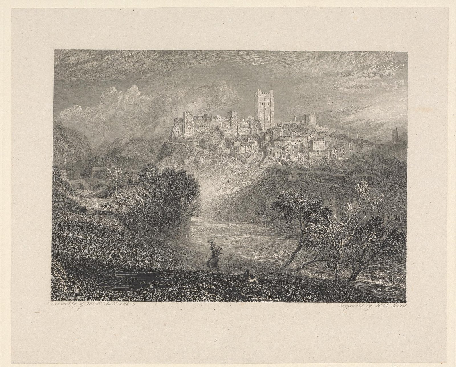 Richmond, Yorkshire by Charles Hamilton Smith is licensed under CC CC0 1.0
Major influences of the medieval period
During the medieval period, a large proportion of the dale was managed by a number of monastic houses, both within and outside of the dale. For the medieval elite, Marske Hall, and it's deer park served to showcase the dales, and as a place where aliances and agreements be formed.
| House | Order & foundation | What they owned in-dale | Economic role |
|---|---|---|---|
| Marrick Priory | Benedictine nuns, founded 1154–58 by Roger de Aske | c. 400 acres around Marrick; out-lying holdings at Hurst, Marske, Richmond & Carperby | Wool clip (8+ sacks/yr), cheese, and tithe lead from Hurst mines; alms to the poor (c. 20 % of income) (Marrick Priory) |
| Ellerton Priory | Cistercian nuns, late-12th c. (Egglescliffe / Aske family) | Meadows on the south bank of the Swale opposite Marrick; fishpond complex | Managed hay and stock until Scots raid of 1342; dissolved 1536 (Wikipedia) |
Both houses sent their wool and surplus produce out via Richmond market, using the corpse/packhorse ways that still criss-cross upper Swaledale.
Why Fountains & Rievaulx appear in Swaledale documents
These more distant Cistercian abbeys were the agribusiness giants of their day, and managed properties throughout the Yorkshire Dales and North Yorkshire:
Rievaulx Abbey – Gilbert de Gaunt’s charter of 1251 granted the monks “the whole grazing of Swaledale”, adding the right to build sheep-folds and lodges on the moor (DHI).
Fountains Abbey – ran a chain of upland granges; its Morker Grange (above Muker) supplied summer pasture and hay meadows that show up in 13th-century “manca” account lists of hay-ledges (individual hay stances) around the current Muker SSSI. Earthwork banks around Ninevah Farm preserve part of that layout.
These external houses pumped thousands of fleeces a year through Richmond’s wool merchants and onto the Humber–Flanders export route.
Richmond’s two small friaries tie the dale to wider trade
| House in Richmond | Order | Dates | Link to Swaledale |
|---|---|---|---|
| St Martin’s Priory | Benedictine cell of St Mary’s, York | c. 1100 – 1539 | Collected tithes (incl. lead) from Grinton parish and hosted Swaledale wool merchants (Wikipedia) |
| Greyfriars | Franciscan friary | 1258 – 1538 | Gave Richmond a second religious house and shelter for pack-trains; bell-tower still overlooks the marketplace (Wikipedia) |
Richmond’s weekly wool market and Michaelmas fair were the clearing-house through which Marrick, Ellerton, Fountains and Rievaulx all monetised dale produce.
The “monks’ packhorse bridge” on the Coast-to-Coast
Wainwright’s modern route crosses the Swale at Ivelet Bridge, a late-16th-century packhorse span with low parapets built for pannier horses—the very feature you quoted. It lies a few miles upstream of Grinton but still channels today’s walkers exactly as the monastic wool-trains once did (Wikipedia, coasttocoast.uk). (Grinton’s road bridge is later and was widened for carts.)
What this meant on the ground
Landscape imprint: the barns-and-walls lattice, hay-ledges around Muker, and vaccary (cattle) place-names echo the grange era.
Transport: corpse roads, flagged causeways, and the surviving packhorse bridges kept wool dry and bullion-heavy lead pigs moving to Richmond.
Society: nuns at Marrick/Ellerton acted as local landlords and almsgivers, while distant abbeys remained largely absentee graziers—explaining why earlier summaries fixate on Fountains/Rievaulx yet omit the dale-based houses.
Swaledale’s monastic landscape was a layer-cake: resident nunneries (Marrick, Ellerton) handled parish life, distant Cistercian giants (Fountains, Rievaulx) exploited the high pastures, a deer park at Healaugh sat between, and Richmond’s priory and friary knitted everything into the regional trade network. Appreciating all four tiers gives a far richer picture than the wool-centric note you spotted earlier.
Marske Hall
Marske Estate and Hall - Marske in Swaledale - marskeswaledale.com
Marske Hall stands on the south-facing slope above the village of Marske in mid-Swaledale, a little over six miles west of Richmond and well inside the Yorkshire Dales National Park.(Wikipedia)
Today the estate centres on a Grade II* Georgian house, an imposing quadrangular stable block added in 1750, and the tree-cloaked oval of the old deer park—now called Deer Park Wood—together covering a landscaped core of about twenty-two acres.(Parks and Gardens, Coast to Coast UK)
The first secure documentary mention of the Hall comes in 1596, when Archbishop Matthew Hutton bought the manor; his son Sir Timothy began rebuilding almost at once. Earlier medieval foundations almost certainly lay beneath, but the Hutton works created the fabric that still shapes the building today.(Yorkshire Dales)
Because that story then stretches across four centuries—passing from deer chase to race-horse stud, to Victorian shooting lodge, wartime school and modern holiday base—I have have set the main phases, owners and typical visitors side-by-side in a single table. Laying the information out that way lets you see, at a glance, how each generation repurposed the same parkland and how those shifts plugged Marske Hall into the wider economic and social life of Swaledale.
| Phase | Key owners / managers | How the estate was used | Typical “guests” & why they mattered | Sources |
|---|---|---|---|---|
| 1590s – c.1730 Early Hutton period | Archbishop Matthew Hutton buys the medieval manor (1596) for his son Sir Timothy | Hall and the 120-ha Deer Park Wood laid out as a status chase and stock-pasture | Northern clergy, Richmondshire gentry invited for deer-coursing and winter hospitality | (Richmondshire Today) |
| c.1735 – 1780s “Bloodstock moment” | John Hutton II rebuilds the hall and erects the great quadrangular stable block (1742) | Private stud farm—stallion Marske stands here and sires Eclipse (1764) |
Prince William, Duke of Cumberland (who bought Marske as a foal) inspecting stock Newmarket dealers such as William Wildman and the 4th Earl of Abingdon, drawn north to negotiate coverings |
(Wikipedia) |
| 1800 – 1900 Shooting-party era | John & Timothy Huttons diversify: banking (Richmond & Swaledale Bank, 1804) and estate sport | Hall run largely as an autumn grouse- and pheasant-shoot lodge; obelisk to Matthew Hutton (1814) becomes a dining-ride landmark | Railway-age elites—MPs, bankers, and the Earl of Zetland’s circle—combine race-week at Redcar with driven shoots at Marske | (Yorkshire Post, Country Life) |
| 1940 – 1946 Wartime refuge | Estate loaned to Scarborough College | Classrooms installed in the ballroom; park used for cricket and cross-country instead of deer | 200+ evacuee pupils & staff, whose memoirs give a vivid inside picture of the house under rationing | (Scarborough College, Wikipedia) |
| 1960s – present Holiday & leisure campus | Sold out of the family (1961); converted to flats, then high-end holiday lets; 24 acres landscaped around ornamental ponds | Walkers on the Coast-to-Coast path, wedding parties. | The modern “hunt” equivalent - golfing parties who base themselves here while playing at Richmond (Yorks) Golf Club (1892 course, 7 km away) | (richmondyorksgolfclub.co.uk) |
How the hall and park helped shape Swaledale
Economic spin-offs – stud fees from Marske & Eclipse financed local lead-smelting ventures; 19th-century shooting traffic flowed through Richmond market, mirroring the nunneries’ wool trade.
Landscape fingerprints – the Deer Park Wood pale, Hutton’s Monument obelisk and the Gothic barn (a “folly” cow-house) still script the skyline above Marske. (Coast to Coast UK)
Social memory – wartime evacuees’ photographs and today’s golfing society dinners occupy the same dining hall that once hosted venison feasts for Cumberland’s horse-traders—a tidy arc from hunt to handicap.
Although never monastic, Marske’s deer park and later sporting estate mirror the way Cistercian abbeys exploited Swaledale’s uplands: both moved stock around large enclosed tracts, imported high-spending outsiders, and left enduring field-patterns. Slotting Marske alongside Marrick & Ellerton therefore fleshes out the lay tier of power that sat cheek-by-jowl with the nunneries.

"Bunton Hush" by b3tarev3 is licensed under CC PDM 1.0
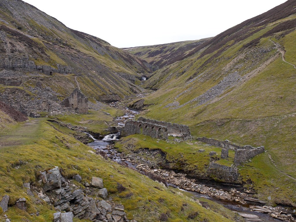
Post-medieval lead-mining landscape (17th–19th c.)
Hushing gouged scores of V-shaped scars (Bunton, Blakethwaite, Old Gang). Reservoir banks and hush-channels are intact, giving textbook cross-sections of a mining method unique to Britain.
Stone-arched smelt mills (Old Gang, Crackpot) and peat-store platforms record the shift to ore-roasting technology.
Two of the main mining villages, Gunnerside and Keld, grew from Shieling hamlets into centres of miner-smallholder life; the pattern of mine-ruin, meadow and intake wall is still legible from almost every fellside track.
The Enclosure Acts, and the Parliamentary-walls
The enclosure acts of the 18th and 19th centuries saw many Dales people dispossessed of their ability to live in the dales, and that had a dramatic effect on the nature of Swaledale. Long straight Parliamentary Walls were set out across the dale, changing boundaries and land use that had been agreed rights, possibly since before the Roman period.
What happened to Swaledale’s people when the commons were “walled in”?
When Parliament authorised the division of Swaledale’s stinted pastures (the main awards came in 1814 – 1825 for Grinton-Reeth and 1824 – 1843 for Muker/Gunnerside) the dale acquired the ruler-straight dry-stone “parliamentary walls” we still see today. But the physical neatness masked a radical social shift.
Land ownership and control
Before enclosure most dale households—yeomen, copy-holding miners, and cottagers—held tiny rights to graze a handful of beasts on the township commons; these were protected by the custom of “stints”.
After the award the surveyors allotted the lion’s share of former common to a few dozen larger farmers and to outside investors (notably lead-mine partnerships who wanted moorland for water-capture reservoirs). Cottagers and tenant miners received token plots—often steep, rushy ground that was impossible to wall without spending more than the land was worth. eprints.lancs.ac.uk
Within a generation many smallholders had sold their allotments or slipped into pure wage labour, consolidating fields into today’s 10- to 30-hectare livestock units.
Population movement
Parochial censuses show a brief spike during the 1820s–1840s as men were hired to wall and drain the new allotments, followed by steady decline once lead prices slumped and small graziers lost common
Twentieth-century military & modern conservation
The Stainton military firing range east of Richmond and WWII pillboxes at Marske show the dale’s use as a training area.
After mine closure (1913–30) Swaledale re-branded for amenity; 1954 inclusion in the Yorkshire Dales National Park and 1960s SSSI designations halted barn demolition and secured hushes as geological monuments.


