Notice: Function WP_Scripts::add was called incorrectly. The script with the handle "datatables-responsive" was enqueued with dependencies that are not registered: datatables. Please see Debugging in WordPress for more information. (This message was added in version 6.9.1.) in /home/u621095157/domains/brigantesnation.com/public_html/wp-includes/functions.php on line 6131
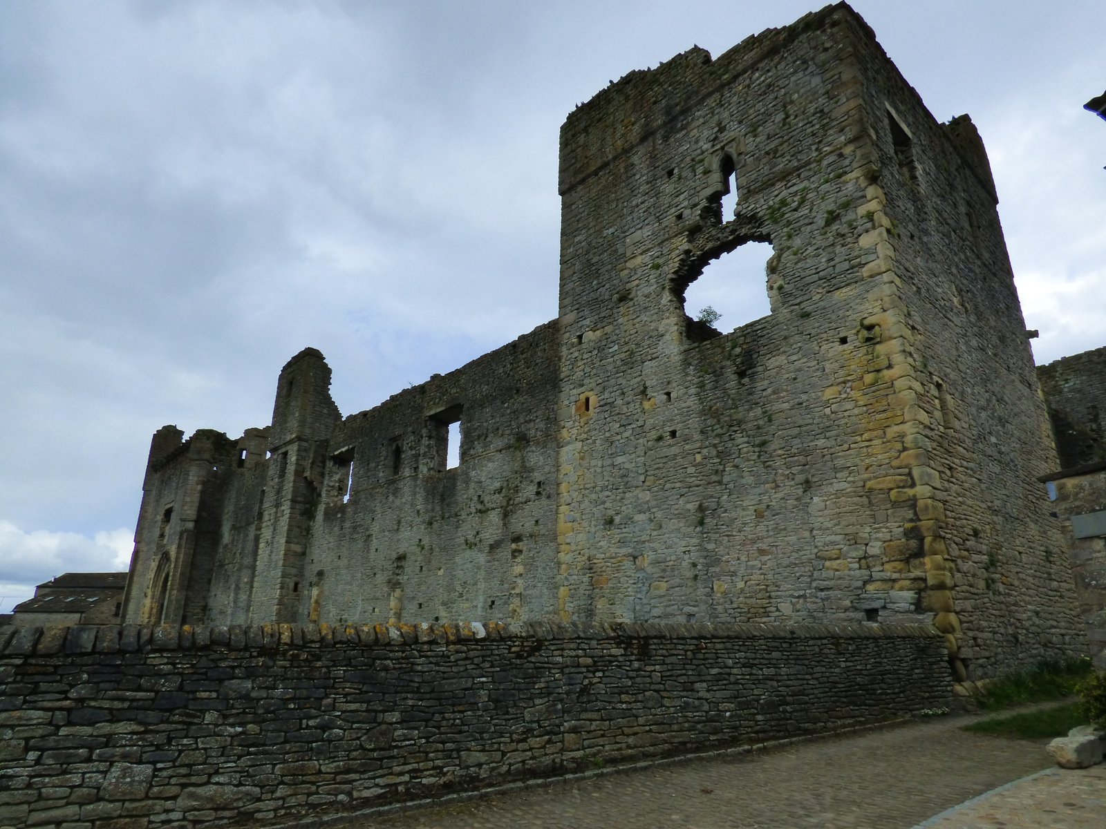
Middleham Castle, with its deep historical roots and architectural grandeur, stands as a remarkable testament to England's medieval past. Built Read more
The Premonstratensians, emerging in the early 12th century, represent a unique blend of monastic traditions and clerical duties. Founded by Read more
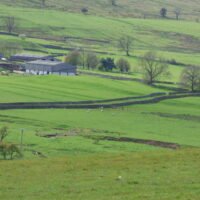
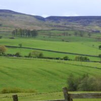
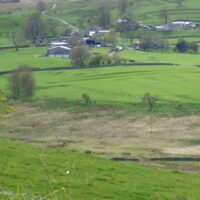
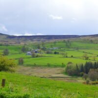
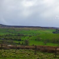
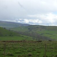
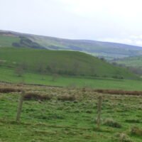
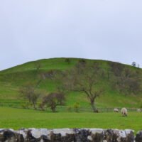
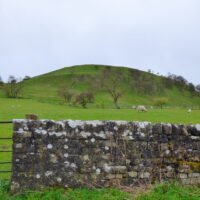
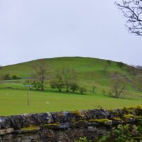
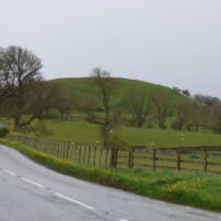
How Hill, near Downholme in North Yorkshire, is the site of a large Univallate hillfort.
How Hill Hillfort, Downholme (SE 1083 9799) — what we know so far
Topic
Evidence & interpretation
Topographic position
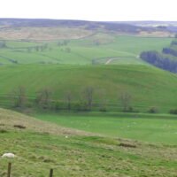
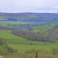
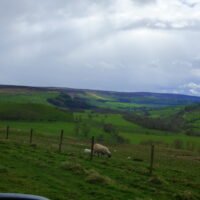
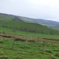
A domed Limestone/Grit knoll on the north edge of the Swale gorge, 275 m OD. The fort commands two strategic corridors: (i) the narrow mouth of upper Swaledale to the west and (ii) the natural south-east break in the hills that carries today’s Richmond–Leyburn road to the Vale of York. (SWAAG)
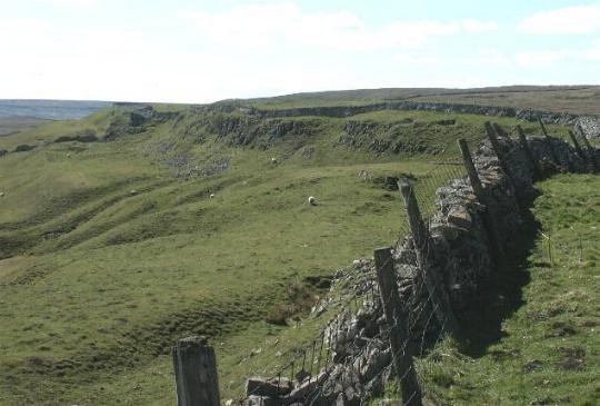
Defences
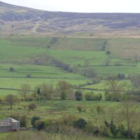
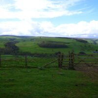
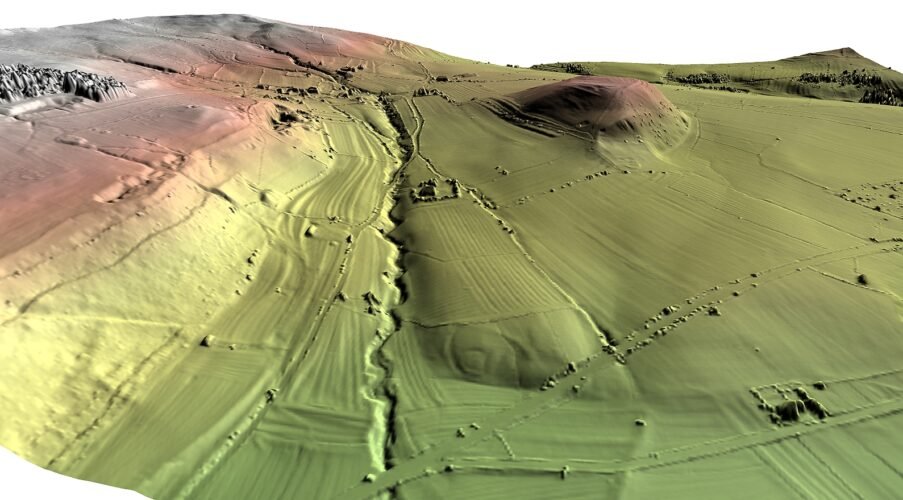
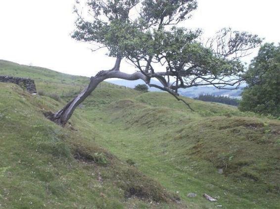
A single rampart/ditch circuit encloses c. 4 ha (a “large univallate” hill-fort). • Best-preserved west & north: rampart 2.5 m wide, 0.3 m high; outer ditch 5.8 m wide; slight counterscarp. Steep slopes here provided extra defence.
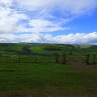
East & south: earthwork flattened by medieval ploughing, but 1946 RAF photographs and modern LiDAR still show the buried ditch, and medieval ridge-and-furrow neatly respects the vanished bank. (Historic England)
Entrances
Air-photo transcription suggests two original breaks, E and W, both aligned on the easiest approaches. No in-turned entrance passages have survived above turf.
Size & date bracket
Diameter ≈ 230 m (area c. 4 ha). Morphology places it in the later Iron Age (c. 400 BC – AD 100). Large univallate forts are rare north of the Humber; How Hill is one of fewer than a dozen in Yorkshire. (Historic England)
Artefacts & internal features
No modern excavation. A 1993 Cambridge University earthwork survey noted slight platforms on the summit but recovered no datable finds. Magnetometry for the MOD (2016) located a ring-gully (probable round-house) near the centre and several large pits, but results remain unpublished beyond an Ariadne metadata stub.
Later reuse
Medieval clearance ridged the summit; a 19th-century boundary wall clips the rampart on the south. No evidence for re-fortification, nor for Roman occupation.
Research history
1850s: first sketched by antiquary J. R. Morton.1946: RAF vertical photography plotted full circuit.1993: A. Fleming topographic survey (University of Bradford/English Heritage).2016: non-invasive survey for Catterick Training Area (magnetometry, drone Photogrammetry). (Historic England, SWAAG)
Legal status & condition
Scheduled Monument no. 1012604 (1995). Condition: “generally good” on N & W scarps; southern arc vulnerable to continued arable ploughing. Historic England monitors cultivation depth in agreement with the landowner. (Historic England)
What makes How Hill important
Frontier vantage-point – it sits exactly where anyone moving between Brigantian upland (Swaledale) and lowland zones would be funnelled.
Rarity – large univallate forts are common in Wessex but scarce this far north, so How Hill is pivotal for comparing northern Iron-Age power centres with their southern counterparts.
Landscape Palimpsest – rampart, medieval ridge-and-furrow and 19th-c. walls all visible in one sweep; ideal for studying long-term land-use on a single hill-top.
Untapped interior – because there has been no invasive excavation, floor deposits and any structural remains under the plough-soil are likely still intact, offering high research potential (e.g., for first aDNA/charcoal dating or isotopic studies).
The hillfort occupies a strategic position, commanding access to upper Swaledale and overseeing the route leading south to the Vale of York.
Gaps & next steps for community or academic projects
Publish the 2016 geophysics – raw grids would confirm the suspected house gullies and pit cluster.
Targeted coring through the rampart to sample construction layers and obtain OSL or radiocarbon termini.
Drone LiDAR at ≤ 20 cm to refine the entrance traces and map rig-and-furrow overprint.
Local artefact survey – systematic field-walking on the ploughed eastern flank could recover pottery or slag that pins down the fort’s active centuries.
With those modest steps, How Hill could move from “impressive earthwork” to type-site for late Brigantian hill-forts in the central Pennines.
Its defining features include a rampart and ditch, particularly visible on the western and northern sides.
The rampart is about 2.5 meters wide and stands 0.3 meters above the ground, while the ditch, enhanced by the natural slope, is approximately 5.8 meters wide. There's also a counterscarp bank that measures 1.9 meters across and 0.5 meters above the ditch level.
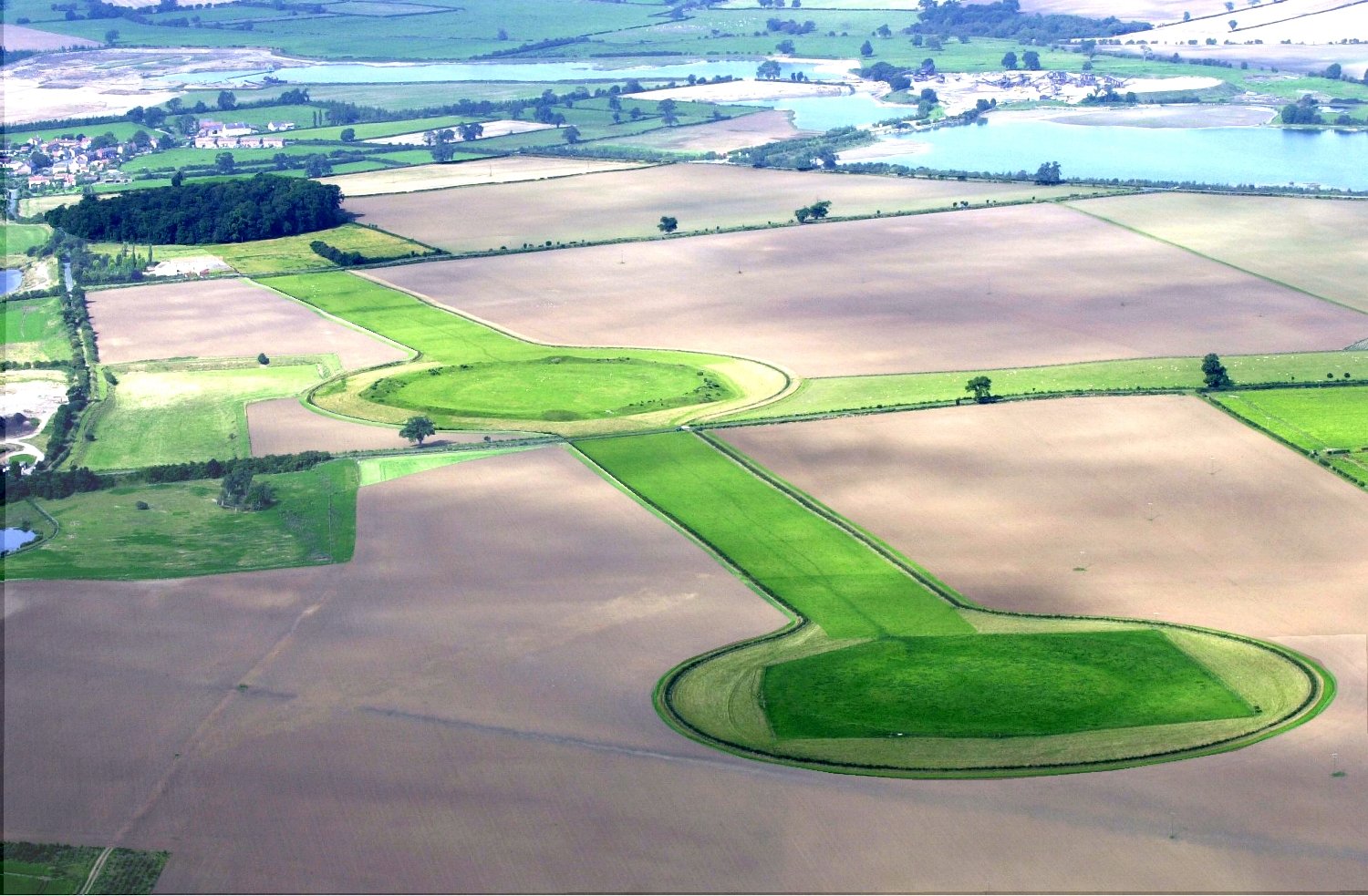
However, aerial photography has revealed that the summit was once fully enclosed, with the now unfilled ditch still traceable, and the patterns of ancient ploughing following the former extent of the rampart circuit. On the less cultivated western and northern perimeters, substantial lengths of the rampart and ditch have survived. These remnants provide valuable insights into the Iron Age period, most likely dating the construction and use of the hillfort between the fourth century BC and the first century AD. Historical records suggest that much of the eastern and southern ramparts were destroyed during medieval times due to agricultural activities. A 3D LIDAR model of this hillfort can be viewed and downloaded from this Sketchfab link https://t.co/smhqAgIJx4 The image is taken from the model.


 The rampart is about 2.5 meters wide and stands 0.3 meters above the ground, while the ditch, enhanced by the natural slope, is approximately 5.8 meters wide. There's also a counterscarp bank that measures 1.9 meters across and 0.5 meters above the ditch level.
  A 3D LIDAR model of this hillfort can be viewed and downloaded from this Sketchfab link https://t.co/smhqAgIJx4 The image is taken from the model.