Notice: Function WP_Scripts::add was called incorrectly. The script with the handle "datatables-responsive" was enqueued with dependencies that are not registered: datatables. Please see Debugging in WordPress for more information. (This message was added in version 6.9.1.) in /home/u621095157/domains/brigantesnation.com/public_html/wp-includes/functions.php on line 6131
~1 200 mm yr-¹ rainfall on moor-tops; cool summers, frost-prone winters
Favours dairy & hay over arable; challenges road users and builders. (Yorkshire Dales)
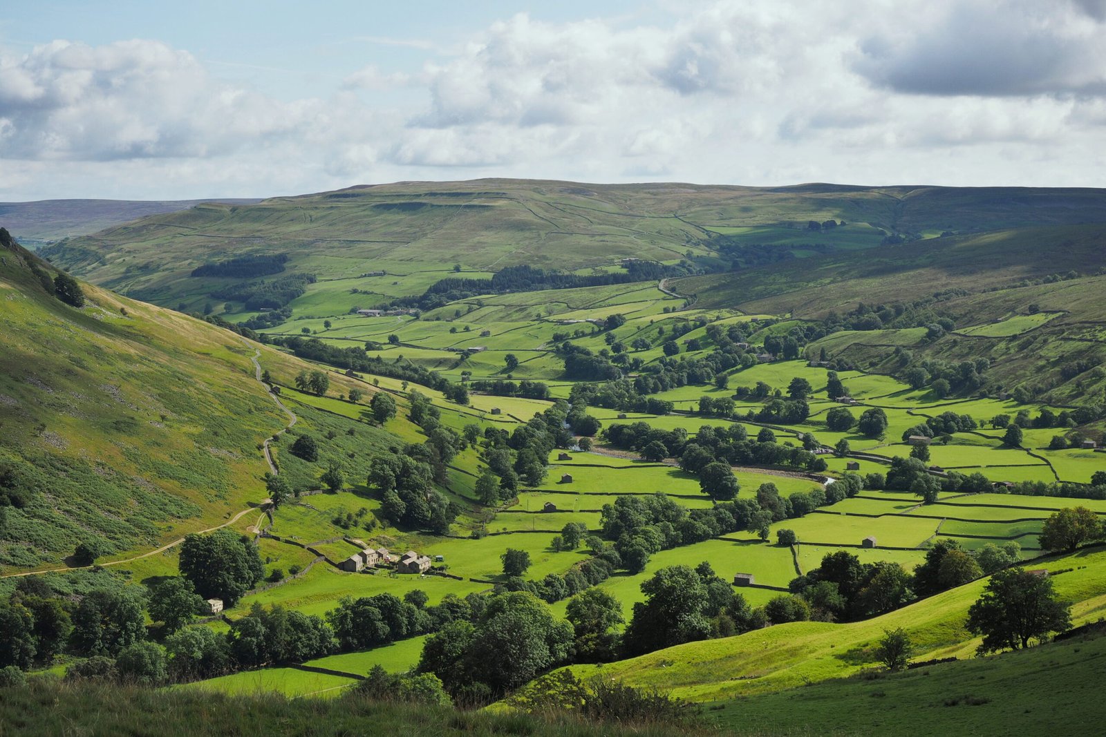
Geography: a high Pennine corridor turned east-flowing vale
30 km long, carved by the River Ure, it is the only major Yorkshire dale not named after its river. The headwaters leap off the Pennine spine at 450 m O.D., then fall east to 140 m at Wensley, squeezing through Aysgarth gorge before opening onto the Vale of Mowbray.
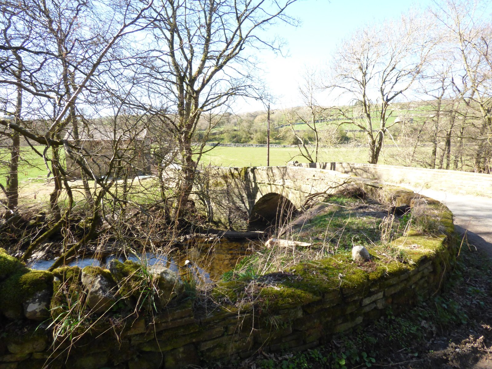
Lateral “side-dales” (Bishopdale, Coverdale, Waldendale) drain the high moors; the dale floor carries the A684 turn-pike line and, since 1878, the Wensleydale Railway.
Climate is cool-wet (c. 1 200 mm a-1 on the moors), with frequent winter floods that periodically cut the road at Aysgarth and Bainbridge – a perennial challenge to residents and hauliers. (yorkshiredales.co.uk)
Geology: the Yoredale staircase
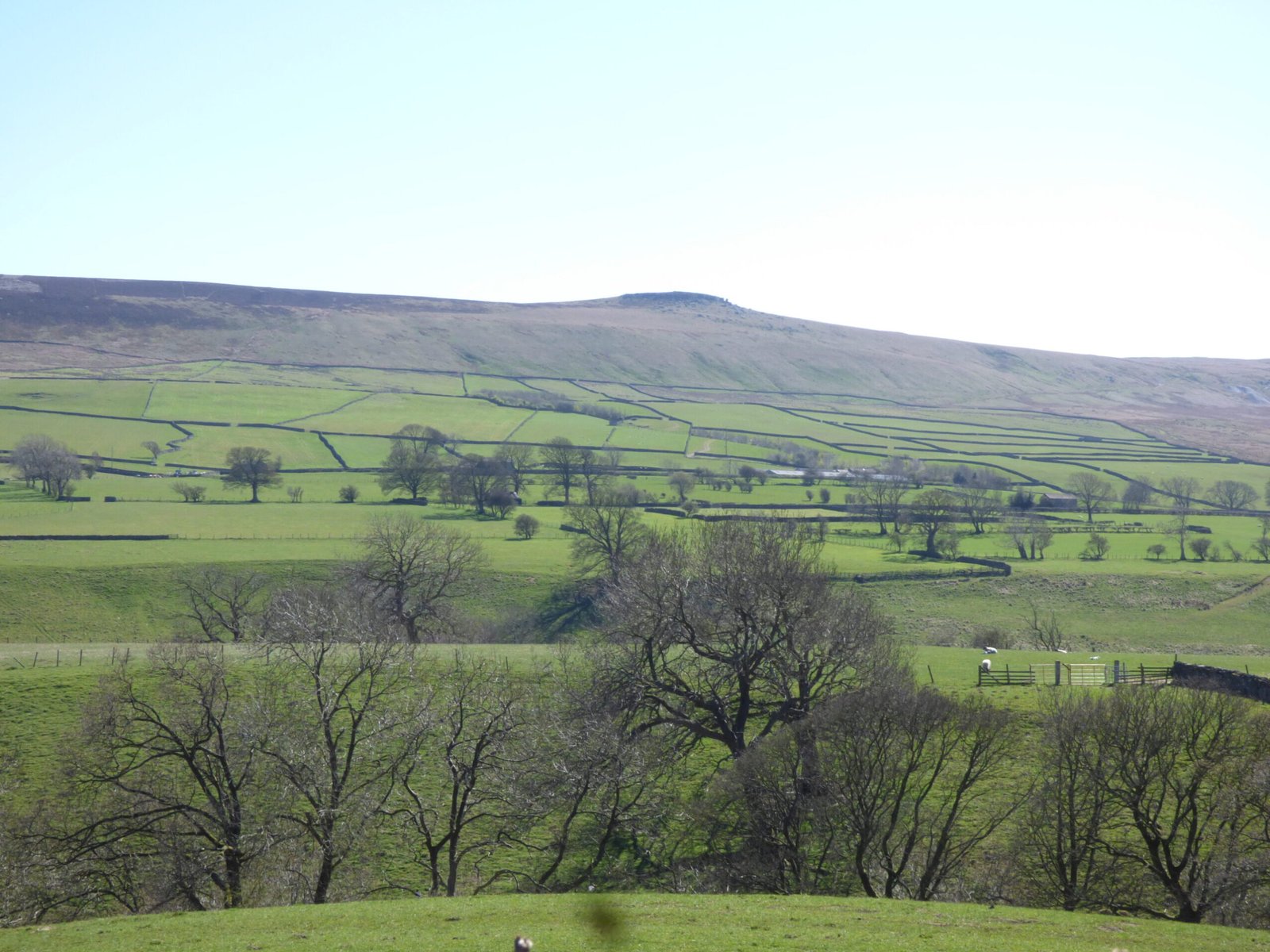
Bedrock is the Yoredale Group – rhythmic beds of Limestone, sandstone and Shale that weather into a classic stepped profile. The harder limestones form terraces (castle and abbey sites love them); the Shales host spring-lines and waterfalls such as Aysgarth Falls. (Wikipedia, dalesrocks.org.uk)
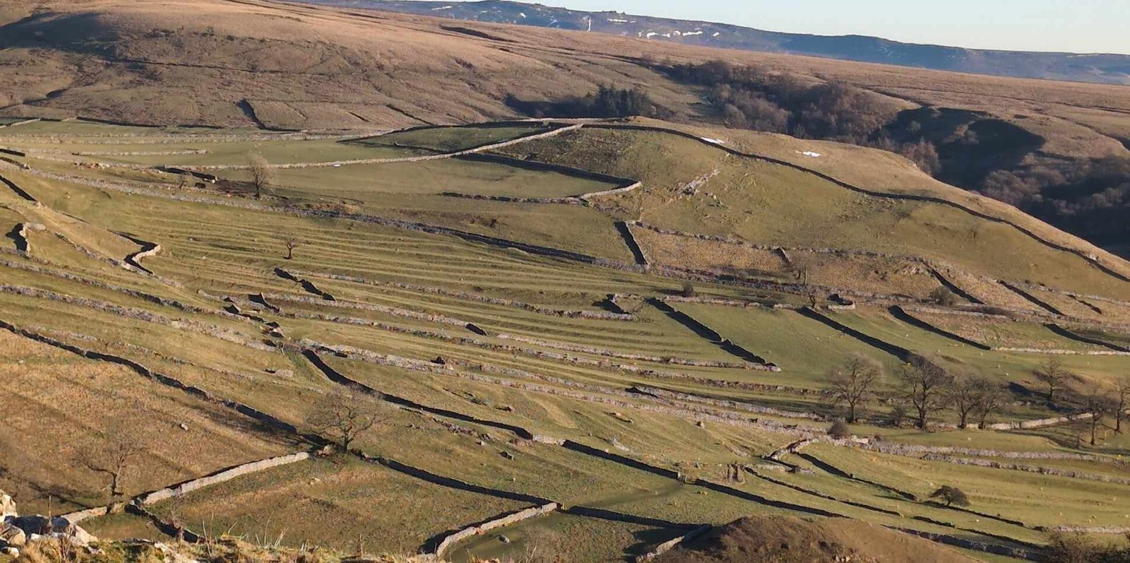
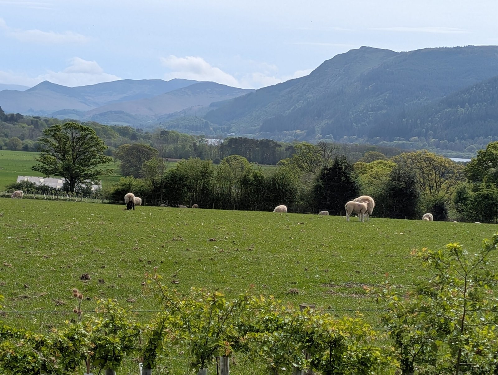
Devensian ice truncated the valley into a U-profile and left Drumlins (e.g., Lady Hill at East Scrafton). The till mantles give heavy soils – good for dairying, but tough to plough.
Mineral veins cut the Yoredales: lead, fluorspar and barytes drove an 18th- and 19th-century mining boom centred on Redmire, Bolton Park and Carperby. (yorkshiredales.org.uk)
Bed
Rock type
Landscape expression
Main Limestone
thick dolomitic limestone
Flat terraces – good for villages, abbeys, hay meadows.
Sandstones (“grit”)
pebbly or flaggy
Crags & waterfalls (e.g., Aysgarth Falls).
Shales with thin coals & ironstone
weak, landslip-prone
Spring-lines, small collieries (Coverdale, Bishopdale).
This rhythmic succession is the Yoredale Group, first described here—hence the geology term. (Wikipedia)
Archaeological Time-frame
Period
Signature sites / finds
Mesolithic (9 000 BC –)
Flint scatters at Semerwater & Countersett.
Neolithic
Castle Dykes henge, formerly regarded as Neolithic, has now been dated to the Iron Age. We will need to find another monument 🙂
18-19th c. Lead & fluorspar mining (Greenhaw, Bolton Park), 6 000+ stone-built field barns, Turnpike (A684), Wensleydale Railway (1878).
Historic arc
Cistercian agrarian Engine – monks of Jervaulx introduced sheep-cotes and Wensleydale cheese (French techniques, 12th c.), exporting wool through Hull. (England's Northeast)
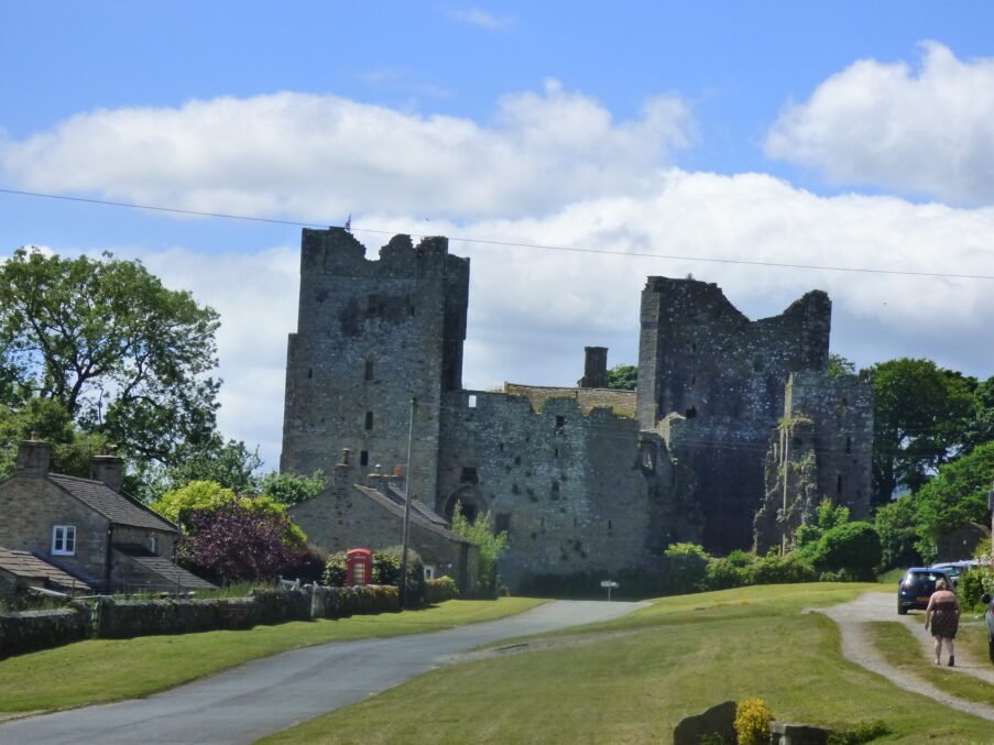
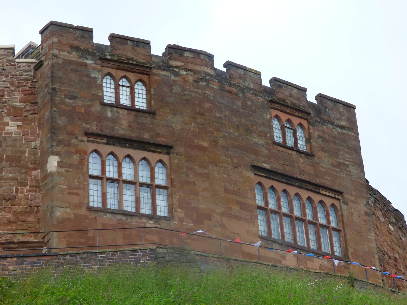
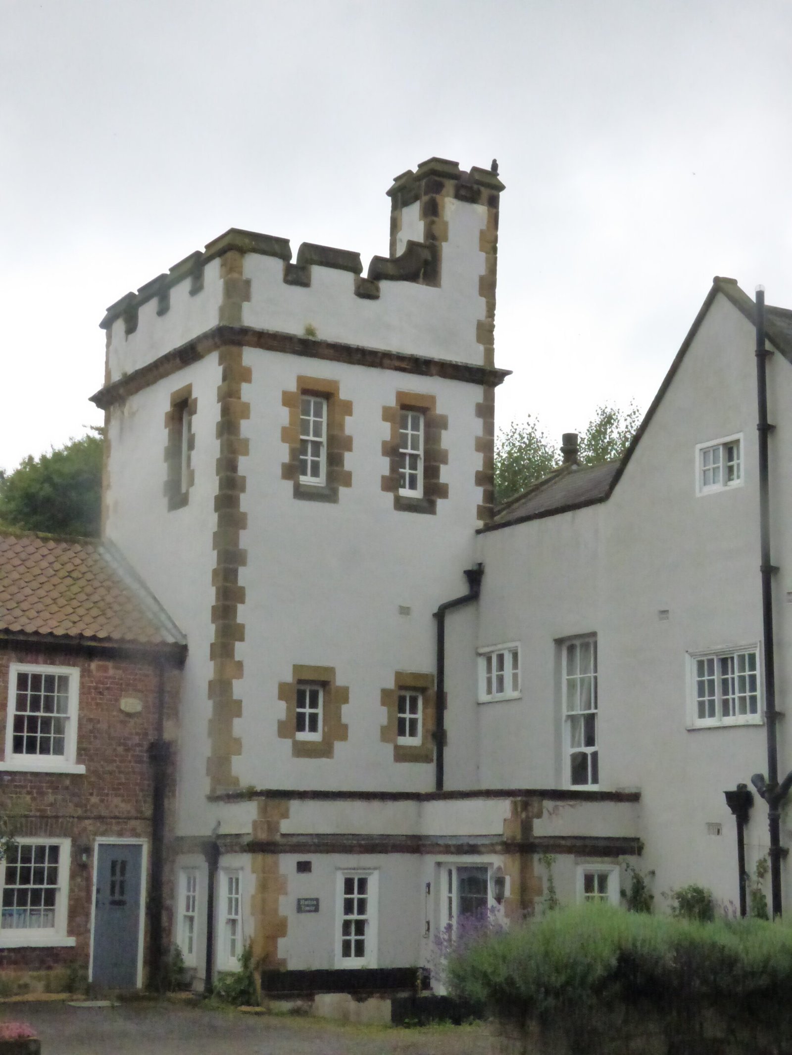
Turbulent 14th–17th c. – Scots raids prompted pele-towers (e.g., Nappa Hall). Bolton Castle garrisoned Royalist troops and held Mary, Queen of Scots (1568-69). (Britain Express)
Lead-silver bonanza – Lord Bolton’s mines made the dale a world-scale producer c. 1750–1880; Grinton, Marrick and Keld Heads smelt-mills modernised ore dressing and water power. (Northern Mine Research Society, yorkshiredales.org.uk)
Industrial bypass & tourism – deep coal and steam age slid past; instead the dale reinvented itself with Victorian health resorts (Aysgarth Falls Hotel, 1890) and early 20th-century motor touring. National-park designation (1954) cemented the leisure economy.
Living in Wensleydale – challenge vs. pleasure
Challenge
Why
Counter-pleasure
Flood & frost block the A684, isolating hill farms.
Fast run-off from Grit uplands; narrow gorges.
The same water creates Aysgarth & Hardraw Force – tourist magnets.
High house prices; few year-round jobs after mining ended.
Second-home & holiday demand.
Heritage-led micro-businesses: cheese, craft ale, guiding, film locations (“All Creatures Great and Small”).
Infrastructure – a single east-west road; rail closed to passengers 1954 (heritage line now), broadband only recently universal.
Economic fragility – dairy prices, tourism seasonality, housing affordability. Lead and coal long gone, leaving limited year-round jobs.
Why it is a pleasure
Scenery & solitude – big skies over limestone scars, wildflower-rich hay meadows, and dark-sky nights.
Heritage density – Bolton Castle, Middleham Castle (Richard III), abbeys, field barns, and the Dales Countryside Museum.
Cheese, ale, walks – PDO Wensleydale cheese, Masham & Leyburn breweries, Coast-to-Coast and Pennine Way links.
Community & culture – agricultural shows (Wensleydale Show since 1913), brass-band concerts, “All Creatures Great and Small” TV nostalgia. (Yorkshire Post)
Place in the wider story
Wensleydale’s layer-cake geology fuelled a medieval wool boom, an early-modern lead boom and, in turn, the distinctive stone barns and walls that define today’s postcard Dales. It exported cheese that survived industrial rationing, became a royal and cinematic backdrop, and still teaches geologists the meaning of “Yoredale rhythms.” Its perpetual balancing act between harsh upland realities and rich cultural landscapes makes Wensleydale both a testing place to farm and an enduring delight to explore.
Geology named here – “Yoredale rhythms” became a teaching model for cyclic sedimentation.
Strategic corridor – Romans, Cistercians, drovers and Turnpike Trustees all chose the same east-flowing valley to link the Pennines to the Vale of York.
Iconic rural brand – Wensleydale cheese (PDO), Bolton Castle heritage, and the Dales field-barn landscape define the English upland vernacular.
Modern climate-adaptation test-bed – Ure catchment flood mitigation and carbon-positive peatland schemes now pilot national practice.