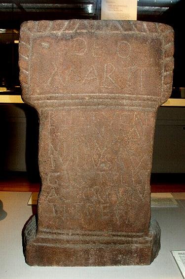
Votive inscriptions to the Goddess Brigantia have been found in the North of England using four names: Caelestis Brigantia, Nympha Read more
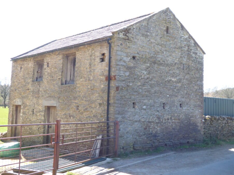
The Coal Barns of Coverdale
“Coal Barns”, are, in the case of Coverdale, and smaller coal producing dales, often, simply ordinary barns, which have been used, and perhaps partially converted for use as coal storage.
How many “coal barns” did Coverdale actually have?
The short answer is: very few—probably no more than half-a-dozen sites that we can name with confidence, and several of those were hybrids rather than purpose-built coal depots.
Candidate coal barn / yard
Earliest attestation
Map / record trace
Status today
“Coalstead Close”, Agglethorpe
1732 Bolton manor survey
Labelled on 1845 tithe plan; disappears from 1911 OS 25-inch (field amalgamated).
Platform visible as faint Scarp; barn lost.
Coverhead Limekiln coal shed
Lime-book 1786: “coal barn at kiln foot”
Shown as roofed rectangle on 1856 OS; ruin by 1912 revision.
OS marks “P.H.” only, but rear range footprint matches.
Rear outbuilding extant, now store.
Horsehouse Fair-Green coal pen
1852 Turnpike trustees minute: “coal pen to be railed”
Not separately mapped; likely open stack at green’s edge.
No built structure; green used for parking.
West Scrafton Colliery yard stack
“Stack yard inventory” in Day Book, 1872-89
Shown as roofed bothy on 1893 OS; gone by 1967.
Earth platform, coke-oven rubble.
Little Haw Drift lean-to
Mines inspector’s note 1896: “coal store 6 x 4 ft”
Too small to show on OS; site lost under scrub.
Trace only as scatter of flagstones.
Why the number is small
Output size – Annual tonnage rarely justified permanent bulk stores; most coal went straight from pit to user by cart or pack-animal.
Multiple use buildings – Limekiln sheds, smithies or inns simply set aside one bay for coal, so the map or rent roll doesn’t label them “coal barn.”
Seasonal work – Winter extraction meant stacks could stand outside; only wet-sensitive steam coal (for the 1870s winder) demanded a roof.
Terminology drift – Documents use coal garth, coalstead, coal house, and cole barn interchangeably; many tithe plans omit outbuildings unless taxed separately.
Research implications
Archival scan – Tithe apportionments and land-tax returns are better guides than OS maps; search by field-name elements Coal-, Cole-, Colestead-.
Archaeological signature – Look for black clinker, coke, or Shale scatter near small building platforms, not just the structures still standing.
Landscape modelling – When mapping coal logistics, treat barns as occasional nodes in a network otherwise dominated by direct pit-to-kiln or pit-to-farm haulage.
So, while coal was a recognised commodity, the dale’s modest output and flexible, farm-based economy meant only a handful of dedicated—or semi-dedicated—“coal barns” ever dotted Coverdale’s landscape.
How to spot a Coverdale‐style “coal barn” in the field
Because most barns in the Dales were built for hay or stock, a structure that once held coal usually shows a cluster of physical and contextual clues. None is decisive on its own, but when three or more line up the case for coal handling is strong.
Diagnostic feature
Why it matters
What to look for (Coverdale specifics)
Black interior staining
Coal dust impregnates lime wash and mortar, leaving a matte grey-black sheen.
Rub a fingertip on protected wall faces or ceiling joists; coal barns often lack the tarry soot associated with threshing-barn coke fires.
Flagstone or rammed-earth floor – not cobbled
Coal stacks need a hard, smooth surface for shovelling; cobbles snag the shovel edge.
Thin flags laid directly on clay; sometimes a shallow slot along one edge where a wooden bin divider once fitted.
Opposed wide door openings (cart-width) with low sills
Coal was tipped in and shovelled out by cart; through-draft doors helped dust disperse.
Lintel height only ~2 m (for farm cart), door cheeks battered to resist wheel-hub knocks.
Ventilation slits placed low (below 1.2 m)
Coal heats and sweats; low slots relieve dampness without risking wind-blown rain.
Narrow (5–8 cm) vertical slits, sometimes splayed internally; too low and narrow to serve hay ventilation.
Absence of full-height hay loft
A coal bin needs head-room; cross-beams are set high or the loft removed entirely.
Joist sockets at > 3 m or truncated mortises; if a loft survives it is half-width with a bin space below.
Proximity to kiln, smithy or bridge crossing
Coal barn usually sits at a logistics node, not amid meadow rigs.
Map shows it beside limekiln clamp, near Nathwaite Bridge, or at field edge where two hollow-ways meet.
Black clinker & small coal outside doorway
Hand-loading always spills chippings that weather slowly in acidic dale soils.
Context – within 50 m of a kiln, bridge, or documented coal track?
Document name – parcel called Coalstead/Coal Garth?
Four or more positives: probable coal barn.
Two or three: mixed-use barn—needs archive cross-check.
Fewer: likely hay, cattle or general purpose.
Using these criteria in tandem with map and documentary evidence lets you sort Coverdale’s modest stock of outbuildings into true coal barns, mixed commodity sheds, and ordinary field barns—vital for reconstructing the dale’s coal logistics network with confidence.
A Probable Neolithic flint piece of debitage possbily intended to be a blade.The fragment is made from a tertiary flake of semi-glossy light grey flint with slightly darker grey patches. It is sub-triangular in plan [...]
A very worn and chipped Roman copper alloy radiate of uncertain emperor dating to the period AD 260-275 (Reece period 13). Unclear reverse type depicting figure standing left. Unclear mint. [...]
A heavily worn Medieval silver 'short cross' cut farthing of an uncertain monarch, Henry II to Henry III dating to the period c.1180-1247. Not further defined.Length: 9.6mm; width: 9.4mm; thickness: 0.5mm; weight: 0.4g. [...]
Silver medieval penny of an uncertain ruler, probably Henry V to Henry VI (1413 - 1461) minted at York. The coin is in poor condition, is 16mm in diameter and weighs 1.00g. [...]
A Roman copper-alloy radiate of Tetricus I/II dating to circa AD 271-274 (Reece Period 13). PAX AVG reverse type depicting Pax standing left holding branch and vertical sceptre. Gallic Mint I. [...]
A Roman copper-alloy nummus of Magnentius or Decentius dating to AD 250-253 (Reece Period 18). VICTORIAE DD NN AVG ET CAE reverse type depicting two Victories holding wreath inscribed [VOT/V/MVLT/X]. Mint of Trier. [...]
A Roman silver denarius of Antoninus Pius (AD 138-161) dating to AD 154-155 (Reece Period 7). COS [IIII] reverse type depicting Fortuna, draped, standing right, holding rudder, vertical on globe, in right hand and cornucopiae, with tip [...]
A Roman copper-alloy barbarous radiate copying a coin of Victorinus (AD 268-270) dating to circa AD 275-285 (Reece Period 14). Copying PAX AVG reverse type depicting Pax standing left holding branch and transverse sceptre. Unclear [...]
A Roman copper-alloy radiate of Carausius (AD 286-293) dating to circa AD 286-293 (Reece Period 14). PAX AVG reverse type depicting Pax standing holding branch and vertical sceptre. Unclear mint. [...]
A Roman copper alloy radiate of Tetricus II (AD 272-274) dating to circa AD 272-274 (Reece Period 1). [SPES AVG] reverse type depicting Spes walking left holding branch and raising hem of robe. Unclear mint. [...]
A free-standing pierced stone weight of uncertain age, but probably dating to the Post Medieval period.The object is sub-square in plan and rectangular in cross section. Its sides appear to have been sanded to give [...]
A Roman copper-alloy barbarous radiate copying a coin of Divus Claudius II (AD 270-271) dating to circa AD 275-285 (Reece Period 14). Copying CONSECRATIO reverse type depicting altar with crescent. Unclear prototype mint. [...]
A free-standing cast lead conical 12.43g weight of uncertain age, but probably dating to the Post Medieval period.It has a sub-circular base with concave tapering sides up to a slightly flattened apex. A circular hole runs through [...]
A free-standing cast lead conical 20.79g weight of uncertain age, but probably dating to the Post Medieval period.It has a sub-circular base with tapering sides up to a slightly flattened apex. A circular hole runs through the [...]
A clipped Post Medieval silver halfgroat of James I (AD 1603-1625). First coinage, dating to AD 1603-1604. Mint of London. North (1991: 144) No. 2076, thistle mintmark. [...]
A very worn Post Medieval silver three pence of Elizabeth I (AD 1558-1603) second coinage dating to AD 1561-1582. Mint of London. Unclear initial mark. North (1991: 135) no. 1998. [...]