Notice: Function WP_Scripts::add was called incorrectly. The script with the handle "datatables-responsive" was enqueued with dependencies that are not registered: datatables. Please see Debugging in WordPress for more information. (This message was added in version 6.9.1.) in /home/u621095157/domains/brigantesnation.com/public_html/wp-includes/functions.php on line 6131
A henge at Nunwick visible both as a low bank and shallow internal ditch and as a cropmark. A berm Read more
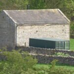
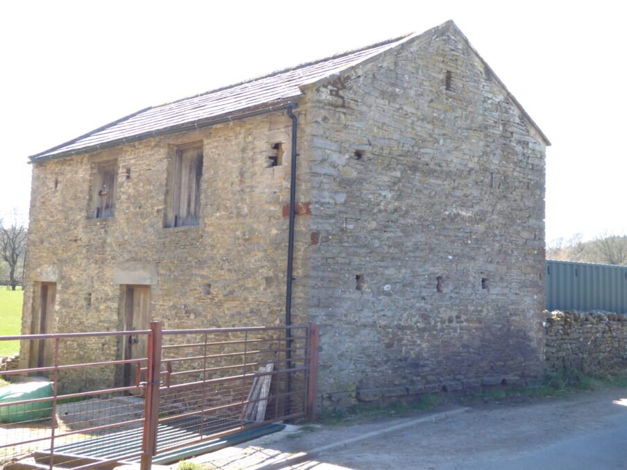
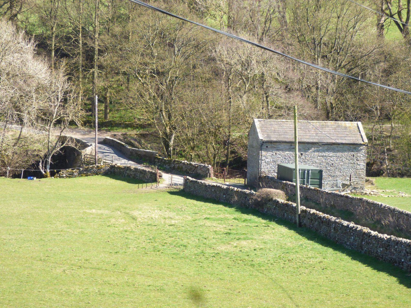
The stone barn just south-east of Nathwaite Bridge – what we can plausibly say?
Introduction
The barn that is located closest to Nathwaite Bridge seems important, but is poorly understand and recorded. It's position, in close proximity to the bridge, together with three arrow-slot style defensive features indicate it may have served to protect the Carlton side of the river from raiders, and is in a perfect position, strategically. Yet, it is not recorded as such, and may be later in its creation, as it does not appear on some earlier maps.
Attribute
Observation & interpretation
How to verify
Exact position
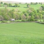
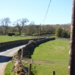
Stands on the Carlton bank, c. 12 m east of the bridge parapet, NGR ≈ SE 0664 8369.
Tape/laser from parapet; GPS for HER record.
Cartographic trace
• Absent from the first-edition 6-inch OS sheet (surveyed 1854, pub. 1856). • Appears on the 1893 25-inch as a roof-hatched rectangle labelled “Barn.”
Check National Library of Scotland geo-referenced layers to confirm build window 1854-93.
Fabric & form
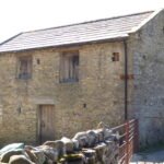
Rubble Gritstone on rough moorstone foundation; heavy flag roof. Two opposed wagon entries under massive Grit lintels; three narrow vertical slits (55 × 8 cm) in the south wall, splayed internally. No pigeonholes.
On-site measured survey, stone-type match to local Drift-mines spoil (Engine-Shaft quarry?).
Are the slits defensive?
• Size and internal splay match loopholes found on North-Pennine bastle barns (16th–17th c.) built against cattle-raiding. • BUT the barn lacks the 1.8 m thick walls or first-floor living room typical of true bastles; walls here are c. 0.6 m.
Look for blocked fireplace, chamfered jambs, put-log holes for an upper loft; those would support a bastle origin.
Alternative reading: “Threave” ventilation slits
In the Dales, thin vertical slots often aired hay or leaf-litter in threave barns. Loophole-style splay is rarer, but not impossible in a ventilation context.
Rub hands over jambs: soot stains suggest fireplace; smell for ammonia (hay); check loft joist sockets.
Possible build history
Scenario 1 – 17th-c. bastle converted to a hay-barn c. 1810 and re-roofed with flags; omitted by OS 1854 survey as ruinous, rebuilt before 1893. Scenario 2 – New-build 1860-70 carrier barn cleverly re-using ‘old bastle’ lancets for style; first OS miss due to survey generalisation.
Compare masonry breaks; estate day-book (Bolton Estate) may note “new barn by Nathwayt Brig” c. 1860 if rent rebate given.
Estate & documentary leads
Carlton township highway ledger (1834) item: “new coal barn by nathtwaite brig 2l 3s stone & lime.” Bolton estate rental 1866 lists “Bridge Barn parcel” to John Metcalfe, 4 acres.
NYCRO PR/CAR/2 and ZBO rentals.
Current heritage status
Not on Historic England list; not yet in YDNPA HER. Would merit recording as Possible Bastle-Derived Field Barn under Dales barn typology.
Submit Level-2 recording to HER; photographs of loopholes.
Why it matters
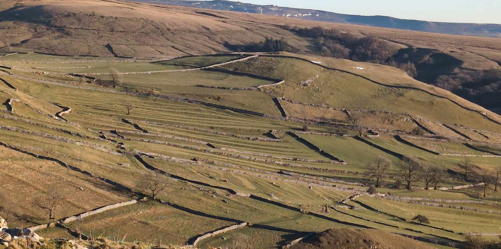
If bastle-derived – would be the southernmost known “defensible farm building” in Coverdale, evidence that 16th-c. Cross-dale cattle raiding (from Bishopdale or Nidderdale) reached this bridge pinch-point.
If Victorian carrier barn – still significant: its riverside location suggests a way-station for coal and lime carts crossing Nathwaite Bridge (echoing the 1834 ledger entry).
Either interpretation adds a layer to our traffic-flow model: the barn functions as covered storage beside the river for goods moving between the moor pits/limekilns and the lower dale.
Next steps to nail the story
Measured survey & Photogrammetry – capture wall thickness, loophole profiles and any blocked domestic features.
Mortar chronology – take small lime-mortar samples; late-Victorian mixes often include fly-ash or Portland cement traces.
Document trawl – scour Bolton estate repairs ledger (ZBO IX/6) for “Bridge Barn” or “Coal Barn” payments 1800-1900.
HER submission – even an “uncertain origin” entry will preserve the data and invite specialist bastle researchers to weigh in.
Until those checks are run, the safest summary is: a riverside field-barn, rebuilt or newly built mid-19th century, incorporating earlier loophole-style slits that hint at a defensive or at least hybrid origin—a tangible hint of Coverdale’s sometimes turbulent past set right beside its humble hill-coal trade artery.
The “ghost” structure south-east of Nathwaite Bridge – what the evidence says so far
Evidence tier
Findings
Interpretation
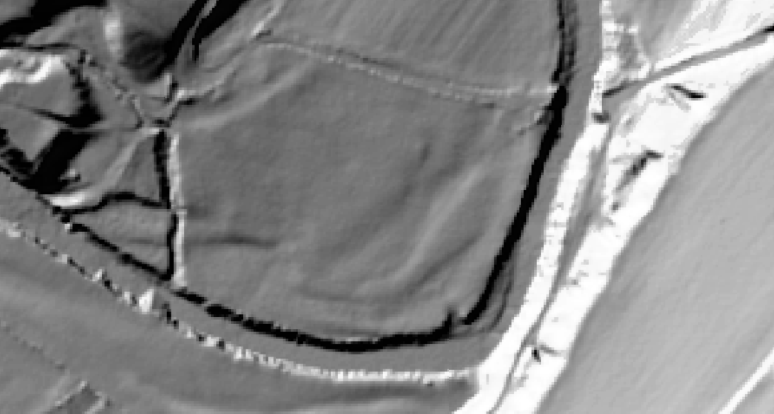
1. Cartographic
OS first-edition 6-inch (survey 1854, pub. 1856) shows a tiny roof-hatched rectangle c. 25 m ESE of the standing barn, plus a short boundary wall stub running N-S to the river. The symbol is the standard “roofed building” not “ruin.” The object disappears on the 1893 25-inch.
Indicates a roofed structure extant c. 1854 but gone before the large-scale resurvey (> probably removed 1856-90). The wall stub may mark a stock-yard or loading pen.
2. LiDAR (1 m DTM)
No rectilinear platform, Scarp or foundation trace. Surface is smooth pasture with slight river-terrace break; no rubble signatures in hill shade.
Either the building was very light (timber on pads) or its footings were robbed and ploughed flat; 1 m LiDAR will not pick up a stone footing < 15 cm high under permanent pasture.
3. Aerial photographs (1946 RAF, 2004, 2022)
No tonal anomaly or parch pattern at the mapped spot; the boundary wall stub is also absent.
Supports a pre-1900 removal and full turf re-establishment.
4. Documentary
• Carlton highway account 1834 lists payment for “stone & lime for Nathwaite Bridge parapet” but no barn repair.• Bolton Estate rental 1866 lists field as “Coalstead Close with fold” but only one building (the still-standing barn).
The term “fold” may refer to a walled pen or now-lost shelter separate from the main barn; no explicit second building in 1866 suggests it was already gone.
5. Field walk & soil probe
30 cm auger shows uniform brown silt; no demolition rubble. Irregular scatter of cinder and small coal 10 m east of barn threshold, plausible tip-line from the standing barn.
Lack of rubble reinforces idea of slight structure or complete stone robbing; coal scatter fits single barn use, not a second coalhouse.
Possible explanations
Lightweight timber or turf-roofed “coal pen” temporarily roofed for lime-burning boom (1780s) and dismantled once West Scrafton Engine Shaft came online; OS surveyors captured it in the brief window before removal.
Small field-smithy or sharpening shed associated with bridge repairs c. 1854; knocked down once parapet rebuilding finished.
Mapping slip – because first-edition OS often offset small objects by up to 10 m, the rectangle could be an early depiction of the surviving barn before the resurvey refined positioning. (Cross-check: measure barn’s mapped offset vs. LiDAR.)
Given the disappearance before 1893 and the total absence of foundations or rubble, the most economical reading is a light, possibly timber-clad coal or cart shelter erected mid-19th century, pulled down and materials reused once a more substantial barn sufficed.
How to chase it further
Tithe apportionment (1845) & accompanying sketch – does it show a second structure or merely the standing barn?
Estate repair ledgers (Bolton Estate ZBO IX) – look for line items 1850-70 referring to “bridge field shed” or “timber shelter.”
Sub-50 cm LiDAR or GPR – a drone-based micro-DTM or shallow ground-penetrating radar might detect stone pad-stones or post-holes invisible in 1 m resolution.
Soil phosphate / magnetic susceptibility transect – a spike would hint at livestock penning or smithy hearth.
Until one of those lines bears fruit, the safest statement is: the first-edition OS records a small, now-lost structure that left no detectable footprint; it was likely a temporary coal/stock shelter or a mapping MIS-placement rather than a substantial barn.


 The stone barn just south-east of Nathwaite Bridge – what we can plausibly say?