Notice: Function WP_Scripts::add was called incorrectly. The script with the handle "datatables-responsive" was enqueued with dependencies that are not registered: datatables. Please see Debugging in WordPress for more information. (This message was added in version 6.9.1.) in /home/u621095157/domains/brigantesnation.com/public_html/wp-includes/functions.php on line 6131
This is our master collection page for all of our heritage articles and sites. It is the root of our Read more
OS Ref: SE231991 OS Map: Landranger 99
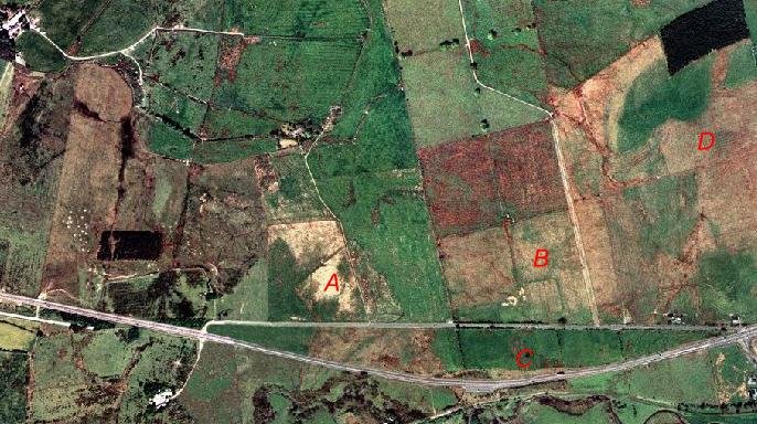
Size; (160+ x c.230 m) 9 acres (3.6 ha). Discovered only recently by air survey and geophysics, this camp lies on the alluvial plain of the River Swale, on the south bank of the river just north-east of Catterick racecourse. The camp lies some 350m to the west of Dere Street. Only the north-east corner angle, a length of the north rampart and a longer section of the eastern defences have been recorded. There is a gateway with a possible external titulum located about mid-way along the northern side, other than this, the camp is poorly defined and not easy to interpret. Other possible related Earthworks covering a possible south-west corner have also been identified.


 OS Ref: SE231991 OS Map: Landranger 99


