Period: Roman

Anciens Arsenaux Neolithic Settlement, Sion – Switzerland

Upper Rhone Valley

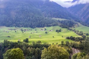
Sion lies midway along the upper Rhône Valley, an east‑west trench gouged by repeated Pleistocene glaciers and now flanked by the Pennine and Bernese Alps. The settlement area sits on the alluvial fan of the Sionne torrent, a cone of well‑sorted sands and gravels that projects onto the wider Rhône flood‑plain. 

Gnaeus Julius Agricola

In a series of annual military campaigns Agricola put down revolts in north Wales, subdued the Brigantes tribe in the north, extended Roman control over the Scottish lowlands, where he established a string of forts between the Forth and the Clyde, sent troops into Galloway, and made inroads into the eastern Highlands. During the latter campaign his vessels were the first to circumnavigate the islands.

Liverpool Street Roman Road, Manchester

Liverpool Street Excavations - Roman Road - Manchester University

Archaeologists have exposed a well-preserved cambered Roman road surface in Manchester’s Castlefield area (Liverpool Road/Liverpool Street reporting), astonishingly only c. 15 inches (≈38–40 cm) below modern tarmac, with an assemblage of Romano-British pottery and other small finds broadly dating its active use to the 1st–3rd centuries AD.

Mamucium Roman Fort, Manchester

Roman Gatehouse at Mamucium

Mamucium occupies a low sandstone promontory at the junction of the Rivers Medlock and Irwell. The bedrock is the Triassic Sherwood Sandstone Group, a firm, well‑drained red sandstone that gave Roman engineers a stable platform for earthworks and timber palisades, while nearby river gravels supplied road‑making aggregate.

Castro de Trona fort – Pontevedra, Spain

Petroglifo castro Troña

Castro de Trona is an oval enclosure with significant terracing to the west and a large ditch to the east. This castro (a hillfort settlement) has an accepted date of around 600 BCE. Like many others in Galicia, this castro reached its peak during the 1st and 2nd centuries CE. It measures approximately 200 metres east to west by 150 metres north to south.

Roman Road to the West uncovered under Manchester Street

Sections of a Roman road can be seen in this trench

A stretch of Roman road just 38-40 cm (15 in) below Liverpool Road in Castlefield. The trench shows the classic Roman construction sequence – a cambered rubble core surfaced with tightly packed cobbles – and runs on a north-east/south-west alignment that leaves Mamucium’s north gate and heads towards modern Salford.

Doncaster Roman Fort (Danum)

Dunum Roman Fort artistic impression

← South Yorkshire Roman Rig Defensive Works The Roman Rig is a defensive dyke built to defend against attack from the south. It runs from Sheffield, past Read more Templeborough Roman Fort – Rotherham Templeborough Roman Fort occupies a commanding position on the north bank of the River Don at Rotherham (OS grid SK Read …

Continue reading

Adwick-le-Street Roman Fort (Derventio)

Adwick-le-Street Roman Auxilliary Fort - Artistic Impression

Derventio was an auxiliary fort, it probably housed a mounted ala or an infantry cohort. It is located immediately west of modern Adwick le Street (OS SE 553 008), astride Ermine Street (the Roman Ridge).

Templeborough Roman Fort – Rotherham

Templeborough Roman Granary remains at Clifton Park Museum

Templeborough Roman Fort occupies a commanding position on the north bank of the River Don at Rotherham (OS grid SK 410 916), where the Magnesian Limestone ridge drops into the floodplain. Originally constructed in timber and earth in the mid–1st century AD, it was later rebuilt in stone and occupied—possibly intermittently—until the withdrawal of Roman authority in the early 5th century AD

Wincobank Hill Fort

Wincobank Fort – LiDAR – National Library of Scotland 3

This is an oval fort with an internal area of 2.5 acres. A bank, ditch and counterscarp bank are continuous around it except on the N side where ditch and counterscarp have been destroyed.

Contact Us
close slider