Notice: Function WP_Scripts::add was called incorrectly. The script with the handle "datatables-responsive" was enqueued with dependencies that are not registered: datatables. Please see Debugging in WordPress for more information. (This message was added in version 6.9.1.) in /home/u621095157/domains/brigantesnation.com/public_html/wp-includes/functions.php on line 6131
Marrick Priory, a historic gem nestled in the Yorkshire Dales, has a rich history that dates back to the 12th Read more
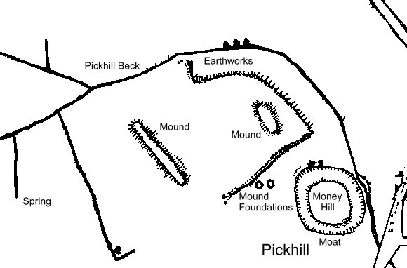
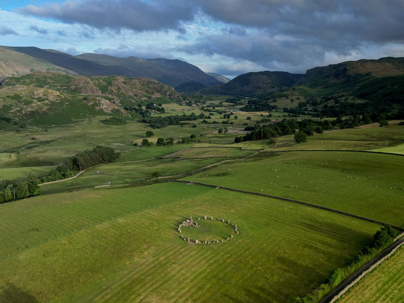
The earthworks surrounding Stainton in North Yorkshire are part of a rich archaeological tapestry that speaks to the region's ancient past. These structures are believed to be remnants of extensive field systems, possibly dating back to the post-Roman period.
They are distinct from the Grinton-Fremington Dyke System, which is thought to have marked the boundaries of an early British kingdom.
The earthworks are indicative of the complex social and agricultural practices that have shaped the landscape over centuries.
While the exact origins and purposes of these earthworks are not fully understood, they are a testament to the enduring human impact on the Yorkshire Dales, offering a tangible connection to the lives and labours of those who lived here long before the modern era.
The earthwork complex in Stainton, North Yorkshire, is indeed a fascinating subject for archaeological conjecture.
The presence of features such as hills with partial spiral paths and other modified hills suggests a purpose beyond mere agriculture.
Scholars have explored these features extensively, considering their potential significance in prehistoric times.
For instance, the linear earthworks of the Yorkshire Wolds have been studied to understand their role in land division and boundary systems during the Late Bronze Age and Iron Age.
These monumental structures are thought to reflect the cosmologies of prehistoric communities, serving not just practical purposes but also embodying the beliefs and social structures of the time.
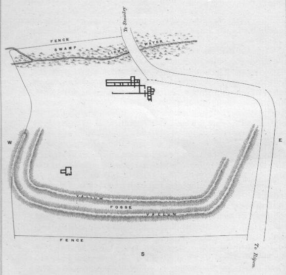
Similarly, the massive Iron Age earthwork complex at Stanwick, not far from Stainton, has been interpreted as a Brigantian 'royal' site, with its extensive perimeter earthwork suggesting a significant presence in the landscape.
The construction of such earthworks likely had multifaceted roles, including territorial, defensive, and ceremonial functions.
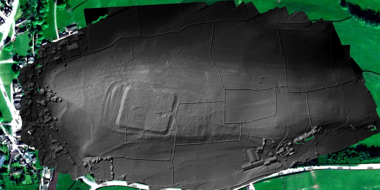
Moreover, recent geophysical surveys at Stanwick Oppidum have revealed new features that hint at the complexity of Late Iron Age settlement patterns.
While direct evidence linking these features to Stainton's earthworks is not explicitly stated, the parallels in construction techniques and purposes provide a basis for informed conjecture about the Stainton earthworks' role in the broader prehistoric landscape of North Yorkshire.
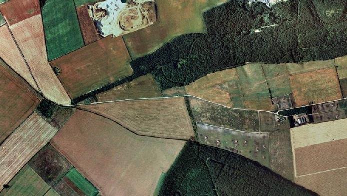
From satnav images it can be seen that the earthworks at Stainton, although having some relation to potential field systems, also have a number of other features which are not directly related to agriculture. These earthworks are not only extensive, but they also seem to hold potential structures, and hill-based earth works that could indicate other purposes for the site than simply farmland.


 From satnav images it can be seen that the earthworks at Stainton, although having some relation to potential field systems, also have a number of other features which are not directly related to agriculture. These earthworks are not only extensive, but they also seem to hold potential structures, and hill-based earth works that could indicate other purposes for the site than simply farmland.


