Blog Archive

Mote of Mark Hill Fort

Mote of Mark from sea shore path

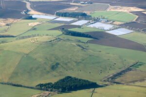
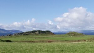
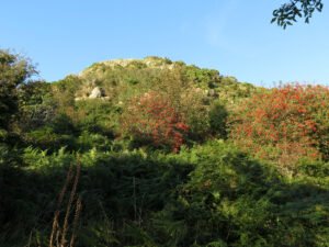
The Mote of Mark is a defended hilltop overlooking the Urr estuary. It was the court or citadel of a powerful Dark Age chieftain, possibly one of the princes of Rheged. The site was occupied during the 6th century and appears to have been destroyed by fire in the 7th century.

Barry Hill Fort

Hillfort on Hill of Barra, near Old Meldrum, from the air

Barry Hill is a textbook “big fort waiting for a small trench”: its spectacular vitrified rampart, enigmatic outer works and Arthurian folklore offer equal attraction to scientists and story-lovers—yet almost everything we know comes from surface survey. A single, well-designed excavation season could pivot the site from picturesque curiosity to a securely dated anchor point in the defensive story of eastern Scotland.

Dunagoil Hillfort, (Isle of Bute, Argyll & Bute)

Dunagoil Hillfort

Dunagoil crowns a 30 m-high columnar-basalt promontory on the south-west coast of Bute, overlooking the Sound of Bute and the Cumbraes. Cliffs on the north and west form natural ramparts; only the gentle ESE saddle gives easy access.

Tap O’Noth Hill Fort

Tap O Noth Hillfort

This is one of the best examples of a vitrified fort, it is near the village of Rhynie in northeastern Scotland. This massive fort from prehistory is on the summit of a mountain of the same name which, being 1,859 feet (560 metres) high, commands an impressive view of the Aberdeenshire countryside.

How Hill Hillfort, Swaledale

How Hill Downholme LIDAR

How Hill, near Downholme in North Yorkshire, is the site of a large univallate hillfort.

Aldborough Roman Town

Aldborough Roman Town mosaic

Aldborough, or Isurium Brigantia as it was known in Roman times was the capital of Brigantia, at least from some point during Cartimandua’s acceptance as client Queen, governed by Rome. As such, it is a key site in our search for Brigantia

Mam Tor Hill Fort, Castleton, Derbyshire

Despite is unusually high position, this fort contains traces of a number of huts, and on investigation these have yielded plentiful pottery, as well as charcoal giving a surprisingly early radio carbon date

Lady Hill, East Scrafton – Coverdale

Lady Hill East Scrafton - LiDAR

Located in East Scrafton, a small hill called Lady Hill is marked on the OS Series 1 map. The term “Lady” is of interest, since it has been used elsewhere in sites that appear important for religious purposes.

Cow Ford close to Nathwaite Bridge

Fords and River crossings at Nathwaite Bridge Coverdale - OS Series 1 - Thanks to National Library of Scotland

In the field of Bridge Barn, close to Nathwaite Bridge, there are two fords marked on the OS Series 1 map. This site page holds the details of our investigation into the fording point we think may be called Cow Ford.

Intach Ford: Upstream of Nathwaite Bridge, Coverdale

Ford close to Nathwaite Bridge

In the field of Bridge Barn, close to Nathwaite Bridge, there are two fords marked on the OS Series 1 map. This site page holds the details of our investigation into the fording point we think may be called Intach Ford.

Contact Us
close slider