Period: Iron Age

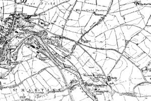
Earthworks at the top of Holly Hill, Well

While details about these earthworks are not widely documented, the area is known for its rich archaeological significance. Holly Hill itself is a place of interest, with its Grade II listed status indicating its historical importance.

The use of the word Lady in relation to water related structures

Lady Bridge in Tamworth is a historical structure with medieval origins, serving as a testament to the town’s rich past. Initially constructed to span the River Tame, the bridge has undergone several transformations throughout the centuries. The original wooden bridge dates back to 1294.

Field Systems at Reeth

The field systems at Reeth are particularly noted for their historical coaxial layout, and are characterized by long, parallel boundaries that run across the landscape, a pattern indicative of significant central organization and planning.

Bainbridge Camp – Hill Fort

With kind permission of YAAMAPPING

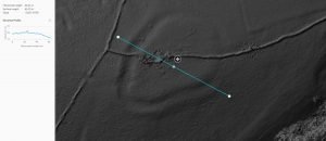
The subject of much speculation and, frankly, little fact this looks like a classic hill fort to us, check out the below elevation map of the area with the hillfort showing up beautifully. We have also included elevation profiles so you, dear readers, can appreciate the classic hill top location: note how from all directions the hillfort perches nicely on the top of the highest point: visible from all directions and can see in all directions. A classic see & be seen location, achieving the twin aims of defence and impressing visitors.

Woden Law Hill Fort

With kind permission of YAAMAPPING

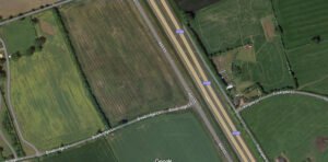
Wodens Law is actually the name of the great mountain that the Hill Fort is perched upon. Ok, so its not a mountain being a mere 500m high, but in this wild and desolate landscape it looks a lot more.The facts of the fort are impressive: there are multiple levels of ditch and bank defences surrounding the peak. There are considered to be three phases of occupation: firstly, a wall enclosed a substantial occupation area, this dated to the first century AD.

The Brigantes of Lancashire

An image illustrating an article about The Brigantes of Lancashire on thealicesyndrome.com

An interesting heading in Robert Morden’s map of Lancashire (1695) places “The Brigantes” in Lancashire. Worth investigating to try to understand exactly what Robert Morden was trying to portray here.

Sutton Common Fort

Sutton Common is an early Iron Age fort/enclosure site just north of Doncaster, A key feature of this “marsh fort” is that it seems to use the surrounding marsh land as part of its defence – a twist on the more common hill fort.

Norham Fort

Norham Iron Age Hill Fort

Finavon Fort

Finavon Hill has attracted a great deal of archaeological interest from antiquarians and archaeologists over the years especially since it displayed traces of vitrified rock.

Eileen na Goar Fort

Eilean nan Gobhar

This island, locally termed Eilean na Goar, is the most eastern and is bounded on all sides by precipitous gneiss rocks; it is the abode and nesting place of numerous sea birds. The flat surface on the top is 120 feet from the sea level, and the remains of the vitrified fort are situated on this, oblong in form, with a continuous rampart of vitrified wall five feet thick, attached at the SW end to a large upright rock of gneiss

Contact Us
close slider