← South Yorkshire Roman Rig Defensive Works The Roman Rig is a defensive dyke built to defend against attack from the south. It runs from Sheffield, past Read more Templeborough Roman Fort – Rotherham Templeborough Roman Fort occupies a commanding position on the north bank of the River Don at Rotherham (OS grid SK Read …
Location: South Yorkshire
Templeborough Roman Fort – Rotherham
Templeborough Roman Fort occupies a commanding position on the north bank of the River Don at Rotherham (OS grid SK 410 916), where the Magnesian Limestone ridge drops into the floodplain. Originally constructed in timber and earth in the mid–1st century AD, it was later rebuilt in stone and occupied—possibly intermittently—until the withdrawal of Roman authority in the early 5th century AD
Great Roe Wood (Roe Wood) Enclosure – Woodhouse
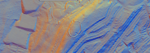
Great Roe Wood (often simply called “Roe Wood”) sits on the Magnesian Limestone ridge that carries the Roman Rig between Sheffield and Doncaster, just northeast of the village of Woodhouse (OS grid SK 450 920). This ridge forms a natural corridor overlooking the Don valley, with shallow soils over limestone giving way to deeper alluvial gravels in the valley bottom.
Brigantia
The name Brigantia represents three separate concepts: a goddess, a people, and a tribal federation. By the Roman period, the name represented a tribal federation compromising all of what would become the Roman province of Britannia Secunda, except for the Parisi territory, east of the River Derwent.


