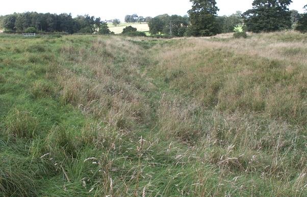
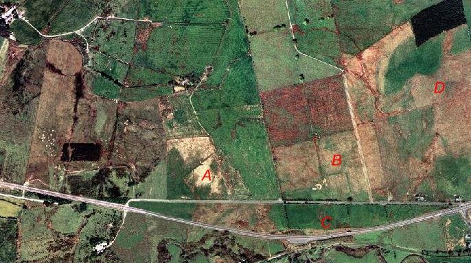
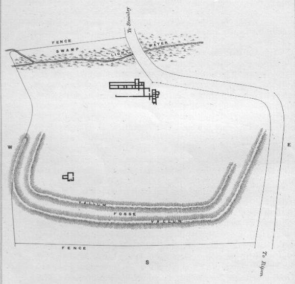
This earthwork was partially excavated in 1870, these revealed the foundations for a Roman villa of obvious opulence. It's final Read more
Site Details:
Historic Origins of Hutton Rudby
What do the place names mean?
Hutton (the –ton ending shows this is an Anglo-Saxon name) means "village on a hill". Rudby (the –by ending shows this is a Viking name) means either "Rudi's village" (a man's name) or "Rudda's village" (a woman's name). Sexhow means either "Sekk's hill" or "the six hills". Skutterskelfe means "village on the bank of a stream".
Leven is a Celtic word, from the people who lived here before the Romans. It probably means "smooth". Hutton Rudby, located in North Yorkshire, England, has a history that stretches back to ancient times. The name "Hutton" is derived from the Old English words "hoh" (hill or spur of land) and "tun" (farm or settlement), indicating that the area was recognized for its geographical features and agricultural significance.
The suffix "Rudby" likely originates from "Rudda's By" (Rudda's farm or settlement), pointing to Norse influences and suggesting that the area was inhabited during the Viking era. Another interpretation is that the name "Rudby" is believed to derive from the Old Norse words "ruth" (meaning "clearing" or "cleared land") and "by" (meaning "village" or "settlement"). Whilst confused, this etymology indicates a potential Viking influence, which would place the origins of Hutton Rudby in the Viking Age, likely between the 8th and 11th centuries. The Vikings began their incursions into Britain in the late 8th century, and many Scandinavian place names in England date back to the period of Viking settlement.
Early History
Hutton Rudby was once known as Hutton-juxta-Rudby, or Hutton-nigh-Rudby, because it is really two villages: Hutton and Rudby, separated from each other by the River Leven. How old is the village? There have been people living here for thousands of years. Stone Age tools have been found in North End.
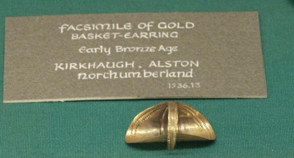
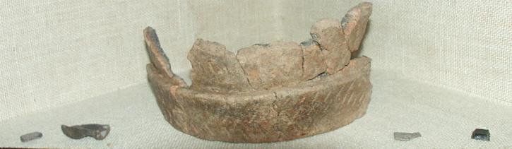
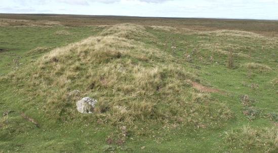
The people of the Bronze Age buried their dead on Folly Hill in a 'round barrow', excavated in 1889 by Canon Atkinson, the famous vicar of Danby. Bronze Age arrowheads have been found and the quernstones with which people ground their corn. There were Iron Age villages near Sexhow and Hundale.
Romans
From the 1st century AD, the Romans invaded and colonised Britain, and they lived here too. There are the remains of a hypocaust (the heating system for a house) by the river between Hutton Rudby and Stokesley.
Roman Road: Evidence of Roman roads in the vicinity of Hutton Rudby suggests that the area was part of the extensive network of Roman Britain. These roads facilitated trade and movement across the region, hinting at the strategic importance of the area. Some recent investigations have noted that the main road leading to and from the bridge, include a base layer of very old stone, possibly Roman. In addition, both walkways leading to the bridge, and therefore also the church as raised, indicating a pilgrimage or ritual purpose for that walkway. We know the Romans, and the Celts, prior to them had a cultish fascination for watery crossing points, and the Romans were well known for their syncretic integration with local tribal cults, often building their temples and shrines in the locations of existing Iron Age cult locations.
Anglo-Saxons
Next to come were the Anglo-Saxons, warriors who came across the North Sea to Britain from the 5th century. In areas under their control, most villages took Anglo-Saxon names – this village became "Hutton".
Early Christianity
After a time Christianity, which had come to Britain in Roman times, grew strong again and a church was built in Hutton, but we do not know where. From the end of the 8th century, the Vikings began raiding the coast and at last took control of the north-east of England. Hutton now lay in the Viking Kingdom of York, and the villages of Rudby, Skutterskelfe and Sexhow have Viking names.
The Norman Conquest
When William the Conqueror invaded England in 1066 he divided the land amongst the men who followed him from Normandy. But in the North fighting against William continued and in 1069 William ordered his soldiers to lay waste the land, murdering the people, burning their homes and crops and killing their animals. There was nothing left to feed the people who survived, and they sold themselves into slavery or fled south to find food.
The following year it was written that there was still "no village inhabited between York and Durham; they became lurking places to wild beasts and robbers and were a great dread to travellers." As a result of this, the Domesday Book in 1086 shows Hutton and Rudby to be "waste" – hardly inhabited or farmed. The new Norman lords, the Meynills, built a church by the river, and each of the medieval townships, Hutton, Rudby, Skutterskelfe and Sexhow, had its own manor house.
Hutton began to take the shape we know today with houses gathered around a village green, which was probably where animals were kept safe at night.
Medieval Period
Hutton Rudby is first mentioned in the Domesday Book of 1086, a survey ordered by William the Conqueror. The Domesday Book records that Hutton Rudby was part of the land held by Robert Malet, with the area primarily engaged in agriculture, including arable farming and livestock.
During the medieval period, the village developed around a manorial system, with the local manor playing a central role in its administration and economy. Berengar de Tosny; Count Alan; Hugh d'Avranches, Earl of Chester; Hugh FitzBaldric, the sheriff; King William as landholder; Ralph Paynel; Ralph de Mortimer; Robert Malet; Robert, Count of Mortain; Thomas, Archbishop of York; William de Percy; Stephen, Abbot of St Mary of York.
All Saints' Church
The village's medieval church, All Saints' Church, has origins dating back to the 12th century, indicating the establishment of a significant Christian community. The church has undergone various modifications over the centuries but remains a crucial historical landmark.
Medieval Pottery: Excavations in and around Hutton Rudby have uncovered medieval pottery fragments. These artifacts provide insights into the daily life, trade practices, and material culture of the medieval inhabitants.
Post-Medieval Development
In the post-medieval period, Hutton Rudby saw gradual growth. The agricultural economy continued to dominate, with the introduction of more advanced farming techniques. The village also benefitted from its location, with improved transportation links facilitating trade and movement. During the 18th and 19th centuries, Hutton Rudby experienced some industrial activity, particularly with the establishment of mills along the River Leven. These mills were primarily used for corn milling and flax spinning, contributing to the local economy and employment.
Modern History
The 20th century brought significant changes to Hutton Rudby, as it did to many rural communities in England. The village expanded with new housing developments and improved infrastructure, reflecting broader social and economic trends. Despite these changes, Hutton Rudby has managed to retain much of its historical charm and rural character.


 Historic Origins of Hutton Rudby
 Leven is a Celtic word, from the people who lived here before the Romans. It probably means "smooth". Hutton Rudby, located in North Yorkshire, England, has a history that stretches back to ancient times. The name "Hutton" is derived from the Old English words "hoh" (hill or spur of land) and "tun" (farm or settlement), indicating that the area was recognized for its geographical features and agricultural significance.
 Early History
 Early Christianity
 The Norman Conquest


