Category: Vitrified Fort

Tap O’Noth Hill Fort

This is one of the best examples of a vitrified fort, it is near the village of Rhynie in northeastern Scotland. This massive fort from prehistory is on the summit of a mountain of the same name which, being 1,859 feet (560 metres) high, commands an impressive view of the Aberdeenshire countryside.

Mote of Mark Hill Fort

The Mote of Mark is a defended hilltop overlooking the Urr estuary. It was the court or citadel of a powerful Dark Age chieftain, possibly one of the princes of Rheged. The site was occupied during the 6th century and appears to have been destroyed by fire in the 7th century.

Knockfarrel Fort

This had substantial ramparts made of stones with a timber frame, enclosing a large area and making good use of the natural defences of the hill-top.

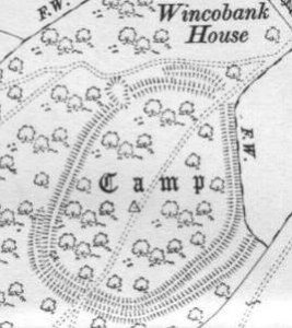
Wincobank Hill Fort

This is an oval fort with an internal area of 2.5 acres. A bank, ditch and counterscarp bank are continuous around it except on the N side where ditch and counterscarp have been destroyed.

Finavon Fort

Finavon Hill has attracted a great deal of archaeological interest from antiquarians and archaeologists over the years especially since it displayed traces of vitrified rock.

Eileen na Goar Fort

This island, locally termed Eilean na Goar, is the most eastern and is bounded on all sides by precipitous gneiss rocks; it is the abode and nesting place of numerous sea birds. The flat surface on the top is 120 feet from the sea level, and the remains of the vitrified fort are situated on this, oblong in form, with a continuous rampart of vitrified wall five feet thick, attached at the SW end to a large upright rock of gneiss

Dunnideer Fort

The Medieval Castle, the most prominent feature in the hill, stands inside, and is built from the debris of, an oblong vitrified fort, a maximum length approximately 70 m, which crowns the summit. Outworks, most clearly marked on the E, may be associated with this phase.

Craig Phadrig Hill Fort

Craig Phadraig is a hilltop fort within a Forestry Commission plantation, 2.5km west of Inverness. It occupies a position with excelent views over the Beauly Firth.

Clickhimin Broch

This site was occupied in several periods, originally late Bronze age between 700 – 500BC. Firstly a simple farmstead which expanded to a blockhouse (fort) and then by a huge circular broch. A population of around 60 lived in this little fortress. Later, 2nd century occupation is shown when a wheelhouse was added.

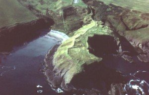
Castle Point Fort

10 miles W of Fraserburgh. Access to this promontory fort is by a motorable track N from the B9031, W of the steep-sided valley of the Tore of Troup.

Contact Us
close slider