Eileen na Goar Fort
← Highlands
How to Vitrify a Fort
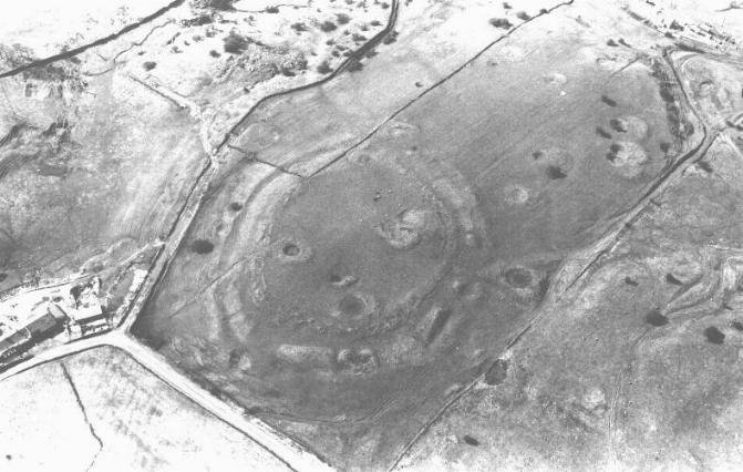
[caption id="attachment_7395" align="aligncenter" width="743"] Castle Hill and Almondbury from Kirkheaton
Vitrification of Hill Forts The Vitrification process Vitrification as seen
Read more
Why Vitrify a Fort?
Originally, it was thought that the forts had become vitrified due to an enemy attack. A theory proposed by Childe Read more
Castercliff Hill Fort
This denuded hillfort is oval and encloses almost two acres. The defences comprise triple circuits of bank and ditch, with Read more
Castle Hill, Almondbury
Castle Hill’s imposing silhouette hides a great prehistoric fort, Norman castle and Victorian tower. Thanks to Varley’s trenches and the Read more
Craig Phadrig Hill Fort
Craig Phadraig is a hilltop fort within a Forestry Commission plantation, 2.5km west of Inverness. It occupies a position with Read more
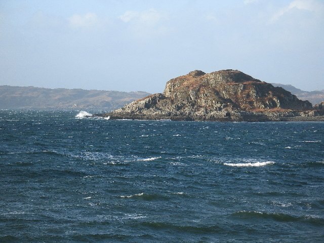
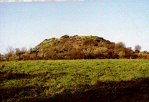
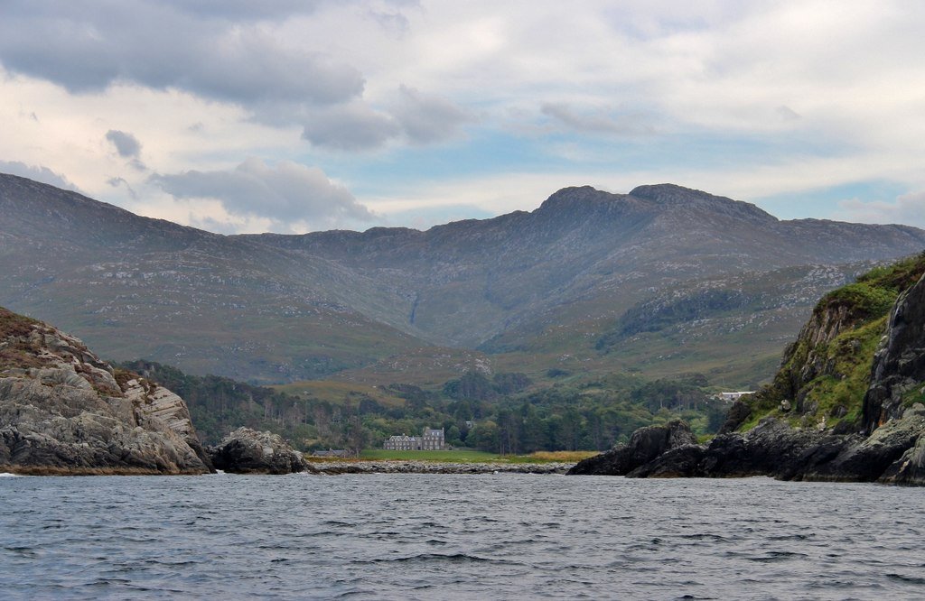
 Eilean nan Gobhar
Here's a clear digest of everything scholars currently know about the hill-fort that antiquarian literature calls Eilean na Goar. Modern datasets list the same place under its Gaelic name Eilean nan Gobhar (“Goat Island”), a small rocky isle that guards the entrance to Loch Ailort on Scotland’s west coast. Below is a synthesis of the archaeological, geological and historical information that has been recorded so far.
Setting and naming
- Location – Grid reference NM 6938 7938; the island rises c. 35 m above sea-level and is ringed by near-sheer gneiss cliffs, so the only practical approach is by boat.
- Name variants – Early antiquarian sources (e.g. E. Hamilton 1880) use “Eilean na Goar”, while national records (Canmore, Highland HER, Atlas of Hillforts) standardise on “Eilean nan Gobhar”; both denote the same island. (Lochaber Geopark)
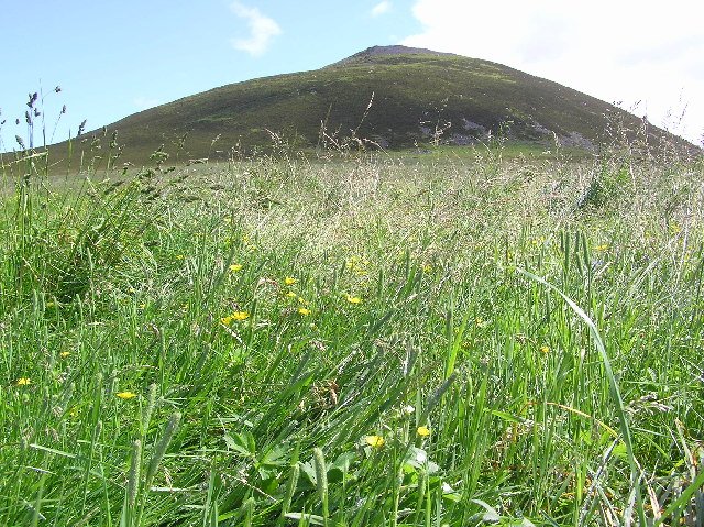
- Landscape role – The isle sits like a plug in the loch mouth, commanding sea routes between the Inner Hebrides and the Great Glen, a strategic vantage that helps explain why it was fortified and refortified.
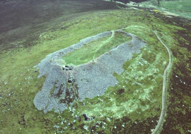
Two super-imposed vitrified forts
Field survey has demonstrated that the summit carries two discrete stone-built enclosures, both intensely vitrified:
| Fort |
Position |
Internal size |
Wall thickness & state |
Notable features |
| Fort 1 (upper) |
Crowning the highest knoll |
c. 40 m (WNW-ESE) × 22 m |
4–5 m thick; core fused to glassy slag; survives up to 2.5 m high on the S |
Three round stone huts (Ø ≈ 6 m) terraced into interior; traces of outworks blocking two gullies that give access to the top (Lochaber Geopark) |
| Fort 2 (lower spur) |
90 m to the NNE on a secondary ridge |
c. 25 m × 16 m |
4.5–5 m thick; outer face stands up to three courses; entrance unclear |
Hint of an internal hut ring and embankment; appears later, but re-uses vitrified rubble from Fort 1 |
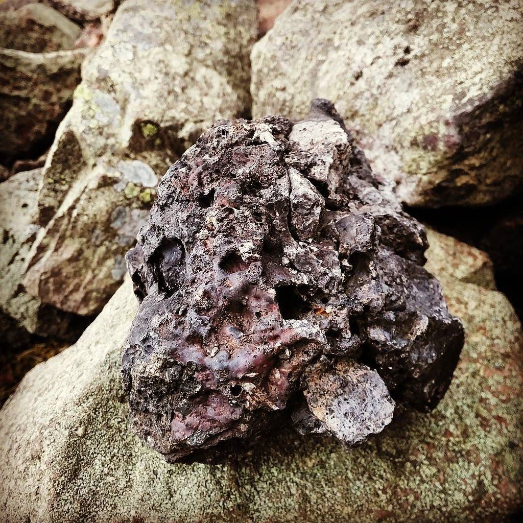
Both walls were built of local gneiss and then exposed to temperatures > 1 to 100 °C, hot enough to melt quartz grains and fuse stone into a green-black glass. Charcoal lenses survive inside the slag, but no charcoal has yet been dated.
What does “vitrified” mean here?
Vitrification is rare outside Scotland. Laboratory work, on samples from Eilean nan Gobhar (specimens HH 88 & HH 89 in National Museums Scotland) shows the glass contains pulverised wall-rock, charcoal ash and rare droplets of iron bloom, matching other Iron-Age vitrified forts. Whether the burning was deliberate (to harden defences or display power) or the catastrophic result of attack remains debated.
 Probable date and cultural horizon
No modern excavation has produced radiocarbon dates, but comparative morphology and the general Scottish pattern place construction in the mid–late Iron Age (c. 500 BCE – 200 CE), with possible re-occupation in the Early Medieval/Pictish period (up to 9th century CE). This broad bracket is the one used by the Highland HER record.
Research history in brief
| Year |
Activity |
Key outcomes |
| 1880 |
Survey by E. Hamilton (Archaeological Journal) |
First plan; recognised vitrification |
| 1963 |
R. W. Feachem publishes in Guide to Prehistoric Scotland |
Links site to wider “vitrified forts” phenomenon |
| 1970 |
Ordnance Survey visit (N. K. Blood) |
Differentiates Fort 1 & 2; notes hut-circles and outer defences |
| 1974-75 |
H. C. Nisbet geological studies |
Petrographic work on slag; confirms local stone was fired in situ |
| 2014-16 |
Mapped for the Atlas of Hillforts of Britain & Ireland |
Digitised plans, 3-D terrain model (Lochaber Geopark) |
So far no targeted archaeological excavation has been undertaken, leaving chronology, occupation sequence and social context open questions.
Outstanding questions and research potential
- Chronology – Secure dating (radiocarbon, archaeomagnetism) could fix whether the two forts represent successive phases or contemporary enclosures.
- Function of vitrification – Experimental archaeology is moving towards the view that sustained bonfires deliberately fired the walls, but evidence of warfare versus ritual remains equivocal.
- Environmental context – Pollen cores on the adjacent mainland could show how Iron-Age communities managed woodland for fuel to achieve the extreme temperatures recorded.
- Public access & conservation – The isle is uninhabited seabird territory; visitor pressure is low, but the vitrified masonry is friable and vulnerable to trophy collectors.
Key take-away
Eilean na Goar / Eilean nan Gobhar encapsulates the mystery of Scotland’s vitrified forts: dramatic coastal placement, massive stone engineering, and a still-unsolved episode of intense prehistoric burning. What we know comes from surface survey and geological analysis; the crucial story—who built it, why they fired it, and how many times it was re-used—awaits the first spade-in-the-ground investigation.