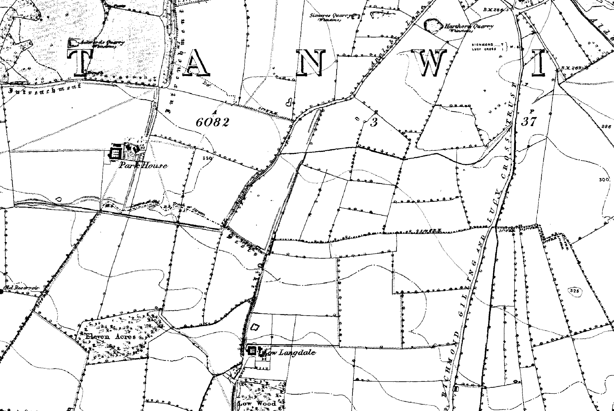
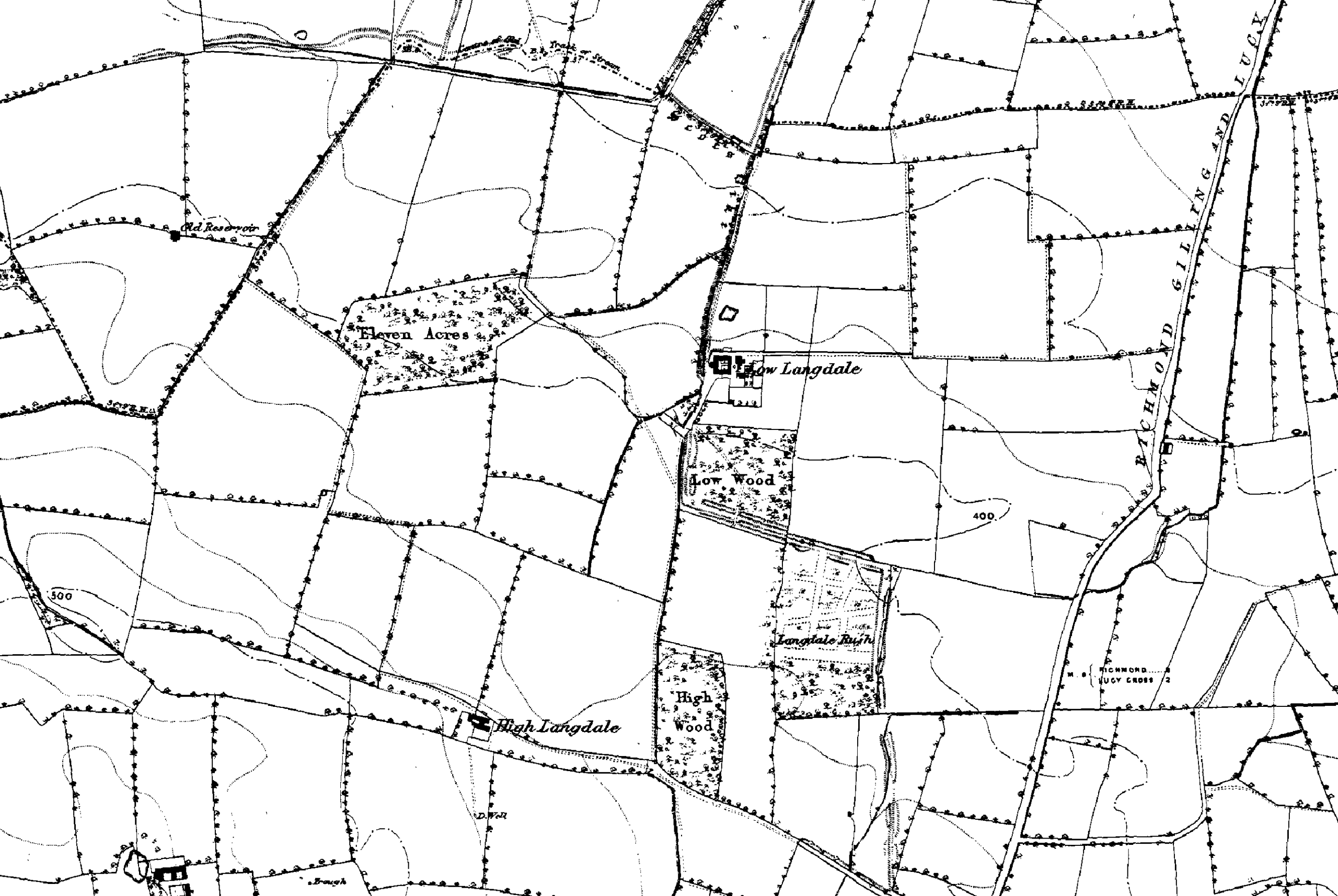
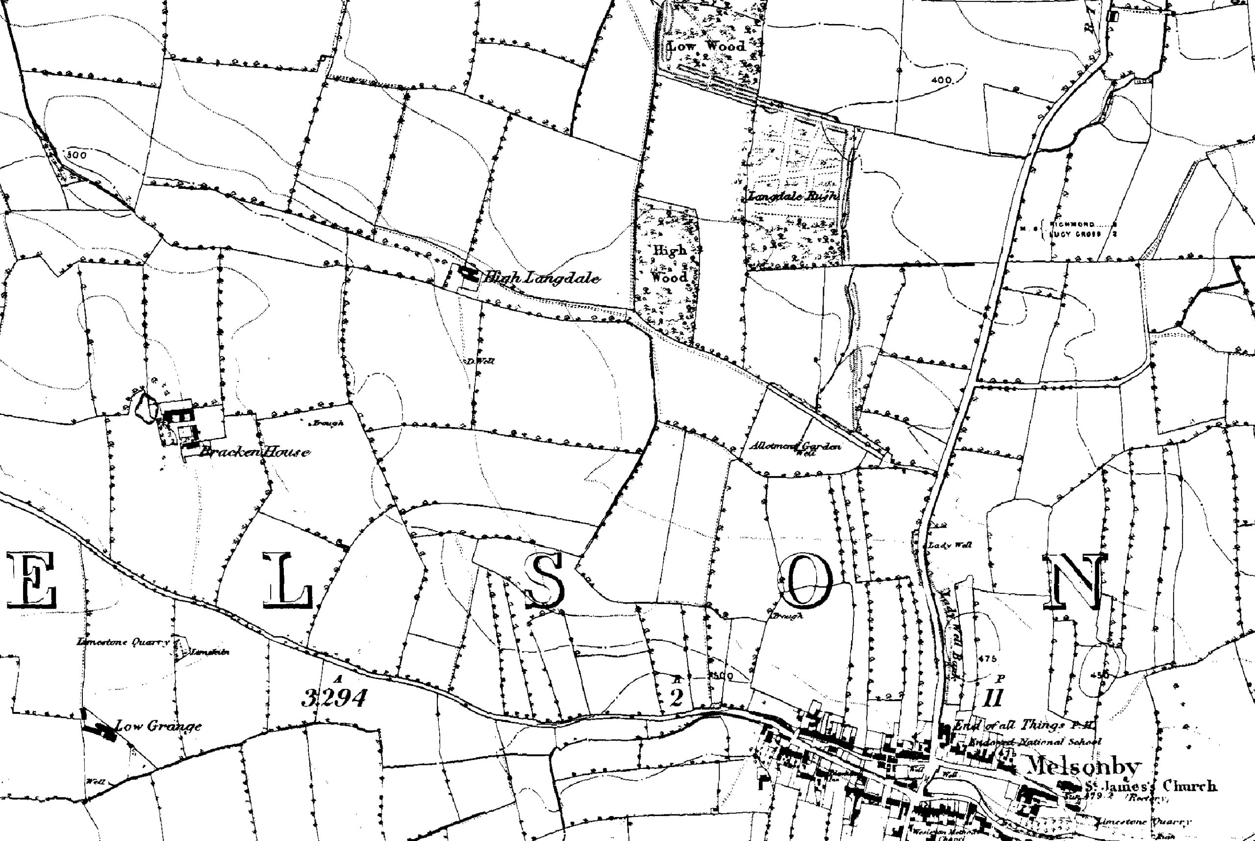
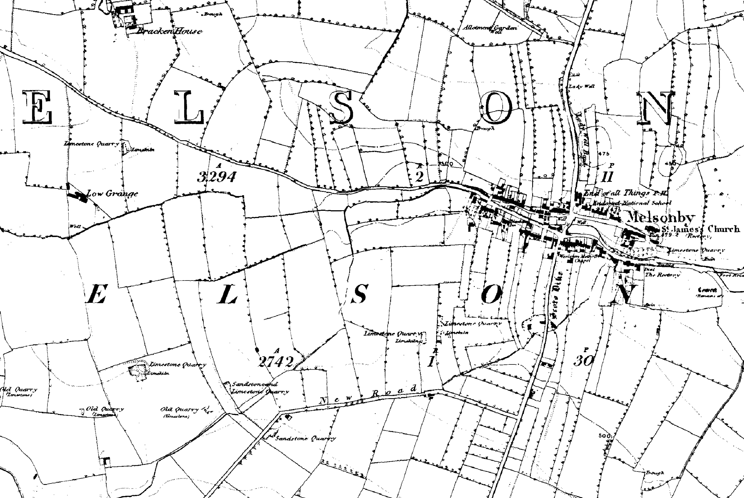
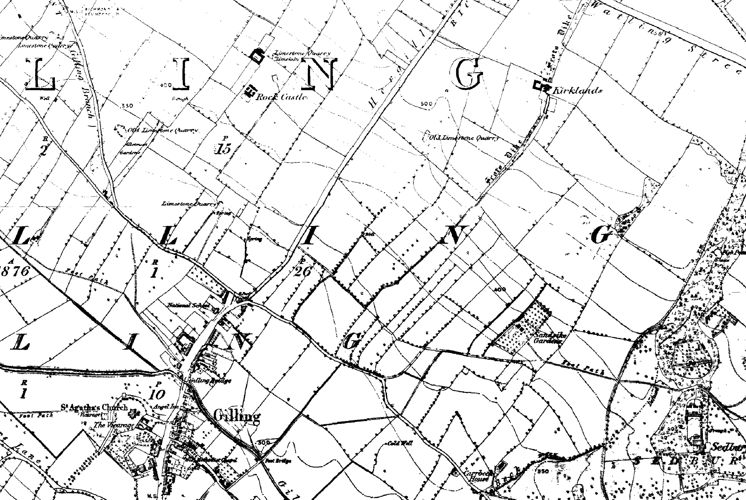
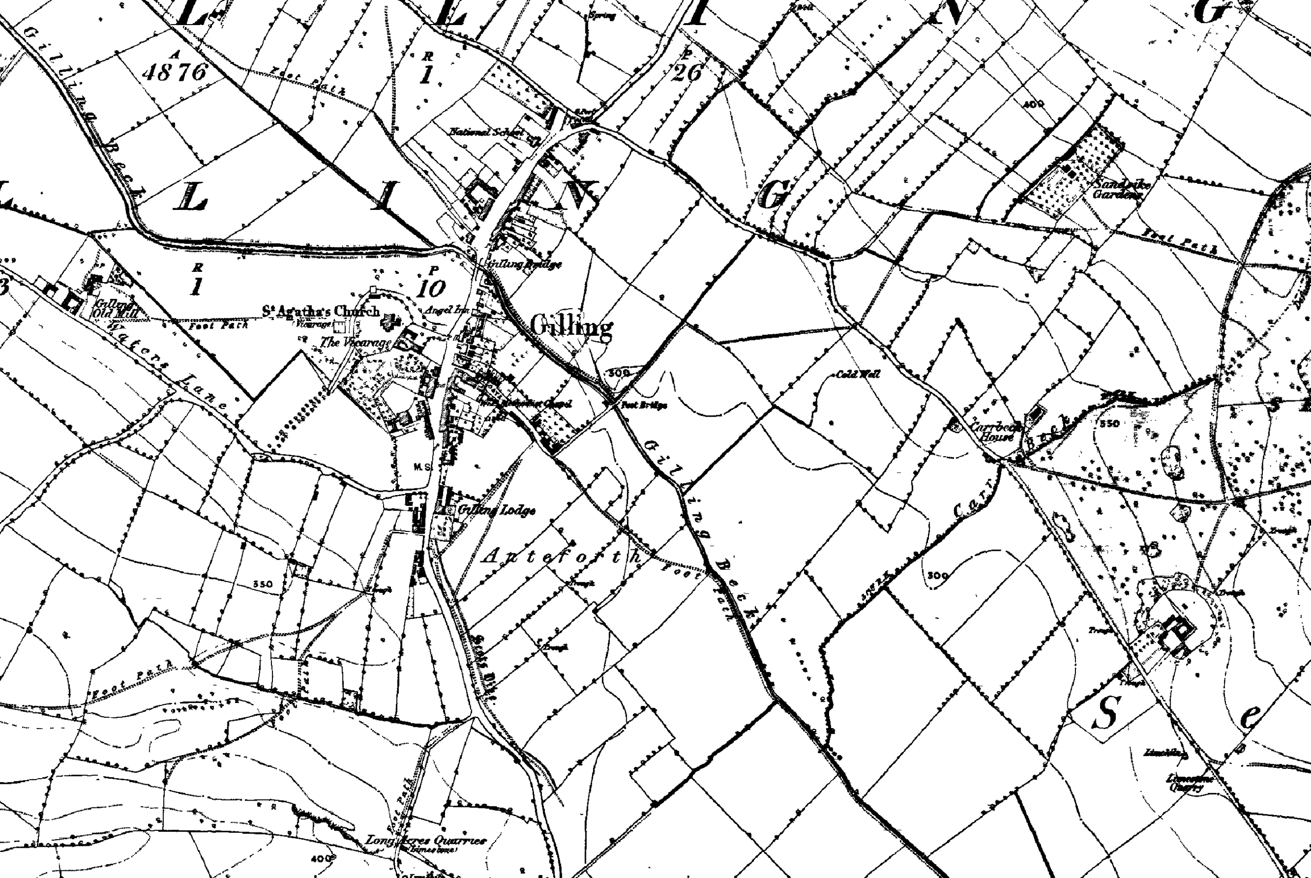
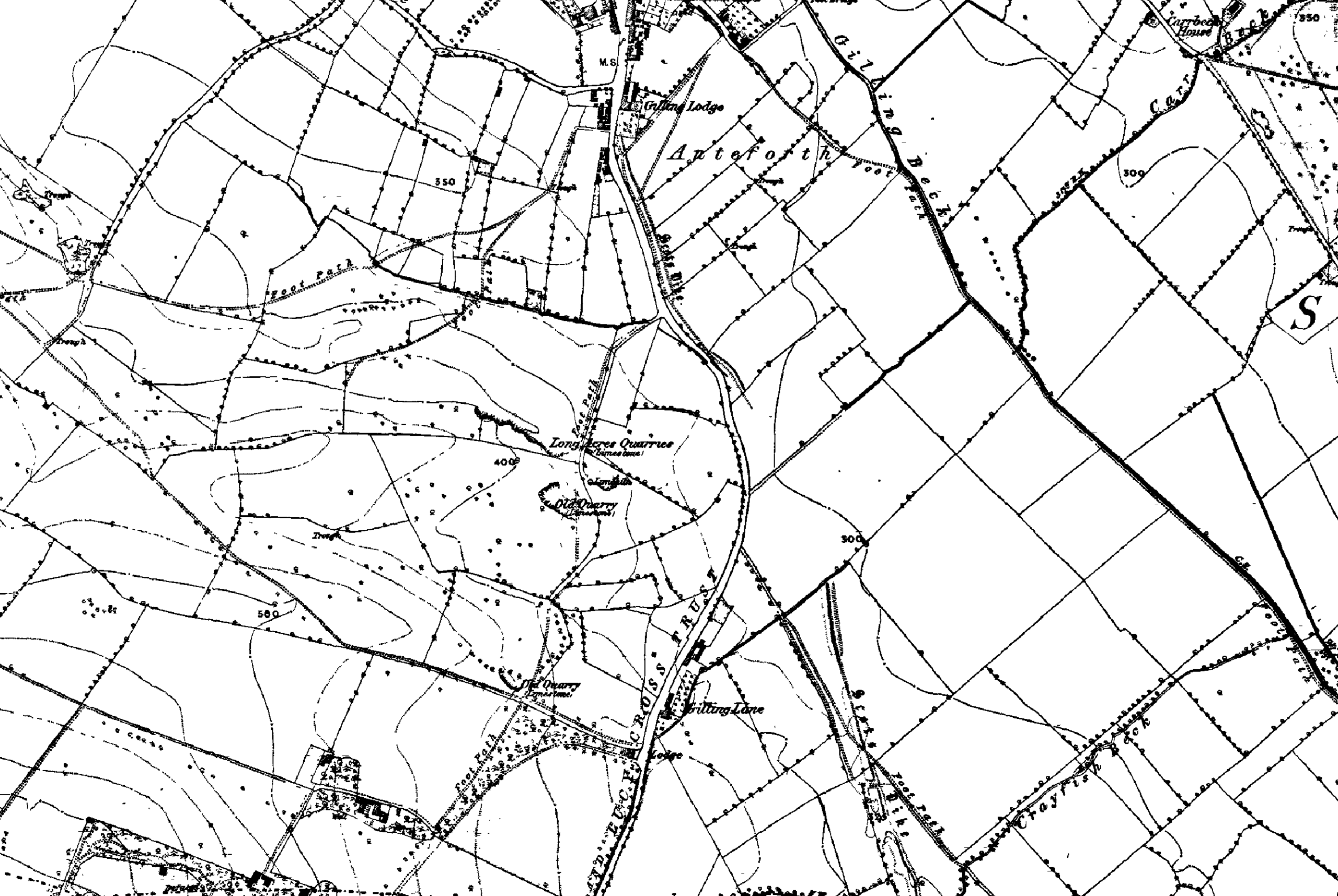
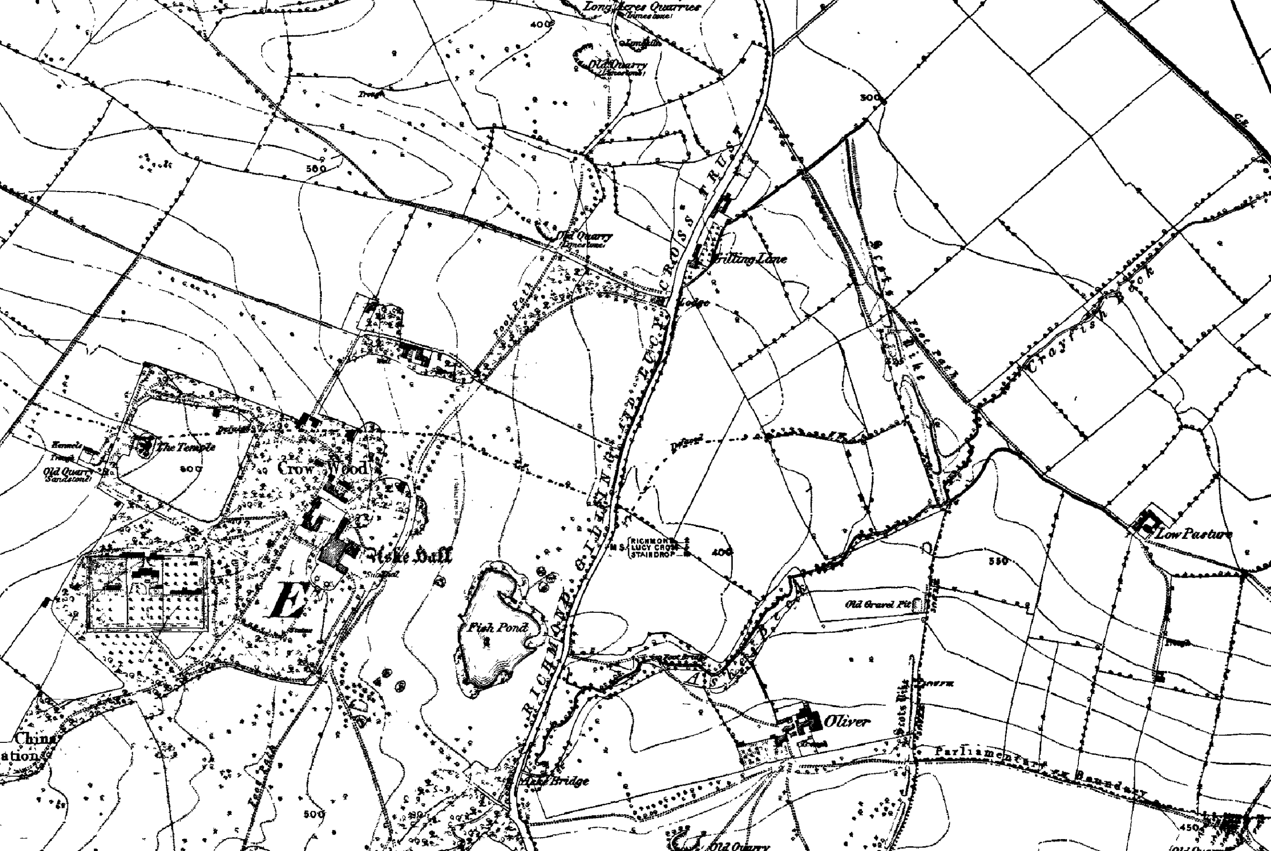
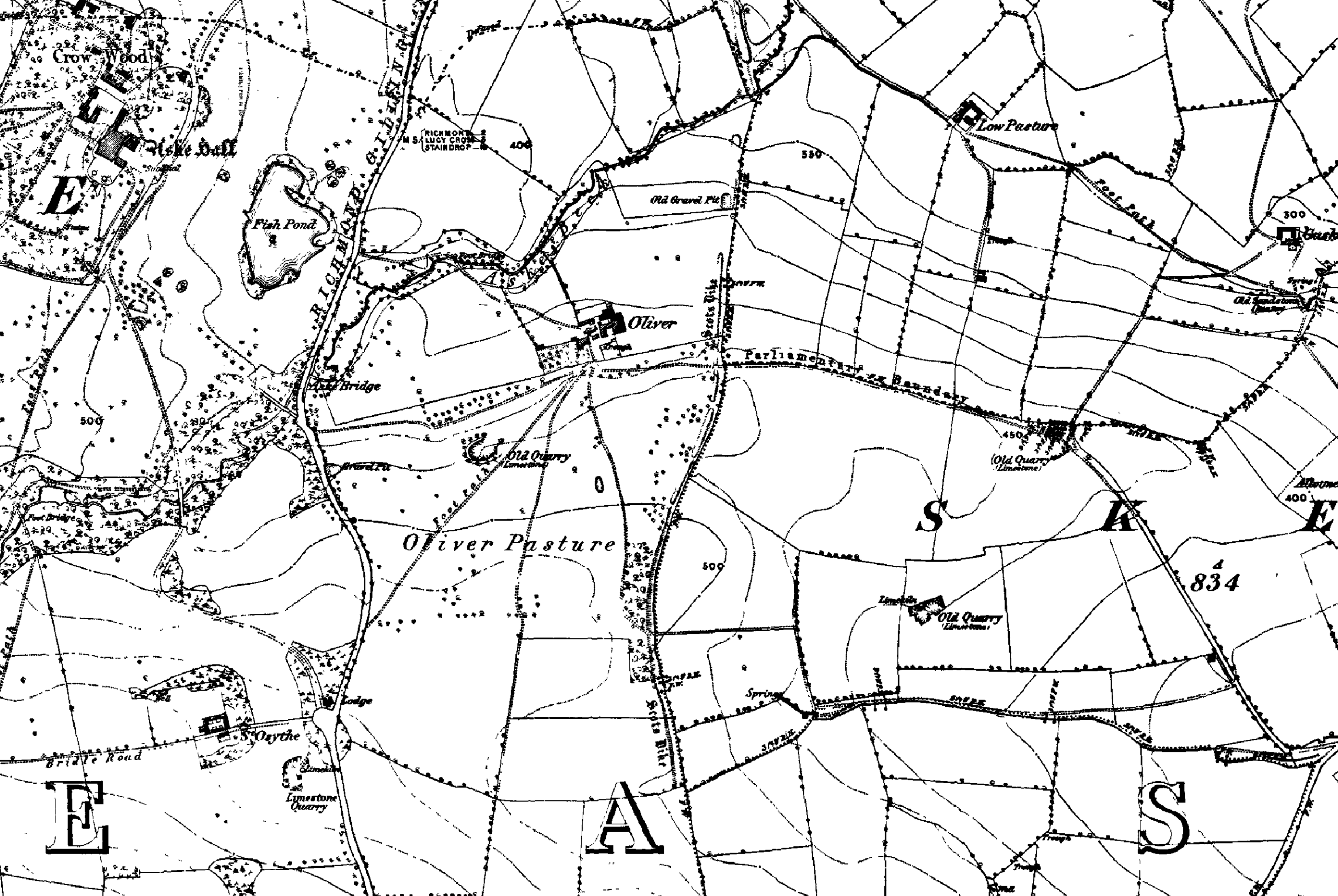
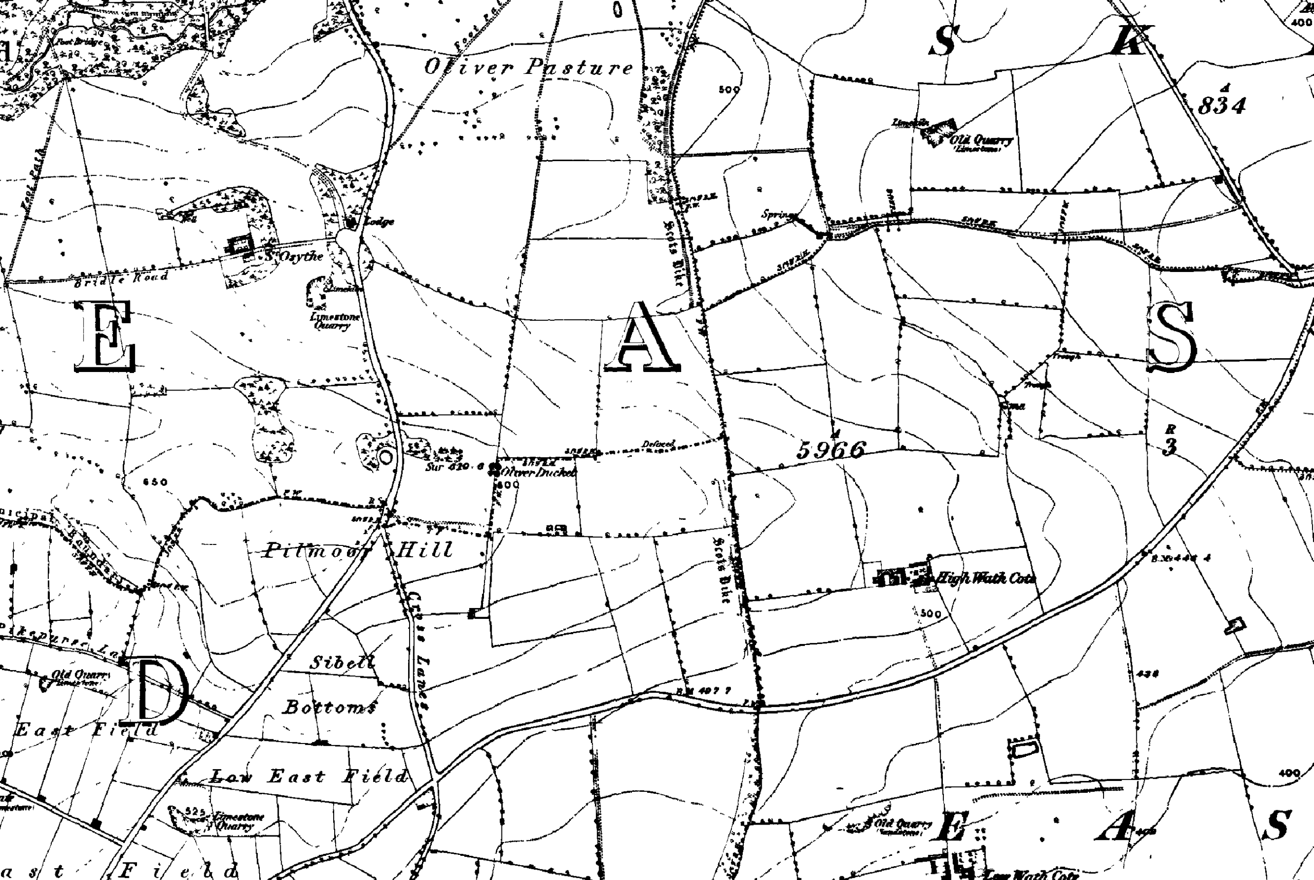
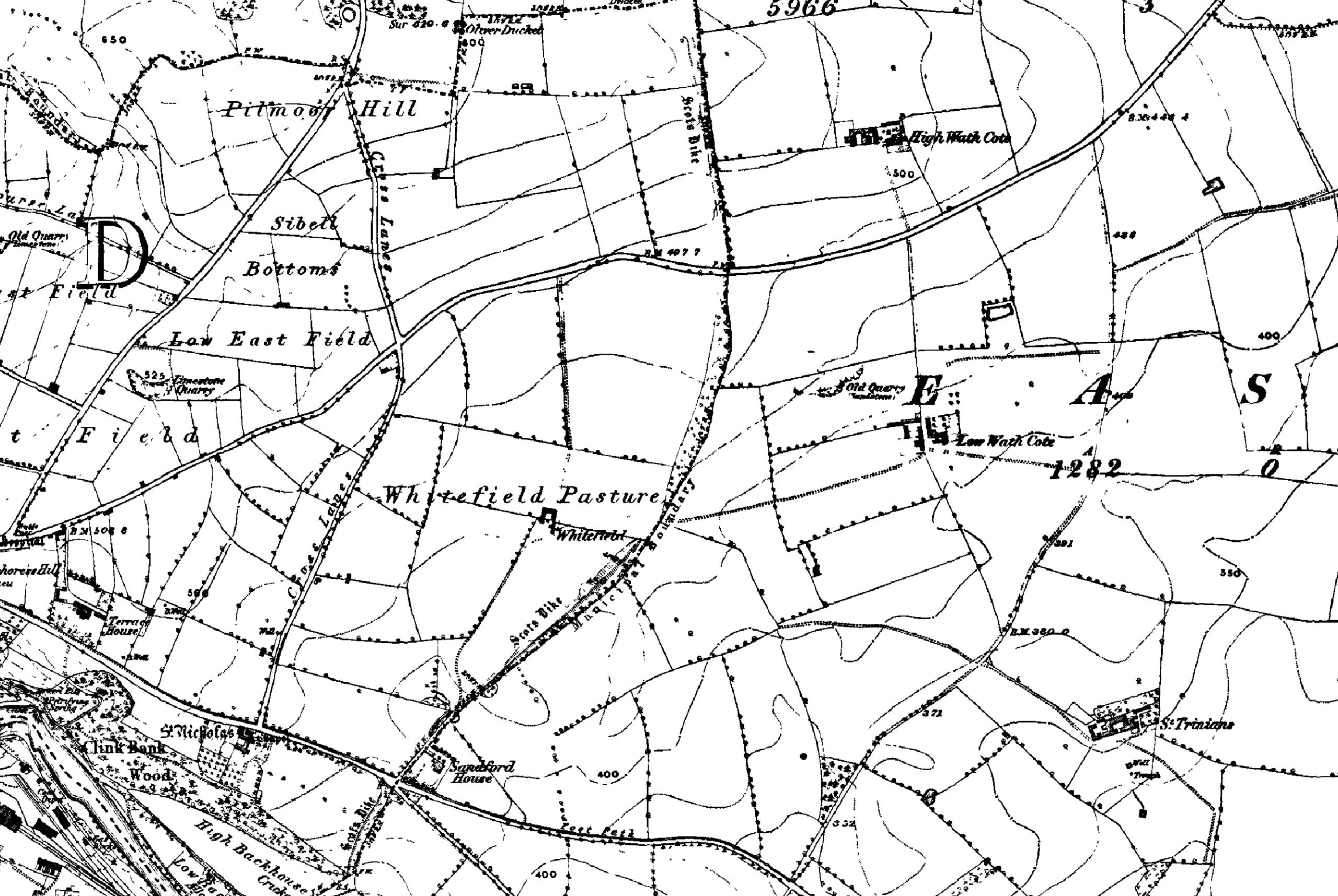
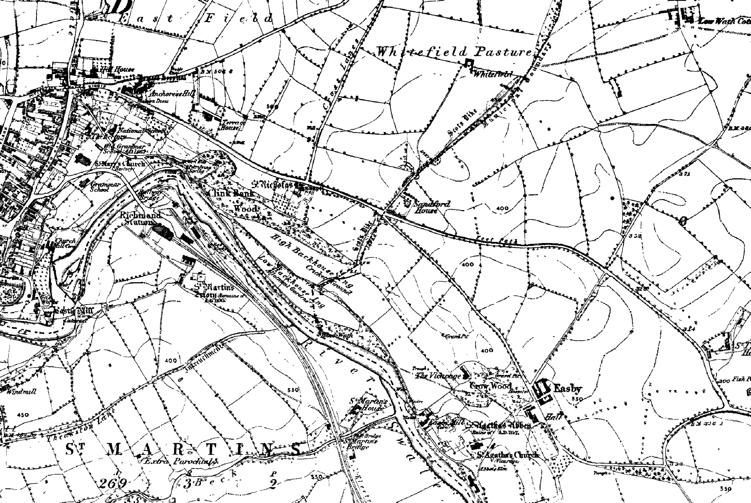
Scotts Dyke was an extensive embankment running north-eastwards from just south of Richmond. It crossed the Brompton-on-Swale Road at Easby and then veered north to cross the Darlington Road, marking the eastern edge of the current Richmond boundary. It continued northwards on a line east of Gilling and Melsonby terminating at the Brigantian fortification at Stanwick (see also Battle at Scotch Corner). Scott's Dyke, also known as Scots Dyke or Scots Dike, is a significant linear earthwork stretching approximately fourteen kilometres from the River Swale to the River Tees, this ancient structure is believed to date back to the period between the first century BC and the first century AD. The dyke's construction varies along its length, suggesting that different sections were built by separate groups of workers. Notably, south of the A66 road, the dyke features a bank up to 1.5 meters high and 10 meters wide, accompanied by a ditch 7 meters wide and 1 meter deep. On the eastern side, remnants of a counterscarp bank about 5 meters wide have been observed. While parts of the dyke may represent a double dyke, with two banks and a ditch in between, as indicated by Ordnance Survey maps at the northern end, there is no definitive evidence linking it to the nearby Stanwick Oppidum earthworks. Archaeological investigations, particularly during the A66 road improvements in 2006-2007, provided an opportunity to study the dyke more closely. However, no artifacts were recovered that could establish a clear relationship with the Roman road nearby. Archaeomagnetic dating of sediment fills from the dyke suggests that it began to fill up during the aforementioned period, offering a glimpse into its antiquity.
The purpose of the Dyke is not known. Possibly, it was a boundary, but if so, the effort involved in building it seems disproportionate. It may have been a defensive fortification. The date of the Dyke has not been determined, but it is almost certainly pre-Roman.
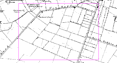
The outline of the Dyke can still be seen in some places, notably the eastern edge of Richmond (as shown below). Although much reduced in one or two places, the extent of the embankment of an earth and stone mound may still be seen. From the highest remaining point there is a commanding view eastwards and south-east to the North Yorkshire Moors and the Vale of York.
Easby Abbey
The relationship between Scott's Dyke and Easby Abbey is a subject of historical interest but remains speculative. Easby Abbey, founded in 1152, is a Premonstratensian monastery known for its well-preserved ruins and rare 13th-century wall paintings. The dyke predates the Abbey by several centuries, and there is no direct evidence to suggest a connection between the two. However, given their proximity, it is possible that the inhabitants of Easby Abbey were aware of the dyke and may have incorporated it into the landscape of the Abbey's extensive grounds. The dyke could have served as a boundary or marker for the Abbey's lands, or it may have been used in some capacity by the Abbey's community. The lack of concrete evidence means that any potential relationship between Scott's Dyke and Easby Abbey is a matter for conjecture, likely influenced by the changing landscape and social structures over the centuries. There is also the possibility, as seen elsewhere, that the site of Easby was chosen because it was a site of spiritual significance before the advent of Christianity in this area.
Stanwick Iron Age Fort
It is interesting that the dyke itself does seem to reference that location. Stanwick Iron Age Fort While the precise relationship between these two significant earthworks remains a matter of conjecture, the temporal proximity of their origins suggests a potential complementary function. The Stanwick Fortifications, associated with the Brigantes tribe, represent the largest Iron Age fortifications in Britain, and their strategic importance is well-documented. The proximity of Scott's Dyke to these fortifications, as well as its formidable construction, has led some historians to propose that the dyke may have served as an additional defensive structure, perhaps delineating an outer boundary or serving as a barrier against incursions. The notion that Scott's Dyke was a military work rather than a mere boundary marker is supported by its scale and the effort required for its construction. Such an extensive earthwork would have required a significant mobilization of resources and labour, implying a purpose of considerable importance. The dyke's alignment with the natural landscape, utilizing rivers as natural barriers, further supports the theory of a defensive role. Moreover, the lack of artifacts or clear evidence linking the dyke to the nearby Roman road suggests that its origins are more deeply rooted in the pre-Roman era, possibly as an attempt to repel invasions or assert territorial control. While the absence of direct archaeological evidence precludes a definitive conclusion, the circumstantial evidence invites speculation that Scott's Dyke and the Stanwick Fortifications were part of a broader defensive network. This network may have been designed to protect the heartland of the Brigantes territory, with the dyke acting as a first line of defence, or as a demarcation of controlled lands.


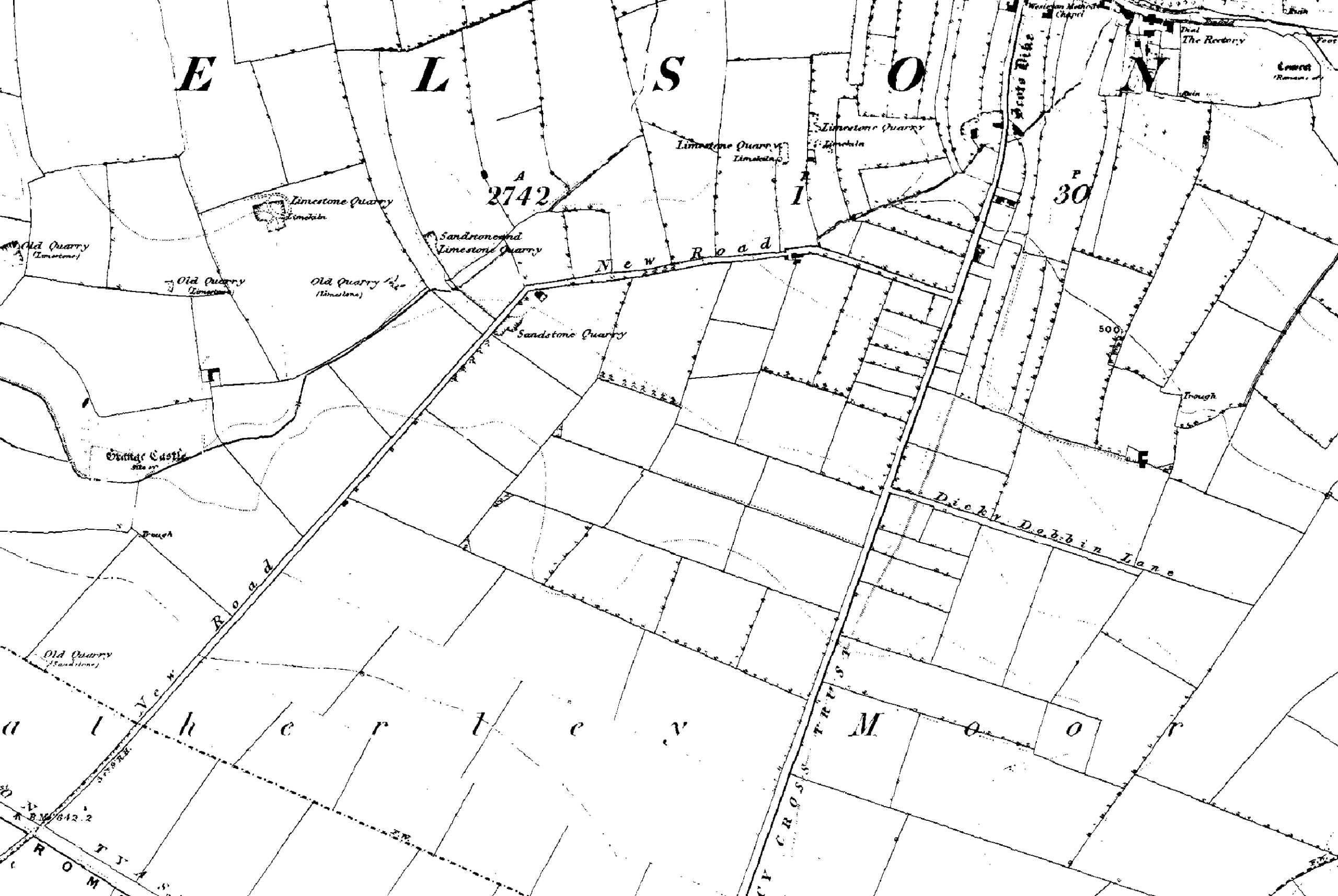
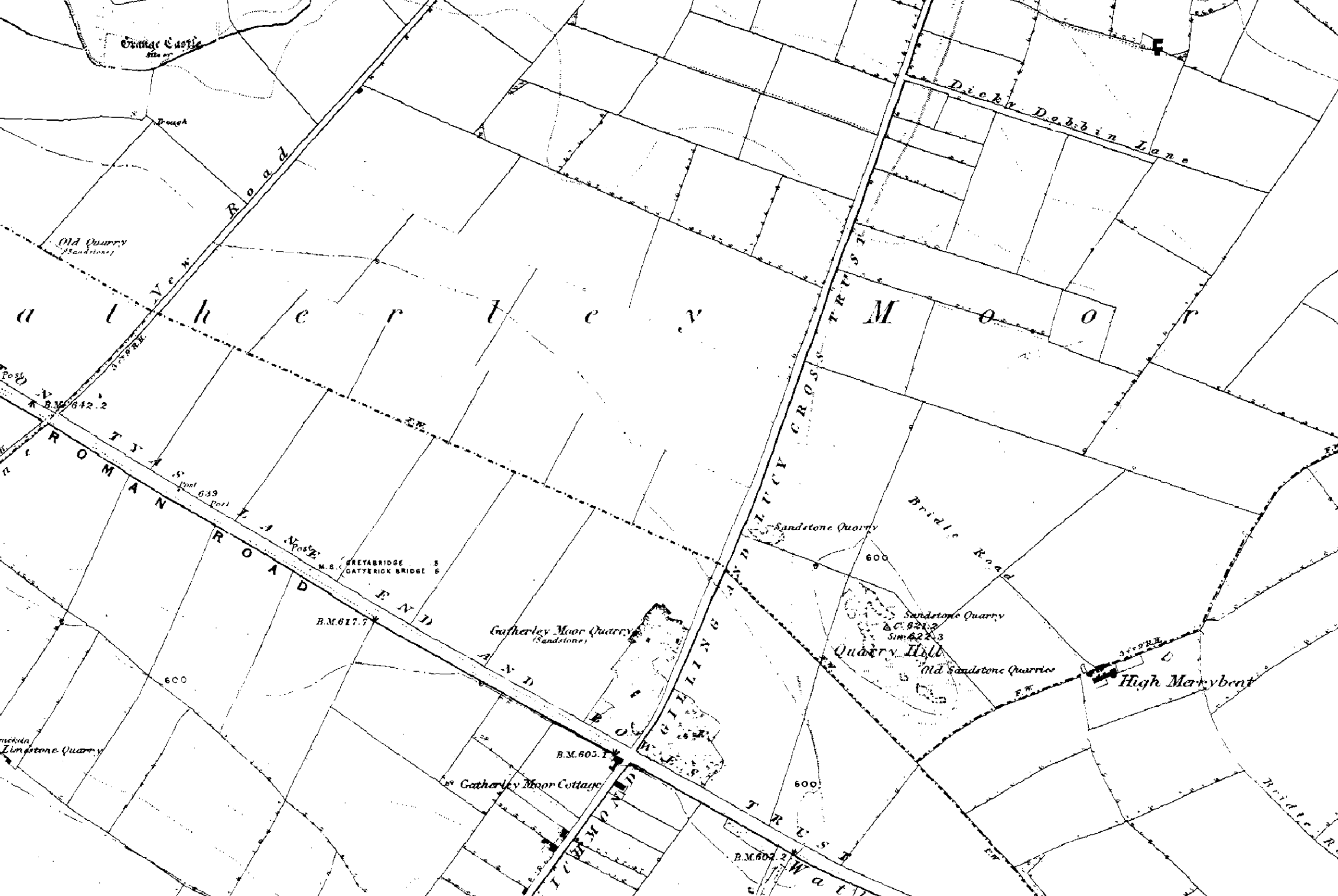
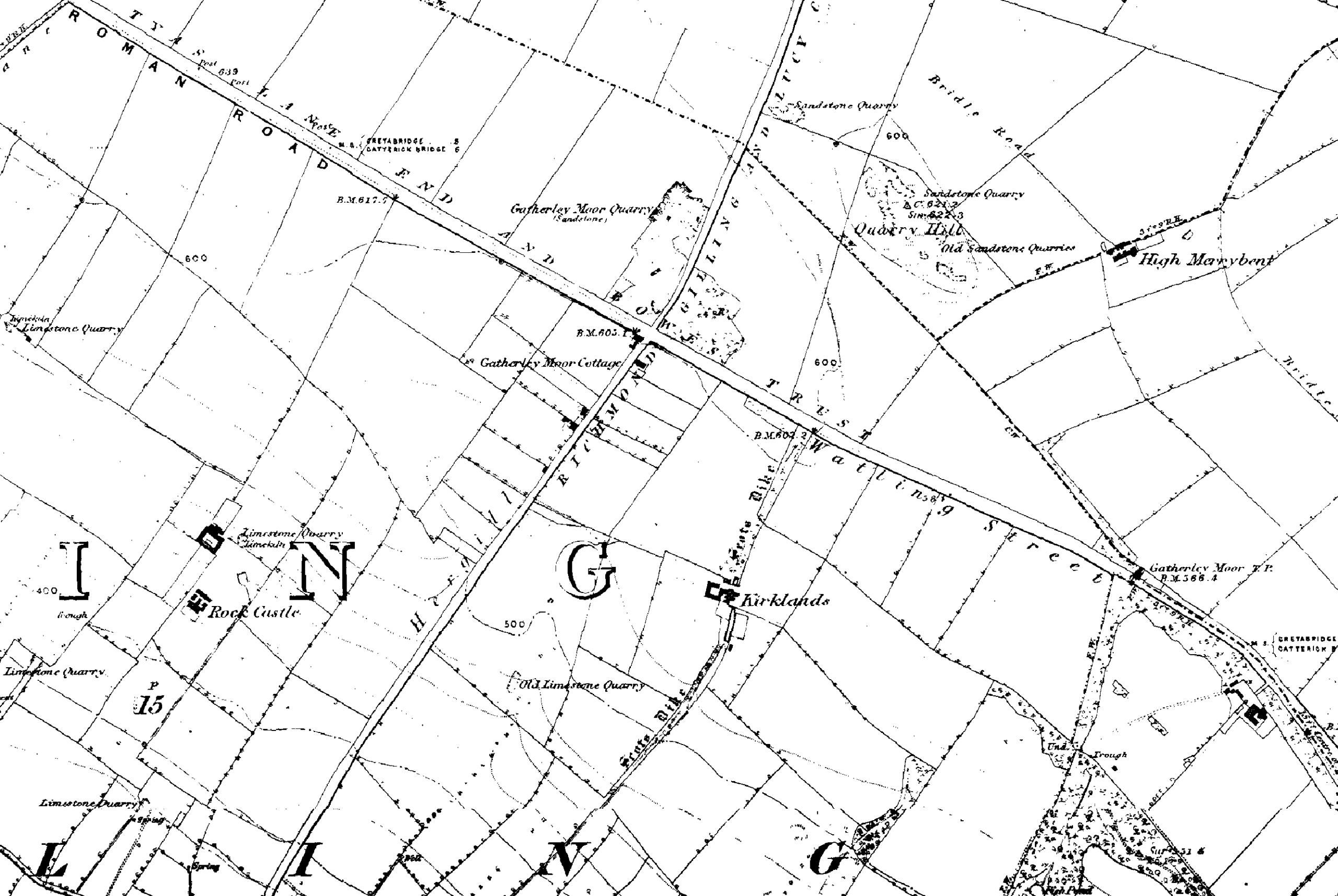
 Scotts Dyke was an extensive embankment running north-eastwards from just south of Richmond. It crossed the Brompton-on-Swale Road at Easby and then veered north to cross the Darlington Road, marking the eastern edge of the current Richmond boundary. It continued northwards on a line east of Gilling and Melsonby terminating at the Brigantian fortification at Stanwick (see also Battle at Scotch Corner). Scott's Dyke, also known as Scots Dyke or Scots Dike, is a significant linear earthwork stretching approximately fourteen kilometres from the River Swale to the River Tees, this ancient structure is believed to date back to the period between the first century BC and the first century AD. The dyke's construction varies along its length, suggesting that different sections were built by separate groups of workers. Notably, south of the A66 road, the dyke features a bank up to 1.5 meters high and 10 meters wide, accompanied by a ditch 7 meters wide and 1 meter deep. On the eastern side, remnants of a counterscarp bank about 5 meters wide have been observed. While parts of the dyke may represent a double dyke, with two banks and a ditch in between, as indicated by Ordnance Survey maps at the northern end, there is no definitive evidence linking it to the nearby Stanwick Oppidum earthworks. Archaeological investigations, particularly during the A66 road improvements in 2006-2007, provided an opportunity to study the dyke more closely. However, no artifacts were recovered that could establish a clear relationship with the Roman road nearby. Archaeomagnetic dating of sediment fills from the dyke suggests that it began to fill up during the aforementioned period, offering a glimpse into its antiquity.


