Notice: Function WP_Scripts::add was called incorrectly. The script with the handle "datatables-responsive" was enqueued with dependencies that are not registered: datatables. Please see Debugging in WordPress for more information. (This message was added in version 6.9.1.) in /home/u621095157/domains/brigantesnation.com/public_html/wp-includes/functions.php on line 6131
"We were shocked to discover such a huge complex," said Alastair Oswald, archaeological field investigator for English Heritage. Preliminary examinations Read more
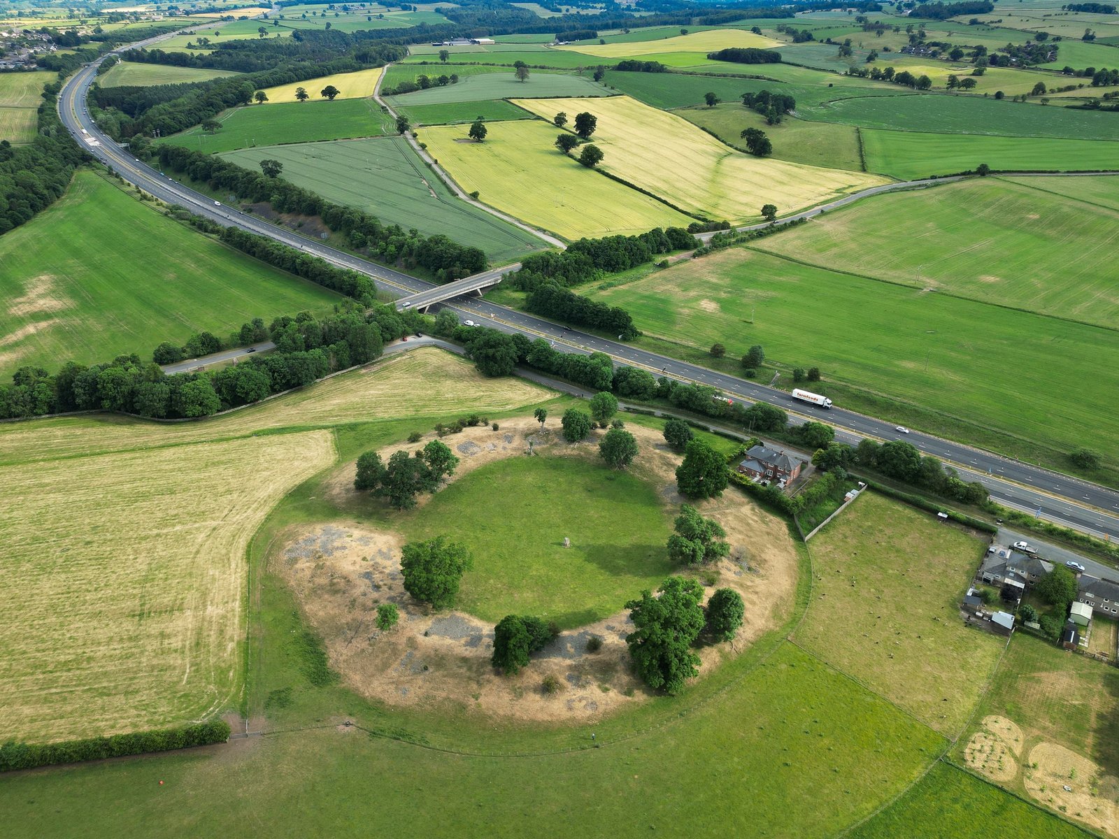
Castle dykes it is a small class one henge, 90m across, perched on the high ground up in the North Read more
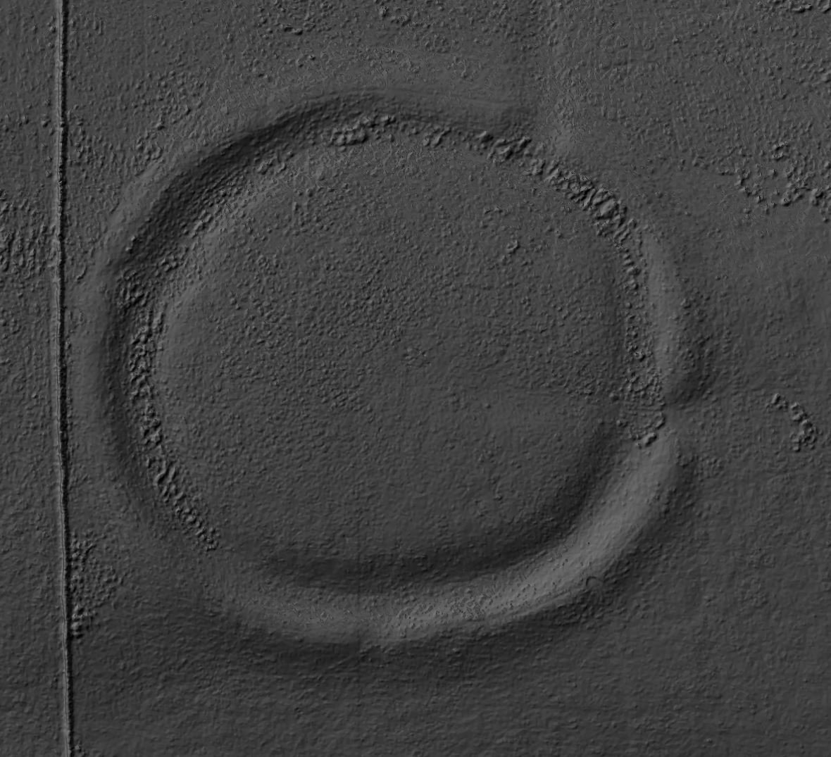
Air photo showing the location of the henge
Catterick Henge
Catterick Henge lies inside the in-field at Catterick Racecourse, immediately east of Dere Street and a few hundred metres south of the Roman town of Cataractonium. Air photographs and a short stretch of low bank still visible between the running rails show that the original monument was a nearly circular ring of river-cobbles between 135 m and 145 m across, enclosing an interior about 90–100 m wide. Unlike most henges, it seems never to have had a surrounding ditch; its builders raised a single stone bank directly on the gravel terrace, much as they did at Mayburgh Henge in Cumbria. (heritagegateway.org.uk, themodernantiquarian.com)
Originally thought to be an amphitheatre
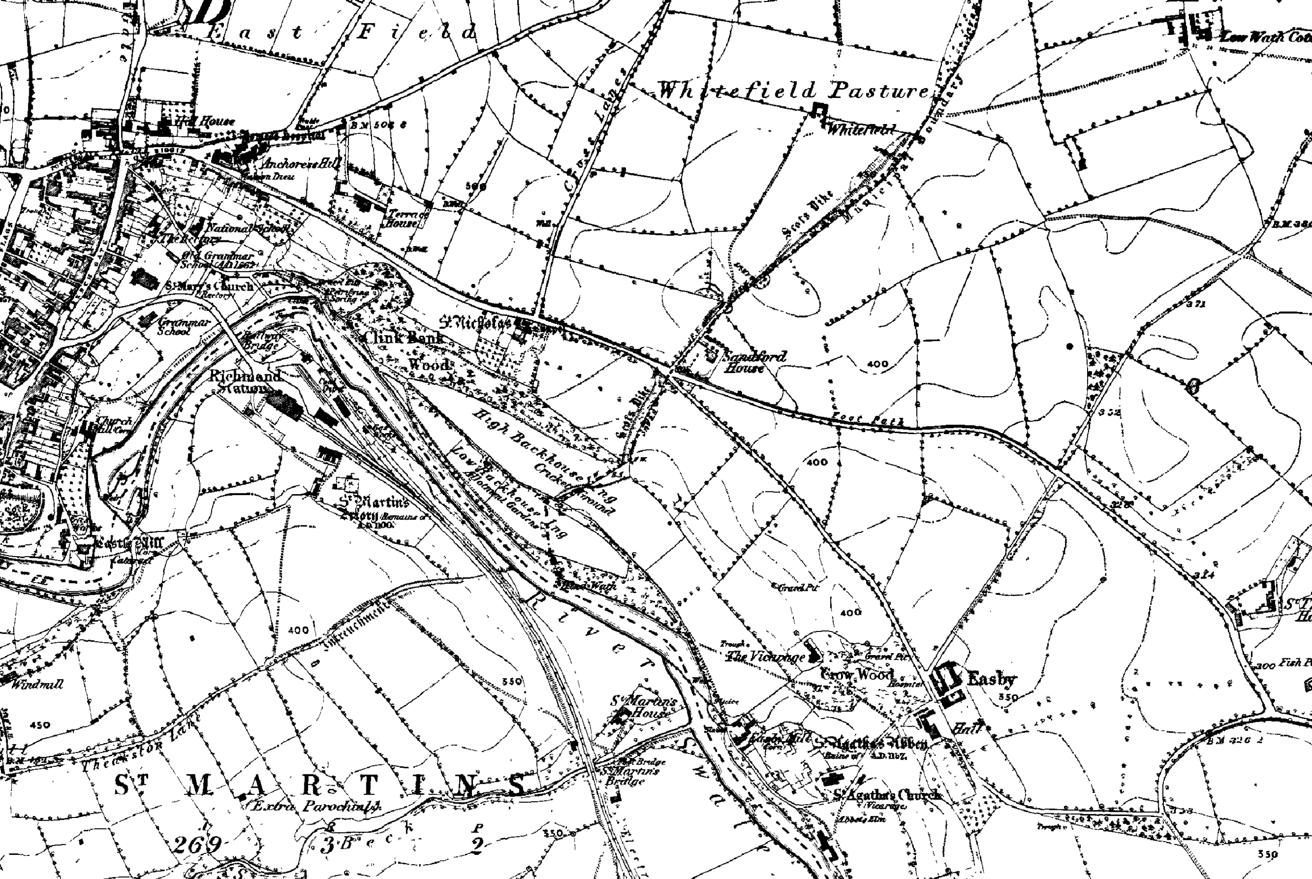
The earthwork was already faint when antiquarian H. MacLauchlan walked the ground in 1849 and recorded only “slight traces of Tumuli” in the fields then called Thrummy Hills. It was later misread as a Roman amphitheatre, but the identification as a Late-Neolithic henge became secure after rescue work in the 1980s–90s, when quarrying and course realignments sliced away the western arc. Excavation by the West Yorkshire Archaeological Service showed that a 38 m-diameter Cairn of rounded cobbles had been incorporated into the henge bank and produced a few sherds that look Early-Bronze-Age in date. The investigators also confirmed that no ditch was present and that the only structural material was redeposited river gravel. (heritagegateway.org.uk)
Today barely a quarter of the circuit survives: a low Scarp on the north-west edge of the racetrack, a cropmark arc to the east and a thin slice under the rails on the south-west. The Roman military road of Dere Street drove straight through the western side in the second century AD, and successive phases of quarrying and racecourse engineering account for most of the further loss. The remains are part of a single scheduled area that also protects the Roman settlement, but Historic England classes the henge as vulnerable because nothing more than buried archaeology and faint turf undulations are left in situ. (heritagegateway.org.uk)
Place in the wider landscape
Although stratified dating evidence is still meagre, the scale, bank-only construction and twin north–south entrances place Catterick Henge within the same late-third- to early-second-millennium BC horizon as the Thornborough and Nunwick monuments farther down the Ure–Swale Valley. Its alignment continues the broader prehistoric axis that runs from the Devil’s Arrows at Boroughbridge through Nunwick and Thornborough to the Swale cursus, suggesting that the builders were consciously linking one ceremonial node to the next across forty kilometres of landscape. (themodernantiquarian.com)
Archaeologically, the site still has much to give. Only narrow rescue trenches have been dug, leaving open whether timber settings, pits or burials once stood inside the ring; charcoal noted in the lower ditch fills but never sampled could fix construction more precisely; and geophysics could trace how the henge related to the cairn and to the later Roman and medieval reworking of the ground. For now, however, Catterick Henge remains a partly obliterated but still crucial piece of the prehistoric chain that punctuates the Great North Road corridor.
Mostly lost
Unfortunately, the site has suffered damage over the years due to the construction of the racecourse and quarrying activities. Despite this, it remains an important archaeological feature, shedding light on the ancient landscape of the region.
"Until now the Mayburgh henge has been considered exceptional in that it lacked a ditch and its single bank was composed of small river derived stones. The Catterick henge appears, from the excavated evidence, to be of similar plan and construction, and it is only slightly larger than Mayburgh, which has diameters of c. 87.5m (internal) and c 124m (external) with a single entrance through the 36.6m wide bank. Unfortunately, none of the apparent gaps in the bank at Catterick can be positively identified as entrances". P. R. Wilson - Cataractonium.
Early curiosity
Early curiosity about the low swelling inside Catterick racecourse owed more to antiquarian field notes than to science, but three lines of modern enquiry have since given the henge a secure place in the wider pre-historic story of the Ure–Swale valley.
Air Photography
First came air-photography and mapping by the Royal Commission in the 1970s. Their plots showed a near-circular ring about 140 m across whose bank sat directly on the gravel terrace with no surrounding ditch, a plan that immediately invited comparison with the bank-only henge at Mayburgh and hinted at a Late-Neolithic date. The same photographs also fixed two opposed entrances on a north–south axis, aligning the monument with the string of henges that runs from the Devil’s Arrows through Nunwick and Thornborough. (heritagegateway.org.uk)
Single Excatation
The only excavation followed in the mid-1990s, when West Yorkshire Archaeology Service stripped a pie-slice from the western arc during track realignments. Their trenches confirmed that the bank was nothing but redeposited river cobbles, that no ditch had ever existed, and that the builders had cannibalised part of an earlier cairn whose fabric yielded sherds of Early-Bronze-Age pottery. From that moment, Catterick was recognised as a hybrid monument in which a Neolithic enclosure and a Bronze-Age burial mound had physically merged. (archaeologydataservice.ac.uk)
Cataractonium
Research on the Roman town of Cataractonium, undertaken sporadically between 1958 and 1997, then clarified how later engineers treated the prehistoric earthwork. Excavators showed that Dere Street, laid out in the second century AD, sliced straight through the western bank and that Roman gravel-digging had further eroded the circuit. The henge thus became one more feature in a densely occupied military and civilian landscape, its prehistoric identity effectively buried under roadside industry and quarry spoil. (woolmerforest.org.uk)
The most recent leap in understanding has come from the A1 Leeming-to-Barton motorway upgrade of 2013-17. Open-area digs along the new carriageway exposed dozens of pits, burials and timber post-rings of late fourth- and early third-millennium BC date, together with Iron-Age farmsteads and an Anglo-Saxon settlement. By showing that ceremonial, domestic and funerary sites cluster along the river terraces for fifteen kilometres either side of the henge, the motorway work confirmed that the bank inside the race-course was only one node in a very long-lived ritual corridor. (archaeologydataservice.ac.uk, assets.highwaysengland.co.uk)
Other research
Satellite projects have reinforced that picture. Excavations at Marne Barracks on the opposite bank revealed a palisaded enclosure of similar date and scale, while geophysical survey on the floodplain traced a lattice of trackways and field systems that wrap round both the henge and the Roman town. Together these discoveries argue that Catterick’s monument was sited deliberately at a crossing-point where prehistoric pathways, the later Roman road and eventually the Great North Road all converged. (researchgate.net)
Crop-mark mapping defined the henge, the 1990s rescue dig explained its mixed bank and cairn fabric, Roman-town excavations showed how much of it was levelled in antiquity, and the motorway programme set the site back into a much larger prehistoric landscape. Each wave of work has widened the frame, transforming Catterick Henge from an oddity under the grandstand into a key reference point for ritual architecture and route-ways in northern England.


 Air photo showing the location of the henge


