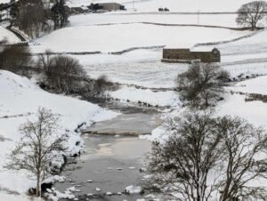
Tag: Archaeology

Guide – Introduction to Glacial Archaeology

A frozen River close to Keld in the Yorkshire Dales

Glacial archaeology is a fascinating field that examines the impact of glaciation on the landscape, and how ancient human activity interacted with the forces of ice and meltwater. The processes of glacial erosion and deposition have left behind a variety of landforms, such as moraines and glacial terraces, which not only shape the topography of the region but may also provide clues to human occupation and activity in prehistoric times.

Guide – Photography: Camera Buying Guide

A photographer attempting to take a photo while standing on the edge of a clif

When it comes to archaeological photography, capturing the best possible images—whether of small artifacts or large sites—requires thoughtful consideration of the camera’s capabilities. The right camera allows you to document sites and findings clearly, effectively, and with long-lasting quality.

Guide – Photography: Framing the Shot

Earthwork features from Stainton Swaledale

When photographing archaeological sites, the key to a successful shot lies not just in the technology you use but in how you frame the scene, manage lighting, and anticipate the environment. The art of capturing the best possible image is a blend of technical understanding and creative intuition.

Guide – Introduction to Photography

Gold Head from St Andrews Church Aldborough

Photography has long been an essential tool in archaeology, providing a visual record of sites, finds, and features. In the context of archaeological research, photos do more than simply document—they offer crucial evidence that can be revisited, analysed, and shared.

Guide – The Power of Air Photo Coverage

Thornborough Southern Henge from the air

When it comes to uncovering the secrets of the past, air photography is an invaluable tool that offers a bird’s-eye view of archaeological sites and their surrounding landscapes.

Guide – Exploring the Past with LIDAR

A scene showing a Roman archaeologist in the field, holding a tablet displaying LIDAR data.

Imagine being able to see the landscape around you in a completely new way—an invisible layer revealing the hidden structures of the past, right beneath the surface.

Guide – Landscape Archaeology: The Geological Environment of Britain

The Geological Environment of Britain: The Foundation of Our Landscape The landscape of Britain has been shaped by millions of years of geological processes. From the formation of ancient mountain ranges to the shaping of valleys and river systems, the land we see today is the product of a dynamic and ever-changing history. Understanding the …

Continue reading

Guide – What is Landscape Archaeology?

Landscape archaeology is the study of past human interaction with the natural environment. It focuses on understanding how ancient societies perceived, organized, and shaped the land they inhabited, revealing the relationships between people, their settlements, and the broader landscape in which they lived.

Guide – Landscape Archaeology Introduction

Landscape archaeology is a vital tool for understanding how ancient peoples interacted with their environment, shaping and being shaped by the land they lived on.

Guide – Empathic Archaeology: Building a Strong Straw Man

An object that appears entirely different depending on the perspective of the observer

Empathic Archaeology: Building a Strong Straw Man Question Everything and Question Again When engaging in Empathic Archaeology, the process of creating and refining a straw man—a provisional model of the past—requires a delicate balance of imagination and rigor. The archaeologist’s imagination fills the skeleton of the straw man with ideas and concepts, but these must …

Continue reading

Contact Us
close slider