
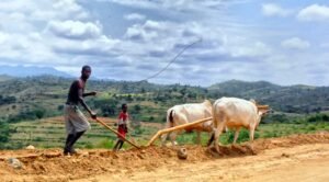
The ard, also known as a scratch plough, represents one of the earliest forms of agricultural technology used by the people of ancient Brigantia.
Feb 07
The ard, also known as a scratch plough, represents one of the earliest forms of agricultural technology used by the people of ancient Brigantia.
Feb 06
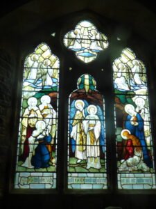
The placement of church doors and windows, including the absence of eastern doors, reflects both theological symbolism and practical architectural traditions
Jan 24
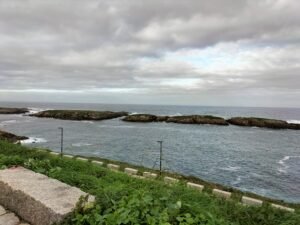
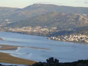
The region of Galicia, located in the northwest of the Iberian Peninsula, is a land defined by rugged coastlines, mountainous terrain, and fertile valleys. Galicia’s geography and geology have played a fundamental role in shaping both its natural environment and the ways in which ancient civilizations, such as the Gallaeci (the Celtic tribes of Galicia), interacted with their surroundings.
Jan 24

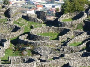
Hillforts, or castros, are some of the most iconic archaeological features of Galicia and provide valuable insights into the region’s Celtic past. These ancient settlements, typically constructed on hilltops or elevated locations, were used for defensive and residential purposes by the Gallaeci and other Celtic groups in northwest Spain.
Jan 24
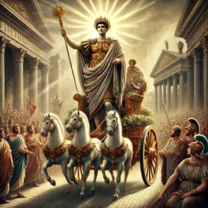
Roman Invasion of Hispania: The Romans’ first significant incursions into the Iberian Peninsula began in 218 BCE during the Second Punic War, when Hannibal Barca, the Carthaginian general, crossed the Alps and threatened Rome. This prompted Roman intervention to ensure control of their western Mediterranean territories.
Jan 24

Breogán is a legendary figure in Galician mythology and is regarded as the founder of the Galician people. The myth of Breogán is part of the ancient Celtic tradition, and while the details of his story vary across sources, he is universally seen as a key figure in the mythological ancestry of the Galicians.
Jan 23
The region of Galicia, located in the northwest of the Iberian Peninsula, has a history that stretches back to prehistoric times. Known for its Celtic roots, rolling hills, rugged coastlines, and rich folklore, Galicia is a place steeped in ancient traditions and mystery.
Jan 23
Julius Caesar made the first significant Roman attempt to conquer Britannia in 55 BCE during his campaign in Gaul. He landed on the shores of south-eastern Britain, but his invasions were brief and mostly for reconnaissance. Despite some skirmishes, there was no lasting conquest at this stage.
Jan 23
The landscape of Thornborough before the arrival of humans was shaped by the end of the last Ice Age, approximately 10,000 years ago. As the glaciers receded, the land began to warm, leading to the rebirth of plant and animal life. The area would have been covered by a mosaic of vegetation that slowly replaced the tundra-like conditions left behind by the retreating ice sheets.
Jan 23

Celtic Heads Celtic Head from Witham, 2nd c B.C. (British Museum) “Celtic” carved heads are found throughout the Read more Timeline 60BC – 138AD This timeline is focussed on the British Celtic culture and those cultures which had influence on the British Celts. It Read more Heads at St Michael, Kirklington An analysis of head …
 NLS Map Explorer
 Google Earth
 Google Maps
 Lidar Finder
 TMA
TMA
 Megalithic Portal
 Yorkshire Arch. Air Mapping
 ADS
ADS
 Brigantian Adventure FB Group
Stone Bothering FB Group
Stone Faces FB Group
Brigantian Adventure FB Group
Stone Bothering FB Group
Stone Faces FB Group
 Heritage Gateway
 ARCHI® MAPS: UK
 Atlas of Hillforts
 Portable Antiquities
 British History Online
Brigantes Nation FB Group
British History Online
Brigantes Nation FB Group

