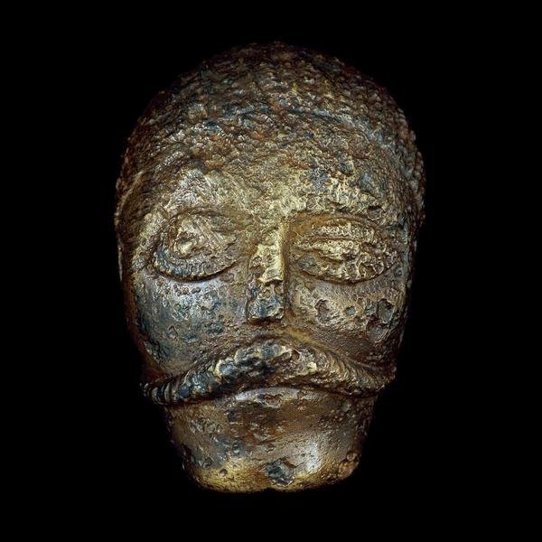
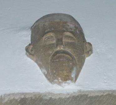
Celtic Heads
Celtic Head from Witham, 2nd c B.C. (British Museum) "Celtic" carved heads are found throughout the Read more
Timeline 60BC – 138AD
This timeline is focussed on the British Celtic culture and those cultures which had influence on the British Celts. It Read more
Cartimandua
Yorkshire, and much of northern Britain was also ruled by a queen, the most powerful ruler in Britain in fact. Read more
Caratacus
Caratacus was highly influenced by the Druids, and both he and his brother Togodumnus were among the leading lights of Read more
Cerialis Petillius
Quintus Petillius Cerialis Caesius Rufus was the son-in-law of Vespasian Cerialis and became Governor of Britain in AD.71; his instructions Read more
Julius Caesar
Ask anyone to name a famous Roman character, and the name of Julius Caesar is sure to be the most Read more
Vespasian
Born in the year 9 at Reate, north of Rome, Vespasian was the son of a tax collector, Flavius Sabinus Read more
Augustus
Suetonius wrote of him: He was very handsome and most graceful at all stages of his life, although he cared Read more
Claudius
Tiberius Claudius Nero Germanicus was born Lugunum in 10 BC, the youngest son of Nero Drusus, brother of Tiberius. He Read more
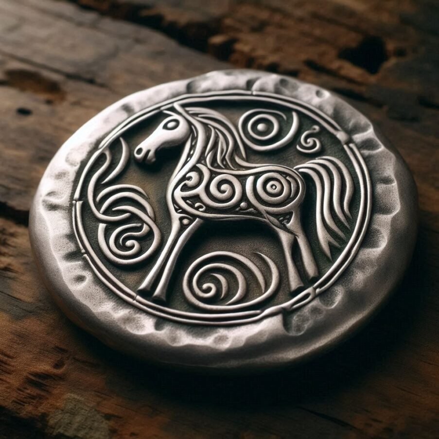
Celtic Gods
Many Celtic deities seem to have been associated with aspects of nature and worshipped in sacred groves. Some appear in Read more
The Celtic Tradition
History Of The Celts
The Celts Part I: Their Origins & Pre-History by Nick Griffin, M.A. (Hons.), Cantab.
“The whole nation is war-mad, both high-spirited and ready for battle, but otherwise simple, though not uncultured.” – Strabo, 1st century C.E. geographer “Golden is their hair and golden their garb. They are resplendent in their striped cloaks, and their milk-white necks are circled with gold.” – Virgil, 1st century B.C.E. poet “Celts”:
If the name means anything to the average American, it probably calls to mind a parade in Boston on St. Patrick’s Day, when even the beer is dyed green. Beyond a vague notion that the Irish, Scots, and Welsh share a romantic common heritage in some way different from the English whose language they mainly use, the Celts lie forgotten and irrelevant in the mists of time.
Such ignorance is one of the symptoms of a race on the verge of collective suicide, for those with no knowledge of, or pride in, their forefathers are no more likely to have any concern for future generations of their kinfolk either. Yet the Celts are regarded by historians as “the fathers of Europe.” Genetically as well as culturally they played a major part in laying the foundations for the great achievements of the White race. Just as important, many of the mistakes they made which condemned them to defeat and collapse contain lessons today for those striving to save our race from sinking forever into a sea of colour, ignorance, and eternal filth.
Let us, then, find out more about the Celts. Who were they? Where did they come from? What sort of lives did they lead? How did they rise to dominate much of Europe? And why did they fall from such a pinnacle into the scattered obscurity of today’s “Celtic fringe”? The Celts first burst into recorded history in the writings of the ancient Greeks and Romans in about 500 B.C.E.
The great city-state civilization of Greece had been established centuries before by fair-skinned Nordic invaders from the north who had subdued and enslaved the Mediterranean aborigines. Already headed down the slippery slope of racial integration with their conquered subjects, and consequent ruin, the Greeks still maintained advanced standards of life and learning. They founded trading settlements in France, Italy, and Asia Minor, and even sailed out into the Atlantic, turning north to the British Isles and beyond.
The Greeks discovered that the area of central and north-western Europe was dominated by a huge number of tribes who, although independent and often even at war with each other, possessed a common culture and common origins. They wrote the name by which these people referred to themselves as Keltoi and counted them, along with the closely related Scythians from the steppes of southern Russia, and the Persians and Libyans, as one of the four great barbarian peoples of the world. Among various reporters, the fifth century B.C.E. historian Herodotus recorded that the Celtic lands stretched from the headwaters of the Danube to all but the west coast of Iberia.
The Celts, then, were already a mighty and widespread people when they appear in recorded history. To trace their origins we must go back far into prehistory, where sometimes conflicting theories seek to make sense of the scattered evidence of archaeology. Nora Chadwick, late professor of Anglo-Saxon at Cambridge and internationally renowned authority on the origins and customs of the Celtic peoples, in her book The Celts (1970) traces Celtic prehistory to the end of the third millennium B.C.E.
The crucial evidence is the spread throughout east-central Europe–modern Hungary, Slovakia, the Czech Republic, and Austria–of a distinctive type of socketed axe head, often found in graves under distinctive circular Barrows. Clearly weapons of war, these were first made of polished stone, but their makers were also quick to adopt the new science of bronze working which appeared in Slovakia and the Carpathians in the first half of the second millennium B.C.E.
It has long been held that these “Battle-Axe People” were responsible for the initial spread of the Indo-European race and language. This conclusion is based not merely on archaeological evidence, but also on the study of the similarities among the languages which later developed from the Indo-European, or Aryan, tongue. Although all the languages involved have changed a great deal over thousands of years, linguistic changes follow certain philological rules.
For example, the original Indo-European vowel e often remained an e in Latin, but mutated to i in the Celtic tongues and became a in the Sanskrit of ancient Aryan India. Thus the Latin word for king, rex, is paralled by Celtic rix and Sanskrit raj. Consonants also changed according to predictable patterns. The Indo-European p sound at the beginning of words, for example, was retained in Sanskrit and Latin, and in the modern descendants of the latter, such as French. Meanwhile it mutated in German and English to v or f, and disappeared altogether in old Irish. Aware of these facts, we can at once see the common origins of Sanskrit pitar, Latin pater, Irish Celtic athir, German vater, and English father.
Whoever spread the language, one further example will suffice to show how even some of the now most diverse tongues of Europe spring from the same roots. There is an old and optimistic Baltic proverb, the meaning of which in English is: “God gave the teeth; God will also give bread.” In Lithuanian this reads: Dieva dawe dantis; Dievas duos ir duonos; in Latin: Deus dedit dentes; Deus dabit et panem; in modern Welsh, which derives directly from one branch of ancient Celtic, the first half of the proverb is: Duw rhoddodd y danedd. Translated into ancient Sanskrit, it would read: Devas adadat datas; Devas dadat apidhanas. From these it is possible to reconstruct the theoretical Indo-European original: Deivos ededot dntns; Deivos dedot dhonas.
When we also discover that English “tooth” once had the plural form “tand “, and that consonants such as d, g, p, b, and v have, in effect, swapped places with each other several times over the last two thousand or so years, we begin to see the less obvious connection between these examples as well as the collection of similar phrases which are found if the exercise is repeated with various modern Germanic languages such as Dutch, English, German, and Danish.
Such studies show that Celtic was closely related to the Italic language which gave rise to Latin, and also clearly connected with the Germanic, Slavonic, and Hellenic tongues, as well as with those of many of the early civilizations of the Middle East, including Persian, the recently rediscovered language of the Hittites, and the Sanskrit of northern India, which is preserved in texts dating back to 2,000 B.C.E. The waves of Indo-European warriors and civilization builders which spread the common parent of this great family of languages even reached as far as China.
Thousands of miles to the west, the Battle-Axe carriers seem to have collided with another distinctive people. Known today as the Beaker Folk, after the pottery drinking vessels found in so many of their graves, they inhabited a wide area from Bohemia to Britain and south into parts of Iberia, from which they may have spread northwards in the first place.
They too were mainly pastoralists, although they favoured sheep rather than the cattle associated with the immigrants from the east. Their chief weapon was the bow, firing arrows tipped with flint. This should not give the false impression that they were primitive savages, for they used bronze and possessed an advanced knowledge of astronomy. They also had developed a sufficiently sophisticated social organization to enable them to build the great megalithic observatories, such as the lines of giant stones at Carnac in Brittany and the huge stone circles at Stonehenge, Avebury, and nearby Silbury Hill, the last being the largest prehistoric structure in Europe.
The two groups merged, although the Battle-Axe element seems to have been dominant. From this time, around 2,000 B.C.E., the materially simple self-sufficiency of late Neolithic times is transformed into a society dominated by a warrior aristocracy equipped with bronze weapons and displaying their power and wealth with well made and decorated personal possessions which already have a uniquely “European” style, different from those of the emerging civilizations of the eastern Mediterranean and Middle East.
Throughout this period there is a growing disparity between the grave goods of ordinary people and those buried with the aristocracy. At least some of this new-found wealth came from the growing trade in copper, tin, amber, and, no doubt, furs and other perishables, with the urban centers to the east and south. This well developed Bronze Age culture is named after Unetice, a village south of Prague where particularly good examples of its artifacts, dating from around 1,800 B.C.E., have come to light. The area was a trading crossroads, and wealth and metalworking skill accumulated rapidly.
Within 300 years a fresh wave of Battle-Axe migrants from the east appears to have arrived without conflict, bringing with them the custom of raising round burial mounds like the kurgans with which they had covered their dead on the steppes. Under their influence the rich grave of a chieftain was marked by the tumulus from which this transformation of the older Unetice Culture takes its name.
This Tumulus Culture spread beyond the bounds of its predecessor, stretching as far as Hungary in the east, but shifting its center of gravity westward into Bavaria. In spite of this change, the close similarities between the artifacts discovered from these periods shows that there was a great deal of continuity. There is clear evidence for the development of local “schools” of metal working, and the steady continuation of trade also points to peaceful development.
Toward the end of the second millennium B.C.E., however, technological innovation–this time the development of heavy, bronze slashing swords and armor and shields of the same metal–again seems to have sparked off a period of more violent expansion. Around 1,200 B.C.E. the tumulus inhumations give way to a new funerary rite in which the dead were cremated and their remains deposited in pottery urns buried in cemeteries without Tumuli.
The grave goods buried with them, however, remain fundamentally the same, and there is some overlap between the two customs, so archaeologists generally agree that this so-called Urnfield Culture was the result of a change in ritual rather than of a further large-scale invasion. Certainly there is no archaeological evidence of cremation back on the Russian steppes from which the earlier invaders had come. On the other hand, it is clear that this time did see the widespread disruption of the eastern Mediterranean by “pirates from the north.” Around 1,200 B.C.E. the Mycenaean and Hittite civilizations, both already in decay as their rulers mixed with the non-Aryan natives, were devastated by the blonde invaders with their newfound superiority in warfare.
The folk from the north who swept into Greece at this time were known as the Xanthoi –the Golden Ones–a name which reflected their ideals of nobility and greatness as well as their appearance. This wave of fresh Nordic blood laid the foundations of classical Hellenic civilization, particularly its Dorian branch, which was later to reach a peak in the city-state of Sparta. It was also at this time that the Egyptians recorded incursions of bands of tall, fair-haired warriors from across the sea.
All these upheavals probably resulted from technological advance among the peoples living on the upper reaches of the Danube and the Rhine, which shifted the interests of the aristocracy away from trade and toward warfare, plundering, and conquest on an epic scale. This would also account for the rapid development of hill-forts and larger houses which call to mind the great halls of local kings and their war bands which are featured so often in the poetry and sagas of later “Dark Age” Europe.
Their art by this time shows direct links in style with that of the later Celts, and the evidence of place-names shows that they spoke an early form of Celtic. These proto-Celts dominated the east and central European homeland of their forefathers, but also spread across the Rhine to the west and the Alps to the south. It is not possible to point to an exact date from which the term “Celt” may be used accurately, although the next development noted by archaeologists is universally accepted as involving a fully Celtic people and culture. Georg Ramsauer, mid-19th-century director of the Hallstaat State Mine, near Salzburg, Austria, was fascinated by the discovery in the salt mine of the well-preserved body of a prehistoric miner. Inspired to find out more, he began to excavate a huge cemetery nearby.
Some 2,500 graves revealed that from about 770 B.C.E. a society of aristocrats ruling over a settled peasantry used salt from the mine as the basis for widespread trade. The wealth and patronage of its rulers created a highly-skilled school of craftsmen utilizing a strong, new metal. The Iron Age had arrived. The art and economy of this new culture, now named after the finds at Hallstaat, show close continuity with those of the earlier Urnfield folk of the same area, and it seems probable that they themselves adopted ironworking. But there is also widespread evidence that the Hallstaat period saw the arrival of the domesticated horse in central Europe.
From the eighth and seventh centuries B.C.E. bronze harness mounts and horse-bits become widespread throughout eastern and central Europe and are even found as far west as Wales. At the same time, the Hallstaat chieftains adopted the practice of wagon burial, which, like the use of the horse, first appeared in the steppes to the east. All this points to the arrival of another group of immigrants.
The power and prestige created by their horses would have either made them natural new overlords or, if they were insufficient in numbers to take over completely, encouraged the established aristocracy to adopt their technology and customs. Since the move away from cremation was widespread but not universal, and since the two rites co-existed for much of the period, the latter is probably closer to the truth.
The discovery of iron had a revolutionary effect on the farming economy, as well as on warfare. Where their forebears had been largely confined to exploiting areas of light Loess –soil deposits laid down by the wind as the glaciers had retreated–farmers with the new iron axes and heavy, iron-tipped ploughs, were able to clear and cultivate dense forests on heavier ground.
Within a couple of generations this must have led to a very significant and accelerating population increase. Then, as boys grew to manhood, they were cheaply armed with weapons of higher quality than those owned by the most powerful chieftains of their grandfathers’ days. This expanding population stimulated further trade with the civilizations to the south and east, but growing self-confidence also encouraged local craftsmen to new heights of skill in their own very distinctive style of sweeping abstract designs merging with the heads of fantastic animals and birds.
The earliest burials to preserve these new developments are found along the Upper Danube, in Upper Austria and Bavaria, and in Bohemia. If we want to pinpoint a specific area, this may be regarded as the birthplace of the historic Celts. By the start of the sixth century B.C.E. the pressure of population and perhaps the ambitions of young nobles led to rapid expansion to the west. Indeed, the whole centre of the Celtic domain shifted into the Upper Rhine, southwest Germany, Switzerland, and Burgundy.
Two particularly fine graves tell us a great deal about the people involved. A grave mound at Vix, near Chatillon-sur-Seine in Burgundy, was found to contain the remains of a young woman of about thirty. She was laid on the frame of a wagon, whose four wheels had been removed and placed against the east wall of the wooden chamber. As in all such graves, no animals were buried, but complete sets of horse harness were provided for use in the next world.
The rich grave goods which surrounded her show that she lived in a wealthy society which held women in high esteem. They included a magnificent, five-foot high wine krater from the Greek settlement at Massalia, modern Marseilles.
This evidence of the high standing of women is supported by literary references. Plutarch, for example, says that Celtic women were allowed to speak at tribal assemblies, while the surviving stories from Celtic Ireland tell us of queens, such as Maeve, who were as powerful in their own right as Boudicca and Cartimandua appear to have been in the Roman account of the conquest of Britain.
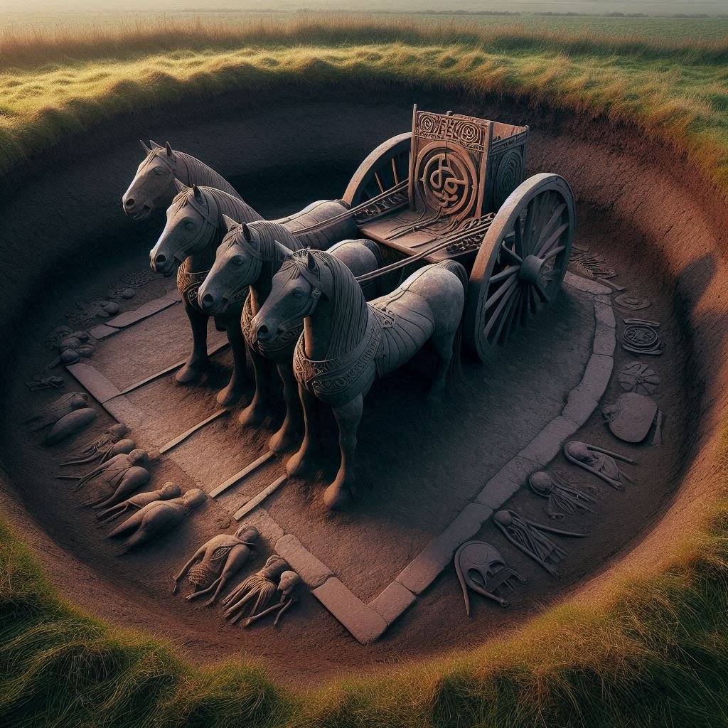
Another large burial mound was excavated in 1978 at Hochdorf near the Black Forest. The tomb consisted of two rooms with oak-beamed walls and roof, topped with a 24-foot pile of stone. In the burial chamber itself, one late summer around 550 B.C.E., a six-foot tall man of about 40 was garlanded with flowers and laid on a bronze couch covered with wool blankets and badger skins. He was decked in gold: even his shoes bore strips of gold. In the outer chamber, piled with bowls, knives, and cooking pots, was a cart with four well-made, iron-bound wheels.
A row of ornate drinking horns hung on the wall, no doubt for use in the next life when the chieftain would wake and refresh himself from a large, bronze cauldron, which had originated in a Greek colony in southern Italy. When excavated it still held the sediment of the mead buried with him more than 2,500 years earlier. The Hallstaat influence spread rapidly. Initially, at least, this may well have involved bands of marauding young warriors rather than complete tribal units.
Finds in southeastern Britain dating from the seventh century B.C.E., for example, have produced Hallstatt warrior gear without the evidence of domestic crafts which normally accompany them in Europe. Such adventurers in all probability established themselves as a new ruling class over the previous inhabitants and, to a greater or lesser extent depending on their numbers, intermixed with them.
The same had happened with the earlier invasions of Neolithic Aryans and Bronze Age Celts. While, for example, the Goidels of Ireland appear fully Celtic, their Pictish neighbors in the west of Scotland seem to have retained a number of pre-Aryan customs, particularly matrilineal descent, which indicate that a significant portion of their population was descended from the aboriginal inhabitants of the land.
This pattern of conquest followed by gradual integration was probably repeated a number of times. The influx of Hallstaat warriors at this time may account for the sudden change in the Greek name for the British Isles. In the sixth century B.C.E. the term the Greeks used was Albion. Within 200 years though, Greek geographers began describing these westerly islands as Pretannia (Britannia). In all probability the change was the result of the dominance of the iron-using invaders’ Brythonic dialect, which replaced the older Goidelic tongue everywhere except in Ireland.
Back in continental Europe, the heart of the Celtic world saw further developments. Swords became longer, used for slashing, with short daggers used for in-fighting. The typically Celtic, long, wooden shield, edged with iron and sometimes covered with beautifully worked beaten bronze, also became common. The design of some helmets and armor still shows a degree of influence from the Greeks and Etruscans, as do some of the more elaborate hill-forts built during the sixth century.
Evidence of burning and destruction at many sites points to widespread warfare during this period. This may have been merely inter-tribal cattle raiding, as is recorded in many of the later stories which survived in Ireland, but it also can be taken to support the theory that the cultural changes shown by the archaeological record reflect large-scale territorial expansion by particular groups.
By about 500 B.C.E. a final change in the military equipment of the Celts of the heartland, together with a further refinement of their artistic skills, led to the evolution of the La Tene culture, which takes its name from the village in Switzerland where a major find in 1858 first drew attention to the development. During construction work on the edge of Lake Neuchatel, a drainage operation exposed a row of blackened timbers. Subsequent excavations showed these to be the remains of a long pier, from the end of which votive offerings of harness, tools and weapons, and stunningly beautiful eating and drinking utensils, had, over several hundred years, been cast into the water in a typically Celtic sacrificial rite.
The La Tene site is actually on the south-eastern edge of the initial range of the new development, which seems to have been centred on the Middle Rhine. Clearly directly evolved from the earlier Hallstaat style, this full flowering of the Celtic artistic genius is very closely identified with the aristocracy, which either gained or consolidated its power through the sudden development of a light and technologically advanced, two-wheeled war chariot.
This immediately calls to mind the ancient stories preserved in Ireland of heroes racing past enemy lines casting spears at their opponents at the start of a battle. The chariot owners showed off their status by commissioning local craftsmen to make drinking goblets, wine flagons, cauldrons, and personal ornaments of gold, bronze, coral, and, more rarely, silver.
These masterpieces were richly decorated with intricate designs, repeated to cover every available space. Initially they were influenced by imports from Etruscan Italy, Greece, and beyond, but even obvious borrowings were heavily adapted and combined with the swirling knotwork which remains the hallmark of Celtic art. As Chadwick comments, the La Tene style “might be considered the first truly indigenous art of temperate Europe.” The sudden flowering of the La Tene Culture coincided with the beginning of a vigorous expansion in all directions: an expansion which continued for several centuries.
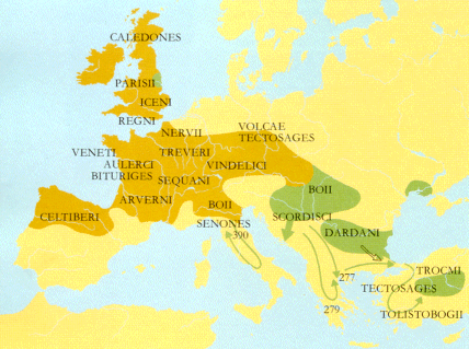
Further settlements were established in Britain and in Gaul. In the north the new arrivals reinforced the already Celtic population, but further south, in Aquitania, they rapidly mixed with the native Iberians to create a hybrid Celto-Iberian population and culture. A similar dilution of Celtic blood took place following the invasion of the Iberian peninsula itself. Greek writers begin to refer to Celts in Iberia from the fifth century B.C.E. Herodotus states that they were the most westerly people in Europe, except for the Cynetes, in what is now Portugal. In 350 B.C.E. the Greek writer Ephoros compiled a history of the world and noted that the Celtic domain extended to Cadiz.
However, the survival of placenames in the languages of the native Iberians and Ligurians in even the main areas of Celtic settlement in Spain shows that large numbers of the earlier inhabitants survived. In some areas the chiefs of Celtic war bands were probably accepted as leaders by the natives. The leading figures in the later Celtiberian war of independence against the Romans all bear Celtic names. Other groups of Iberian Celts seem to have held their own territory by force of arms, for whereas most of the Celtic placenames in Gaul are based on words such as “field” and “plain,” suggesting peaceful settlement, the majority in Spain include the suffix –briga.
This is cognate with German –burg and indicates a strongly defended hill fort. Notable examples include Segobriga (Segorbe) and Laccobriga (Lagos). Just as the chains of forts in Thuringia, on the eastern edge of the Celtic world, probably mark the shifting frontier between the Celts and their close cousins the Germans, so those at the western extremity show us settlers threatened by a numerous aboriginal population. Even the well-organized civilizations of Greece and Rome were hard-pressed by the Celtic expansion. According to Livy’s The Gallic Wars , the Celts of Gaul, impelled by overpopulation, formed a confederation under Ambicatus, king of the Bituriges.
He sent out two colonial expeditions, each under the command of one of his nephews. Sigovesus led one column eastward through the forests of Germany and down the Danube, while Bellovesus commanded an invasion of Italy over the Alps in 396 B.C.E. Certain areas north of the River Po had already been settled by Celts in the previous century, and the estimated 300,000 newcomers passed through these peacefully. Further south, however, the cities of the Etruscan civilization were looted and destroyed.
The people of the Boii tribe, whose original homeland still bears the name Bohemia, seized the countryside around their new settlement, which we know today as Bologna. Related tribes founded other towns, including Milan. After a brief pause, the push south continued in 387 B.C.E. A Roman army sent to oppose them was so terrified by the war cries of some 30,000 Gauls that the soldiers panicked. The Roman force was utterly destroyed, and the triumphant Celts swept southward. A powerful army under Brennus completed the humiliation by occupying Rome and extracting an enormous ransom of gold before withdrawing to the north. For the next 40 years Celtic armies terrorized Italy. Rome was attacked three more times, and much of central and northern Italy was repeatedly looted and laid waste. Livy, however, also records that the ill-disciplined tribesmen often drank themselves into oblivion and grew fat on the rich but easy pickings. The invaders were decimated by plague and later by famine. Even worse, they had no idea of the power of organization.
Where the Celts had tribal loyalties and reckless individual bravery, the Romans had devotion to the state and iron discipline. Rome raised and trained new armies from the south and, around 349 B.C.E., went on the offensive. According to the Graeco-Roman historian Polybius, the Celts, once again marching to plunder Rome, were so surprised to encounter serious opposition that they fled. A series of Roman victories drove the surviving Celts back to the north. By 335 B.C.E. they were forced to accept harsh peace terms and settled down in Cisalpine Gaul (i.e., Gaul on the Italian side of the Alps), as the Romans named the new Celtic colony, noted for its productive agriculture. Nothing is known directly of the movements of the colonial expedition sent out by Ambicatus to the east. Around this time, however, Celtic settlements appeared along the lower Danube and in parts of the Balkans. By 369 B.C.E. the Gaulish population of the region was strong enough for Celtic mercenaries to play a notable part in the Peloponnesian War.
From then on, Celts were regularly employed by the Greeks, both in their own civil wars and against their neighbors to the east. In 335 B.C.E. a delegation of Celts from the Adriatic paid court to Alexander the Great, who asked whether it were true that their people feared nothing. “Only,” they replied, “that the sky might fall.” Hellenic civilization was by now fading rapidly, owing to widespread race-mixing between the Indo-European masters and their aboriginal slaves. In 280 B.C.E. the Celts moved to take advantage of this decadence. Two Celtic armies routed the Macedonian army. Macedonian resistance ended when a third army of Celts, commanded by another Brennus, arrived the following year to deliver the coup de grace. Brennus’ army was estimated at 150,000 foot and up to 20,000 horse and almost certainly included many former mercenaries with experience of Greek military organization. In any event, having dealt with the Macedonians, Brennus marched on Greece.
A largely Athenian army tried to hold the strategic pass at Thermopylae but was defeated much more easily than the Spartans had been two centuries earlier. Town after town went up in flames. Even Delphi was sacked and its sacred oracle looted. Some confusion followed, and Brennus was wounded, according to the Greeks by the God Apollo himself. The Celts withdrew in good order, but Brennus, disgraced by the withdrawal and injury, committed suicide, and his mighty host broke up. A Celtic kingdom was established in Thrace, but a combination of interbreeding with the earlier inhabitants and pressure from its Greek neighbours meant that it was quickly Hellenized and overwhelmed.
Other Celts took service under various warring Greek rulers or moved northward founding various towns, including Belgrade. A thin line of Celtic placenames even runs along the coast of the Black Sea north of the Danube, with a scattering of La Tene artifacts being found in southern Russia, including a cemetery near Kiev, and as far as the Sea of Azov. An army of 10,000 Celts with a similar number of dependents were invited to Asia Minor by a local king in 278 B.C.E.
They quickly found it more profitable to operate on their own account, ravaging and extracting tribute from the terrified cities. Their antics were curbed eight years later by a crushing defeat at the hands of a Syrian force equipped with elephants. The majority then settled on a series of poor plateaux henceforth known as Galatia, now in Turkey. A generation later they backed the losing side in a local civil war and were repeatedly defeated by Attalus of Pergamum.
To celebrate the victory, the Greeks created a series of magnificent bronze statues. The Romans copied several of these in marble, including the Dying Gaul of the Capitol and the Ludovisi group showing a Celt, having killed his wife, stabbing himself with his sword rather than surrender. From then on, the Galatians stayed quietly in their new homeland. For several hundred years though, no prince in the East could do without his corps of Gauls. A revolt in Upper Egypt in 186 B.C.E. was put down with the help of Gaulish troops. During a lull in the campaign, four of them wandered into a deserted chapel of Horus, leaving grafitti telling how they caught a fox there.
The mercenaries quickly learned Greek, but as late as the fourth century C.E., St. Jerome wrote that the Galatians still also spoke a Celtic dialect similar to that used by the Treviri tribe of the Belgae. Other evidence bears this out. The leaders of the initial invasion and the settlements they founded often had Belgic names, and statues show that many of them wore the wide trousers for which the Belgae were always noted.
At the other end of Europe, Belgic immigrants probably also were responsible for the fresh continental influences which appeared in the British Isles in the last few centuries before the Roman invasion. Several items dredged from the mud of the River Thames–including a delicately embossed, horned helmet and the famous Battersea Shield–are among the finest examples of La Tene art in the world.
In addition to this impressive war gear, changes in pottery and fortifications also can be seen as evidence of successive waves of settlers from the continent, some arriving as new overlords, others settling in new areas to establish island offshoots of continental tribes. Having outlined the traditionally accepted view of the “coming of the Celts,” it must be noted that this migrationist school has in recent years been challenged by a diffusionist model, according to which such changes spread slowly through pre-existing populations as a result of emulation.
In this theory the desire of local rulers to “keep up with the Joneses” is the chief agent in spreading new technology and cultural fashions. The diffusionists make the superficially convincing analogy of archaeologists several thousand years hence explaining the sudden appearance of highway networks, filling stations, and the rusted remains of automobiles in terms of aggressive expansion by the “Car People.” Since, they argue, we know this to be untrue, why should we imagine that the prehistoric spread of chariots, battle-axes, or styles of pottery was different?
It must be understood, however, that many of the advocates of this diffusionist view are motivated by egalitarianism. Their views owe less to the realities of history than to their ideological and emotional commitment to the myth of human equality. According to the diffusionists, the populations of prehistoric Europe were essentially the same in their temperaments and capabilities. Cultural and technological innovations are assumed to have arisen at random in this undifferentiated mass, before spreading in slow-moving ripples from these various centers. In this view, “Celt” is an almost entirely cultural designation with no connection to ethnicity.
According to the diffusionists, therefore, there was never a “Coming of the Celts”: they were already in possession of their lands before slow, cumulative cultural change made them into Celts. And, having developed this identity, they did not burst out in waves to impose it on much of Europe, either as colonists or as a ruling aristocracy. As is so often the case though, such Politically Correct theorizing has litle basis in reality and is totally at odds with the surviving contemporary reports. Classical commentators such as Strabo and Lucan noted the clear racial differences between the population of Gaul and that of Britain, and the fact that, while both groups were much fairer than the Mediterraneans, the pure Germans were blonder still. In a triumph ordered by Caligula, a parade of “German” prisoners was boosted for the benefit of the onlookers by the simple expedient of including a number of unusually tall Gauls whose hair was bleached for the occasion.
Caesar makes it clear that the inhabitants of Aquitania–roughly the area south of the Garonne valley–were much more like the mixed Celt-Iberians of Spain than their purely Celtic neighbors to the north. Many classical writers reported that typical Celts were tall and muscular with blue eyes and blonde or–like Boudicca, the warrior-queen who led the anti-Roman revolt by the southeastern British tribes–red hair.
The fourth century Byzantine writer, Ammianus Marcellinus, was drawing on first-hand reports from the first century B.C.E. when he commented: “Nearly all the Gauls are of a lofty stature, fair and of ruddy complexion: terrible from the sternness of their eyes, and of great pride and insolence. A whole troop of foreigners would not be able to withstand a single Gaul if he called his wife to his assistance, who is usually very strong and with blue eyes.” Tacitus agrees on the generally Nordic nature of the Celts, but comments on the notable exception of the tribe occupying South Wales: “The dark faces of the Silures, their usually curly hair, and the position of Spain opposite, are evidence that the ancient Iberians crossed the sea and settled there.”
The diffusionist denial of the role of mass tribal migrations or warrior-aristocracy conquests in the ethnic history of various parts of Europe is also guilty of ignoring many reliable classical references to just such events. In his De Bello Gallico , Caesar tells us: “The inland part of Britain is inhabited by tribes declared in their own tradition to be indigenous to the island, the maritime part by tribes that migrated from Belgium to seek booty by invasion.”
He also makes it clear that this was a recent development. Unfortunately for the trendy theory that changes in grave goods are unrelated to changes in population, the pottery of this time found in southern England shows a sudden increase in continental influence. So the literary and archaeological evidence bear out the migrationist view. Many Celtic place-names also give us glimpses of past migrations. Thus the Belgic Parisii not only held the area around the future capital of France, but also had a branch in Yorkshire, England. The Brigantes are best known in history as a powerful tribe in northern England, but it is likely that the town of Bregenz on Lake Constance marks their original home in the Celtic heartland, from which another wandering offshoot eventually reached Spain and founded the settlement of Brigantium on the site of modern Corunna.
Other Roman writers noted that the Celts themselves had an ancient tradition that they had come from low-lying areas on the fringes of the North Sea, from which they were driven by floods. It is very likely that this was an accurate folk memory of the rise in sea level which resulted from the melting of the northern ice cap during the unusual warmth of the middle of the Bronze Age, or of the return to much colder and wetter conditions which marked its end and would have led to repeated floods along the lower reaches of rivers such as the Rhine.
The traditions of classical Irish literature refer in detail to mass folk migrations, stating that their island had been invaded by five successive groups of settlers, and that the Celts themselves had arrived long after settlers from Spain had built the Megalithic Tombs which dot the landscape. The Irish epic, the Tain Bo Cualnge –The Cattle Raid of Cooley–actually gives us a picture of a Celtic army setting off to war, followed by their families and cartloads of possessions: “Thereafter the hosts set out upon their march. It was difficult to attend to that mighty army, which set forth on that journey, with the many tribes and the many families and the many thousands whom they brought with them that they might see each other and know each other and that each might be with his familiars and his friends and his kin on the hosting.” Livy’s history of the Gallic wars, and the even more detailed records of the last great Celtic invasion of Italy at the turn of the second century B.C.E., also give us direct accounts of mass migrations, telling of the widespread upheaval among the Celtic tribes which began when the Cimbri abandoned their homeland, probably in Jutland, and poured south.
They were joined by the Teutones–whose name is of Celtic origin and means “people”–whose leaders, like those of the Cimbri, all bore Celtic names. The Cimbri attacked those of the Boii who had remained in Bohemia, then marched to the eastern Alps. Defeated by a Roman army at Noreia in 113 B.C.E., the Cimbri moved into Gaul and annihilated two Roman armies. The horde then split up. Half rampaged homewards through Gaul, where the Belgae in the north later boasted that they were the only people to stand up to them, a success they attributed to the martial vigour inherited from their own “Germanic” origins from across the Rhine several centuries before.
A 6,000 man Cimbri rearguard left behind in Belgium became an important tribe in its own right only fifty years later. The other half marched into Spain to seek new land there. In 103 B.C.E. they returned to Gaul and linked up again with the Teutones. Together they swept through the Brenner Pass into Italy, but were smashed at Vercellae in 101 B.C.E.
The following year the remainder clashed with the legions at Aix-en-Provence. Most were butchered, but thousands were dragged back to Rome as slaves. The largely empty old territory of the Teutones was quickly filled by fully Germanic tribes. Where the Celto-German border at the start of the La Tene period was in Thuringia and Saxony, Germanic villages and forts now spread rapidly to the Rhine. The modern liberal dogma of change through gentle ripples of peaceful emulation fits ill with this reality of wandering tribes bringing terror and destruction to everything in their path before being wiped out themselves by the next people destined to dominate Europe.
The diffusionist theory also calls for the rejection of the idea that cultural, military, and linguistic changes are often the result of changes in the ruling elite. The politically aware student of liberalism will not be surprised to note that it is very fashionable nowadays to downplay the role of elites and to explain everything in terms of economic determinism. Indeed, grateful though we must be to the outstanding modern British scholar of prehistory, Professor Colin Renfrew, for his book Before Civilization , which established that our ancestors were early innovators rather than barbaric imitators of the cultures of the Near East, we must disagree with the neo-Marxist sentiments with which he concludes his later book, Archaeology and Language .
Having criticized what he sees as the traditional Eurocentric and ethnocentric basis of historical analysis, he expresses the Politically Correct hope that from now on “we can attempt to rethink these issues, with less emphasis on specific ethnic groups and their supposed migrations, and rather more upon the underlying economic and social processes at work.” Clearly the professor’s groundbreaking scholarship is not matched by a similar ability to think for himself when he ventures into the realm of politics. Certainly Renfrew’s rejection of elite dominance and mass migration bears little resemblance to the facts. Having denied that elite dominance is a major factor in producing linguistic change, he has to admit in passing that out of the four still-living Celtic tongues, two–Scots Gaelic and Breton–are entirely the result of this very process.
The inhabitants of the north and west of Scotland originally spoke Pictish or a dialect of the Brythonic tongue which later developed into Welsh. It was only in the fifth century C.E. that the Ulaid of Ulster sent colonists over the narrow sea to Scotland to escape the attacks of their southern Irish neighbors. This new settlement, speaking a dialect of Goedelic Gaelic, gradually expanded until its language entirely replaced the earlier Brythonic and Pictish ones.
As we shall see, the history of Breton is similar. Nor does Renfrew take his brief quest for analogies in other times very far. It is a fine irony for a man writing in modern English to deny that a small group of well-armed and vigorous foreigners can take over an entire society and drastically alter its language. For the fact is that more than half of our vocabulary is of Latin origin, and that most of that portion entered our speech via French, as the result of the conquest of a population of several million by about six thousand French-speaking cutthroats who, unlike the natives, had perfected the art of fighting on horseback. For at least a hundred years after 1066 it was possible that Norman-French would take over from Old English completely. Only King John’s loss of his French lands and the subsequent long struggle of later kings to regain them created an upsurge in nationalist feeling in England which led to French falling from favour and the recovery of the prestige of a much changed version of English.
The rise of Latin and of the Roman Empire is another classic case of elite dominance. Hungary–which, up until 1919 in particular, included millions of Slovaks, Ukrainians, and Serbs under the rule of Magyar gentry–shows up on Renfrew’s language map as an island of non-Indo-European speech in the heart of Europe. This was the result of another of the great invasions which have happened throughout recorded history but which the diffusionists deny took place in prehistory. Since human nature is unchanging, and since inequalities between different peoples, both innate and technological, have always existed, there is no reason why mass invasions and takeovers by warrior bands should have been any less frequent before and during Celtic times than they have been since. Having said that, Renfrew is right to say that when we see a particularly dramatic change in population and language, whether sudden or gradual, we may expect to find its roots in some major practical development in the economic, military, or technological field which took place either at the same time or shortly before. As he argues so convincingly, in the prehistory of Europe and a large part of the Middle East as far as India, the only event significant enough to have led to such a widespread dispersal of Indo-European speakers is the introduction of agriculture. Similarly, there is no doubt that a very significant military advantage would have been enjoyed by the first people to learn to make weapons of bronze and later of iron, and by the first folk to ride the horse or chariot into battle. In each of these changes we have the practical motor for change by elite dominance.
The idea that the first group to make each of these advances wouldn’t have taken advantage of them at the expense of neighbouring peoples is too absurd for words. It is a basic part of human nature which can still be seen at work all over the world today, except on behalf of a White race softened by generations of drivel about “equality” and letting the ugly, the stupid, and the botched inherit the Earth. Our ancestors had no such qualms, which is why the archaeological evidence of burnt villages and periods of major fortification work bears out the classical accounts of widespread disruption at the start of both the Bronze and Iron Ages, and again with the introduction of the war chariot.
While it is certainly going too far to regard a simple change of fashion in prehistoric pottery as indicating the arrival of a new people, wherever we find evidence of a major increase in the effectiveness of the weapons of war, there is every reason to suppose that it upset the balance of power and led to the creation of new elites, if not to the displacement of entire tribes. In the 1934 English translation of his monumental The History of the Celtic People , French expert Professor Henri Hubert uses lingusitic evidence to make a convincing case for two major periods of expansion coinciding with the coming of bronze and iron. The first included the Nordic descent into Greece and Italy, as well as the breaking off of the linguistically conservative Goidels, whose language survives today in the Q-Celtic tongues of Ireland, Scotland and the Isle of Man. By the time the dawn of the Iron Age led to the second great expansion, the language in the Celtic heartland had changed substantially.
In particular, the consonant q or k had mutated into a p . The new dialect of the militarily and culturally dominant iron users became dominant throughout Gaul and mainland Britain, which is why modern Welsh, Breton and Cornish are described as P-Celtic. Only in remote Ireland did the older language survive. Whatever the exact timescale of their dispersal and language changes, the Celts at their peak dominated a vast swath of Europe: from Spain to the Balkans, from the estuary of the Elbe to the southern foothills of the Alps, from the windswept Atlantic coast of Ireland to the forests of central Germany. Their influence went even further.
Celtic ornaments have been found in Sweden, and some of the finest examples of La Tene craftsmanship are votive offerings recovered from the peat bogs of Denmark. These were made in the Celtic heartland, but seem to have been obtained by the local Germanic chieftains through trade with their southern neighbors. The magnificent Gundestrup Cauldron, for example, is made of silver from the middle Danube, and its typical Celtic decorations include an elephant. We have noted the role of Gaulish soldiers of fortune in Asia Minor and the settlements on the edge of the Black Sea. Even the Romans learned from them, borrowing their chariots, many of their words, and their long shields.
The Germans learned even more. Many important military, political, and economic terms in German were borrowed from the language of the Celts, including those for “hostage,” “office,” and “value.” The Celtic word for “inheritance”–orbe in Irish–gave the Germans Erbe . Where the King of a Gaulish tribe was known as the Rix , the old German Gothic tongue changed the word to Reiks , from which derived the modern Reich. The German for “breastplate” comes from the same Celtic root as the Irish and Welsh words for “chest,” bruinne and bron respectively.
The fact that the Germans learned the word for “iron” from their western neighbours suggests that the Celts very early came to influence or even to dominate the Germanic tribes to their east. It is even possible that groups such as the Teutones were partly or largely Germanic, but with an aristocracy descended from Celtic warbands, as we have already seen may well have been the case among the Celtiberians far to the southwest.
Part II: Celtic Folkways & The Clash With Romans & Germans
In the previous part we looked at the origins and prehistory of the Celts. We traced their spread westward over Europe and their growing influence on their neighbors, up until the time of their first clashes with the Romans. Although they were ferocious enemies, the Celts were certainly not unwashed or uncultured barbarians.
The fourth-century Graeco-Roman historian Ammianus Marcellinus noted that “the Gaul’s are all exceedingly careful of cleanliness and neatness, nor in all the country . . . could any man or woman, however poor, be seen either dirty or ragged.” Pliny tells us that the Celts invented soap and were taking regular baths long before the Romans adopted the habit. The women used perfumes and cosmetics, checking their appearance in delicately decorated bronze mirrors. The men were generally clean-shaven, except for their characteristic long, drooping moustaches.
The Celts had a great reverence for natural beauty, including that of the human body. Obese men, unsightly and unfit for war, could be fined. As with all the Aryan peoples of northern Europe before the coming of Christianity, their women enjoyed a great deal of freedom, and sex was not regarded as sinful. When the wife of fourth-century historian Sulpicius Severus reproached the wife of an aristocratic Celt for the wantonness of Celtic women, the Celtic woman replied cuttingly: “We fulfill the demands of Nature in a much better way than do you Roman women: for we consort openly with the best men, whereas you let yourselves be debauched in secret by the vilest.”
In those late days of decadent Rome, commerce and wealth were overwhelmingly in the hands of immigrant Levantine merchants, particularly Jews, so the proud Celt chose her words well. Both sexes were well dressed. The toga-wearing Mediterraneans were especially impressed by the trousers favoured by the men, a practical fashion the Romans adopted for their cavalry–the best of whom were in any case recruited from Celtic tribes.
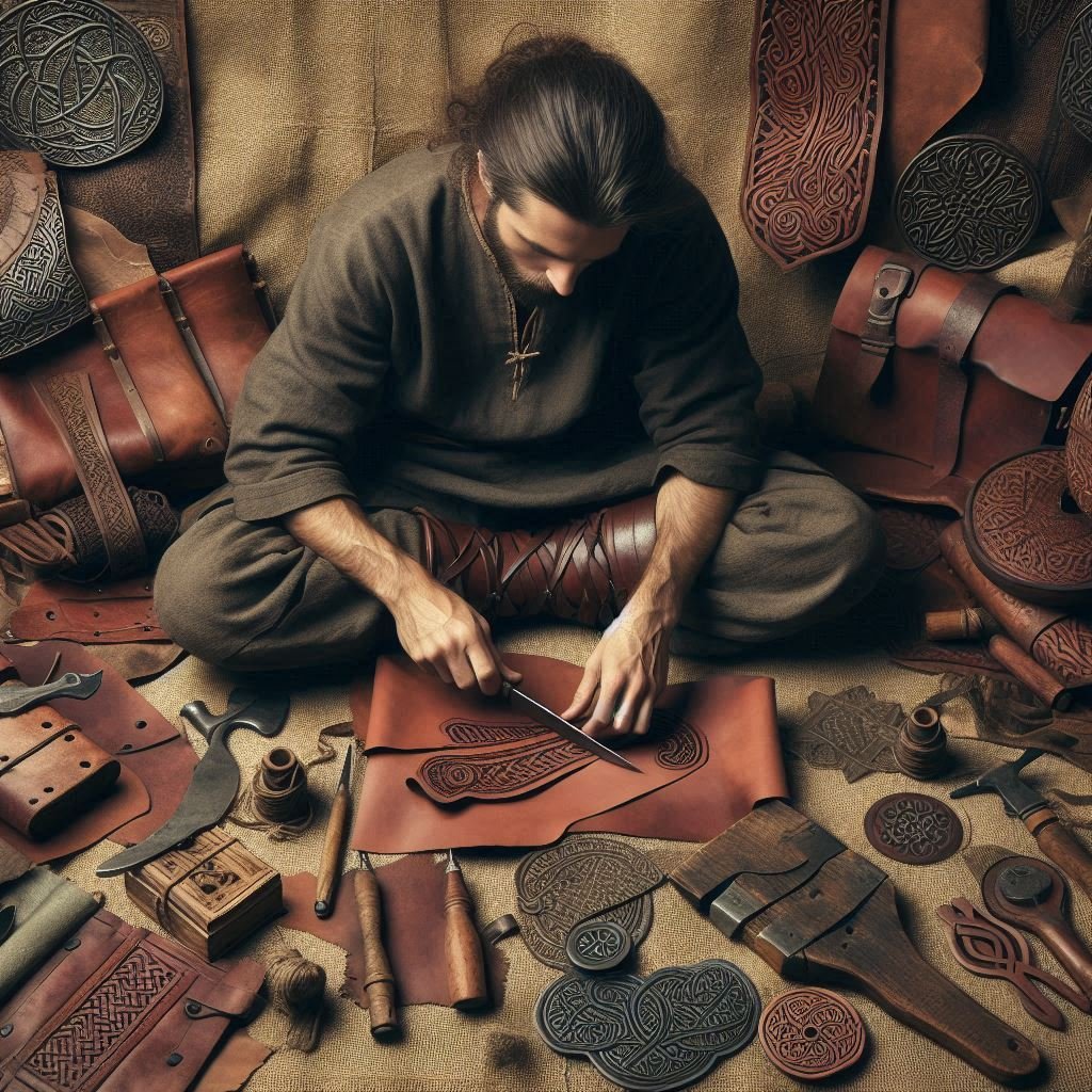
Knee-length linen tunics were worn by both sexes, as were long and often gaudy woollen cloaks. Strabo comments on their personal ostentation: “To the frankness and high-spiritedness of their temperament must be added the traits of childish boastfulness and love of decoration. They wear ornaments of gold, torques on their necks, and bracelets on their arms and wrists, while people of high rank wear dyed garments besprinkled with gold. It is this vanity which makes them unbearable in victory and so completely downcast in defeat.” Linen and woollen garments from the Celtic lands were popular with well-to-do Romans, as was Celtic leatherwork, including fashionable Gaulish boots. Archaeologists have recovered fragments of Celtic textiles which, as with their metalwork, show consistent levels of skill which can only have been maintained by a well-ordered system of craft apprenticeship. Such specialization is only possible in a society with regular surpluses of food; hence, it is no surprise to learn that the Celts were great farmers.
Many of their agricultural innovations remained the basis of the rural economies of the European peoples until the modern era. These included the system of leaving fields fallow every third year; the heavy, two-wheeled iron plow; the harrow; the hay-scythe; the breeding of strains of cattle for various roles, including draught purposes; the selective development of new types of grain; and the cultivation and use of a large number of herbs.
Some parts of France still noted today for the quality of their pork charcuterie first established their reputation by exporting their products to ancient Rome. At the Butser Hill research station in southern England experimental archaeologists have recreated an Iron Age farm. Using only the techniques and tools possessed by the Celts, they have found that their small fields of wheat yield similar quantities to those expected by English farmers in the 19th century.
Although this is only half the modern yield, analysis of the grain shows that it has twice the protein content of today’s heavily chemical-dependent crops. For many years, historians of the period were puzzled by evidence of a strange cart with a long row of wooden teeth along its front edge and drive shafts to allow a horse or ox to push it. The Butser Hill researchers built a replica and thereby proved it to be a “combine harvester,” giving the big estates of late Celtic times the ability to harvest far larger areas than would have been possible by hand. Once collected, the grain was stored in pits dug deep into the ground, lined with basketry and sealed with a lid of wet clay. This method has also been tested at the experimental farm and shown to work well even in unusually wet years.
These facts suggest that one of the reasons for the Roman conquest of Britain was to secure a large and reliable supply of grain to feed the legions and the growing population of parasites in Rome. But before the inexorable rise of Rome ripped the heart from the Celtic world, the Celts built upon this sound agricultural base a sophisticated and clearly European rural civilization. The Celts of Ireland, whose culture was never disrupted by Roman invasion and which continued to prosper for centuries, did not grow such quantities of grain.
The wet and mild climate of Ireland, while unsuitable for wheat, is ideal for rearing cattle, so the country’s economy was always based on them. Fines were based on the value of a cow, cattle-raiding was endemic–a cross between an aristocratic sport and tribal warfare–and seasonal cattle fairs combined with religious festivals to provide the focus for a totally rural way of life. This emphasis on cattle may well have preserved the lifestyle of the earlier continental Celts. The La Tene culture developed following a marked climatic deterioration and an accompanying increase in the importance of cattle.
The great Irish epic, The Cattle Raid of Cooley, although not put into writing until the twelfth century, uses language from four hundred years before and has some verses which appear to date back to the sixth century; and even the latter are based on a tradition which was already hundreds of years old when they were composed. Regarded as the oldest vernacular epic in Western literature, the story describes a society of boastful warrior-aristocrats: chariot fighting and feasting, head-hunting and cattle-raiding. It is an authentic picture of the Iron Age. Another story from the ancient literature of Ireland, Bricriu’s Feast, tells of the tragic outcome of rivalry, where each of the three heroes invited to a feast claims the best cut of pork: “the champion’s portion.”
Compare this with the account of Celtic life left us by the Roman Diodorus Siculus: “When they dine . . . they have hearths with big fires and cauldrons, and spits loaded with big joints of meat . . . and some of the company often fall into an altercation and challenge one another to single combat. They make nothing of death.” These stories, with their emphasis on personal honor, physical courage, and loyalty unto death, bear marked resemblances to ancient Greek epics, such as Homer’s Iliad. Both the Romans and the Greeks approved strongly of the typical Celtic maxim quoted by Diogenes: “To worship the Gods, to do nothing base, and to practice manhood.”
Closer to home, the original motifs discernable in the heavily Christianized Welsh Mabinogion reveal the fundamental unity of the Celts’ great tradition of oral literature, its close kinship with the original culture of all the early Aryans, and its similarity to the later sagas of the Germanic branch of the family. In Ireland these tales were preserved and declaimed by the filid, an ancient institution of highly trained storytellers and law-bearers, who enjoyed high rank and, through their ability to praise or satirize a ruler, substantial power. Their role and status were very similar to those of the vates described by Strabo as important among the Gauls, who were as a people so renowned for their eloquence that wealthy Romans sent their sons to be trained in rhetoric by Gaulish tutors. Even more demanding was the 20-year training undergone by the Druids, the mysterious priests and seers who, according to Caesar, “are concerned with the worship of the Gods, look after public and private sacrifice, and expound religious matters; a large number of young men flock to them for training and hold them in the highest honour.”
The Druids were also renowned for their knowledge of the stars and the motions of the planets. A bronze moveable calendar found at Coligny in France was used to predict eclipses as well as to note the passage of the months. Rather than days, they thought in terms of nights–our word “fortnight” being a distant echo of this. As with the Germanic peoples from whom we get the word for our main divisions of the year, the Celts reckoned by the phases of the moon, splitting their year into 28-day cycles. These in turn were grouped into four seasons, the start of each of which was marked by a religious festival intimately linked with the natural concerns of a farming people.
The Celtic New Year began on Samhain, at the beginning of November. This marked the gathering in of the cattle and the slaughter of livestock which could not be over-wintered. Imbolc fell on the first day of February and seems to have been connected with the lactation of ewes. Beltaine–the feast of the Good Fire–was the forerunner of the later May Day celebrations and marked the day when the spring sun allowed the herds to be let out onto the fresh pastures, having been driven through twin fires around which the young men and women danced sunwise. Lugnasadh, on the first day of August, was even more strongly a sun festival, being dedicated to the solar God Lugh.
Sympathetic magic was used during this festival to ensure the success of the ensuing harvest. A number of Gods seem to have been widely revered. Lugh’s name occurs in placenames from Lyon (ancient Lugdunum) to Carlisle (ancient Caer Luel); Cernunnos–“the Horned One”–is named on an altar in Paris and is widely represented elsewhere, including on the Gundestrop cauldron. The cult of the horse Goddess Epona seems to have been popular in Britain and may even account for the long-standing British taboo against eating horsemeat. There does not, however, appear to have been a single, well organized pantheon of Gods on the Greek or Roman model. It is likely that each tribe and various special locations such as springs and groves had their own local deity.
Dedications on altar stones have given us the names of more than 400 Celtic Gods, the vast majority of whom are only mentioned in one place. In addition to these local communal Gods, each family worshipped its own ancestors, gathering in prayer around the hearth which, as with the Romans, was the spiritual center of the home. Like all the true Indo-Europeans, the Celts did not consider the worship of any particular God to preclude veneration for another.
This acceptance that other folk could pray to different deities without being regarded as sinful non-believers is reflected in the ancient and widely accepted Irish oath: “I swear by the Gods my people swear by.” As well as leading the sacrifices and rituals at the great festivals, the Druids taught the doctrine of the immortality of the soul. This belief was no doubt a major reason for the Celts’ total lack of fear of death. So strong was their faith in the afterlife that they would make loans in this life with agreement to repay them in the next.
Caesar also noted that the Druids were recruited only from the aristocracy and that they delivered legal judgments in everything from murder cases to boundary disputes. In this judicial role, there was an overlap between the functions and rights of the Druids and of the brithem, experts on the traditional brehon law of Ireland recruited from the ranks of the filid poetic order. This latter fact, together with Caesar’s accounts of Druidic human sacrifice and statement that the cult originated in Britain, suggests that the Druidic order was not entirely of Celtic origin, but had its roots among the older Atlanto-Mediterranean population. Having said that, the Italic tribes and early Romans had a similar institution, as did the early Aryan conquerors of Iran and the northern part of the Indian subcontinent. It is also necessary to remember that Caesar’s account was sensationalist propaganda aimed at boosting his own prestige by, among other things, painting an ugly picture of his enemies.
The real reason for his determination to exterminate the Druids was probably their key role in stirring up rebellions, both in Britain and in Gaul. The fundamental religion of all these peoples was based on the sun worship which was universal among their common ancestors, and the Celts were no exception. The sunwheel and three and four armed swastikas are common Celtic solar symbols. The life-giving force of the sun is, of course, more important to a people living in a land of harsh winters than to those who dwell in warmer climes, hence it is quite possible that this religion, like the fair complexions of its devotees, arose thousands of years earlier among their ancient ancestors, who had for generations survived the rigors of life on the edge of the European ice sheets.
By the time the Aryans began to spread out from their original homeland, their religion, like their language, was already fully developed, with the result that, in the words of distinguished British archaeologist Professor T.G.E. Powell: “There are many vestiges in myth, cult, and sacred terminology, springing from a common Indo-European tradition which the Celts shared in particular with the Aryan ancestors of the Hindus and with the Italic forerunners of the Romans.” The same was true of many Celtic laws and institutions of government.
The Irish brehon laws dealt with all aspects of social organization, including marriage, distraint, sick-maintenance, and the relationships between the different strata of society. These were ancient when finally put into writing by Christian monks at the end of the sixth century. Preserved orally until then in verse form, the language was already archaic and many points obscure. According to the Irish expert, Professor Binchy, “Irish law preserves in a semi-fossilized condition many primitive Indo-European institutions of which only faint traces survive in other legal systems derived from the same source.” Many historians have noted the marked similarities between the Celtic laws and social structure found in Ireland and the fossilized Aryan system preserved in the Vedic laws of India.
The duties and privileges of the now hereditary Brahmin caste certainly reflect those of the Druids, as well as those of the Magi of Iran. According to the French expert on the Celts, the late Professor Henri Hubert, “the priesthoods are not merely very similar, but exactly the same,” and this “proves that Druidism was an Indo-European institution,” albeit a pre-Celtic one inherited from the Aryan farmers who had settled in Britain and Gaul long before the great period of Celtic expansion.
Many aspects of the institution of kingship are clearly related; even the vocabulary involved is fundamentally the same. Binchy comments that in the brehon laws “we also find the unreal schematism and passion for classification which meet us in the Hindu law books.” Nora Chadwick, late professor of Anglo-Saxon at Cambridge and internationally renowned authority on the origins and customs of the Celtic peoples, in her book The Celts (1970) notes that the customs connected with the symbolic “marriage” between the king and the land have affinities with traditions traceable to ancient India, and that such similarities show the “close relationships” between the two far-flung groups of Indo-Europeans.
Quite apart from the links with northern India, she also points out that “the society of Homeric Greece offers parallels, and in Italy the Italic-speaking peoples possessed perhaps the closest links with the Celts until the supervention of Etruscan and, then, urban Roman institutions.” A specific example given by Hubert is that both the Indo-Aryans and the Irish Celts used ritual fasting by an aggrieved party to gain redress. The laws, institutions, and languages in each of these later Aryan culture are so alike that they can only spring from an ancestral system which was already fully established before the Aryans began the wanderings which made them the masters of so many lands.
This fact can be reconciled with Professor Colin Renfrew’s convincing theory about the link between the initial expansion of the Indo-Europeans and the spread of subsistence agriculture if we think in terms of the first wave of Aryan farmers spreading by slow colonization over many generations, as he maintains, and then the subsequent development in one part of their range of some improvement in military technology which gave its possessors the opportunity to spread, in a far shorter time, as an aristocracy ruling over their more and more distant relations.
Thus, the Battle Axe people may have been the first such example of a later Aryan elite, rather than the initial carriers of the Indo-European language and racial type. The men of the same race who first made the more deadly long bronze sword took advantage of a similar superiority, and the Celts who replaced it with weapons of much stronger iron became in their turn the masters wherever they spread. Because their new technology also enabled them to increase greatly their food production, the Celts would have been able, in the thickly forested parts of western Europe at least, to swamp the earlier Indo-European and aboriginal inhabitants by mass migration rather than by a genetically much less effective change in the ruling elite alone. In food-rich coastal areas, and particularly in the warmer southern and southeastern parts of the Indo-European lands, where the environment could support relatively large numbers of primitive hunter-gatherers, the initial settlers were probably thoroughly mixed with the aborigines by the time of the Battle Axe expansion.
While the Aryan warriors who destroyed the agrarian cities of northern India around 1500 B.C.E. had nothing but contempt for the “dark ones” (as they refer to the aboriginals in the Vedic literature), it is thus quite possible that the creation of the despised inhabitants’ relatively advanced but stagnant civilization had been the work of a tiny but vigorous Indo-European minority which already had vanished. Indeed, that is the case in the Indian subcontinent today, with the now-vanished British conquerors and culture-bearers of the 18th century in a similar role to that of their ancient Aryan forebears.
Certainly the Aryans–the “Shining Ones,” a name they used both in the figurative sense of “noble” and literally, on account of their blondeness–were well aware of the genetic danger of race-mixing. The Hindu caste system originated with their ultimately unsuccessful attempt to reinforce racial segregation by incorporating it into their religion. A great deal of information as to what the Celts made of their Aryan inheritance may be gathered from the well-preserved literature of Ireland, at the other end of the Indo-European range. This shows us a very hierarchical system of up to a hundred petty kingdoms, each occupied by a tuath–meaning “tribe” or “people”–and led by its ri.
Each of these minor kings was bound by oath to his ri ruirech, the “over king” of one of the five wider provincial kingdoms, who in turn owed allegiance to the High King seated at Tara. Society below the king was divided into three sections: the aes dana–the intelligentsia–made up of Druids, bards, jurists, and skilled craftsmen; a warrior aristocracy of land owners; and the class of freemen, commoners, and minor craftsmen. This arrangement is very similar to that recorded by Caesar in Gaul: druides, equites (“knights”), and plebs. At the bottom of the ladder in both Ireland and Gaul came slaves and kinless outlaws. In parts of Celtdom with a large pre-Celtic population the lower levels of society were initially composed entirely of these subjugated inferiors, but over the generations the lines were blurred. Even when this process was long advanced, however, the bards generally upheld the ancient convention that high rank in men and beauty in women went hand-in-hand with blonde hair, blue-eyes, and fair skin. The rights and obligations of each class were clearly defined by custom.
Here was a homogeneous and stable hierarchy which needed no “police” to maintain social order; tradition and the threat of banishment from the communal religious rituals were quite sufficient. The parties in any dispute were bound to accept the ruling of the brithem jurists. Prisons were unknown; the basis of punishment and restitution for serious crimes such as murder being the payment of a fixed “honour price,” which varied according to the rank of the injured party.
Payment of this sum wiped out the guilt of the crime and its injury to the honour of the victim and his family, thereby avoiding the perpetual warfare which inevitably results from blood feuds in less disciplined tribal societies. Various Germanic peoples, including the Saxons, used the same system: Wergeld, literally “man gold.” Unlike the later Saxons, however, among the Irish such payments were not made solely by the guilty party alone, but by his entire extended family, his fine.
This kin group spanned four generations, and its members were jointly liable for the actions of any person within those four generations. This obligation was matched by a right to a share in the inheritance of the elders of the fine when they died. Naturally, this institution created powerful bonds of mutual responsibility and support which helped to impose a complex pattern of laws with a relative scarcity of legal machinery. In the words of Professor Powell, “the maintenance of customary law was not due to the power of any central authority, but it in fact rested on its own venerability, ritual potency, and popular acceptability.” Although the heroic poetry of the Celts emphasizes the importance of the actions of great men and exceptional women, their society was geared towards the Preservation of the entire folk community, rather than the “rights” of any individual.
All ranks were restricted by their status as to what they could and could not do. A king who failed in battle was expected to commit suicide or to give himself up to the enemy as a sacrifice to save his people. Many of the Irish tales feature kings or heroes dying violent deaths, often by fire or drowning, on feast days. Such stories are almost certainly based on memories of the ritual sacrifice of aging or ailing kings in order to restore agrarian fertility by making way for a new and virile young consort for the Goddess of the tribal land. If there was any facet of sky-based and patriarchal Celtic religion strongly influenced by the earth-based and matriarchal faith of the earlier, Atlanto-Mediterranean agriculturalists, it was this. Perhaps an even deeper gulf between the organic society of the Celts and today’s atomized and alienated individualism is the fact that people only enjoyed whatever rights they were entitled to within their own community. An individual who had, for one reason or another, lost or been cast out by his kin group had no rights at all.
An identical state of affairs existed in Wales until early medieval times, where the kinless alltud was regarded as a cross between outlaw and slave. The Welsh kindred–the cenedl–also spanned four generations. Even today, the Celtic-speaking populations in the western fringes of the British Isles are well known for the importance they place on their family trees and on knowing who is related to whom. Its kinship laws gave the Celtic world great stability.
Likewise, an overall cultural unity was maintained over great distances by the fact that the aes dana were excepted from the requirement to remain in their tribal territory. The bards and jurists in particular wandered where they wished or where events demanded. Traders and skilled craftsmen also seem to have been unrestricted. For whatever reason a Celt became a traveller, he would have found a communications system which was at least as good as that of medieval Europe. Not only does the widespread use of heavy goods carts and fast, light personal chariots imply a well-kept road system, but the Irish laws actually tell us how it was maintained.
The obligations of each community for the upkeep of the roads running through its area are clearly set out, as are the arrangements for ferry services at major river crossings. Nor did the sea present any obstacles. Caesar’s account of the wars in Gaul includes comments on the immense navy of the Veneti, a maritime tribe in southern Britanny occupying the area around the modern port of Vannes. In 56 B.C.E. this people and their allies from the rest of the Armorican coast and Britain opposed the Romans with a fleet of 220 massive ships. Their oak planks were “fastened by iron nails as thick as a man’s thumb” and their sails were made of thin leather. Unfortunately for the Celts, a sudden shift in the wind left their heavy vessels at the mercy of the lighter Roman ships, and the defeated crews drowned themselves rather than surrender. Nevertheless, the ability to muster such a fleet of ocean-going vessels with experienced crews gives an indication of the seafaring skills of the Gauls.
Throughout much of the Celtic era, the trade facilitated by this communications network was based on barter, with wealth itself being reckoned in cattle. Long, sword-sized ingots of raw iron seem to have been used as a form of currency, however, and in view of the importance of salt in the preservation of winter food supplies it is likely that the Celts also used it as a medium of exchange, just as Roman legionaries were later to receive salt as part of their wages (the salarium: hence, “salary”), which was used to pay for goods and services supplied by occupied peoples. The use of coins reached Gaul in the late third century B.C.E., with the style of the early currency inspired by the gold staters of Macedon and the silver coins of the western colonial Greeks. At about the same time the Gauls began to move away from their traditional scattered and undefended rural settlement pattern.
After four hundred years of peace, they now established walled towns on strategic hilltops, known to the Romans as Oppida. It is unclear to what extent this was a response to the growing threat of invasion, first by Germanic-Celtic tribes from across the Rhine and later by Roman legions, and how much urbanization was due to increased trade and the fashionable example of Rome. Certainly the oppida developed far beyond the original use of hilltop enclosures for occasional festivals. The hill fort of Bibracte, the site of which was near Autun in modern France, encompassed 335 acres, dwarfing the Homeric settlement at Troy, which covered a mere five acres.
Such evidence of large local populations, together with classical material such as the estimate of the first-century B.C.E. Greek historian Poseidonius that the largest of Gaul’s three hundred or so tribes could raise 200,000 men and the smallest 50,000, leads Hubert to conclude that the population on the eve of Caesar’s conquest was in excess of 30 million: at least as big as that of France under Louis XIV. The many tribes making up this vast population were linked together in sixteen separate, large groups, which the Romans termed civitates or nationes.
Each of these possessed its own name and capital Oppidum. Hubert points out that the names of many of these are perpetuated in France to this day–Paris was the capital of the Parisii, Trier the tribal center of the Treveri, and so on–and goes so far as to claim that the political divisions of modern France are based essentially on the Gaulish structure taken over by the Romans.
Each of the nationes had its own king, although by Caesar’s time the king’s influence was giving way to that of the vergobret, or chief magistrate, further evidence that the Celtic world was increasingly coming under the influence of bureaucratic Rome.
Each kingdom was in turn divided into pagi, to use the Roman term; to the Romans a pagus was a village, but as applied to the Gauls it meant a rural district or province. The major divisions of each Gaulish army were the pagi.
In 221 B.C.E. the mixed Iberian and Celtiberian tribes of Spain were attacked and quickly defeated by Hannibal, the great general of Rome’s deadly rival on the North African coast, Carthage. Hannibal was joined by a few Celtic allies as he marched on through the mainly Ligurian south of Gaul, but most of the Celts stood aloof as the fortunes of Hannibal’s war with Rome lurched from one side to the other. Finally, with disastrous timing, large numbers of Celts threw their lot in with the Carthaginians when the latter were already effectively defeated. As a result the Celts of southern, and particularly Cisalpine, Gaul were broken with heavy losses.
Although the Gaulish colony in northern Italy was not formally annexed as a province until 82 B.C.E., the failure of the adventure with Hannibal pushed the Celtic boundary in the Italian peninsula northward to the Alps by 178 B.C.E. The Roman armies which had entered Spain to stop Hannibal did not leave when he was defeated. From 197 B.C.E. until 133 B.C.E. the campaign to subdue the Celtiberians went on with only short breaks. As we have already noted, the native resistance seems to have been led by a Celtic aristocracy, but in spite of their resistance and continual rebellions, the whole of Spain was effectively under Roman rule by 154 B.C.E.
Since the Celts of Spain had already been more or less absorbed by the Mediterranean majority, this Roman success had no immediate effect on the true Celts further north. But the conquest of Spain and the destruction of Carthage greatly increased both the manpower and resources of the growing Roman Empire. The days when the Gauls could count on their freedom without fighting for it were numbered. A more immediate threat to the Celtic heartland, however, was the increasing pressure from land-hungry German tribes pushing over the Rhine.
In 71 B.C.E. the Celtic Sequani of Gaul invited the Germanic Suevi to join in an attack on their Celtic neighbors, the Aedui in the Rhone valley. The Aedui were themselves divided by a power struggle between their former king Divitiacus and his brother and popular successor, Dumnorix. Divitiacus, in his position as vergobret, appealed to the Romans for help against the Germans. Imperial ambitions, the wealth of Gaul, and the memory of the threat posed by the Celts in the past had already persuaded the Romans to attempt to conquer the Gauls north of the Alps, so this was the opportunity for which Caesar had been waiting. His legions defeated the Germans, and then with the help of his Aedui allies he turned on the Belgae and the other independent tribes.
Having fought his way to the Channel coast, Caesar undertook two brief expeditions, in 55 and 54 B.C.E., against the southern Britons who were sending reinforcements to their continental cousins. The conquest of Gaul was a triumph for Rome and an object lesson in the power of organization: a relatively tiny but well-trained and well-equipped force overcame far greater numbers which were lacking in unity and discipline. Breaking the power of one Gaulish tribe after another, a total of just 60,000 legionnaires led by a brilliant commander conquered a martial people numbering millions. Not until the British conquest of India in the 18th century were so many again subdued by so few.
Caesar’s campaign lasted eight years, but only in the last few did the Celts make a determined effort to resist on a “nationwide” basis. By the end of 54 B.C.E. Gaul was in ruins, with more than three million of her best warriors dead or enslaved and 800 hill forts and villages razed to the ground. In the wake of the legions came the slavers, hurrying to make a quick profit. This trade already was dominated by Levantine immigrants, notably Jews and Syrians.
No doubt these racial aliens, then as now, found the blondest girls the most desirable and the most profitable. As the flower of Gaul’s youth were driven in chains to the slave markets of Rome, Ambiorix, king of the Eburones, led an attack on a Roman fortress on the middle Moselle. The uprising spread like wildfire throughout the most purely Celtic north and center of the country.
The desperate Celts adopted scorched earth tactics to deny the invaders food, and for two years the struggle hung in the balance. No quarter was given on either side: after seizing the rebel town of Avaricum, Caesar ordered that every one of its 40,000 inhabitants be put to the sword. The hideous torture of Celtic prisoners was routine. The struggle for freedom had become a fight for survival. In mountainous central France lived the Arverni, a people whose name is still preserved in that used for the region, the Auvergne. Their king was the charismatic Vercingetorix, a Celtic name meaning “warrior king.” He soon showed himself worthy of his name.
Joining the uprising, Vercingetorix inflicted several heavy defeats on the Romans, rousing the hopes of many who had thought that all was lost. Tribe after tribe flocked to his banner, and it began to look as if Caesar might be driven back across the Alps. Although the Celts were fearless warriors, they were too impetuous and individualistic to accept the discipline which was needed to defeat the Romans. Chances of a crushing victory were thrown away until, in the summer of 52 B.C.E., Caesar trapped Vercingetorix and 80,000 followers in the fortified town of Alesia, on the Seine well upstream from modern Paris. Preparing for a long siege, Caesar ordered his own men to construct an outer ring of defences of their own to hold off any attempt by the Gauls to relieve their heroic leader.
By the time the expected reinforcements arrived, the Roman fortifications were complete. The huge army of a quarter of a million men, drawn from 41 tribes, made repeated but futile attempts to break through, and the Celts encircled in the ring of Roman steel slowly starved. Finally, in the cool dawn of a late September day, in a valiant attempt to save his men from certain death, Vercingetorix rode out and surrendered himself to Caesar. The defeated hero was sent to Rome in chains. Without its inspiring leader the rebel confederation quickly crumbled, and the remaining pockets of resistance were easily mopped up. Caesar took ferocious revenge for the shock of his near defeat. After taking the town of Uxellodunum, for example, he had the hands of every prisoner chopped off.
Thus the once mighty tribes of Gaul were utterly conquered by a Rome which, although many of her military leaders, soldiers, and men of letters were still of Nordic stock, was already irreversibly mongrelized. The end of the Celts as a world force was symbolized during Caesar’s triumphal procession through Rome in 46 B.C.E., when Vercingetorix was dragged from his dungeon to be strangled and beheaded in the Forum for the entertainment of the braying, half-caste mob. Back in Gaul the following years saw a number of scattered uprisings, but the surviving Celtic aristocrats quickly found that there were distinct personal advantages for them in cooperating with the new regime. Under the old laws of their people, kings had ruled their tribal land, but did not own it.
Their power and prestige were tempered by customary duties, and under no circumstances could a king sell or otherwise alienate a single square foot of his tribe’s patrimony. Under the new regime, on the other hand, while huge tracts of land were given to Roman speculators and army veterans, large parts of what was left now became the personal possessions of the local king and his direct descendants.
This led to a rapid breakup of the old social order and the speedy creation of a heavily Romanized native upper class whose interests coincided with those of their conquerors rather than with those of their own folk. Deprived of their true leadership, the last desperate rebellions were ineffective peasants’ revolts. Large numbers of Gaulish refugees sought a safe haven across the sea in Britain. Once again, however, the wealth and prestige of Rome weakened the resolve of a number of local British kings. Some, such as the Cantii–whose name is preserved in the English county of Kent between London and the Channel–were already effectively puppets by the time Claudius launched a renewed Roman assault on the island in 43 C.E.
The heroic leader of the British resistance, Caratacus, defeated in the south of the country, headed north to gain fresh support, but was treacherously handed over to the Romans by Cartimandua, Queen of the Brigantes. Like Vercingetorix, the prisoner was taken in chains to Rome, but the shameful memory of the Romans’ ancient defeats by the Celts was now in the distant past, and Caratacus justified his defiance so eloquently that he and his family were freed.
The ruthless dispossession of the British Celts continued apace, however. Once again, the squabbling tribes realized their mortal danger too late. In 61 C.E. Suetonius destroyed the last Druid stronghold on the island of Mona, known in English as Anglesey, but still to the Welsh as Mon, then turned south to deal with the Iceni and their allies.
Their rebellion was sparked by the expropriation of Queen Boudicca’s lands and the rape and flogging of her daughters. It spread throughout the southeast, with the total destruction of the three main Roman cities, Camulodunum (Colchester), Verulamium (Saint Albans), and the important new trading centre of Londinium. Both the revolt and its suppression were particularly brutal affairs, with the few surviving rebels being enslaved and worked to death draining the low-lying, disease-ridden fen country north of Cantabrigensis (modern Cambridge).
The lowland parts of mainland Britain were rapidly Romanized and remained so for nearly 400 years. Caledonia, the bulk of modern Scotland, however, was fiercely defended and too poor to be worth the effort of subduing. This northern border of the Roman Empire fluctuated several times, but was finally stabilized along the line of the great wall and chain of forts and watchtowers built by the Emperor Hadrian from Carlisle to the North Sea estuary of the Tyne.
The Welsh mountains too were not worth completely pacifying, although a network of military roads and forts ensured that the natives didn’t interfere with the lead or gold mines. Only Celtic Ireland remained completely independent, though during Agricola’s campaign in southern Scotland the great general kept a disaffected Irish chieftain by his side as a potential ally and calculated that the island could be subdued with a single legion.
Fortunately for our posterity, Agricola had more pressing business elsewhere, and Ireland, once a conservative backwater of the Celtic world, now became its sole survivor. We have already seen how this happy accident bequeathed us a large body of what is essentially Iron Age literature. Much of this deals with the doings and deaths of kings, thereby reflecting the interests of the poets’ aristocratic patrons. But the fragments of archaic poetry and prose also show a great appreciation of natural beauty. For example, the song of the hermit Marbon to his brother, the king of Connaught, tells of the joys of his lonely life in the forest:
The voice of the wind against the branchy wood
Upon the deep-blue sky:
Falls of the river, the note of the swan,
Delicious MUSIC.
The significance of such snippets is explained well by Kuno Meyer in his Introduction to the Ancient Irish Poetry: “In Nature poetry the Gaelic muse must vie with that of any other nation. Indeed, these poems occupy a unique position in the literature of the world. To seek out and watch and love Nature, in its tiniest phenomena as in its grandest, was given to no people so early and so fully as the Celt.” Here, surely, is the source of the impulse which, for all our industry and technology, also puts Western man at the forefront of efforts to conserve nature for its own sake all over the world.
As with Celtic literature, so the La Tene artistic style, which ceased almost overnight when the Roman conquest destroyed the patronage of the aristocracy, continued to develop in Ireland. Harnessed by a native church with strongly Celtic undertones, the La Tene style enjoyed a long final flowering until the Viking invasions. The fantastic imagery of sinuous plant tendrils merging into strange animals and the heads of birds and dragons graced not only the tall, stone crosses which still dot the countryside, but also the pages of many handwritten religious works, such as the Book of Durrow.
The famous Book of Kells dates from between 760 and 820 C.E., and in its richly illuminated pages it is possible to find superb examples of virtually every motif and piece of artwork ever produced in the entire Celtic world. Irish silversmiths raised Celtic art to its most dazzling peaks. The master craftsman who made the eighth-century Ardagh Chalice used typical La Tene enamelling and abstract swirls, but made them more dramatic than ever by abandoning the old practice of covering every scrap of surface with intricate detail. His own superb designs stand out from the areas of plain, pure silver which he dared to leave unadorned.
This is not a well-made trinket from a rude rural backwater; this is one of the most beautiful man-made objects ever contrived on planet Earth. Long before this last artistic flowering, the final collapse of Rome early in the fifth century C.E. left the former Celtic provinces to fend for themselves and, perhaps, to take back control of their own destinies. The softened, urbanized inhabitants of Gaul proved totally incapable of doing either. In spite of a general drop in population as a result of the various problems created by the Roman “system collapse,” the population of the country must still have numbered millions.
Even so, they offered no effective resistance to the waves of marauding German tribes who swept through the crumbling defences along the Rhine, alternately requesting or seizing land, or simply looting and demanding protection money from the cowering citizens of the wealthy towns and cities. The Britons seem to have put up a stiffer fight, perhaps because their province was already strongly militarized as a result of fending off hit-and-run raids and land-grabs, not just from Germanic pirates on the south and east coasts, but from the untamed Picts from beyond Hadrian’s Wall, and from the incursions of the Irish, who, just to confuse the issue, were in those days known as Scots. But in spite of some victories and a general revival in about 500 C.E., which may be the root of the legend of King Arthur, the lowland Britons were steadily overwhelmed by the Germanic invaders of their island.
The earliest surviving British poem, the Gododdin, relates how a handpicked army of heroes marched in about 600 C.E. to glory and death at Catraeth (modern Catterick in northeast England) in a vain attempt to win back their lost lands. The warriors rose, they mustered together. All of the one intent, they charged. Short their lives. Long their kin miss them.
Seven times their own number of English they slew. In that contention, they made women widows. On the lash of many a mother are tears. The surviving fragments of the ninth-century saga dealing with the life three centuries earlier of Llwyarch the Old give a vivid picture of the Celtic collapse.
The verses tell how his last son falls defending a ford against the English; how Heledd, sister of the dead Cynddylan, laments in the cold ruins of his great hall, and how the sea-eagles feast on the bodies of her slain kinsmen near modern Shrewsbury, in the border lands between England and Wales:
Eagle of Eli, loud it cried tonight, It swam in men’s blood.
There in the trees! And I’ve misery on me.
Grey-capped eagle of Pengwern, tonight Is its claw aloft, Greedy for the flesh I loved.
Celtic society was also badly weakened by the emigration of large numbers of aristocrats and the intelligentsia to the part of northern Spain still known as Galicia and particularly to the northwest of France, which was thenceforth called “Little Britain”: Brittany. There is also some evidence that the rough and uneducated Anglo-Saxons had a higher birthrate to add to the effect of continual reinforcement by new boatloads of adventurers, land-hungry farmers, or refugees from other tribal migrations in continental Europe. Perhaps to the ordinary Romano-Briton in the street, the final destruction of what remained of his culture and ethnic identity was not so different from the experience of today’s outbred builders of the great cities of America, Canada, Britain, and the other formerly Celtic lands of Western Europe, as they join the “White flight” to the suburbs or even to new lands in the vain hope of escaping the deluge of today’s far more alien barbarians.
This process of “Celtic flight” continued on and off for centuries. The English conquest of Ireland led to Irish soldiers by the thousand taking service in European armies. A little later the Presbyterian Scots-Irish sought to escape Anglican religious persecution by joining the early settlers in America, where they played a leading role in the War of Independence. In the next century the Catholic Irish followed in their millions, while smaller numbers formed the rough-and-ready backbone of White Australia.
At the same time, some thousands of Welsh nationalists decided to take even more drastic steps to escape the domination of the old Saxon enemy and established colonies in Spanish South America, particularly Patagonia. Their short-lived independence was quickly ended, and their assimilation is now effectively complete. More than a century later, however, at the time of the Falklands War, some of the Argentinian conscripts facing British regiments which included the Welsh Guards were themselves Welsh speakers. This neatly symbolizes the way in which the Celtic peoples, having lost their own cultural identity through their failure to develop effective large-scale political unity, now only appear in world history in events directed by others.
During the American Civil War, Northern recruiting agents toured Ireland, offering the oppressed peasantry the chance both of a new life and a chance to hit back at the “Saxons” by helping to defeat the predominantly English stock of the Confederacy. Having said which, several military historians have seen in the heroic charges and wild yell of the Rebels the last gasp of the furious rush to battle with which the ancient Celts routed even the armies of Rome. Other commentators, however, reserve that honor for the Protestant Ulster division, which was the only section of the British army to get beyond all of its objectives in the first day of the Battle of the Somme in 1916, at a cost of more than 6,000 casualties in a few hours. Their southern Irish counterparts, also all volunteers, were the only other British division to achieve all its objectives in that same terrible slaughter.
The English generals, who for centuries reserved their Scottish, Irish, and Welsh regiments for the most desperate and bloody moments of decision, seem to have seen in them some reckless fire not to be found in the ranks of their equally brave, more dogged, but less wild English troops. Whatever the collapse of their world felt like at the time, the might of the Celts has gone forever. We have seen how, in the remote and rocky fastnesses where Europe meets the Atlantic, their language and culture have clung on for centuries, ironically among peoples who were far less Celtic racially than the larger populations which have vanished without linguistic or cultural trace in modern Germany, France, the Low Countries, and England.
Several of the Celtic languages are at present enjoying a limited revival as part of a natural local reaction to the alienated consumerism of modern Europe. But the numbers involved can never be anything other than totally insignificant in geopolitical terms. The survival of even the memory of the Celts therefore depends completely on the survival of the White race as a whole. In particular, such hope as there is for the future rests with the peoples of the English- and German-speaking world. Although they have often shared their Celtic cousins’ tendency to division and fratricide, these nations at least have the numerical, technological, and military potential to regain the position of world dominance which they have lost so recently through subversion, stupidity, and treason.
They are all descended from the “barbarians” who reinvigorated Aryan Europe after the dark, multi-racial centuries of decadent Rome. Whether or not they can survive the 21st century is not yet clear, but ever since the fifth century, when they cleansed the mess that Rome had made of the Celtic lands, the western vanguard of the White race has been manned by the various branches of the great people known as Germans.