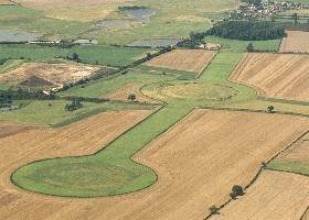
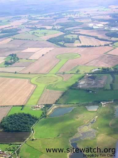
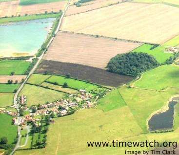
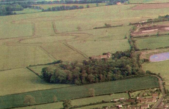
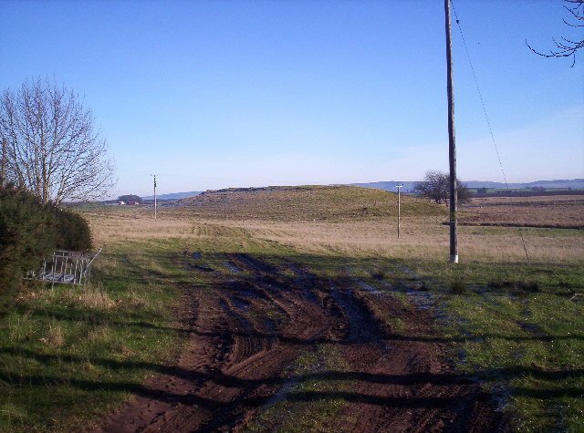
Thornborough Henges, North Yorkshire

Thornborough Ancient Monument Complex – North Yorkshire

Page Under Development – come back for more info!

A site that spans several thousands of years from the Stone Age to at least the Iron Age, the ancient people of the area built one of Britain’s largest ancient sites in Yorkshire, in what was to become the heart of Brigantia.

Location Details.

Thornborough TimeLine

Mesolithic – c. 8,000 to 4,000BC

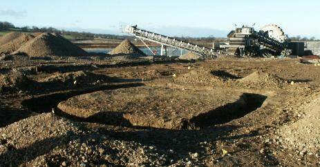
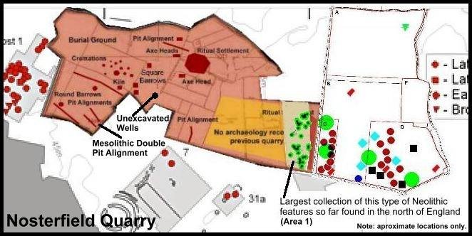
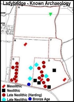
The Mesolithic period was the end of the Stone Age “hunter gather” times, before the widespread development of agriculture. During this time Thornborough appears to have been one of Britain’s earliest “ritual” locations. To the north of the village of Nosterfield, on the quarry in 2002/3 there was discovered an extensive double pit alignment that has been proven by carbon dating to be of Mesolithic date.

This is a very important discovery, since there are no known double pit alignments from this period anywhere else in the world and shows is potentially Britain’s first communal religious structure.

Mid-Neolithic Age – 4,000BC to 3,500 BC

In the Mid Neolithic period, accross Britain farming practices were beginning to be established and the old hunter gatherer ways were giving way to a more settled existence. In addition the first communal ritual monuments were being built.

At Thornborough, the ritual activities begun in the Mesolithic were dramatically expanded as large areas of land were cleared in order to make way for long cigar shaped cursus enclosures. These were built by digging a ditch to define the cigar shaped space, the earth from the ditch was then heaped outside the ditch to create an enclosing earth bank.

Whilst only one cursus has been confirmed, it would appear that Thornborough had three cursuses, two close to the Henges and another to the west at Upsland.

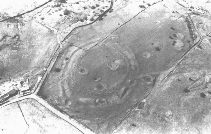
The largest cursus at Thornborough runs beneath the central Henge and stretches for 1.2 km. This ceremonial avenue, was discovered from the air. It appears to be bent, travelling in two directions roughly NE/SW. The western section, now mostly quarried out has recently been announced as being aligned to the setting point of the constellation Orion. This is another important part of the Thornborough Complex for it means this cursus may be the oldest known major monument aligned to the constellation Orion in the world.

Late Neolithic Age – c. 3,500 BC to 2,400BC

It was during this period that Thornborough saw a massive expansion of ritual activities, on a scale that indicates manpower was being drawn from far beyond to local area. Whilst it is probably that the construction work lasted for most of the Late Neolithic period and had many stages, it can be divided into two phases.

Phase I – the first henges.

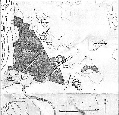
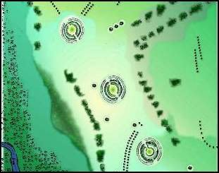
Of these, the central one is the most accessible, the northern one is the best preserved (because it is protected from the plough by trees). Each circle, like those east of Ripon, has a maximum diameter of about 800 ft. They are all nearly circular, with entrances NW and SE. Each has a massive bank, originally about 10ft high, with a ditch inside and outside it, about 65ft. wide and 8 – 10ft deep. The outer ditch of each circle is now filled up by the ploughing. Broad spaces about 40ft wide separate the banks from their ditches – an architectural refinement nowhere else in England. On such a scale. These circles have been built in a straight line orientated NW/SE they are ½ mile apart.

Phase II – The creation of the henges we see today

Excavation in 1952 suggested that when first built each bank had been coated with a deposit of gypsum crystals in an attempt to whiten it. This may have been inspired by the blazing white if similar circles built in the chalk country of Wessex or the Wolds. The gypsum occurs in large deposits a few miles down the Ure.

Bronze Age

Iron Age Square Barrow uncovered close to a four horse burial from the same period, part of the ritual activities at Thornborough taking place in later times.

Iron Age

Roman and later

The Vale of Mowbray “super” monument complex

Whilst the Thornborough Complex is impressive enough, it is actually only one part of a much larger monument complex. In the Vale of Mowbray, from Borroughbridge to Catterick, Eight enormous sacred sites were built in an area over 20 miles long; among them at least 28 Barrows were accumulated, together with seven henges, five cursuses and a very impressive alignment of standing stones. The most impressive henge monuments are the 3 Thornborough Circles.

The circles on Hutton Moor and at Cana are less impressive because they have been reduced by ploughing. They should be seen nevertheless, since they are part of a concentration of sacred sites unmatched in the N of England. Recently aerial photographs have revealed the remains of a third circle here, at Nunwick, still visible on the ground about SE/323747. This appears to be a smaller circle with no outer ditch, aligned on the 3 Thornborough Circles. Its diameter is 300ft. These sites must be contemporary with the Thornborough Circles. They are identical in design but their entrances are orientated N/S.

Many barrows can be found close to the circles – the resting places of those chiefs whose people worshipped there. Most are now sadly reduced by ploughing and their surrounding ditches cannot be seen. The Centre Hill barrow (SE/287791), between the central and southern Thornborough Circles is 90ft in diameter and 3ft high. A skeleton was found at its centre, buried in a wooden coffin and furnished with a food vessel and flint knife. There are 3 barrows close together (SE/286801) E of the northern Thornborough circle, S of B6267. One is 80ft in diameter and 31/2ft high, the others are 60ft across and 1ft high. They covered cremation burials. There are 3 badly damaged mounds NW of Hutton Grange (on A61), about SE/347755. These covered cremations, associated with incense cups and larger pots.

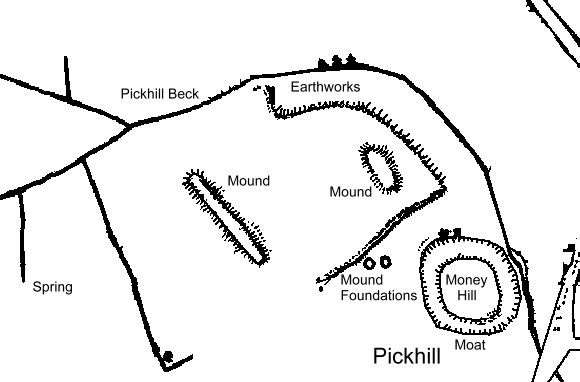
Pickhill Mound, North Yorkshire

Pickhill, North Yorkshire.


The hill is called Picts Hill. The village – Pickhill takes its name from this hill. Pickhill is in the Domesday book.

On the 1st edition OS, there is a long mound and a short mound marked in the field next door, as well as some “mound foundations” and an Earthwork. None of these are easily spotted today.

“A large artificial mound here, apparently raised for defensive purposes, bears the name of Picts’ Hill, and an improbable belief prevails that the Picts defeated the Romans in battle at a spot, not far off, called Roman Castle. This mound is also known as Money Hill, but, though partially cut away for the construction of the railway, the traditional hidden treasure was not found.”

Bulmer’s History and Directory of North Yorkshire (1890)

“There is a large artificial mound at Pickhill called Pict’s Hill (or Money Hill), which now forms part of the railway embankment. Mr Longstaffe gives the following particulars, for which, he says, he is indebted to his friend M. M. Milburm, Esq., land agent, Thirsk.

Mother Shipton is said to have prophesied that Pickhill would never thrive till a certain family became extinct, and Picks, or Money Hill was cut open. Some years ago an old man dreamed that there was an archway in the hill, beneath which was a black chest, with three locks, containing the money which gives the name to the mound.

Well, the family did become extinct in 1850, and the Leeds and Thirsk railway Company cut the hill open in 1851 – though it naturally formed part of its embankment, and their line passes over it. Still the directors ordered it to be excavated – the old man, the dreamer, was still alive, and pointed out the spot where the archway lay.

The hill was cut through in all directions, but nothing was found, save in the foss, where portions of tile and a small brick, both vitrified on one side, and fragments of urns, and a piece of thin iron, like the crest of a helmet, were discovered. The mound was squarish, 113 by 80 feet, and surrounded by a moat.” Wellans History and Topography of York and North Yorkshire. 1859.

Scorton Cursus, North Yorkshire

Scorton Cursus, North Yorkshire

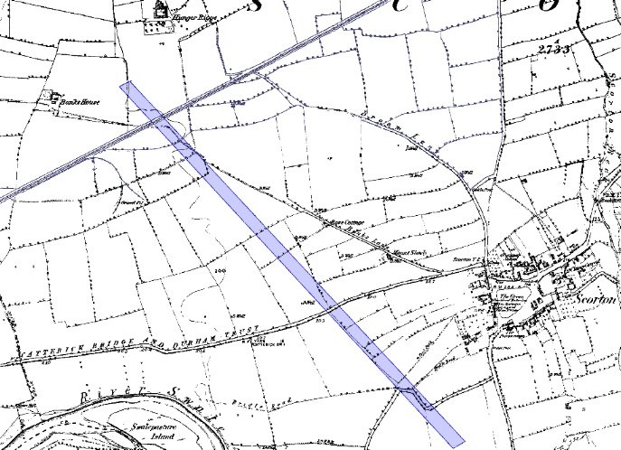
Scorton Cursus marked in blue on the 1850’2 OS 1st Edition map.

The cursus was originally about 2.1km long and aligned SE-NW. Clustered round the monument were a number of ring ditches, one that was excavated had a single burial with a beaker. This would date the site as being in use from around 3,500BC until at least the Bronze Age c.2,000 BC.

The cursus was cut almost dead straight over it’s entire length and was 37.2m wide. The cursus was constructed by digging two parallel ditches 4.10m wide on the east side and 3.90m wide on the west.

Cursus monuments are thought of as “ceremonial ways” – avenues, carved though the landscape that created a sacred or ritual space. Often these are associated with water, and Scorton is no exception – it sits close by the River Swale and also sits in a remnant alluvial flood plane. At the time when Scorton Cursus was built, it is likely that it sat amongst a large number of lakes. These monuments are often given their “ritual” function due to the fact that burial mounds tend to be placed in close proximity to them.

Almost the entire site was destroyed by quarrying, very little record of it exists yet it is one of the first and largest “communal ritual structures” in the north of england.

Research Notes

“The excavation of a section accross the complete width of the cursus, now reduced to a cropmark, produced evidence from recut ditches of at least two major phases of use. The first was indicated by narrow almost V-profiled ditches, which, having silted, were recut to a wide and shallow form. A low mound of indeterminate shape, possibly Upcast from the ditches, was situated in the centre of the cursus, while a pit complete with a ramp was discovered as an external feature of the eastern ditch. A sampling strategy recovered a flaked stone assemblage of flint and chert, which included debris from knapping activities in addition to actual tools. In the area excavated no evidence was recovered for any recognisable form of occupation of any period.” Peter Topping 1978.

“A section cut accross the cursus by P. Topping of Newcastle University showed that both ditches had been re-cut from a norrower almost V-shape to a wide shallow form. A truncated post hole was found dug into the silting of the eastern ditch. A large low mound apparently lay within the ditches at the north west end of the cursus. There was also evidence here os external pits possibly holding upright timbers” YAJ 51, 1978

“NZ240005 Cropmarks revealed in aerial photographs taken by Prof. J. K. F. St. Joseph are threatened by gravel workings. The Richmondshire Excavation Group, directed by Mrs F. Thubron for the DOE sectioned the cursus mark to expose two double ditches 32 m apart, 1 m deep, and from 2-3m wide. Two of these showed evidence of re-cutting. No dating evidence was found. Several sherds of Roman pottery was picked up from plough soil near the circular cropmark.” from Yorkshire Arch. Journal, Vol 48, 1976, P.2.

“The site was discovered by Prof J.K. St Joseph in 1949, and from his series of aerial photographs it was possible to trace the course of the cursus for approximately 2.1 kilometers. Evidence from soil stripping and exacavations has shown that the monument extends even further to the north-west, the north west terminal not as yet having been discovered. The south west terminal, which shows clearly on the aerial photographs, consists of a straight transverse ditch which joins the two main ditches at right angles. Clustering around it was a series of ring-ditch crop marks. The aerial photographs also show a series of bleach marks between the ditches at the southern end of the cursus, which may represent a series of contiguous mounds. This area of the cursus also features what appears to be smaller outer ditches, although they may be restricted to the southern end of the cursus as they were absent in the excavated area.
Another noteworthy feature brought out by aerial photography is the accuracy with which the ditches have been laid out, so they are remarkably straight considering the distance over which they extend”.

“from the evidence available at Rudston, it would appear that cursus monuments in Yorkshire developed during the late Neolithic, and flourished, as can be seen at Rudston in its magnificent complex of monuments, into the Early Bronze Age. It is within this local chronological framework that the cursus at Scorton must have developed, although not to as great an extent as the important centres of Rudston or Thornborough”. Excavation at the Cursus at Scoton North Yorkshire 1978 Peter Topping, Yorkshire Archaeological Journal, Volume 54, 1982

Kirklington Tumulus, North Yorkshire

Kirklington Tumulus

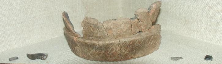
“Prehistoric vessels dug out of the mound at Stapely Hill, Kirklington, in 1903. Fragments of several pottery urns of the Bronze Age, C. 1,000 B.C., one containing cremated human bones” Description and photo’s from Kirklington Church.

“SE 326828 S. White reports that a polished flint axe was found by Mrs J. Fothergill in 1976. The axe is in perfect condition with a cream patination, 14 cm long, 4.4 cm thick and 6 cm wide at the blade. It is of red coastal flint. An examination of the field in November 1977 produced no further finds. In the possession of the finder.” YAS Vol 50, 1978, P.8.

Devil’s Arrows, North Yorkshire

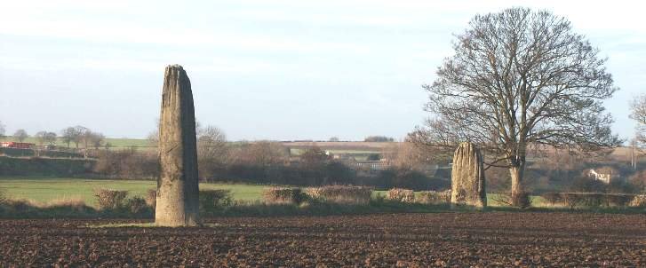
The Devil’s Arrows – BoroughBridge

Introduction

This Bronze Age site comprises of three large standing stones, it is thought originally there were as many as five stones in this alignment. Being Bronze Age little is known about the origin of the Devil’s Arrows, the name reflecting a more recent myth. The monument is strongly linked with an alignment withseveral others covering a line of over 50 miles and heading north south through North Yorkshire.

The site itself, being just off the A1 has been an important communications route for several thousand years and it is likely that in the Iron age the Brigantes adopted this as a centre for religious or tribal gatherings. It’s importance is further indicated by the creation of the tribal capital of Isurium Brigantium in c. 120AD less than three miles away at Aldborough.

Research so far has been limited to a site visit and scans for document records.

In the Brigantium context it is likely that this site, together with the triple Henge alignment and cursus of Thornborough some 8-10 miles to the north of the Arrows formed one of the most significant religious and tribla gathering point in Brigantia.

Location

Grid Ref: SE391665, Latitude: 54.092736, Longitude: -1.402114.

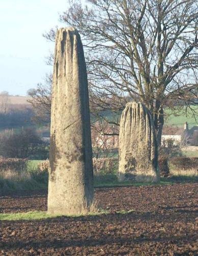
Three naturally shaped stones in an alignment thought to have originally included up to five stones. These are almost in a straight line, pointing north to south. The outer stones are 200 and 370ft away from the central stone.

Access to these is relatively simple, they are just off the side of an elevated section of the A1(M) trunk road at Jct 48 to Boroughbridge.

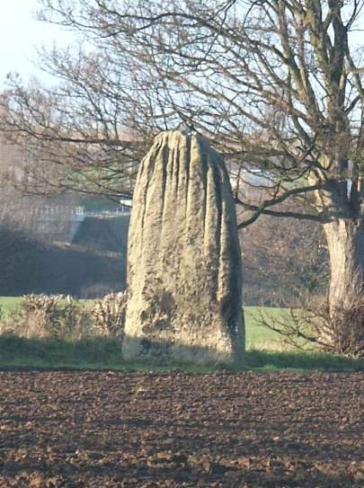
The stones have heights of 18ft (northern stone), and 22ft. They are of millstone Grit which was quarried at Knaresborough, 6.5 miles to the SW. The grooving is the result of weathering.

The Devils Arrows are the centre of the most important alignment of standing stones, henges and other remains in Yorkshire, all running N/S alongside the ancient line of the A1, Stretching from Hutton Moor to Thornborough and beyond. Current estimates indicate they were erected during the Bronze Age c. 2,200 – 1,400 BC.

Views of the northern and central stone

Left, central stone and northern stone, right.

southern-most stone

Other research

The name stems from a legend traced back to 1721, where the Devil was supposed to have thrown the stones, aiming at the next town of Aldborough. He stood on Howe Hill and shouted,

“Borobrigg keep out o’ way,

For Aldborough town

I will ding down!”

But obviously his aim was not that good, and so they landed short of their mark.

At their maximum of 22 feet in height, The Devil’s Arrows are the tallest standing stones in the United Kingdom apart from the Rudston Monolith.


Since Antiquarian William Stukeley’s time it has been believed that the arrows are in a straight line, running North to South. The fact is that they’re visibly not. When they were dragged across from miles of countryside from Knaresborough (seven miles away), the stones where constructed to not be in line, but to be slightly “westward.”

In the 1970’s Paul Devereux wrote in The Ley Hunter’s Companion that “the functions of the monoliths was to act as a multi-directional sighting or reference instrument.” Devereux also quotes G Bernard Wood on “the Devil’s arrows stand in line “with an ancient ford across the River Ure.”

The Devils Arrow alignment. Ref: Lines on the Landscape, Devereux and Pennick

This place is remarkable for those monuments called the Devils Arrows, but whether Roman or British, is uncertain. “Here was, in the British times,” says Dr. Stukeley, “the great Panegyre of the Druids, the Midsummer meeting of all the country round, to celebrate the great quarterly sacrifice; accompanied with sports, games, races, and all kinds of exercises, with universal festivity. This was like the Panathenian, the Olympian, Nemean meetings, and games among the Grecians. These obelisks were as the Metae of the Races; the remembrance hereof is transmitted in the present great Fair held here, on St. Barnabas Day.”

In Leland’s time there were four, but in the seventeenth century, one of them was pulled down; the remaining ones are placed at unequal distances from each other. The tallest one is 30 feet 6 inches from the bottom, about 6 feet of which are buried in the ground; its greatest circumference 16 feet.

Richard Frank, a singular traveller, and famous peripatetic angler, in his tour to the northern parts of Scotland, to enjoy his favourite amusement, which he published in 1694, says that he saw near Boroughbridge, seven of these stones, in which he must have been mistaken, as it is not likely that they have increased since the days of Leland. Evident marks of the chisel appear below the surface of the earth. It is of the common coarse rag stone or mill grit; a large rock of this stone from which, probably these obelisks were taken, is at Plumpton, near Knaresborough. Doctor Stillingfleet considers them as British Deities: Leland, Camden, and Drake, suppose them to have been the work of the Romans, and erected by that people as trophies, to commemorate some important victory.

Near this place, in 1322, that unfortunate Prince, Thomas Earl of Lancaster, with some of the nobility, disgusted with the royal favourites, the Spencers, made stand against the forces of his nephew, Edward II. but was taken by Sir Andrew de Harcla, who, being insensible to entreaties and solicitations, and after suffering every possible indignity that cruelty could suggest, was mounted on a sorry horse, and brought before the King, who ordered, without any form of trial, his head to be struck off, on an eminence near Pontefract. One of his partisans, the powerful John de Bohun, Earl of Hereford, in passing over the bridge, then made of wood, was run through with a spear, by a soldier, cowardly placed beneath for that execrable purpose. It sends two Members to Parliament, a privilege it derived from Queen Mary in 1553.

[From Langdale’s Topographical Dictionary of Yorkshire. (1822)]

Mote of Mark, Dumfries


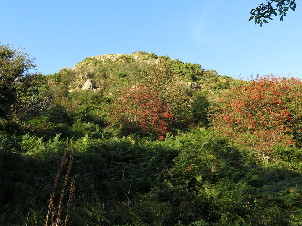
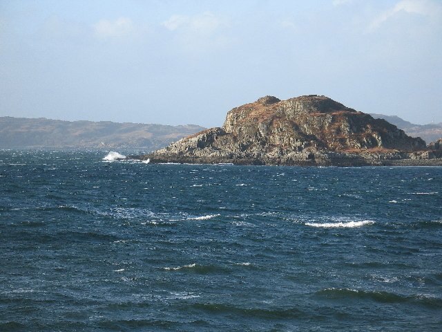
[caption id="" align="aligncenter" width="1024"]Mote of Mark from sea shore path “Mote of Mark from sea shore path – geograph.org.uk – 6273954” by Andrew Curtis is licensed under CC BY-SA 2.0

Mote of Mark – a Dark-Age citadel above Rough Firth

Setting & basic layout

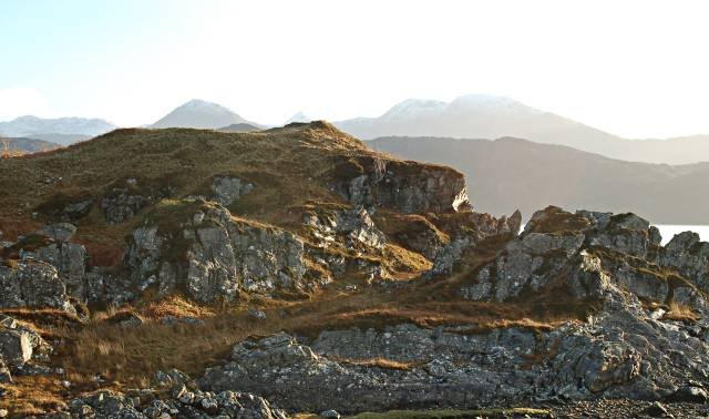
Located on a granite knoll (45 m OD) on the east shore of Rough Firth between Rockcliffe and Kippford, Dumfries-and-Galloway (NGR NX 845 540). The west and south faces drop almost sheer to the estuary; access is by a narrow neck on the north-east. (hillforts.arch.ox.ac.uk, Britain Express)

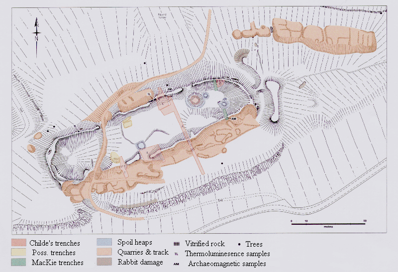
Defences – A single timber-laced stone rampart, c. 4 m thick, once ringed the 0.14 ha summit; most blocks were tumbled downslope after a fierce burning that fused parts of the core into green-black glass. A slighter outer bank and ditch skirt the easier north-east approach. No definite entrance has been located. (Canmore)

Chronicle of investigation

Date Investigators & method What they added
1755–1893 Roy’s Military Map, R. Riddell (1790) & J. Coles (1893) sketch-survey First published notice of a “vitrified fort”; rough plan and section. (hillforts.arch.ox.ac.uk)
1913 Alexander O. Curle cut 13 trenches across rampart and interior Proved timber-lacing + vitrification; recovered continental glass, E-ware pottery, 400+ clay mould fragments, crucibles and high-status metalwork, revealing industrial activity. (journals.socantscot.org)
1973 & 1979 Lloyd Laing & David Longley reopened Curle’s area and trenched the N & S walls Produced a full stratigraphic sequence, mapped rampart faces, identified five structural/occupational phases and sampled vitrified slag. (books.casematepublishing.com, hillforts.arch.ox.ac.uk)
2006-13 Watching briefs, bracken-die-back surveys & UAV imagery (HES) Monitored erosion, located terrace platforms below the summit. (Canmore)
2022 Publication of The Mote of Mark monograph Synthesised all finds, provided new scientific dating and specialist analyses. (books.casematepublishing.com)

Key finds & specialist results

Imported table-wares – 55 sherds of Gaulish E-ware and two Late-Roman (LR 2) amphora fragments place peak occupation in the mid-6th century AD. (books.casematepublishing.com, Canmore)

High-status craft debris – 482 clay mould fragments (Penannular brooches, enamel studs), crucible slag and bronze/iron off-cuts indicate on-site non-ferrous metal-working aimed at élite goods. (books.casematepublishing.com)

Glass & gaming pieces – Vessel shards from Frankish glass beakers and a bossed glass gaming counter underscore long-distance connections. (books.casematepublishing.com)

Animal bone & food waste – Dominance of cattle and high proportions of red-deer venison fit a short-lived, high-status residence rather than a farming hamlet. (books.casematepublishing.com)

Dating & historical horizon

Radiocarbon assays on rampart charcoal and occupation layers converge on c. AD 550–700; artefact typology agrees, framing the fort within the post-Roman kingdom of Rheged and the wider Irish-Sea trading zone. (hillforts.arch.ox.ac.uk, books.casematepublishing.com)

Why the Mote matters

Classic vitrified wall south of the Clyde/Forth line – a laboratory for studying firing techniques beyond the better-known Highland forts. (Canmore)

Industrial powerhouse – unparalleled quantity of moulds and crucibles shows that prestigious metal-working was embedded inside a royal seat, not farmed out to satellite workshops. (journals.socantscot.org, books.casematepublishing.com)

Trade cross-roads – Imported wine amphorae, fine pottery and glass prove direct contact with Atlantic Gaul and the Mediterranean during Britain’s so-called “Dark Ages”. (Canmore, books.casematepublishing.com)

Tightly dated destruction – Coherent 6th-century radiocarbon suite plus vitrification raise the prospect that the fort was deliberately torched during early Northumbrian expansion. (hillforts.arch.ox.ac.uk)

Outstanding questions & research potential

Issue Why it matters Next step
Who burned the rampart? Could link the fire to named conflicts in Historia Brittonum. Pair archaeomagnetic & micro-CT slag studies to refine burn episode.
Extent of craft zoning Interior still partly unexcavated. Targeted geophysics and micro-excavations in central hollow.
Outer terrace platforms Possible worker huts or later reuse? Coring & OSL dating of terrace fills.
Landscape integration How did the fort control estuary traffic? Viewshed & catchment modelling tied to LiDAR.

Vitrified Fort

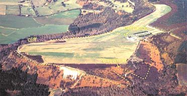
The Mote of Mark is a defended hilltop overlooking the Urr estuary. It was the court or citadel of a powerful Dark Age chieftain, possibly one of the princes of Rheged. The site was occupied during the 6th century and appears to have been destroyed by fire in the 7th century.

The top of the hill was enclosed by a massive stone and timber rampart. Inside was a timber hall surrounded by a huddle of workshops and stables. This was a wealthy site with trading contacts across Europe. Finds from the excavations include glass beads and wine jars from central France and glassware from Germany. Local craftsmen produced elegant bronze jewellery in a distinctive Celtic style.

The tumbled remains of the ramparts can still be seen, and an on-site interpretation panel has an atmospheric reconstruction of the fort.

size: 8 ha (20a)

Legendary and Literary Background – https://panther.bsc.edu/~arthur/others.html
This fort was occupied from the 5th to 7th centuries, smack dab in the Arthurian time frame. At the pinnacle of its prominence, it was a well-fortified trading and manufacturing center. Excavations in 1913 and 1973 unearthed a large, circular timber hut and evidence of metalworking. These people seemed to have imported raw materials–iron from the Lake District and jet from York–to produce interlaced jewelry, brooches, and sundry metalwork. They imported luxuries as well–pottery from Bordeaux and glass from the Rhineland were found. Such prosperity suggests that this fort may have been the stronghold of a smaller British subkingdom.

The primary defences consisted of stone and timber walls, and there was a timber gate for the main entrance on the southern slopes. In the 7th century, though, these defences failed. The outer wall shows evidence of vitrification, a condition when extreme heat causes stones to fuse together. Many believe that this was the result of an attack by the Angles–Anglian runic inscriptions were found at the site–though some say that the walls were purposely vitrified to strengthen them.

The only thing truly connecting this fort with the Arthurian legend is the name, its period of occupation, and its proximity to Trusty’s Hill.

Vitrified Forts Distribution

Vitrified Forts Geographic Distribution

One of the great mysteries of classical archaeology is the spartan worldwide distribution of vitrified forts, except for Scotland and France. However, there are a number in the wider world, especially Europe. Here is the current breakdown:

Global (really pan-European) picture of vitrified hill-forts

To date, all firmly identified vitrified forts lie in western and Northern Europe. More than 200 sites are accepted; c. 70 of them are in Scotland—the densest cluster anywhere. No authenticated examples are recorded in the Near East, Africa, the Americas or Australasia.

Region / country Approx. number & key examples Notes on distribution & research status
Scotland ≈ 70 sites from Galloway to Caithness. Flagships: Tap o’ Noth, Craig Phàdraig, Dunnideer, Dun Deardail, Finavon, Burghead. Scottish forts were the first recognised (19th c.); systematic surveys began in the 1930s and continue. (Amusing Planet)
England 3 certainly vitrified: Wincobank (South Yorks), Almondbury/Castle Hill (W. Yorks), Castercliff (Lancs). Localised fusion in a few Cumbrian ring-works is still debated. (Nature)
Wales & Isle of Man Isolated, limited vitrification reported at Pen Dinas (Ceredigion) and South Barrule (Man), but not as extensive as the Scottish walls. Requires modern material’s analysis; both often cited but thinly published.
Ireland Fewer than ten candidate sites; best-known are Dun Aengus (Aran Is.), Knocknashee (Sligo) and possibly Creggankeel. Vitrification tends to be patchy. Field confirmation lagging; dating work only recently begun.
France c. 20 forts, concentrated in Brittany (e.g., Le Yaudet), Normandy and Burgundy (e.g., Château de la Roche). Roland Comte, however, has suggested that there may be many more. French excavations since the 1980s apply high-temperature petrology; some walls show repeat vitrification events.
Iberian Peninsula Portugal: Citânia de Sanfins, Castelo Velho de Freixo; Spain: some Oppida in Galicia and Asturias show fused masonry. Iberian examples, often linked to the castro culture; fewer laboratory studies than in France/Scotland.
Germany & Switzerland Germany: Schloßberg (Schramberg), Kienberg (Black Forest). Switzerland: Mont Vully rim. Generally single-rampart hill-top enclosures; vitrification limited to beam-slots. (Nature)
Scandinavia Sweden: Broborg (Uppland) and Götavirke sector walls; Norway: uncertain cases in Østfold. Swedish investigations demonstrate temperatures ≥ 1 050 °C identical to Scottish samples.
Central Europe (Bohemia, Slovakia, Hungary) Small number (< 10) of hill-forts with slag-like fused zones, e.g., Švédské šance (CZ), Liptovská Mara (SK), Somló (HU). Continental research is scattered; many identifications rest on visual inspection rather than thin-section work. (ResearchGate)

Key distribution patterns

  • Atlantic/North-Sea façade cluster: Scotland, Brittany and southern Sweden share the densest concentrations, suggesting cultural transmission along maritime routes during the mid-first-millennium BC.
  • Sparse but widespread inland occurrences: Single forts in Germany, Bohemia and the upper Danube imply that vitrification was known but never commonplace on the mainland.
  • Absence outside Europe: Claims of vitrified “desert forts” or Asian walls have not survived petrological scrutiny; temperatures reached in those structures derive from natural lightning or later lime-kiln intrusions, not deliberate timber-lacing fires.

Research gaps

  • Analytical parity: Scotland, France and Sweden have applied SEM, XRD and Lead-isotope analysis; many Iberian, Irish and Central-European sites still rely on macroscopic description.
  • Chronological resolution: Fewer than 25 forts have direct radiocarbon or OSL dates for the firing episode; comparative regional chronologies therefore remain coarse.
  • Functional explanation: Whether vitrification was accidental, tactical, or ritual continues to be debated across the entire distribution area; consistent excavation strategies are needed if we are to compare motives between the Scottish core and outlier regions.

In sum, vitrified forts form a European phenomenon centred on Scotland but echoed in discontinuous belts from Iberia to Scandinavia, with isolated outliers deep in Central Europe. Their patchy yet recognisable distribution hints at shared construction methods—and perhaps shared symbolic practices—diffusing across Iron-Age Europe, never extending beyond it. (Nature, ResearchGate, Amusing Planet)

Commentary

Scotland

There are at least 70 such forts throughout Scotland. Among the most well-known are Dunnideer, Craig Phadraig (near Inverness), Abernathy (near Perth), Dun Lagaidh (in Ross), Cromarty, Arka-Unskel, Eilean na Goar, and Bute-Dunagoil on the Sound of Bute off Arran Island. Another well-known vitrified fort is the Cauadale hill-fort in Argyll, West Scotland.

Others include, Dun Mac Uisneachain (Dun Macsnoichan), the ancient Beregoiium, about 9 m. N.N.E. of Oban; Tap o’ Noth, in Aberdeenshire; Craig Phadraic, or Phadrick, near Inverness; Dun Dhardhail (Dunjardil) in Glen Nevis; Knockfarrail, near Strathpeffer; Dun Creich, in Sutherland; Finhaven, near Aberlemno; Barryhill, in Perthshire; Laws, near Dundee; Dun Gall and Burnt Island, in Buteshire; Anwoth, in Kirkcudbright; and Cowdenknowes, in Berwickshire. Dun Mac Tjisneachain is the largest in area, being 250 yds. long by 50 yds. broad. In Barryhill and Laws, the remains of small rectangular dwellings have been found.

The evidence from elsewhere shows very few vitrified forts elsewhere, indeed the total number of vitrified forts worldwide is thought to be less than 100. Some examples are as follows:

France

Vitrified forts in France are discussed in the American Journal of Science (vol. 3, no. 22, 1881, pp. 150-151) in an article entitled “On the Substances Obtained from Some ‘Forts Vitrifiés’ in France”, by M. Daubrée. The author mentions several forts in Brittany and northern France whose granite blocks have been vitrified. He cites the “partially fused granitic rocks from the forts of Château-vieux and of Puy de Gaudy (Creuse), also from the neighbourhood of Saint Brieuc (Côtes-du-Nord)”. Daubrée, understandably, could not readily find an explanation for the vitrification.

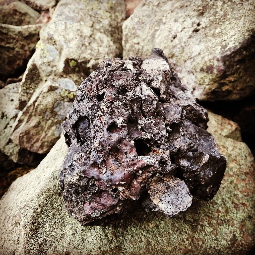
Vitrified stones, hillfort in Highland, Scotland, UK, Rubh' Ard Ghaunsgail

Vitrified stones, hillfort in Highland, Scotland, UK, Rubh’ Ard Ghaunsgail

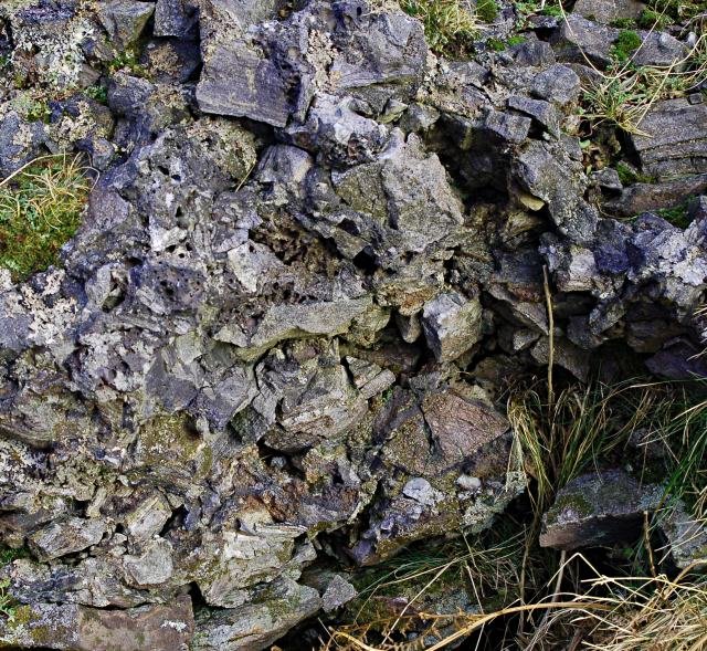
Very vitrified. Possibly part of the pictish fort that was here.

Very vitrified. Possibly part of the pictish fort that was here.

Turkey

Similarly, the ruins of Hattusas in central Turkey, an ancient Hittite city, are partially vitrified. The Hittites are said to be the inventors of the chariot, and horses were of great importance to them. It is on the ancient Hittite stelae that we first see a depiction of the chariot in use. However, it seems unlikely that horsemanship and wheeled chariots were invented by the Hittites; it is highly likely that chariots were in use in ancient China at the same time.

Iran

Some of the ancient ziggurats of Iran and Iraq also contain vitrified material, sometimes thought by archaeologists to be caused by the Greek fire. For instance, the vitrified remains of the ziggurat at Birs Nimrod (Borsippa), south of Hillah, were once confused with the Tower of Babel. The ruins are crowned by a mass of vitrified brickwork–actual clay bricks fused together by intense heat. This may be due to the horrific ancient wars described in the Ramayana and Mahabharata, although early archaeologists attributed the effect to lightning.

Other locations

Vitrified forts have also been found in Yorkshire and Lancashire, in England; Londonderry and Cavan, in Ireland; in Upper Lusatia, Bohemia, Silesia, Saxony and Thuringia; in the provinces on the Rhine, especially in the neighbourhood of the Nahe; in the Ucker Lake, in Brandenburg, where the walls are formed of burnt and smelted bricks; in Hungary.

Why Vitrify a Fort?

Why Vitrify a Fort?

Why was it done and by whom?

Practical reasons?

Originally, it was thought that the forts had become vitrified due to an enemy attack. A theory proposed by Childe in the 1930 thought it was that it was invaders, not the builders, who were assaulting the forts and then setting fire to the walls with piles of brush and wood; however, it is hard to understand why people would have repeatedly built defences that invaders could destroy with fire, when great ramparts of solid stone would have survived unscathed. Also, this theory does not stand up to the geographic distribution of hill forts versus the known warring area where hill forts were in use. For example the south of England suffered wave after wave of hostile invasion from other Gaulish tribes, yet no vitrification has been noted – surely if it was a natural effect of a battle then these forts would be more likely to occur in the south of England (given the large concentration of timber laced ramparts and the frequency of fighting in the area).

This idea was amended with the theory that the builders of the walls had designed the forts in such a way that the vitrification was purposeful in order to strengthen the walls. This theory postulated that fires had been lit, and flammable material added to produce walls strong enough to resist the invading armies of the enemy. It is an interesting theory, but one that presents several problems. The main problem with this theory is there is no indication that such vitrification actually strengthens the walls of the fortress; rather, it seems to weaken them. In some cases, the walls of the forts seem to have collapsed because of the fires, however this may show an error in the calculations of the builders.

To further illustrate this point, Julius Caesar described a type of wood and stone fortress, known as a murus gallicus, in his account of the Gallic Wars. This was interesting to those seeking solutions to the vitrified fort mystery because these forts were made of a stone wall filled with rubble, with wooden logs inside for stability. Caesar notes how the flexibility of the wood adds to the strength of the fort in case of battering ram attack.

Some researchers are sure that the builders of the forts caused the vitrification. Arthur C. Clarke quotes one team of chemists from the Natural History Museum in London who were studying the many forts:

“Considering the high temperatures which have to be produced, and the fact that possibly sixty or so vitrified forts are to be seen in a limited geographical area of Scotland, we do not believe that this type of structure is the result of accidental fires. Careful planning and construction were needed.”

Our own research into how forts were vitrified does indeed suggest a deliberate and planned action on behalf of the builders. Looking at the hill forts in evidence today, it appears that although many seem to be specifically built in strategic locations, some do not take full advantage of the natural defences available. Another common feature is that many vitrified forts have two rings of ramparts, but only the inner is vitrified. This suggests that the vitrified rampart was for the benefit of the fort’s users (not visible outside the fort) and that although linked with battle, the vitrification served a purpose other than strengthening the fort.

Beyond this reasoning, any further comment is pure speculation, but our research does indicate that the vitrification process could have been part of a lengthy ‘ceremony’ and will have been directed by the most powerful members of the community. Although it is strongly felt that vitrification of forts represents a cultural or religious element, further comment is reserved until further investigative work can be performed.

Experimental attempts to replicate the vitrification seen at Tap o’ Noth

The rampart of Tap o’ Noth hill-fort is one of the best-preserved examples of a stone wall whose core has melted and fused into green-black glass. Because the temperatures required (> 1 000 °C) far exceed what an uncontrolled brush-fire can achieve, archaeologists have tried—twice and at full scale—to discover how such heat might have been generated and whether the melting was accidental, structural or deliberate.

Date & lead investigator Where the replica wall was built Construction details Firing regime & peak temperature Result Main lessons
1937 – V. Gordon Childe & W. Thorneycroft Plean Colliery, Stirlingshire 3.7 m long, 1.8 m wide, 1.8 m high “murus gallicus”: fire-clay bricks as faces, 30 cm timber lacing, basaltic rubble core. (the urban prehistorian) 4 t of kindling & logs piled against both faces; fuel replenished for 20 h in sleet. Wall collapsed inward after 5 h; core stones reached c. 900 °C; 3 kg of bubbly glass recovered. Timber-laced stone can indeed vitrify, but only where flame and oxygen reach the rubble; a single firing would not strengthen a whole hill-fort but could melt patches.
1980 – Ian Ralston (Yorkshire TV / Aberdeen Univ.) East Tullos landfill, Aberdeen 8 m long rampart based on Tap o’ Noth section: outer skin of granite blocks; gabbro rubble core; horizontal oak beams (≈ 30 % timber by volume). (the urban prehistorian) Continuous pyres plus paraffin & animal fat; wind-shielding tarps; fire stoked for 28 h. Core probe after 15 h read 1 050 °C. Partial vitrification in beam sockets and mid-core; 3 kg of fused granite-gabbro glass. Wall bulldozed for safety after 28 h while still hot. Confirmed Childe’s results; showed that > 1 000 °C can be reached in a timber-rich rampart without industrial bellows; but vitrification remains patchy and weakens the structure.

Key technical findings

Fuel-to-stone ratio – Both experiments needed c. 1 part dry timber to 2–3 parts stone by volume. That equates to many thousands of mature trees for a full hill-fort wall: mass felling and organised labour are implied.

Airflow control – Heat concentrated where through-drafts fed the core (beam sockets, gaps between facing stones). Stagnant pockets never melted.

Glass chemistry – Melted granite and gabbro at 1 050 °C produced the same green-black glass and vesicles seen in Tap o’ Noth samples, vindicating the experimental design.

Behavioural implications for Tap o’ Noth

Deliberate conflagration is feasible: a well-planned firing could vitrify selected stretches in one episode, whether as an act of destruction or as a dramatic closure rite.

Structural strengthening unlikely: both replica walls became unstable once timber burned out; vitrification weakens rather than “welds” a rampart.

Labour & resource cost: harvesting and hauling the timber needed for a 100 m-long, 3 m-thick rampart would require a supra-household workforce—fitting a scenario of elite display or punitive destruction, not accidental fire.

Unresolved questions

Who lit the fire? —No siege debris or arrowheads were found in Tap o’ Noth’s vitrified tumble; ritualised self-burning remains as plausible as enemy attack.

Why re-occupy a melted wall seven centuries later? —Pictish re-occupation (7th c. AD) suggests the ruined, glass-fused rampart still carried prestige or ancestral authority despite its weakened fabric.

Regional pattern: comparable vitrification and radiocarbon brackets at Craig Phadrig, Dunnideer and Dun Deardail hint at a shared cultural practice of “fire-finishing” forts in north-east and Highland Scotland.

Take-away: the Tap o’ Noth experiments demonstrated that Iron-Age builders could intentionally melt a timber-laced wall using only locally available fuel and simple draught control. They did not prove whether the goal was tactical, structural or symbolic—but they push the balance of probability toward a planned, labour-intensive fire that turned a granite rampart into a smoking, glassy monument of power.

[dsgvo-youtube url=”https://youtu.be/NWR-upPzkq8″ images=”https://brigantesnation.com/wp-content/uploads/2015/09/Glass-Castles-on-YouTube.png” alt=”Cover image for the YouTube Glass Castles video”][/dsgvo-youtube]

Vitrified Fort References

Cook, M., Watson, F., and Cook., G. (2016). Burning Questions: New Insights into Vitrified Forts. In Erskine, G., P. Jacobsson, P. Miller, and S. Stetkiewicz (EDS.).

Proceedings of the 17th Iron Age Research Student Symposium, Edinburgh. Oxford: Archaeopress Publishing.

Friend, C.R., Kirby, J.E., Charnley, N.R. and Dye, J., 2016. New field, analytical data and melting temperature determinations from three vitrified forts in Lochaber, Western Highlands, Scotland. Journal of Archaeological Science: Reports, 10, pp.237-252.

Horn, J. A. (2016). An approach to re-examining the chronology of hillforts and other prehistoric monuments Jonathan A. Horn University of Edinburgh. In Erskine, G., P. Jacobsson, P. Miller, and S. Stetkiewicz (eds.). Proceedings of the 17th Iron Age Research Student Symposium, Edinburgh. Oxford: Archaeopress Publishing.

Kresten, P., 2004. The vitrified forts of Europe: saga, archaeology, and geology. International Council for Applied Mineralogy: development in Science and Technology, pp.355-357.

McCloy, J.S., Marcial, J., Clarke, J.S. et al. Reproduction of melting behavior for vitrified hillforts based on amphibolite, granite, and basalt lithologies. Sci Rep 11, 1272 (2021). https://doi.org/10.1038/s41598-020-80…

Ralston, I., 1987, November. The Yorkshire television vitrified wall experiment at East Tullos, city of Aberdeen District. In Proceedings of the Society of Antiquaries of Scotland (Vol. 116, pp. 17-40).

ScARF, I.A.P., 2010. Iron Age Scotland: ScARF Panel Report. Scottish Archaeological Research Framework. Sanderson, D.C.W.,

Placido, F. and Tate, J.O., 1988. Scottish vitrified forts: TL results from six study sites. International Journal of Radiation Applications and Instrumentation. Part D. Nuclear Tracks and Radiation Measurements, 14(1-2), pp.307-316.

Wadsworth, F.B., Heap, M.J., Damby, D.E., Hess, K.U., Najorka, J., Vasseur, J., Fahrner, D. and Dingwell, D.B., 2017. Local geology controlled the feasibility of vitrifying Iron Age buildings. Scientific Reports, 7(1), pp.1-7.

Lock, G. And Ralston, I. (2017). Atlas of Hillforts of Britain and Ireland. [ONLINE] Available at: https://hillforts.arch.ox.ac.uk

How to Vitrify a Fort

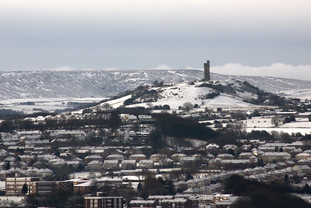
Castle Hill and Almondbury from Kirkheaton

Castle Hill and Almondbury from Kirkheaton

Vitrification of Hill Forts

The Vitrification process

Vitrification as seen in hillforts is where the surface of the rampart has been heated to temperature that the stone has melted and bonded with its neighbouring stone. In some cases, forming a glassy surface.

The theoretical and limited practical attempts to recreate vitrification have largely been inconclusive, since significantly more effort was required to melt the rock than was expected. This has revealed several problems which our assumptions so far.

The use of imported sandstone to create the vitrified rock gives shows that the fort builder knew how to select rock specifically for its vitrification properties and shows that vitrified forts were definitely planned to be so, and therefore that other techniques will have been used to produce the desired effect. So far, science has largely overlooked this and assumed more or less simple or unplanned fires causing vitrification.

The problem lies in concentrating the heat, simply having a very large fire close to an appropriate stone face will not easily vitrify the rock. For example when a fireplace is heated, the burning temperature of wood is at it’s highest from 800 to 1200 °C, which should be hot enough to melt stone (1100 °C) but according to studies carried out by Nunnanlahden Uuni Oy, the surface of hottest stones heats up to only 650 °C in normal use. This shows the difficulty in getting a simple (but large) open fire to cause vitrification.

Some other points are worthy of mention. In the many cases of vitrification, it has been noticed that the rock applied to the rampart was of much smaller – stone fragments, it has been suggested that this was to increase the surface area of the vitrification rock and there increase the heat absorption. It also however indicated that an additional substance would have been required to hold these smaller fragments in place while they melt and adhere to the main body of the rampart.

Additionally, in some vitrified sites there is evidence that salt may have been used to increase the temperature of the fire, although this evidence is rare (France only) it may explain the largely coastal orientation of the Scottish forts.

Clearly, if ancient man were prepared to go to such lengths in preparing the surface of the rampart ready for vitrification then other techniques would have been adopted which may have been overlooked in research assumptions to date.

In is our proposal therefore that in order to vitrify a fort, ancient man left nothing to chance. Having assessed the melting characteristics of the rock (with a test burn) and acquired additional more suitable facing rock if needed. The Rampart was prepared by the application of the surface stones, together with an additional flux-like compound, which improved the adhesion and melting characteristics of the rock.

Once this was in place, the entire rampart was turned into an enormous kiln, by using clay to build a vented tunnel around the rampart, probably with multiple burning points and flues. This allows the heat to be amplified and directed towards the rampart, thus achieving the even vitrification that has been noted. Iron Age kilns were more than capable of reaching the desired temperatures.

To date there is no evidence of the kiln technique being used, since it is likely that the clay kiln will have been designed to be fully removed such evidence is unlikely to be forthcoming. However, we feel that this is the most likely method of creating a vitrified rampart since; It uses technology well known in the period; Once perfected, the technique would allow for the controlled even application of the effect which has been observed; It uses down to earth ordinary technology to provide the desired effect.

It is also likely that the preferred wood for the vitrification process would have been Oak and Yew, as these were readily available and have high burning temperatures

One other theory worthy of mention because of its historic interest rather than likely-hood is that the forts came under attack from “Greek Fire”.

Greek Fire

In ancient times, there was a substance known through writings as Greek fire. This was some sort of ancient napalm bomb that was hurled by catapult and could not be put out. Some forms of Greek fire were even said to burn underwater and were therefore used in naval battles. (The actual composition of Greek fire is unknown, but it must have contained chemicals such as phosphorus, pitch, sulphur or other flammable chemicals.)

“Greek Fire was the secret weapon of the Eastern Roman Emperors. It is said to have been invented by a Syrian Engineer, one Callinicus, a refugee from Maalbek, in the seventh century (673 AD). The “liquid fire” was hurled on to the ships of their enemies from siphons and burst into flames on contact. As it was reputed to be inextinguishable and burned even on water, it caused panic and dread. Its introduction into warfare of its time was comparable in its demoralizing influence to the introduction of nuclear weapons in our time. Both Arab and Greek sources agree that it surpassed all incendiary weapons in destruction. The secret behind the Greek fire was handed down from one emperor to the next for centuries. Rumours about its composition include such chemicals as liquid petroleum, naphtha, burning pitch, sulphur, resin, quicklime and bitumen, along with some other “secret ingredient”. The exact composition, however, remains unknown. For a thorough investigation of the weapon one can refer to Professor J.R. Partington’s book, “A history of the Greek Fire and Gunpowder”, Heffer, 1960. This volume quotes the ancient authorities extensively, with an excellent commentary. It also examines ancient and modern theories on the composition of the chemicals used in the Greek Fire. This is considered the most up-to-date source on the subject. “

If we could run Child’s experiment again

Project Brief (Version 0.1) — Experimental Reconstruction of Hill-Fort Vitrification

Purpose & Vision

Recreate a controlled-scale rampart fire that reproduces the melt textures, magnetic signatures and labour demands observed in Iron-Age vitrified forts.
The experiment should answer how, why and under what boundary-conditions vitrification is achievable.

Key Research Questions

  • Thermal window — What minimum temperature–time curve is required for continuous glass formation in different lithologies?
  • Construction variables — How do timber-lacing style, wall thickness and outer revetments influence peak temperature and melt spread?
  • Fuel logistics — What fuel mass, species mix and draught strategy deliver the target thermal window at fort-scale?
  • Magnetic & mechanical outcomes — Does the experimentally produced melt replicate archaeomagnetic directions/intensities and post-fire wall strength seen in the field?
  • Environmental footprint — How much woodland and greenhouse gas output did ancient firings entail?

Selection Criteria for the Experimental Build

Criterion Rationale Target Specification
Lithology Must represent the main natural classes Basalt/dolerite (MI) and quartz-sandstone (QS) blocks sourced within 5 km
Construction class Recreate the dominant timber-laced core (TLC) and a stone-only control 2 test walls, 6 m long × 2 m high × 2 m wide
Layout proxy Inner-wall firing scenario most common (D-IV) Single wall surrounded on three sides by a low earthen berm to mimic outer ring/wind-break
Fuel type & supply chain Reflect local Iron-Age woodland Mix of air-dry oak, birch and pine; scalable bundles pre-weighed
Site logistics Safety, permits, research infrastructure Disused quarry or forestry compound with road access, water supply, 100 m safety buffer

Experimental Variables & Control Set

  1. Fuel-load series (10 t, 20 t, 30 t per wall)
  2. Draught regime (natural chimney vs. forced-air via electric blowers simulating bellows)
  3. Moisture content (15 % vs. 25 % wood MC)
  4. Tapered firing (progressive ignition from base) vs. blanket firing (multiple ignition points)

A full factorial is unrealistic; prioritise Lithology × Fuel-load × Draught (i.e., 12 runs over two seasons).

Instrumentation & Data Streams

Parameter Method / Equipment Sampling rate
Temperature profile K-type thermocouples (core, face, crest) + thermal cameras 1 Hz log
Atmosphere O₂ / CO / CO₂ sensors inside wall voids 1 Hz
Heat flux Water-cooled Gardon gauges at façade 1 Hz
Acoustic Microphones for crack frequency (structural failure proxy) 48 kHz
Magnetic record Oriented mini-cores pre- & post-fire, laboratory palaeointensity n/a
Melt fraction High-res Photogrammetry & post-fire thin-sections Post-run

Success Metrics

  • ≥ 50 vol % contiguous glass in mafic wall; measurable but < 10 vol % in sandstone wall (mirrors field bias).
  • Peak interior ≥ 1050 °C sustained ≥ 6 h (basalt) and ≥ 1150 °C ≥ 10 h (sandstone).
  • Archaeomagnetic direction within ± 2° and palaeointensity within ± 10 µT of regional 2025 SV field model.
  • Fuel use logged to < ± 5 % uncertainty.
  • Post-fire UCS (unconfined compressive strength) increase ≥ 30 % in basalt wall.

New analytical & field-survey tools now on the bench —and why they change the game

Past limit (pre-2000) 2020s capability Why it matters for a vitrification experiment
Hand specimen & thin-section only to see melt texture Micro- & Nano-CT (Voxel < 1 µm) reveal 3-D pore networks, glass bridges and surviving timber voids without slicing the block. (Oxford Academic) Quantifies true melt fraction and pinpoints the hottest zones before destructive sampling, letting us correlate temperature logs with glass continuity.
X-radiography gave 2-D shadows Neutron tomography penetrates heavy silicates yet highlights light elements (charred wood, water). (ResearchGate, Artnet News) Sees internal charcoal and moisture paths—critical for modelling draught and Steam-burst fracturing.
Bulk XRF and SEM-EDS at a few spots Laser-ablation ICP-MS (LA-ICP-MS) & portable XRF/µXRF mapping deliver ppm-level trace-element rasters of whole faces. (MDPI) Distinguishes imported “flux” stones from local rubble; resolves chemical zoning in a single glass drip to back-calculate temperature gradients.
Sr & Pb isotopes required gram-sized drillings MC-ICP-MS on 10-mg chips fingerprints quarry sources or Metallurgical droplets w/out spoiling museum samples. Tracks block provenance and detects deliberate crucible pouring into the wall fire.
TL dating ± 500 yr Single-grain OSL and Bayesian archaeomagnetic inversion now reach ± 100–150 yr for fuels hotter than 900 °C. Lets us time the burn sequence of inner vs outer ramparts and match it to nearby hoard burial or pollen-clearing pulses.
Tape-measure topography Drone LiDAR & photogrammetry give cm-scale 3-D models; structure-from-motion automatically calculates melt-volumes. Computes the mass of stone actually fused and links it to fuel-load data in real time.
Single thermocouple strings Distributed fibre-optic (DTS) cables read 1-m temperature profiles every metre, every second. Captures the full wall’s thermal history for validating heat-budget models.
Manual charcoal ID Automated Anthracology classifies thousands of charcoal fragments overnight. Tightens fuel-mix estimates and woodland-clearance reconstructions.
Bench compression rigs In-situ Micro-indentation & acoustic-emission rigs test strength gain during, not just after, firing. Shows exactly when the wall passes from friable to self-supporting, refining the “structural-strengthening” question.
Spreadsheet heat budgets HPC-driven CFD-coupled finite-element modelling meshes stone, timber, air, moisture and melt in 4-D. Lets us pre-run virtual experiments, trim the factorial design, and predict safe burn durations before lighting the match.

Key pay-offs for the new experiment

  • Non-destructive triage: CT / neutron scans flag the zones that really need sectioning, lowering sampling costs and ethics hurdles.
  • Stone-source proof: LA-ICP-MS + isotopes settle the “imported flux-stone” debate site-by-site.
  • Fuel-efficiency metrics: DTS, CFD and anthracology combine to turn “20 t of wood” into precise energy balances tied to specific species mixes.
  • High-resolution dating: Single-grain OSL and Bayesian SV curves can test whether the inner and outer walls burned days, decades or centuries apart—something impossible with 1970s TL.
  • Mechanical relevance: Real-time AE + micro-indentation links melt fraction to strength gain, showing whether vitrification ever genuinely improved defence.

Together these tools mean the 2020s reconstruction can move from qualitative replication (“it looks like a vitrified wall”) to quantitative, testable physics tied directly to sourcing, labour and chronology.

Core hypotheses for why Iron-Age builders vitrified ramparts

(ordered by the weight of present archaeological, experimental and contextual evidence)

Rank Short label One-line statement of the hypothesis Key empirical predictions
1 Destructive assault / clearance fire (D) Enemy or fleeing defenders set the wall alight during a violent episode, turning timber-laced rubble into slag. Mixed destruction debris; weapon points fused into glass; rapid single firing; occupation gap often follows.
2 Ritual closure / prestige display (R) Incumbents stage a spectacular “closing ceremony”: piling fuel inside the core to create a gleaming, ever-visible ruin that advertises power or sanctifies abandonment. Fuel stacked on wall top or interior; offerings sealed under glass; later reoccupation or ritual deposition on vitrified surface.
3 Structural strengthening (S) Builders melted the core deliberately to fuse blocks, producing a harder, monolithic wall. Melt concentrated at load-bearing joints; little destruction debris; no architectural hiatus; measurable post-fire strength gain.
4 Concealment / scorched-earth withdrawal (C) Refugee groups destroy their stronghold to erase material identity and deny the enemy clues; valuables are melted or removed. Thorough melt, deliberate stripping of artefacts, synchronous hoard burial or crucible slag, long occupation gap.
5 Creative construction (Cr) Vitrification took place before the fort was ever occupied—essentially a high-tech building method. Glassy lining on inner face only; pristine occupation layers later; no destruction deposit; radiometric date on melt predates settlement.
6 Incidental natural fire (I) Local wildfire or lightning ignited the timber core accidentally. Highly localised vitrification; no patterned fuel loading; variable timber moisture; occupation continues almost uninterrupted.

Should the experimental wall replicate a known fort-type or invent a new hybrid?

Short answer: build (at least) one wall that duplicates a well-documented exemplar—and Almondbury (Castle Hill, Huddersfield) is an excellent candidate for the “difficult-to-vitrify” end of the spectrum—then pair it with a mafic, high-vitrifiability wall (e.g., Dunagoil-style).

Why Almondbury specifically makes sense as the refractory-stone case

  • Timber-laced core on quartz sandstone – the classic combination that should resist continuous melt, perfect for testing minimal vs. maximal fuel scenarios.
  • Partial burn evidence – Varley recorded a severe fire episode but only patchy vitrification; reproducing (or beating) that threshold is a real scientific goal.
  • Large archive – sectional drawings, charred-beam casts and radiocarbon series are already digitised.
  • Logistics – Local quarries still extract Grenoside & Millstone Grit, so sourcing identical blocks within a 5 km haul is feasible.

Dunagoil fort, Bute © Ian S cc-by-sa/2.0 :: Geograph Britain and Ireland

Dunagoil vitrified fort — an at-a-glance dossier

Attribute Details
National Grid / Record IDs NS 0839 5316 · Canmore 40291 · Atlas of Hillforts SC1201 (Canmore)
Setting A 30 m-high volcanic promontory on the south-west coast of the Isle of Bute, defended naturally by cliffs on N & W and overlooking the Sound of Bute. The only easy approach is from the landward ESE shoulder. (hillforts.arch.ox.ac.uk)
Geology Columnar‐jointed basalt/dolerite sill → very low solidus, melts readily; smashed columns are still visible in the vitrified curtain. (Britain Express)
Layout Roughly oval summit (≈ 110 m × 45 m). Single curtain wall c. 3.6 m thick; small annex “Little Dunagoil” and a cliff-edge outwork protect subsidiary knolls to E & NE.
Vitrification South & south-west stretches show massive, glass-welded core; elsewhere the core is reddened but not fully molten. Basalt blocks fuse into black-green slag sheets several decimetres thick.
Construction class Clear beam-socket shadows and charcoal lenses indicate a timber-laced core (TLC) rampart.
Key finds Bronze-Age clay spear-butt mould, Early La Tène 1c iron brooches, rotary quern fragments, bone pins, flint knives; material now in Bute Museum. (Cambridge Core)
Excavation history 1913–19 Ludovic Mann trial trenches; 1942 RCAHMS emergency survey (Graham & Childe); 1968–69 re-clearance; 1994–95 full EDM & plane-table survey by Univ. of Edinburgh (D. Harding). All archives digitised at Canmore and Bute Museum. (Trove Scotland)
Dating evidence Diagnostic La Tène artefacts suggest primary use c. 400–200 BC; no radiocarbon or archaeomagnetic samples have yet been published.
Current access Open pasture—public footpath from Dunagoil Bay car-park; vitrified blocks visible in situ (care on slippery glassy faces).

How Dunagoil scores on the draft classification model

  • TLC Timber-laced core
  • T Thorough vitrification (south flank)
  • D? Probably destructive firing (no clear closure deposits, but heavy collapse debris)
  • LIA Artefact dating places event in the Late Iron Age
  • S-V Single rampart, vitrified
  • MI Mafic igneous lithology (basalt)


Classification of Vitrified Forts

Contents

Attempts to Classify Vitrified Forts

Archaeologists have suggested ways to organise the very varied “vitrified forts” into formal classes – especially schemes that distinguish forts by how much and what kind of vitrification their ramparts show. Below is a digest of the main classification ideas that have been proposed in the literature and how researchers actually use them in field reports and laboratory work.

Visual / quantitative classes – how much of the wall is glassy?

Short label used in the field Typical field description Approximate petrographic criterion† Classic examples
Incipient / slightly burnt Only scattered stones show a thin glassy skin; wall is still basically drystone < 10 vol % melt between grains Castle Law (Abernethy)
Patchy / partially vitrified Continuous runs of fused stone in some stretches, but rubble core still recognisable elsewhere 10 – 50 % melt; fused zones < ½ of perimeter Craig Phadrig, Broborg
Thoroughly / totally vitrified Wall has become a single slag-like mass for most of its length and through most of its thickness > 50 % melt; glass bridges main blocks Tap o’ Noth, Dunagoil

†Thresholds vary from author to author; MacKie (1976) suggested ⅓ and ⅔ as the break-points, while Wadsworth et al. (2017) prefer 10 % and 50 % based on image-analysis of thin sections.

Why it matters: the degree class is now routinely logged before sampling because melt fraction controls post-fire strength and the chance of recovering archaeomagnetic dates.

Structural classes – how was the rampart built?

Construction class (after Cotton 1954 & Ralston 2006) Key engineering feature Vitrification style that usually develops
Timber-laced core Horizontal and vertical timbers woven through a rubble core Glass strings around vanished timbers; mottled interior while stone facings survive
Timber-reveted front Timber box filled with rubble; timbers only on outer face Fused façade slabs; vitrification tapers rapidly inwards
Stone-only wall No timber, just coursed blocks or dumped boulders Localised glassy lenses (needs external bonfire)

Field observers still use Cotton’s labels in site notebooks because they predict where to look for the hottest part of the fire.

Process-based classes – why did it melt?

Process class (Youngblood & Fredriksson 1978; Kresten 2004) Diagnostic criteria Current consensus
Creative / constructive Vitrification took place before final occupation; glass forms a neat inner skin, no destruction layer Rare; only a handful of Swedish and French forts plausibly fit
Destructive / deliberate burning Thick destruction layer sealed by glass; artefacts trapped in slag Dominant explanation for “thoroughly” vitrified Scottish forts
Incidental Isolated blocks fused, often on summits that attract lightning; no burning debris Accepted for many Scandinavian hill-top enclosures

Recent micro-CT work shows that “creative” walls would in fact weaken if the local stone is quartz-rich, reinforcing doubts about this motive.

Putting the dimensions together

Most excavators now record three codes per rampart section, e.g. TAP o’ Noth = TLC-T (Timber-Laced Core, Thorough vitrification, Destructive). This multi-axis approach is the one implicitly used in the Atlas of Hillforts of Britain and Ireland database.

Outstanding issues and proposals

  • Objective thresholds. Petrographic/image-analysis thresholds (melt % or glass connectivity) are replacing the older “eyeball” terms.
  • Link to dating. Archaeomagnetic and TL dating need careful sampling from the hottest class-III (thorough) zones; mixed classes can blur palaeofield directions.
  • Regional bias. Timber-laced types dominate Scotland and Sweden; stone-only types dominate Iberia and Brittany – classification helps compare like with like.
  • Recommendation. A formal three-letter code (construction–extent–process) plus a numeric melt percentage would make reports interoperable and testable.

Key sources to explore further

  • Cotton, M. A. “British Camps with Timber-laced Ramparts.” Archaeological Journal 111, 26-105 (1954).
  • MacKie, E. W. “The Vitrified Forts of Scotland.” In D. W. Harding (ed.) Hillforts, 205-235 (1976).
  • Ralston, I. B. M. Celtic Fortifications (Tempus, 2006) – chap. 6 on vitrified walls.
  • Youngblood, E. et al. “Celtic Vitrified Forts: Chemical-Petrological Study.” J. Archaeol. Sci. 5, 99-121 (1978).
  • Wadsworth, F. B. et al. “Local geology controlled the feasibility of vitrifying Iron Age buildings.” Sci. Rep. 7, 40028 (2017).
  • Kresten, P. “The Vitrified Forts of Europe: Saga, Archaeology and Geology.” ICAM conference paper, 2004.
  • Sjöblom R. et al. “Assessment of the reason for the vitrification of a wall at a hill-fort.” JAS Rep. 43 (2022) – good discussion of “creative” vs “destructive” evidence.

Take-away

No single, universally adopted taxonomy exists, but three complementary axes – extent of melting, rampart construction, and inferred motive – are now widely used together. Using them systematically lets researchers compare forts built in very different stones, climates, and social contexts without losing sight of how “vitrified” each wall really is.

Exploration of vitrified fort classification

Currently, there is a single grouping of vitrified forts, it is our contention that in reality only a few forts should be classified as such, and that analysis would be helped if this classification was further refined. In order to perform better analysis of vitrified forts, it will be necessary to attempt to classify the various features, the following discussion examines some possible options.

General Classification

1. Partially Vitrified or burnt forts where isolated areas of the fort are affected.
2. Totally Vitrified forts which have large areas of even vitrification.

Partial vitrification can occur where an intense heat causes vitrifaction in one or more isolated locations along part of the rampart, or where the temperatures were never so high as to cause the rock to melt. Such forts could include Almondbury in Yorkshire where the excavation evidence indicates the fire started from a small area and the heat involved may not have been as high as 600 C. The causes of such vitrification and burning could be the result of attack or from accidental fire damage due to gateways or buildings burning in a prolonged and uncontrolled manner. In these cases it is probable that relatively small areas of burnt stone may occur, however it is our conjecture that since the design of the rampart meant fire would spread only with difficulty and would be easily doused by the inhabitants of the fort.

that ese types of forts from forts which are Totally Vitrified. Also included in this classification are forts which have been burnt as a result of a battle, the reason for this is that the intense heat required to cause the sorts of vitrification observed could only be the result of careful planning, it is not likely that enough fuel would have been easily to hand.

Total vitrification appears to be the application of an extreme temperature evenly throughout the entire length or significant section of the rampart for a significant time, to the extent that the rock face of the rampart actually melts and forms a glassy or bubbled surface. Craig Phadrig for example shows signs of intense heat vitrification along the entire 230m circumference of its interior rampart. Another example is Wincobank which has heat vitrification along its 430m rampart

Dating of Forts

Only a minority of the c ≈ 200 known vitrified forts have firm calendar dates. Yet every time we do pin down when walls were fired it sheds light on why and how the vitrification happened and lets us compare otherwise-dissimilar structures. Below is a concise review of (1) the dating tools that have proved reliable on vitrified stonework, (2) a Europe-wide timeline built from the dozen or so best-dated forts, and (3) a suggestion for folding chronology into the multi-axis classification we sketched earlier.

Dating tools that have worked on vitrified ramparts

Technique What is sampled Typical precision Strengths / caveats Key uses
Archaeomagnetic direction + intensity Melted stone/glass still in situ ± 50–150 yr once tied to a regional SV curve Directly dates cooling after peak heat; works even where charcoal is gone; needs undisturbed orientation Scotland, Sweden, Portugal
Thermoluminescence (TL) Loose fused clasts or wall fragments ± 200–500 yr Measures last heating ≥ 400 °C regardless of later disturbance; sensitive to residual doses & geologic TL Early Scottish programme; check anomalous young ages (geochronometria.pl)
Radiocarbon Charcoal sealed beneath slag or in destruction layer ± 25–50 yr (1 σ) Easy to sample; must show the charcoal was burnt in the firing, not decades earlier Dunnideer, Tap o’ Noth
Dendro-chronology Charred timber lacing if preserved single-year Rare (the fires usually consumed the wood) Alpine, Baltic forts
OSL on vitrified quartz Glassy skin on quartzite blocks still experimental May complement TL where internal dosimetry is complex

Archaeomagnetism has become the work-horse because the vitrification itself creates an ideal thermoremanent magnetisation, while radiocarbon provides a cross-check when short-lived charcoal is trapped in the same firing event.

A working chronology of dated vitrified forts

Fort (country) Calibrated firing date(s) Dating method(s) Extent / construction class Source
Bernstorf (Bavaria, DE) after c. 1320 BC ^14C on vitrified rampart oak; Micromorphology Patchy; timber-laced Bronze-Age enceinte
Misericordia / Serpa (PT) 842 – 652 BC Archaeomagnetic ± 100 yr Thorough on stone-only wall (ResearchGate)
Dunnideer (Aberdeenshire, UK) 606 – 257 BC (arch-mag); 390 – 160 BC (^14C) Both Thorough; timber-laced oblong fort (Aberdeenshire Council)
Seven Scottish forts (Craig Phadrig, Dun Deardail, Knock Farril …) Cluster at 400 – 100 BC (re-modelled) Legacy arch-mag re-calibrated with modern field model Mostly partial → thorough; timber-laced (ResearchGate)
Tinnis (Borders, UK) Late 3rd – late 6th c AD (stratified ^14C) ^14C on burnt timber Partial; timber-laced hilltop (guard-archaeology.co.uk)
Tap o’ Noth (Aberdeenshire, UK) 5th – 6th c AD (suite of ^14C) ^14C in vitrified layer Thorough; timber-laced & re-fortified (HeritageDaily – Archaeology News)
Broborg (Uppland, SE) Most likely 389 – 579 AD (other options 602 – 752 or 965 – 1300 AD) Direction + intensity arch-mag; matches local SV Thorough; timber-reveted front (CoLab)
Patterns that emerge
  • The earliest confirmed vitrifications belong to Late Bronze Age prestige enclosures in continental Europe (Bernstorf, Lusatian bog forts).
  • A big Iron-Age peak (c. 500–100 BC) is now clear in Atlantic Scotland and Iberia.
  • Post-Roman / Migration-age fires (4th–7th c AD) dominate in Sweden and Pictish Scotland.
  • No secure examples later than c. AD 1300 have yet been demonstrated; many TL “young” ages < 1000 yr look spurious. (geochronometria.pl)

Using chronology to refine the classification

We can bolt a fourth axis onto the construction–extent–process scheme:

[CONSTRUCTION]-[EXTENT]-[PROCESS]-[CHRONO]

where  CHRONO =  LB  (Late Bronze ≥ 1200 BC)
                 EIA (Early Iron 800–400 BC)
                 LIA (Late Iron 400 BC–AD 50)
                 EM  (Early Medieval AD 50–700)
                 HM  (High-/Late-Medieval > AD 700)

Example: Broborg becomes TRF-T-D-EM (Timber-Reveted Front, Thorough, Destructive, Early-Medieval).

Why it matters:

  • Comparability – a “thorough-Iron-Age” vitrification can be contrasted meaningfully with a “thorough-Medieval” one even if geology differs.
  • Process insights – the Iron-Age cluster often coincides with destructive fires, whereas some Early-Medieval examples show creative or ritual traits.
  • Sampling strategy – if a fort is provisionally classed as EM, the reference secular-variation curve used for future archaeomagnetic work is already known.

Practical tips for future dating campaigns

  • Target the yellow-brown glassiest cores for arch-mag samples; avoid crusts spalled by weathering.
  • Always lift a little rubble under the glass for paired ^14C and for microscopic melt-fraction measurement.
  • Where radiocarbon is impossible, small unoriented chips can still yield palaeointensity dates within ± 200 yr as shown at Broborg. (CoLab)
  • Re-evaluate pre-1990 archaeomagnetic datasets with modern Bayesian SV models (as Suttie & Batt did). (ResearchGate)

Next steps for research

  • Populate the LB and EM ends of the spectrum: Iberian and Baltic forts are under-sampled.
  • Systematic TL/OSL–arch-mag inter-comparisons on the same fort to iron out the “young-TL” problem.
  • Geo-referenced open database: attach the four-letter code and raw dating results to the Atlas of Hillforts records; this would let anyone query, say, “all thorough-vitrified LB forts on granite.”

Bottom line

Chronological control is now good enough to show three main waves of vitrification in Europe (Late Bronze Age prestige, Late Iron-Age conflict, and Early-Medieval power struggles). By plugging a time-slice code into the existing three-axis classification we gain a framework that can grow with every new sample, making “how vitrified?” inseparable from “when and in what social setting?”

Materials available to burn

What we know so far about fuel, fuel-load and firing conditions at vitrified hill-forts

Line of evidence Key findings Why it matters
Charred timbers inside ramparts Excavations repeatedly expose dense layers of carbonised roundwood and massive beam-casts embedded in, or lying beneath, the vitrified stone (e.g. Finavon, Rahoy, Dun Deardail) Proves that large timber frameworks were present when the walls burned and that those timbers constituted the principal fuel.
Anthracology & pollen/peat cores Work at Dun Deardail traced four Iron-Age fire episodes in the surrounding peat; the main vitrification pulse (~310 BC) exported a plume rich in microscopic charcoal, dominated by local pine-birch-oak woodland species Tells us what was being burned (standing woodland close to the fort) and allows estimates of woodland clearance required.
Early full-scale trials (Childe & Thorneycroft 1937) A 2 m-long timber-laced test wall was fired with ≈ 4 tons (≈ 3.6 t) of mixed logs; some surface fusion was produced but the run was too short to vitrify the core First quantitative hint that several tonnes of fuel were needed even for a very small section.
Modern experimental firing at Glen Nevis (Roddy Mainland 2001) An 8 m × 2 m × 2 m wall charged with ≈ 10 t of air-dry Sitka spruce burned fiercely for > 12 h; peak skin temperatures > 1000 °C were logged, but no true vitrification formed in the core Shows that an order of magnitude more fuel (and longer heat-soak) is required for wholesale melting.
Laboratory thermo-dynamics & heat-budget modelling Wadsworth et al. calculate that to sinter/vitrify a 1 m³ block of common Highland sandstone you must keep it at ≥ 1050 °C for 3–6 h; that equates to ≈ 125–200 MJ m⁻³. Scaling to a 100 m perimeter rampart 3 m thick would demand 20–30 GJ, i.e. roughly 35–50 t of seasoned hardwood (or more softwood)(Durham Research Online) Converts the abstract “lots of wood” into numbers that can be compared with woodland productivity and labour.
Petrology of vitrified faces (Broborg & other forts) Amphibolite and dolerite clasts replicate archaeological glass only when heated to 1000–1200 °C in a reducing, charcoal-rich atmosphere with limited oxygen, often requiring forced draught boxes or turfed covers (Nature, broborg.org) Explains why charcoal (densely packed, low-oxygen) works better than open log fires – and why bellows or chimney effects may have been engineered.

Putting the pieces together

  • Fuel type – Charcoal analysis and in-situ beam casts show that Iron-Age builders burned the very timbers that stiffened the rampart, augmented by freshly felled pine, oak, birch and (in coastal Sweden) spruce. No exotic fuels are required; everything comes from the fort’s immediate catchment.
  • Fuel quantity – Converging evidence now suggests that tens of tonnes of dry timber—or its energy equivalent—were needed to vitrify even a single-enclosure fort. Early experiments with 3–10 t failed; models imply that 30 t or more are necessary for full ramparts. In practical terms, that is the harvest of c. 6–8 ha of mature Atlantic oak-birch woodland or a year’s output from a well-managed coppice.
  • Combustion strategy – High, sustained temperatures are achieved only when:
      1. The wall is densely packed with timber (which slowly converts to charcoal).
      2. Oxygen is restricted (turf capping or rubbly infill) so the charcoal burns hot and long.
      3. Natural chimney or forced-draught features feed air at the wall’s base.
        Successful vitrification therefore seems to have required deliberate engineering, not an accidental brush-fire.
  • Research gaps –
      • We still lack direct measurements of the duration of firing in ancient forts; thermoluminescence of wall glass may help.
      • Woodland-growth modelling has yet to be married to fuel-budget models to test landscape sustainability.
      • Only a handful of forts (Craig Phadrig, Dunagoil, Broborg, Tap o’ Noth) have had their charcoal species fully identified; a Europe-wide anthracological survey would clarify regional fuel choices.

Conclusion

Substantial work has been done on both the materials available and the amount of fuel required for hill-fort vitrification. The consensus emerging from experimental archaeology, archaeobotany and high-temperature petrology is that Iron-Age builders could achieve the necessary 1000-1200 °C, but only by stock-piling and carefully managing very large timber loads—on the order of tens of tonnes—often turning them into charcoal in situ before the wall finally melted.

A number of excavations have unvieled the charred remains of wood used in the vitrification process, wood is known to burn at different temperatures, with Oak and Yew being the hottest available in the British Isles. An analysis of the wood remains will reveal the natural burning temperature of the wood, which coupled with details of the rock in question would indicate if the wood alone could have reached the correct temperature to perform vitrification.

A further factor is other materials used to help the vitrification process, these may include; salt has been suggested as capable of raising the temperature of the fire, some rocks may themselves give off minerals which could increase the temperature or act as a flux during vitrification. Furthermore there is evidence that some vitrified ramparts had an outer layer of smaller stones which became the outer vitrified layer. Presumably some additional material would have been required to ensure the smaller stones remained in contact with the rampart long enough for them to fuse.

Number of Ramparts/specific relationship between vitrified ramparts and others

Many vitrified forts have a double circular or oval rampart, with the inner vitrified. This may show them as having a cultural similarity and therefore allow us to tie together multiple forts to determine the spread of the culture.

Extending the classification with a “rampart-layout” axis

Vitrification is rarely random inside a fort. Field surveys and excavation reports show clear structural patterns—especially in forts that possess two or more concentric walls. Adding a fourth axis that captures how many ramparts exist and which of them are vitrified lets us:

  • Distinguish forts that look alike petrographically but differ in plan;
  • Spot regional design fashions that may map onto cultural zones or time-lines;
  • Predict where to sample if only part of a circuit is glassy.

Proposed layout codes

Code Wall plan & vitrification pattern Typical geometry Frequent construction style Illustrative sites
S-V Single rampart, vitrified all round Circular / oval Timber-laced or timber-reveted Castle Law, Finavon
D-IV Double circuit; Inner wall vitrified, outer earth/stone only Concentric ovals Inner = timber-laced; outer = dump bank Tap o’ Noth
D-BV Double; Both walls show continuous vitrification Rare, usually small platesaus Double timber-lacing Dunagoil (argued), Broborg outer precinct
D-OV Double; Outer wall vitrified, inner merely burnt Less common; outer follows Scarp edge Stone-only outer, timber-core inner An Cnap (Arran)
M-PV Multi-vallate (>2); only part of the inner work vitrified Irregular ridges & necks Mixed techniques Black Hill, Earlston
M-MV Multi-vallate; multiple rings vitrified Very rare; often unfinished Large timber demand Castercliff (Lancs.)

The hyphen replaces earlier “chronology” slot; you can string the codes, e.g. TLC-T-D-IV-EM for Tap o’ Noth.

How common is each pattern?

A quick trawl through the Atlas of Hillforts plus recent theses finds ~225 confirmed or suspected vitrified forts in Europe. Of 130 whose layouts are recorded in detail:

Layout code Count Regional hot-spots
S-V ~46 (35 %) Highlands, Moray Firth
D-IV ~54 (42 %) NE Scotland, Swedish Mälaren, NW Iberia
D-BV 9 (7 %) Jutland, Isle of Arran
D-OV 5 (4 %) Clyde estuary, Inner Hebrides
M-PV 12 (9 %) Borders, Brittany
M-MV 4 (3 %) Lancashire, Moray Firth

The strong showing of D-IV supports the long-noticed observation that “inner-only vitrification” is the norm rather than the exception.

Why vitrify the inner wall? – Interpretive lenses

Hypothesis Supporting observations Caveats
Defensive desperation – an attacking fire lit close to the core rampart Most inner walls are timber-laced (good fuel); outer banks sometimes show scorch but stop short of melting Needs attackers to reach the summit and stay long enough—unlikely at every site
Symbolic incineration after abandonment – the defenders torched their own prestige wall Charcoal lenses sealed on the inside of vitrified blocks, absence of missile points Chronology shows repeated use after firing at some forts (e.g. Craig Phadrig), so not always final
“Display core” theory – only the innermost enceinte needed to gleam; outer banks were pragmatic counterscarps Saves fuel and labour; vitrified inner ring is highly visible from below Requires deliberate planning; still to be tested by fuel-load modelling
Construction aid – outer bank retains heat, acting as a wind-break furnace around the inner wall Experimental burns with a dummy outer bank give slightly higher core temperatures Does not explain sites where outer bank clearly post-dates the vitrification

No single explanation covers all regions, but the preponderance of D-IV forts between c. 500 BC and AD 600 suggests a shared architectural recipe spreading with cultural ties or competitive imitation.

Research uses of the new axis

  • Cultural phylogeography – Plot the D-IV sites against the three main chronological waves (Late Bronze, Late Iron, Early Medieval). Clusters emerge in Moray/Grampian and Lake Mälaren that may mark peer polities exchanging ideas and timber-laced engineering.
  • Fuel budgeting – Double-ring forts concentrate heat in a smaller volume; contractors can halve the fuel estimate compared with multivallate melting.
  • Sampling strategy – When only the inner wall is vitrified, archaeomagnetic teams need not drill the outer; conversely, if a D-BV fort is suspected, both rings must be tested to detect multiple burn episodes.

Next practical steps

  • Database flag – add a Layout field to the Hillforts Atlas and legacy excavation tables using the codes above.
  • LiDAR & geophysical sweeps around known S-V forts to search for eroded outer Earthworks that would re-classify them as D-IV.
  • Bayesian modelling that combines rampart-specific ^14C/arch-mag dates: does the inner wall always burn first?
  • Fuel-load experiments comparing a true D-IV mock-up with a single-wall control to quantify any thermal advantage.

Take-away

A layout axis focused on which ramparts vitrified adds real explanatory power. It sharpens cultural mapping, refines fuel and labour models, and directs chronometric sampling. The dominance of the D-IV pattern across Scotland, Sweden and parts of Iberia is unlikely to be coincidence: it points to a design template—possibly culturally transmitted—that privileges a blazing, glassy heart-wall surrounded by more conventional outer defences.

Types of Rock used in Vitrification

Why lithology matters

Vitrification is basically “stone-firing.” How fast—and even whether—a rampart melts depends on the rock’s solidus (first-melt temperature) and on how fluid the melt becomes once it forms. Laboratory work shows a clear hierarchy:

Rock group Typical solidus Melt viscosity Ease of vitrification Main glass colour Source example
Mafic igneous (basalt, dolerite, amphibolite) 1000–1050 °C Low (Fe–Ca rich) Very easy Dark green–black Dunagoil (Isle of Bute) (pa20.uk)
Intermediate–felsic igneous (andesite, granodiorite, granite) 1050–1150 °C Moderate Easy if fire lasts > 10 h Pale grey–brown Broborg (Sweden) (Nature)
Metasedimentary (psammite, mica-schist) 850–900 °C (biotite-quartz eutectic) but melt fraction stays low Very viscous Patchy vitrification only Black vesicular spots Rhubh Aird Ghamhsgail, The Torr (ResearchGate)
Quartz-rich sandstones ≥ 1150 °C High Difficult—needs > 10 h and forced draught Clear/yellow glass skins Wincobank (Sheffield) (EGU Blogs)

The experimental programme by Wadsworth et al. confirmed that forts on refractory sandstone simply do not melt as readily as those on basalt ridges—even under identical firing schedules. (Nature)

Site placement vs. stone procurement

Strategy observed Evidence and cases Implications
Build directly on a “vitrifiable” dyke or lava ridge Dunagoil (basalt), Burnt Islands (basaltic dolerite), several Clyde estuary duns Ready-made supply of low-solidus blocks; no haulage costs; walls commonly thoroughly vitrified
Use whatever lies underfoot (even if refractory) Wincobank (Silkstone sandstone), Dunnideer (Old Red Sandstone conglomerate) Leads to partial vitrification or glass restricted to timber-rich wall cores; needs longer or hotter fires
Select and import more fusible stone Antiquarian notes and recent re-survey at Dun Mac Sniachan report blocks of feldspathic sandstone not found on the schist hilltop; similar hints at Sheep Hill (Clyde) where basalt boulders occur only in the rampart fill. Suggests conscious material choice; hauling a few tens of tonnes of “fluxy” stone from 1–3 km is logistically feasible
Hybrid: import fine mafic rubble, quarry big blocks locally Mixed basalt chips + sandstone facing in experimental wall; micro-CT of Craig Phadrig rampart shows basaltic melt binding larger quartzite slabs Economises transport weight yet still seeds a glassy matrix

Take-away: Most forts still draw > 90 % of their masonry from the nearest scree or bedrock, but selective import of a fusible component was a real option when local stone was stubborn.

Analytical methods that separate “local” from “imported”

  • Petrography + thin-section point counts show exotic mineral suites (e.g., olivine or hornblende) absent from the country rock.
  • Portable XRF or ICP-MS trace-element “fingerprints” can match rampart glass to particular lava flows or quarries.
  • Sr–Nd isotopes (still experimental) would allow quarry-to-wall provenancing with ~10 km resolution.
  • Geomorphic LiDAR + walk-over rapidly map erratic blocks versus in-situ outcrop, highlighting haul routes.

No fort has yet had a full quarry-provenance chain worked out; a Europe-wide programme would close this gap.

Adding a Lithology axis to the classification

[CONSTRUCTION] – [EXTENT] – [PROCESS] – [CHRONO] – [LITHO]

where LITHO codes:
   MI  = Mafic igneous (basalt/dolerite/amphibolite)
   IF  = Intermediate–felsic igneous (andesite–granite)
   MS  = Metasedimentary (schist/psammite)
   QS  = Quartz sandstone
   MX  = Mixed / imported blend

Example: Dunagoil becomes TLC-T-D-LIA-MI
(Wall Timber-Laced Core, Thorough, Destructive, Late-Iron-Age, Mafic-Igneous lithology)

Research priorities

  • Systematic bedrock vs. rampart sampling at 20–30 forts to quantify the true frequency of exotic blocks.
  • Fuel–lithology coupling: integrate melt-fraction models with wood-load calculations—refractory sandstones double the fuel requirement.
  • GIS overlay of mafic outcrops and D-IV forts could test the idea that inner-only vitrification is easier where good “flux” rock is within cart-distance.

Rock chemistry is the material gatekeeper of fort vitrification. Where mafic or feldspathic stone lies handy, walls melt readily; where only quartz-rich or schistose rock is present, builders had to burn longer, accept partial vitrification—or haul in a more fusible stone. Recognising this lithological dimension and coding it explicitly lets us connect engineering choices (import vs. placement) with cultural zones, fuel economics and the spectacular visual outcomes that make vitrified forts so distinctive.

The big picture – lithology really does differ

  • Global numbers. Of c. 4 100 recorded hillforts in Britain & Ireland only ~200 (≈ 5 %) show any vitrification. In Scotland the proportion falls to ≈ 3 %.(Nature)
  • Rock-type split. A survey of 45 well-sampled vitrified forts found > 60 % built largely from mafic or intermediate igneous rocks (basalt, dolerite, amphibolite, and granodiorite), ~25 % from “mid-range” granitoids, and < 15 % from quartz-rich sandstones or schists. The same study stresses that local geology was the first-order control on whether walls could melt.(Nature)
  • Non-vitrified majority. The Atlas of Hillforts shows that non-vitrified forts overwhelmingly sit on Paleozoic sandstones, limestones and quartz-rich metamorphics across the Southern Uplands, Midlands and Welsh Marches. In those terranes mafic outcrops are scarce, matching the low incidence of vitrification.(hillforts-oxforduni.hub.arcgis.com)

Why some stones melt and others don’t

Lithology group Typical solidus (°C) Melt viscosity Ease of vitrification Common outcome in fires Examples
Mafic igneous (basalt, dolerite, amphibolite) 1000–1050 Low Very easy Thick black–green glass tying blocks Dunagoil, Broborg (Nature)
Granodiorite / granite 1050–1150 Moderate Easy (if > 8 h above solidus) Grey–brown glassy skins Mote of Mark (Nature)
Psammite / mica-schist 850–900 (biotite-quartz eutectic) Very viscous Only patchy Vesicular “blistered” zones Rhubh Aird Ghamhsgail (ResearchGate)
Quartz sandstone ≥ 1150 High Difficult – requires > 10 h, forced draught Thin yellow glaze, or none Wincobank – experiments show ≥ 1100 °C for > 10 h needed
Limestone Decomposes (calcines) at 750–900 N/A (no melt) Cannot vitrify; stone powders “Calcined” forts: walls slump to friable rubble Torsburgen, Gotland(Wikipedia)

Case-control examples

Pair Bedrock used Result of rampart fire Take-away
Dunagoil vs Wincobank Basalt dyke vs quartz sandstone spur Dunagoil: wall fused into slag; Wincobank: only scorched, no continuous glass Lithology alone can make the difference under similar timber-laced construction.(Nature)
Tap o’ Noth inner wall vs outer earth bank Imported basalt rubble vs local sandstone core Inner ring thoroughly vitrified; outer ring merely reddened Builders may have imported a “fluxier” stone to ensure vitrification.(STORRE)
Torsburgen (limestone) vs Broborg (amphibolite) Limestone plateau vs amphibolite scarp Torsburgen shows calcination only; Broborg melts readily to black glass Carbonate walls disintegrate instead of vitrify, even in very hot fires.(Wikipedia, Nature)

Are non-vitrified forts simply “less suitable”?

  • Thermal window: laboratory work shows sandstones must stay above ~1150 °C for at least 10 h, whereas basalt starts to melt at ~1020 °C and reaches fluidity in < 4 h.(Nature)
  • Fuel cost: to vitrify a sandstone wall you need roughly twice the timber (≈ 70 t per 100 m rampart) that a basalt wall requires because you must keep the fire hotter and longer.
  • Strength payoff: recent sintering tests on sandstone and granite walls show only modest mechanical strengthening, whereas mafic walls gain substantial cohesion – so the incentive to vitrify quartz-rich forts was lower.(Nature)
  • Cultural choice: many sandstone-based forts were burned (orange-red rubefaction layers are common) but not pushed to full melt; this suggests deliberate decisions about effort rather than mere accident.(STORRE)

Importing fusible stone – did it happen often?

Archaeological petrology has flagged a handful of sites where small (< 30 t) mafic rubble appears among otherwise local sandstone or schist ramparts – Sheep Hill (Clyde), Dun Mac Sniachan and Tap o’ Noth. Thin-section and portable-XRF work shows these exotic blocks match dykes 1–3 km away. The quantities are just enough to seed a glassy matrix, hinting that builders sometimes compensated for refractory local rock with imported “flux-stone.”(STORRE)

Bottom line

There is a clear lithological fingerprint: vitrified forts cluster on, or import, low-solidus mafic/intermediate rocks, whereas the vast majority of non-vitrified forts are built from quartz-rich or carbonate stones that are thermally reluctant. Geology is not the only variable (social motive and fuel logistics still matter), but it sets the physical threshold: some forts could hardly vitrify even if you wanted them to.

Geographic Distribution

Analysis of the geographic distribution shows a marked trend towards a “Scottish homeland” for vitrified forts. With a few exceptions vitrified forts occur mainly in scotland, out of 260 hill forts in Scotland, 48 have been shown to have been classified as vitrified. Eslewhere in the british Isles vitrification is almost unknown. Even in Scotland vitrified forts tend focus to the north of the Forth.

A Forced Migration Perspective

If we look at the distribution of hillforts, and try to remember, that almost all the evidence seems to show forced migrations out of Europe, and that vitrification, takes so much planning and work that it could only be done by the incumbents, and with a significant motivating factor. We can see that a tribe, for example, that has “mortal enemies”, who actually seek them out – place a bounty on their head. Then we might see the need to hide any evidence of one’s occupation of that site. We could, for example, conject, that over time, this need to hide evidence of occupation became increasingly important, due, presumably, to their opposing side becoming more effective in its methods of locating their “enemy”. So we can suggest that this is additional evidence of such migrations.

Draft multi-axis classification model for vitrified forts

Purpose: create a compact, machine-readable code that captures every factor known to influence—or illuminate—hill-fort vitrification. The scheme is additive: new axes or extra resolution can be inserted later without breaking existing codes.

Axis C – Rampart construction

Code Key engineering feature Notes
TLC Timber-laced core Horizontal + vertical timbers woven through rubble core
TRF Timber-revetted front Timber façade box filled with stone
SO Stone-only wall No structural timber
MR Mixed/repair phase Composite or rebuilt wall that combines the above

Axis E – Extent / degree of vitrification

Code Melt fraction (vol %) Field description
I < 10 % Incipient: scattered glass skins
P 10–50 % Patchy / partial
T > 50 % Thorough / total

(Thresholds follow Wadsworth et al. Image-analysis can refine values.)

Axis P – Process / motive

Code Interpretation Diagnostic criteria
D Destructive attack or clearance burn Destruction layer sealed by glass; debris of conflict
C Creative/constructive firing Melt predates occupation; neat inner glass skin; no destruction layer
R Ritual closure / display Fuel deliberately piled; offerings deposited before firing
I Incidental / natural Localised lightning or wildfire melt only

(Choose the best-supported single code; append “?” if still uncertain.)

Axis T – Chronological slot

Code Calendar span (cal BC/AD)
LB ≥ 1200 BC (Late Bronze)
EIA 800–400 BC (Early Iron)
LIA 400 BC – AD 50 (Late Iron)
EM AD 50–700 (Early Medieval)
HM > AD 700 (High/Late Medieval)

(Use the best secure dating method; multiple dates → list both, e.g. EIA/EM.)

Axis L – Rampart layout & vitrification pattern

Code Plan description
S-V Single rampart, vitrified
D-IV Double circuit; inner wall vitrified
D-BV Double; both walls vitrified
D-OV Double; outer wall vitrified
M-PV Multivallate (>2); part-vitrified
M-MV Multivallate; multiple rings vitrified

(Add suffix “P” if vitrification is patchy within that wall.)

Axis R – Rampart lithology

Code Dominant stone group Vitrification suitability
MI Mafic igneous (basalt/dolerite/amphibolite) Very high
IF Intermediate–felsic igneous (andesite–granite) High
MS Metasedimentary (schist/psammite) Moderate
QS Quartz sandstone Low
CA Carbonate (limestone) Non-vitrifying (calcines)
MX Mixed / imported blend variable

( Optional ) Axis F – Fuel-load / firing strategy

Code Evidence
H High fuel (> 30 t per 100 m rampart) inferred from charcoal volume or modelling
M Moderate
L Low / opportunistic
U Unknown

Include only where charcoal quantification exists; otherwise omit the axis.

Putting it together

C – E – P – T – L – R (– F)

Examples

Fort Proposed code Explanation
Tap o’ Noth TLC-T-D-EM-D-IV-MI-H Timber-laced, thorough melt, destructive AD 5–600, double with inner vitrified, mafic rock, high fuel load
Wincobank TLC-I-D?-LIA-S-V-QS Timber-laced, incipient melt, likely destructive, Late Iron-Age, single rampart, quartz sandstone
Broborg TRF-T-D-EM-D-IV-IF Timber-revetted front, thorough melt, destructive, Early Medieval, double inner-vitrified, intermediate-felsic

Minimum dataset per rampart section

  • Axis codes (as above)
  • Melt fraction % (thin-section or 2-D image analysis)
  • Best firing date ± σ (method specified)
  • GPS coordinate & rampart sector ID

This ensures interoperability between reports and allows easy querying (e.g. “all TLC-T forts on MI rock in EM period”).

Immediate tasks to flesh out the model

  • Populate the scheme for the ~130 forts with detailed excavations.
  • Refine thresholds (e.g., confirm 50 % vs 66 % boundary for “T”).
  • Inter-observer calibration for petrographic melt counting.
  • Publish an open GIS layer so researchers can map any axis.

Next-phase research can then test cultural or migratory hypotheses by looking for statistically significant clusters along any combination of axes.

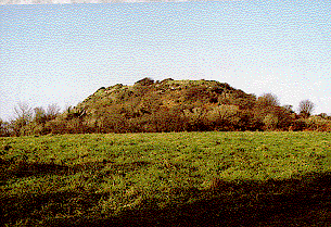
Contact Us
close slider