

Castlerigg stone circle is one of the oldest and most scenic megalithic monuments in Britain, dating back to the late Neolithic period, around 3000 BC
Castlerigg stone circle is one of the oldest and most scenic megalithic monuments in Britain, dating back to the late Neolithic period, around 3000 BC
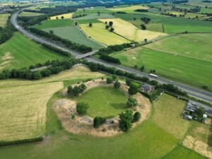
Mayburgh Henge is a remarkable prehistoric monument located near Eamont Bridge in Cumbria, England. It consists of a massive circular bank of river cobbles, enclosing a flat area with a single standing stone near the centre.
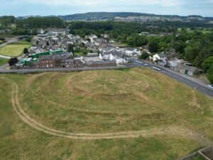
King Arthur’s Round Table is a Late Neolithic Henge (2000-1000 BCE). It consists of a low circular platform surrounded by a wide ditch 12m wide by 1.5m wide , this configuration of a bank and ditch being a characteristic of these prehistoric henges.
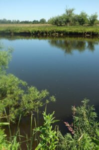
Newton Kyme Henge occupies a slight rise on the south bank of the River Wharfe immediately west of the village of Newton Kyme (OS grid SE 45945 44982), its maximum external diameter extending to around 250 m (heritagegateway.org.uk). The monument is best understood as a Class IIa henge of Late Neolithic–Early Bronze Age date, defined by three concentric ditch circuits with a turf-and-earth bank wedged between the inner and middle ditches.

Those of you who are fans of Bernard Cornwell will know Whitley castle from his latest book: those of you who know their Roman stuff will know it as Epiacum Fort: and those who really know their stuff will know it’s the most complex set of defenses in the Roman world
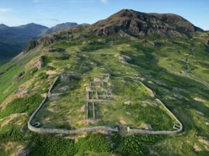
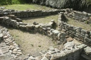
Hardknott Roman Fort, laying strewn like a discarded child’s toy on the high mountain side, impossibly canted to the east and perched precariously on a rugged cliff edge. Known to its builders as Mediobogdum, the fortress is square, as opposed to the usual rectangular shape. It is 115m to a side, and we have the traditional four gates. These are even today over head height.

An interesting heading in Robert Morden’s map of Lancashire (1695) places “The Brigantes” in Lancashire. Worth investigating to try to understand exactly what Robert Morden was trying to portray here.
A henge at Nunwick visible both as a low bank and shallow internal ditch and as a cropmark. A berm was originally present between ditch and bank.
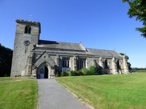
All Saints Church in Rudston sits in the grounds of the famous Rudston Standing Stone, this alone clearly points to the area being of ritual use thousands of years before this Norman church was erected.
The fort at Piercebridge guarded access to the Main north-south crossing of the River Tees in Roman times, a sizeable vicus grew up on it’s eastern side towards the earliest crossing point.
 NLS Map Explorer
 Google Earth
 Google Maps
 Lidar Finder
 TMA
TMA
 Megalithic Portal
 Yorkshire Arch. Air Mapping
 ADS
ADS
 Brigantian Adventure FB Group
Stone Bothering FB Group
Stone Faces FB Group
Brigantian Adventure FB Group
Stone Bothering FB Group
Stone Faces FB Group
 Heritage Gateway
 ARCHI® MAPS: UK
 Atlas of Hillforts
 Portable Antiquities
 British History Online
Brigantes Nation FB Group
British History Online
Brigantes Nation FB Group

