Notice: Function WP_Scripts::add was called incorrectly. The script with the handle "datatables-responsive" was enqueued with dependencies that are not registered: datatables. Please see Debugging in WordPress for more information. (This message was added in version 6.9.1.) in /home/u621095157/domains/brigantesnation.com/public_html/wp-includes/functions.php on line 6131
"We were shocked to discover such a huge complex," said Alastair Oswald, archaeological field investigator for English Heritage. Preliminary examinations Read more
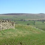
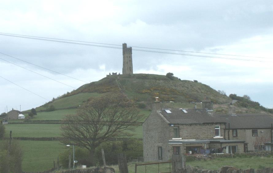
This small farmstead was established on top of the small chalk hills on the northern edge of the Yorkshire Wolds.
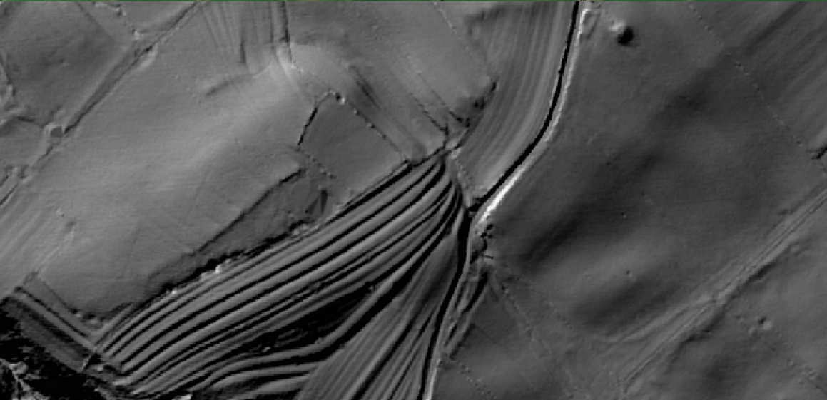
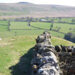
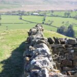
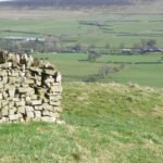
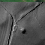
Flats Hill mound is approximately 30 meters in diameter and stands about 3.6 meters high. It has never been excavated, although a dry stone wall seems to have been started, and then stopped, partly over its top. It has been suggested as, and is listed as a probable Barrow, with a presumably wide date, likely to be in the Bronze Age or Iron Age date range.
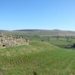
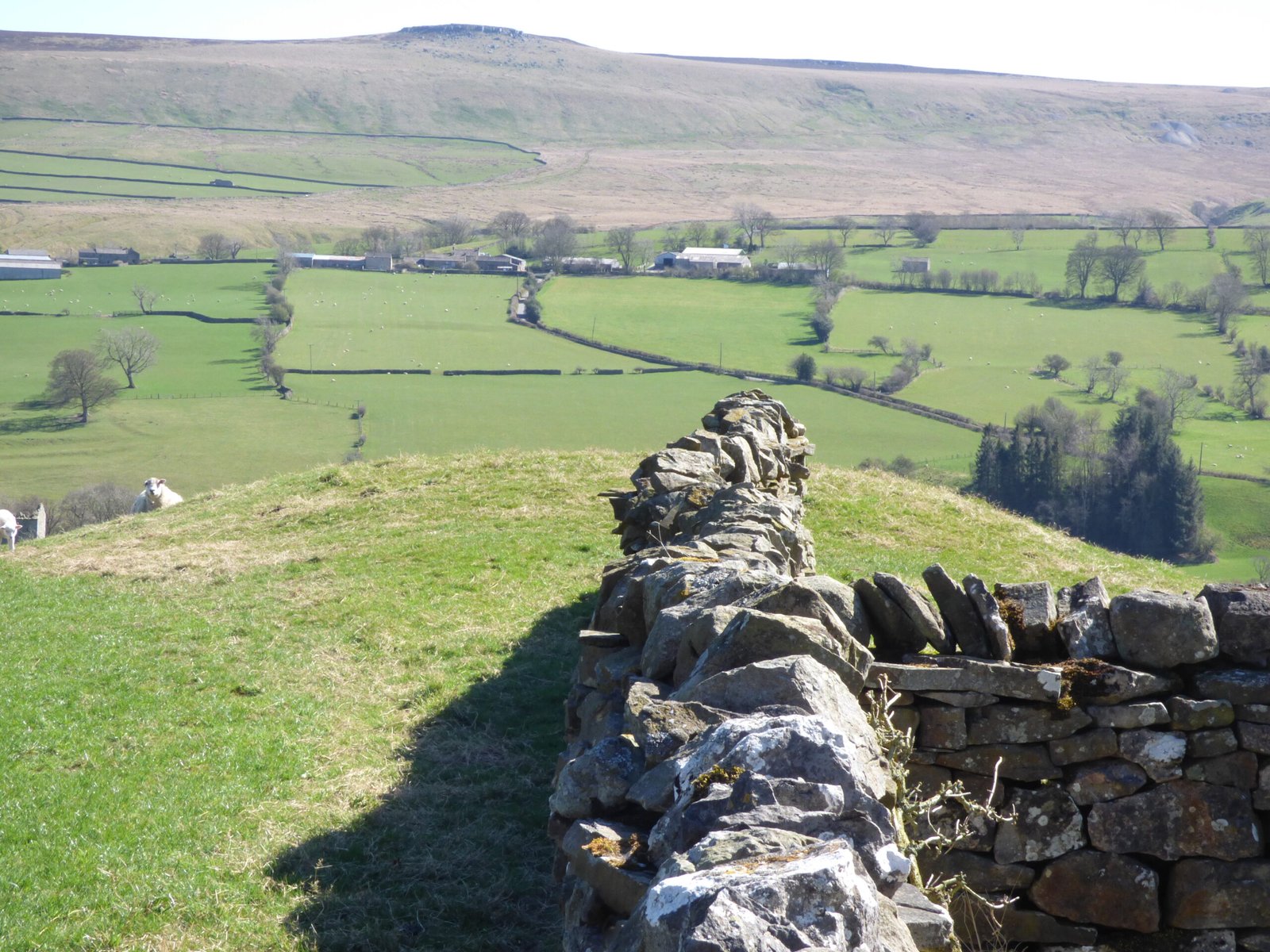
LiDAR imaging shows that this barrow is broadly circular, and has a flat top. It is next to the road, and is also an entry point to a footpath, however, in spring and early summer, you should expect this field to have lambs. They won't appreciate your intrusion. In the wider perspective, the mound can be seen to have a relationship with the terracing immediately to the east of it, also, to the Round Hill Mound, which I suggest probably was not a Motte, and is more likely to have been a barrow. However, there is also a possibility that these cultivation terraces and ridge and furrow workings, which are often very deep with furrows, which can no longer be used to grow crops, may have been part of an elaborate defensive structure. If one imagines attack from the river.
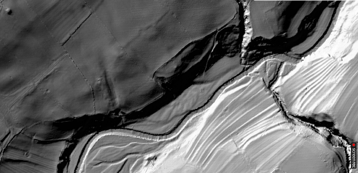
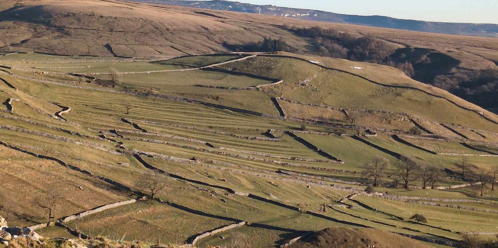
Immediately to the west of Flats Hill are some very impressive and unusual terrace works. These follow the road round towards Gammersgill, and proximity, plus recent archaeological evidence suggesting a more significant relationship between ancient plough marks and Barrows at Catterick serve to suggest we need to hold this structure in mind, when trying to understand the influences of contemporary and later landscape planning.
Furthermore, recent work in the Cheviots has shown that terraces in Northern England can be of Bronze Age origin. While I am far from suggesting that this is a Bronze Age landscape. Given there are no archaeological dates for any of the features here, one needs to keep an open mind.
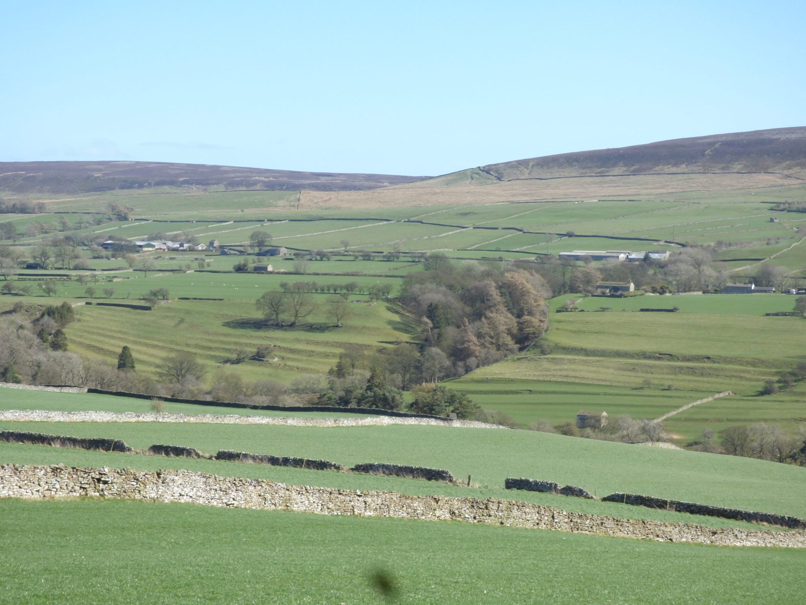
Another interesting relationship, is that with the West Scrafton terraces on the other side of the valley, towards the north-east. The nature of the Coverdale valley, especially here, is that it is very easy for very large things to be hidden, in times without satellite and aerial observation.
The West Scrafton Earthworks, for example, are only visible from the road, after you have passed through Carlton, and are dropping down the final inclines of Pen Hill on the way to the bridge over the river Cover. Thus, anyone wishing to come and inspect or admire those flowing lines of banks at West Scrafton, would want to make a B-line for this location.
HE Entry
Probable Barrow, Flats Hill
Description: Flats Hill. (1) Prominently situated in arable land on a south-east facing slope overlooking the River Cover, a turf covered, flat-topped, earthen mound 16.5m diameter and 1.5m maximum height. The mound is not a natural feature and is probably a tumulus. Published survey (1;2500) correct. (2) MORPH reference. (3) The site is visible on the 2002 digital aerial photography as a roughly circular, turf covered earthwork mound. (4)
Country: England
County: North Yorkshire
District: Richmondshire
Parish: Carlton Town
Grid Reference: SE064843
Map Reference: [EPSG:27700] 406426, 484368
Period: -2350 - -701, BRONZE AGE
Subject: BARROW
Intervention Type: FIELD OBSERVATION (VISUAL ASSESSMENT)
Identifiers: [ADS] Depositor Id: MYD4489 [ADS] Associated Id: National Monuments Record SE 08 SE 7 [ADS] Associated Id: Monarch UID 48738 [ADS] Import RCN: YDNPA13-MYD4489


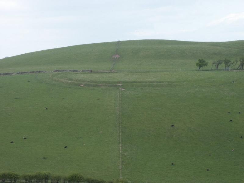


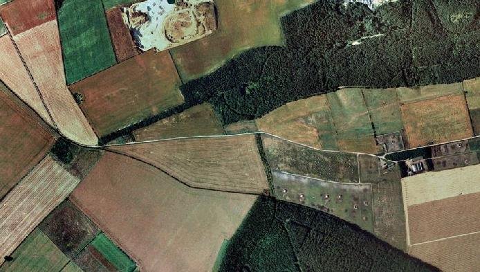
 Flats Hill mound is approximately 30 meters in diameter and stands about 3.6 meters high. It has never been excavated, although a dry stone wall seems to have been started, and then stopped, partly over its top. It has been suggested as, and is listed as a probable Barrow, with a presumably wide date, likely to be in the Bronze Age or Iron Age date range.
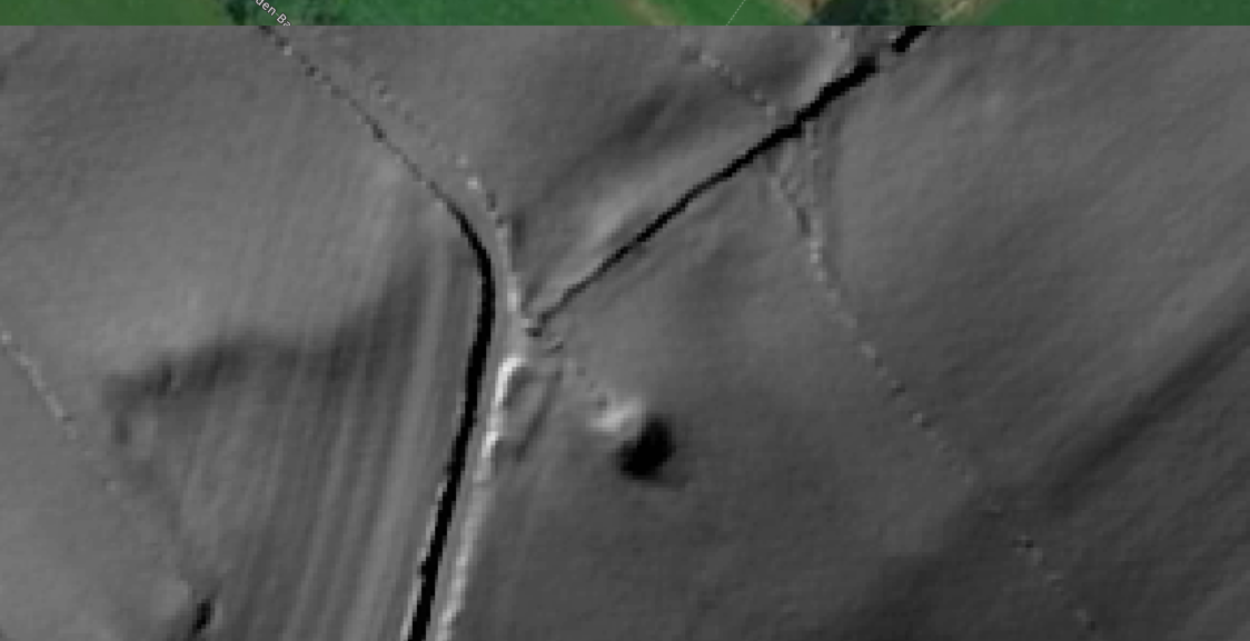
 In the wider perspective, the mound can be seen to have a relationship with the terracing immediately to the east of it, also, to the Round Hill Mound, which I suggest probably was not a Motte, and is more likely to have been a barrow. However, there is also a possibility that these cultivation terraces and ridge and furrow workings, which are often very deep with furrows, which can no longer be used to grow crops, may have been part of an elaborate defensive structure. If one imagines attack from the river.