Notice: Function WP_Scripts::add was called incorrectly. The script with the handle "datatables-responsive" was enqueued with dependencies that are not registered: datatables. Please see Debugging in WordPress for more information. (This message was added in version 6.9.1.) in /home/u621095157/domains/brigantesnation.com/public_html/wp-includes/functions.php on line 6131
Anglers and canoeists still talk of “Roman Ford” on the Swinton fishing beat immediately upstream of Mickley (turn4search0) and the Read more
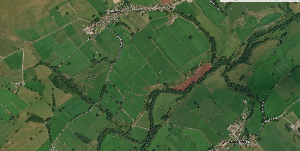
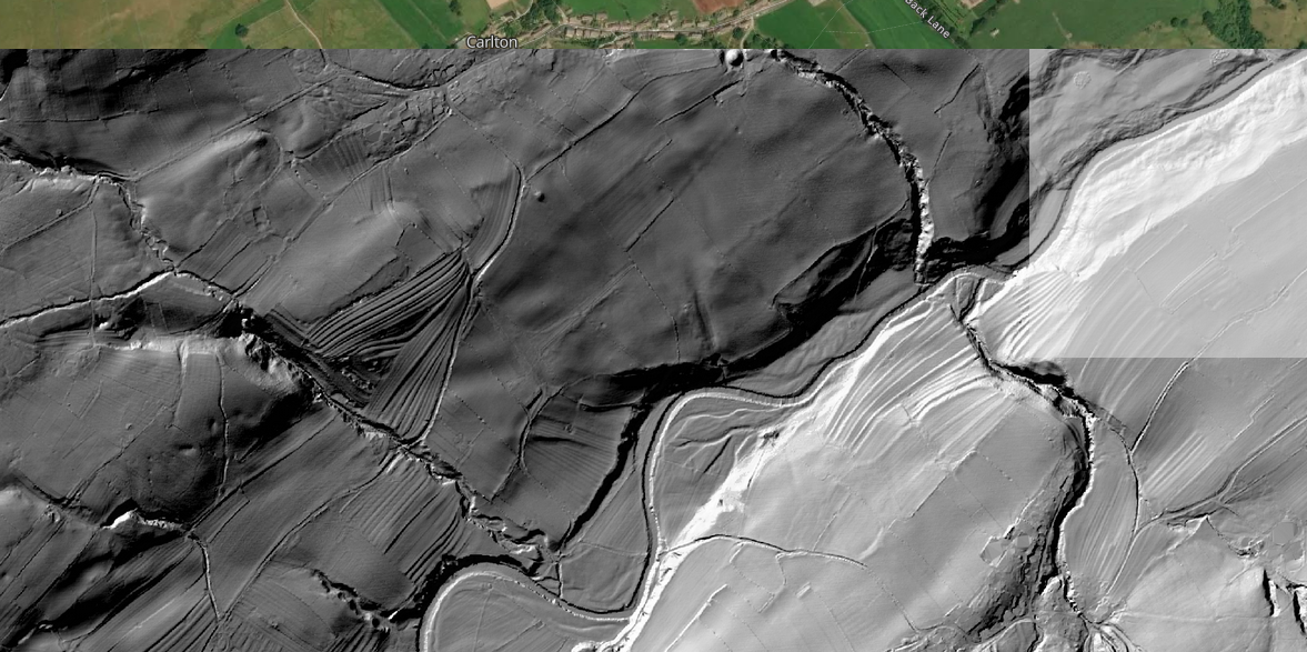
Carlton Castle, or Round Hill Motte, at Carlton-in-Coverdale is an intriguing historical site that offers a glimpse into the medieval past of the Yorkshire Dales. The structure seems related to an extensive set of linear Earthworks that have been interpreted as agricultural, however, their existence asks a question: if these are not older than this medieval interpretation.
Overview
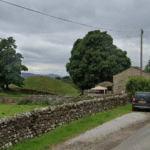
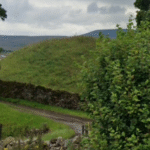
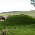
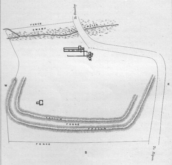
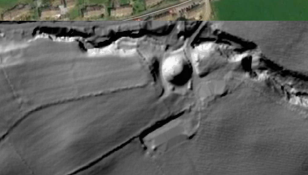
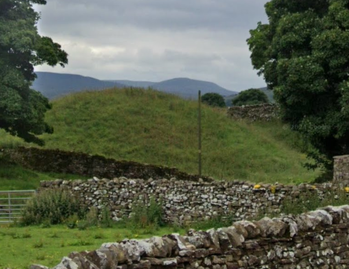
The motte is an earthen mound, a common feature in medieval fortifications. It measures approximately 32 meters in diameter and stands about 3.7 meters high. The motte was constructed using earth from the surrounding ditch, which adds to its historical significance as a defensive structure. Historical Context The motte is believed to date back to the late 11th century, likely founded by Ribald de Rufus, a notable figure of that era. Mottes were typically built as part of a castle complex, serving as a fortified residence for local lords and a defensive position against invaders. This motte seems to have so far been treated in isolation, and little work has been done to plot that original defended area of the motte. As a potential defended position, this is too slight to be any form of significant fortification, and is more likely to either have been perhaps a watchtower, or perhaps this is and older Barrow. Two further mounds are in the vicinity.
Location
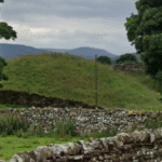
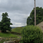
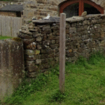
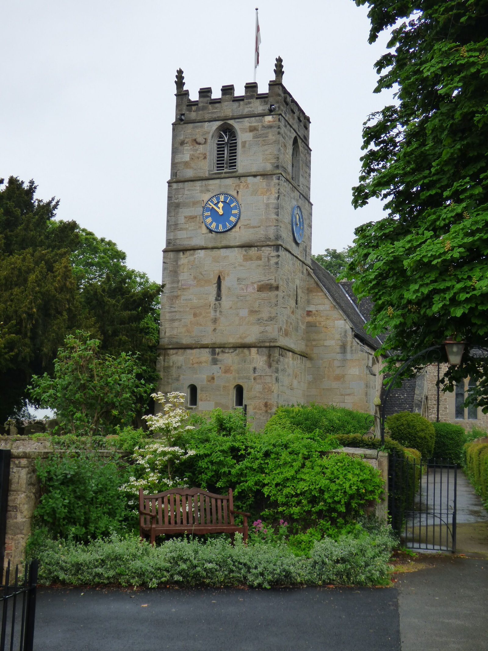
The motte is located at the back of the Foresters Arms Inn, making it somewhat easy to overlook if you're not specifically looking for it. Despite its historical importance, it can be easily missed by visitors, so local guidebooks often highlight its presence.
Relationship with Flats Hill mound
At the very opposite end of the same field that the Motte is located in, there is another mound, Flats Hill, which is smaller, and less regular in its appearance., simply because it offers one of a very few good positions to view the West Scrafton Terraces. This Mound seems to also have a specific linear earthwork connecting it and the Motte, it's strategic potential, and connection to the motte is therefore a distinct possibility.
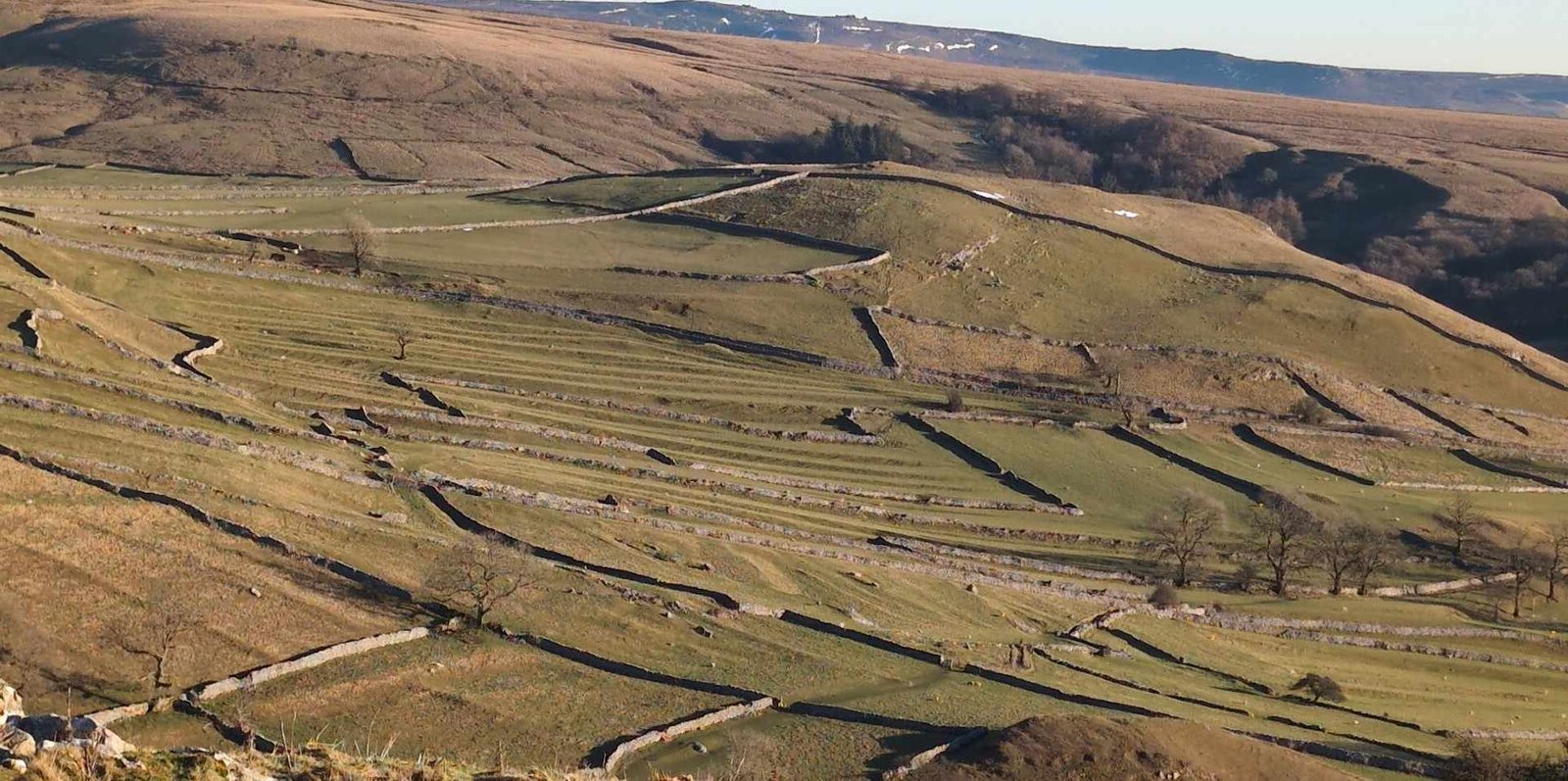
Relationship to crop marks, ridge and furrow, and terracing
The Motte hill appears to be related to two sets of linear plough marks, radiate away from it. One set, ultimately, heads south, to the river Cover and potentially continue further to link up with another set of significant terraces further east along the river at Caygill, close to West Scrafton. The other set head to the river, but then swing dramatically westwards, and seem to link with other significant terraced earthworks at Turnbeck Bridge, but may continue further, to Gammersgill.
A motte consisting of an earthen mound about 32.0m diameter and 3.7m high constructed from the spoil of a surrounding ditch (1.6m deep and 4.1m average width) with the steep slopes of a stream forming the north side. The top is relatively flat 9.0m in diameter with a slight downward slope towards the north, north-west. About 2.0m north-west of the centre, two apparently dressed stone blocks protrude through the turf. (PastScape ref. Field Investigators Comments–F1 AGM 22-AUG-77)
No date or purpose has been assigned to the small steep motte and bailey at Carlton in Coverdale, but it was probably an outpost of Middleham either thrown up during the anarchy of Stephen's reign or intended as an advanced warning post while Middleham was under construction and the threat of Scottish raids were still high. The two main danger periods were 1138 and 1174 when the Scots raided into Yorkshire and burnt some castles. (Butler 1994)
If Round Hill behind the 'Foresters' Arms' in Carlton is a Norman motte (as shown on the Ordnance Survey 1: 25 000 map) it would be an outlier intended to support the fortification on William's Hill, providing a further means of controlling the track to the head of Coverdale and over the watershed to Wharfedale. However, Round Hill seems small for a motte, and its top is not flat but rounded. It seems more likely to be a prehistoric burial mound, but there has not been any archaeological excavation to determine its origins. (Joynes 2006)


 Carlton Castle, or Round Hill Motte, at Carlton-in-Coverdale is an intriguing historical site that offers a glimpse into the medieval past of the Yorkshire Dales. The structure seems related to an extensive set of linear Earthworks that have been interpreted as agricultural, however, their existence asks a question: if these are not older than this medieval interpretation.
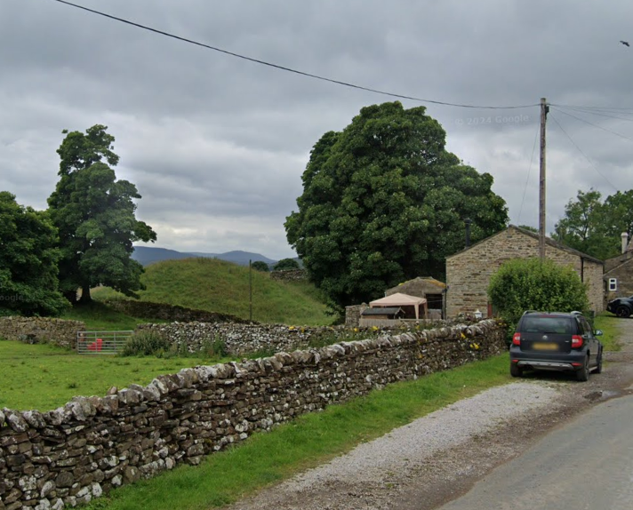
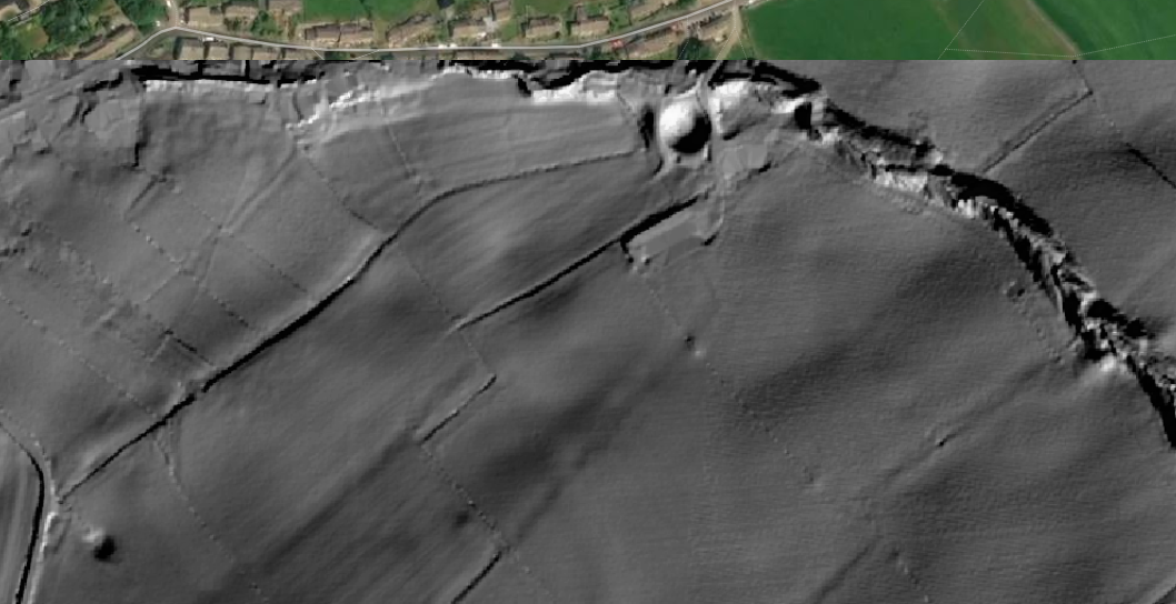
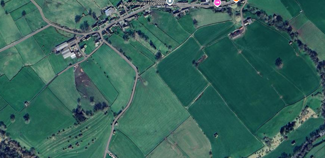
 The other set head to the river, but then swing dramatically westwards, and seem to link with other significant terraced earthworks at Turnbeck Bridge, but may continue further, to Gammersgill.