Category: Archaeological Periods

Tor Dyke

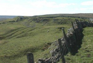
Tor Dyke appears to have been attributed to Venutius which dates it of the period AD 52 – 70. The presence of a legionary size marching camp a few miles to the southwest at Malham certainly indicates an active role in the Roman advance of AD 70. However, given the lack of published research so far a clear picture has yet to emerge.

Prehistoric mounds, cairns and boundary earthworks in Coverdale

Cairn atop Little Whernside

A gazetteer of probable prehistoric mounds, cairns and boundary earthworks in Coverdale. It is not complete and is still being researched.

Castle Dykes Henge, Thoralby – North Yorkshire

With kind permission of YAAMAPPING

Castle dykes it is a small class one henge, 90m across, perched on the high ground up in the North Yorkshire dales. The bank survives up to 1.5 m high in places, and the ditch up to 3 m deep. Early 20th-century reports (1908) noted its intact form, and recent LiDAR-based surveys have confirmed its classic henge profile with minimal later disturbance.

Guide: Ritual/Ceremonial Mounds

Marlborough mound 20240518 looking southwards

These are raised platforms created first and foremost for cult, procession, assembly or conversion—not for fortification or routine boundary-making. They tend to be much more significant and monumental than other mounds and raised platforms. Some are the largest structures known of their type. In Britain, possibly the best known example is Silbury Hill in Wiltshire.

Guide: Barrows

royal kurgans barrow, interior

A barrow is a mound of earth and/or stones raised over a grave or group of graves. Used from the Neolithic through to the Iron Age (roughly 4000 BCE to 500 CE), barrows were often constructed to honour elite individuals, such as tribal leaders, warriors, or chieftains. They are frequently found singly or in cemeteries known as barrow fields.

Guide: Classification of Henge Monuments

Avebury Landscape

Archaeologists use the word “henge” for later-Neolithic and earliest Bronze-Age earthen rings whose ditch lies inside the bank, creating a deliberately bounded interior. The term itself was coined in 1932 by Kendrick; it was refined in the 1950s by Richard Atkinson, whose system still frames most discussion.

Drumanagh Promontory Fort – First Ever Intact Roman Pot Found in Ireland

Roman samian ware

RTE Ireland has reported that more recently they have made yet another remarkable discovery—an intact Roman pot. the first one to be uncovered on Irish soil, and providing more tantalising clues about ancient Roman-Irish interactions.

Although the Roman Empire they never reached Ireland (except, seemingly, in myth). That does not mean, that Roman influence and goods did enter Ireland, and it means that Drumanagh continues to headline as one of Irelands most tantalising archaeological sites for that same reason – exactly what were the Romans doing in Ireland?

Moulton Henge

Moulton Henge - 1m Lidar

Archaeologists now recognise a true Neolithic henge lying immediately south-west of Moulton village, roughly midway between the Swale and Dere Street. The monument is almost 200 m across, with a low earthen bank encircling an inner ditch and a central platform about 110 m wide; the ditch lies inside the bank—the classic “Class II” henge arrangement.

Knockfarrel Fort

Knock Farril

This had substantial ramparts made of stones with a timber frame, enclosing a large area and making good use of the natural defences of the hill-top.

Mote of Mark Hill Fort

Mote of Mark from sea shore path

The Mote of Mark is a defended hilltop overlooking the Urr estuary. It was the court or citadel of a powerful Dark Age chieftain, possibly one of the princes of Rheged. The site was occupied during the 6th century and appears to have been destroyed by fire in the 7th century.

Contact Us
close slider