The recent discovery at Catterick has unveiled a significant Late Neolithic palisaded enclosure, shedding light on the prehistoric landscape of Read more
The one thousand years between 3,000 and 2,000 BC saw the Vale of Mowbray’s most significant period of development. It Read more
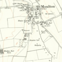
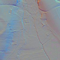
Moulton Henge - 1m LiDAR - National Library of Scotland
Moulton Henge
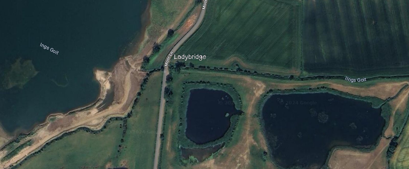
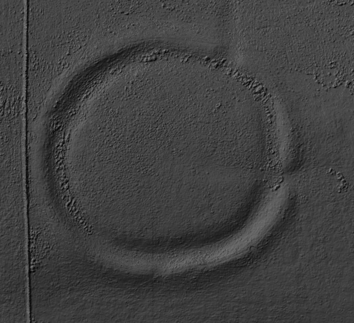
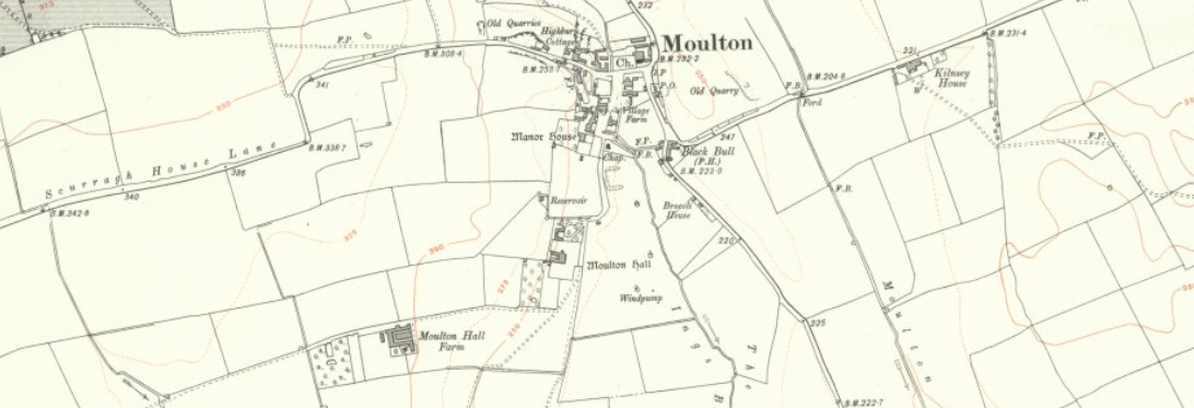
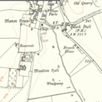
Archaeologists now recognise a true Neolithic henge lying immediately south-west of Moulton village, roughly midway between the Swale and Dere Street. The monument is almost 200 m across, with a low earthen bank encircling an inner ditch and a central platform about 110 m wide; the ditch lies inside the bank—the classic “Class II” henge arrangement.
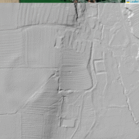
Moulton Henge - OS Series 1 - National Library of Scotland
Moulton Henge - OS Series 1 - National Library of Scotland
Description
Two opposed entrances are visible, the northern one especially clear, and a faint outer ditch skirts the south-west sector. Most of this had gone unnoticed on the ground because medieval house platforms, a moated manorial site and later ridge-and-furrow were draped over the prehistoric Earthwork, but Environment Agency LiDAR data examined in 2016 picked out the full circular plan and prompted Historic England’s detailed reassessment. The site has been scheduled since 2001 as “Moulton Neolithic henge, medieval settlement, field system and moated site,” with the henge element formally acknowledged in the 2021 amendment. (historicengland.org.uk, historicengland.org.uk)
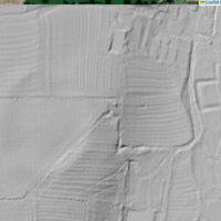
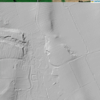
Moulton Henge - 1m Lidar - National Library of Scotland
Moulton Henge - 1m Lidar - National Library of Scotland
No Excavations yet
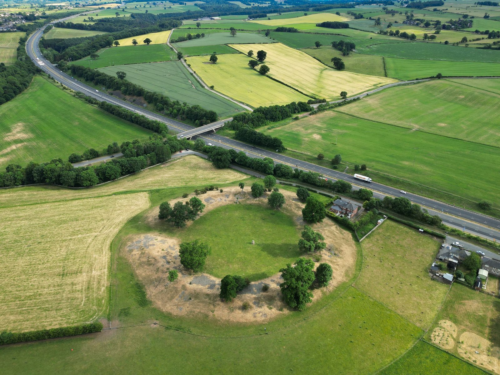
No excavation has yet been undertaken, so dating rests on morphology and comparison. In size, layout and siting on a gravel terrace the ring matches other late-Neolithic monuments in the Swale–Ure lowlands such as Catterick, Nunwick and the Thornborough trio. All of these share a north–south axial alignment that appears to echo the line later taken by Dere Street and, much later, the Great North Road. The idea that Moulton forms one more node in this long ceremonial corridor is strengthened by discoveries made during the A1 (M) upgrade a few kilometres to the north, where excavations revealed a huge late-Neolithic double palisaded enclosure at Marne Barracks and scattered contemporary pits and burials along the new carriageway.
Research Summary
Beyond the LiDAR plotting and rapid earthwork survey, research has consisted of desk-based mapping and walk-overs; no artefacts have been recovered from secure contexts and no geophysical survey has yet been published. Even so, the monument’s protected status means its buried ditch fills should preserve charcoal, pollen and, potentially, structural post-ring trace, offering the prospect of firm dating and insight into the activities that once took place on the 110 m arena floor. The henge is now recognised as a scheduled Neolithic henge that anchors Moulton in the same prehistoric landscape story as its better-known neighbours at Thornborough and Catterick. (teessidepsychogeography.wordpress.com)
A silver Medieval half groat of Edward IV, first reign, light issue, type IX dating to 1464-1470. Rose initial mark and trefoils by neck of obverse bust. Canterbury mint, royal issue. As North 1589. [...]
A fragment of a Roman copper-alloy brooch, interpreted as a trumpet derivative of Wroxeter type, dating to AD 75-200. The surviving element comprises the head, upper decorative projection and a reduced bow/foot. The head is box-like [...]
A fragment of a cast copper alloy Anglo-Saxon brooch, probably a radiate-headed type dating from the mid sixth century AD. Only the foot plate remains; this is triangular with flanking knops at the junction with [...]
A Medieval silver penny of Edward II (AD 1307-1327), Withers Type 30, North Class 11, not further defined,dating to AD 1310-1314. Mint of London: Ref: Withers and Withers 2001: 32. [...]
An incomplete Post Medieval copper-alloy rowel spur dating to circa AD 1600-1700. The spur consists of a small portion of both arms - terminating in old breaks - neck, and rowel box. The box is projects from the upper [...]
A complete Medieval to Post Medieval lead-alloy loom weight dating to circa AD 1200- 1800. It is circular in plan and rectangular in section. It has a central hole of 10mm in diameter. Weights of this [...]
An incomplete Medieval copper-alloy buckle dating to circa AD 1250-150. The extant piece consists of the pin, likely from an annular buckle.The pin shaft is rectangular-sectioned. It has a loop at one and tapers into [...]
A complete Medieval to Post Medieval signet ring dating to circa AD 1400-1600. The ring comprises a broadly circular hoop with expanded sub-oval bezel when viewed from underneath. The shoulders and hoop are plain. The hoop [...]
An incomplete Medieval copper-alloy buckle dating to circa AD 1350-1550. The surviving piece consists of the frame. It is circular in plan with a central offset bar creating two D-shaped loops. The frame is plano-convex [...]
A near-complete Late Iron Age to Roman copper-alloy Colchester brooch dating to circa AD 40–70. The brooch is T-shaped in form, comprising a transverse head of flat wings and a long, tapering bow. The wings are [...]
A cast copper alloy hooked fitting of Medieval date. The rear end has a flat attachment tab with a rivet at the centre. In front of this is a moulded zoomorphic collar in the form [...]
A Roman copper-alloy nummus of the House of Constantine (AD 306-364) dating to circa AD 318-324 (Reece Period 16). BEATA TRANQVILLITAS reverse type depicting altar inscribed [VOT/IS/XX]. Unclear mint. [...]
An incomplete copper alloy toilet set of Medieval date comprising a rectangular blade from a pair of tweezers, which tapers in profile to a to a wedge shaped terminal. The other blade has broken off and the [...]
A decorated rectangular cast copper alloy plate from a late Medieval composite strap end. The plate has broken into two portions; the rear edge is incomplete and the terminal is rounded. The facing side of [...]
An incomplete large early Neolithic leaf shaped arrowhead struck from a brown flint. The arrowhead is broadly "kite" shaped with symmetrical convex sides (cf. Butler (2005), p 123, Type 2C) and has been bifacially worked [...]
Two fragments from a late Medieval to early Post-Medieval copper-alloy purse bar, dating to AD 1450 - 1550 and of Williams class A1. One arm and the loop remain. The arm has a globular terminal with a waisted [...]
An Iron Age continental cast copper alloy potin of the east central Gaulish region (eastern France, Germany and Switzerland) possibly attributable to the Sequani. Obverse: large head, left (potin à la grosse tete). Reverse: horned [...]