
← World Heritage Arka Unskel hillfort, Highlands Arka Unskel is 2½ miles ESE of Arisaig at NM693839 and has also been known as Arisaig Fort, Ard Ghaunsgoik Read more Castle Hill, Almondbury Castle Hill’s imposing silhouette hides a great prehistoric fort, Norman castle and Victorian tower. Thanks to Varley’s trenches and the Read more West …
Blog Archive
East Yorkshire
East Yorkshire’s Middle-Iron-Age story stands out in Britain because the communities who farmed the chalk of the Yorkshire Wolds developed what archaeologists call the Arras culture: a distinctive blend of continental La Tène fashions and local invention that is visible above all in their cemeteries. Three elements make it special.
Lancashire
← World Heritage Arka Unskel hillfort, Highlands Arka Unskel is 2½ miles ESE of Arisaig at NM693839 and has also been known as Arisaig Fort, Ard Ghaunsgoik Read more Castle Hill, Almondbury Castle Hill’s imposing silhouette hides a great prehistoric fort, Norman castle and Victorian tower. Thanks to Varley’s trenches and the Read more West …
South Yorkshire

The county of South Yorkshire
North Derbyshire
The transformation of North Derbyshire from 50AD to the present is a fascinating journey through time, reflecting broader historical shifts in Britain. Initially, during the Roman conquest of Britain, Derbyshire fell under the influence of the Roman Empire, becoming part of the province of Flavia Cæsariensis.
Northumberland

The county of Northumberland, with its rich tapestry of history, has undergone significant transformation since 50 AD. Initially, under Roman occupation, Northumberland was a frontier zone, where Hadrian’s Wall marked the edge of the Roman Empire. Post-Roman Britain saw the region become a part of the Anglo-Saxon kingdom of Northumbria, a name meaning ‘north of the Humber’, reflecting its vast expanse.
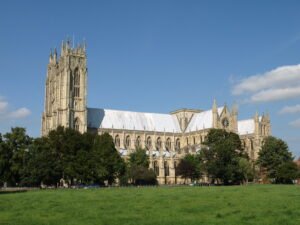
Eboracum, York
Eboracum was the Roman capital of Northern England
Devil’s Arrows

This Bronze Age site comprises of three large standing stones, it is thought originally there were as many as five stones in this alignment. Being Bronze Age little is known about the origin of the Devil’s Arrows, the name reflecting a more recent myth. The monument is strongly linked with an alignment with several others covering a line of over 50 miles and heading north south through North Yorkshire.
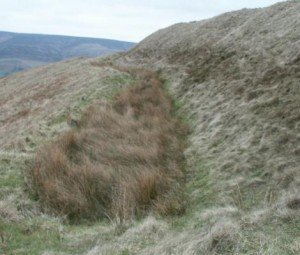
Catterick Roman Fort
The Fort at Catterick. It has an unusual shape due to multiple fort plans being overlaid on it. Originally, it was a Roman fort, but a settlement soon sprang up outside the fort, which soon dominated the fort, and Catterick became one of the most important ‘Small towns’ in the north of Britain.
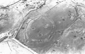
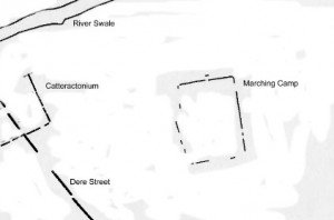
Catterick Roman Marching Camp
Discovered only recently by air survey and geophysics, this camp lies on the alluvial plain of the River Swale, on the south bank of the river just north-east of Catterick racecourse. The camp lies some 350m to the west of Dere Street.
Research Links
 NLS Map Explorer
 Google Earth
 Google Maps
 Lidar Finder
 TMA
TMA
 Megalithic Portal
 Yorkshire Arch. Air Mapping
 ADS
ADS
 Brigantian Adventure FB Group
Stone Bothering FB Group
Stone Faces FB Group
Brigantian Adventure FB Group
Stone Bothering FB Group
Stone Faces FB Group
 Heritage Gateway
 ARCHI® MAPS: UK
 Atlas of Hillforts
 Portable Antiquities
 British History Online
Brigantes Nation FB Group
British History Online
Brigantes Nation FB Group

