Category: Britain

Kilburn White Horse

Kilburn White Horse

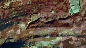
The Kilburn White Horse is a large chalk hill figure cut into the limestone of Roulston Scar, the steep escarpment that defines the western edge of the Hambleton Hills in North Yorkshire. Carved in November 1857 and measuring roughly 97 by 67 metres, it was conceived not as an ancient relic but as a deliberate Victorian creation

Castle Dykes Henge, Thoralby – North Yorkshire

With kind permission of YAAMAPPING

Castle dykes it is a small class one henge, 90m across, perched on the high ground up in the North Yorkshire dales. The bank survives up to 1.5 m high in places, and the ditch up to 3 m deep. Early 20th-century reports (1908) noted its intact form, and recent LiDAR-based surveys have confirmed its classic henge profile with minimal later disturbance.

Moulton Henge

Moulton Henge - 1m Lidar

Archaeologists now recognise a true Neolithic henge lying immediately south-west of Moulton village, roughly midway between the Swale and Dere Street. The monument is almost 200 m across, with a low earthen bank encircling an inner ditch and a central platform about 110 m wide; the ditch lies inside the bank—the classic “Class II” henge arrangement.

Vitrified Fort Sites

1930s photograph of Castle Hill

This page is a master placeholder for all vitrified fort sites in the Vitrified Forts section of Brigantes Nation.

Brigantes Tribe

Thornborough Henges c.2004

The name Brigantia represents three separate concepts: a goddess, a people, and a tribal federation. By the Roman period, the name represented a tribal federation compromising all of what would become the Roman province of Britannia Secunda, except for the Parisi territory, east of the River Derwent.

Coverdale: Nathwaite Bridge river crossing points

Fords and River crossings at Nathwaite Bridge Coverdale - Google satellite - Thanks to National Library of Scotland

Nathwaite Bridge, over the river Cover in Coverdale, is just about the only way any heavy traffic can easily cross between the key villages of Carlton and West Scrafton.  The importance of the location is perhaps underlined as the last place down the river Cover where it remains reasonably ford-able, and therefore crossable in past times when no closer bridge existed.

Nunwick Henge

River Ure southwest of Nunwick

A henge at Nunwick visible both as a low bank and shallow internal ditch and as a cropmark. A berm was originally present between ditch and bank.

East Yorkshire

Beverley Minster

East Yorkshire’s Middle-Iron-Age story stands out in Britain because the communities who farmed the chalk of the Yorkshire Wolds developed what archaeologists call the Arras culture: a distinctive blend of continental La Tène fashions and local invention that is visible above all in their cemeteries. Three elements make it special.

Catterick Henge

The henge at Catterick racecourse is an intriguing prehistoric site. Initially thought to be a Roman amphitheatre, it is now believed to be a henge, a type of Neolithic earthwork. Crop-mark mapping defined the henge, the 1990s rescue dig explained its mixed bank and cairn fabric, Roman-town excavations showed how much of it was levelled in antiquity, and the motorway programme set the site back into a much larger prehistoric landscape.

Maiden Castle Fort Reeth

For over five hundred years, the miners and smelters of Reeth produced mountains of precious lead. The lead ores from Reeth had high concentrations of Silver, Lead itself became and important ingredient in bronze. Maiden Castle, deep in the Swaledale lead mining territory a unique piece of Iron Age architecture. It is the only known fort with what seems to be a processional entrance.

Contact Us
close slider