Notice: Function WP_Scripts::add was called incorrectly. The script with the handle "datatables-responsive" was enqueued with dependencies that are not registered: datatables. Please see Debugging in WordPress for more information. (This message was added in version 6.9.1.) in /home/u621095157/domains/brigantesnation.com/public_html/wp-includes/functions.php on line 6131
These are raised platforms created first and foremost for cult, procession, assembly or conversion—not for fortification or routine boundary-making. They Read more
Hillfort mounds Hillfort mounds are elevated, man-made (or heavily modified) earthen platforms whose crests carry ramparts, palisades or stone walls Read more
The barrow east of Ulshaw Bridge – what is on record
Location
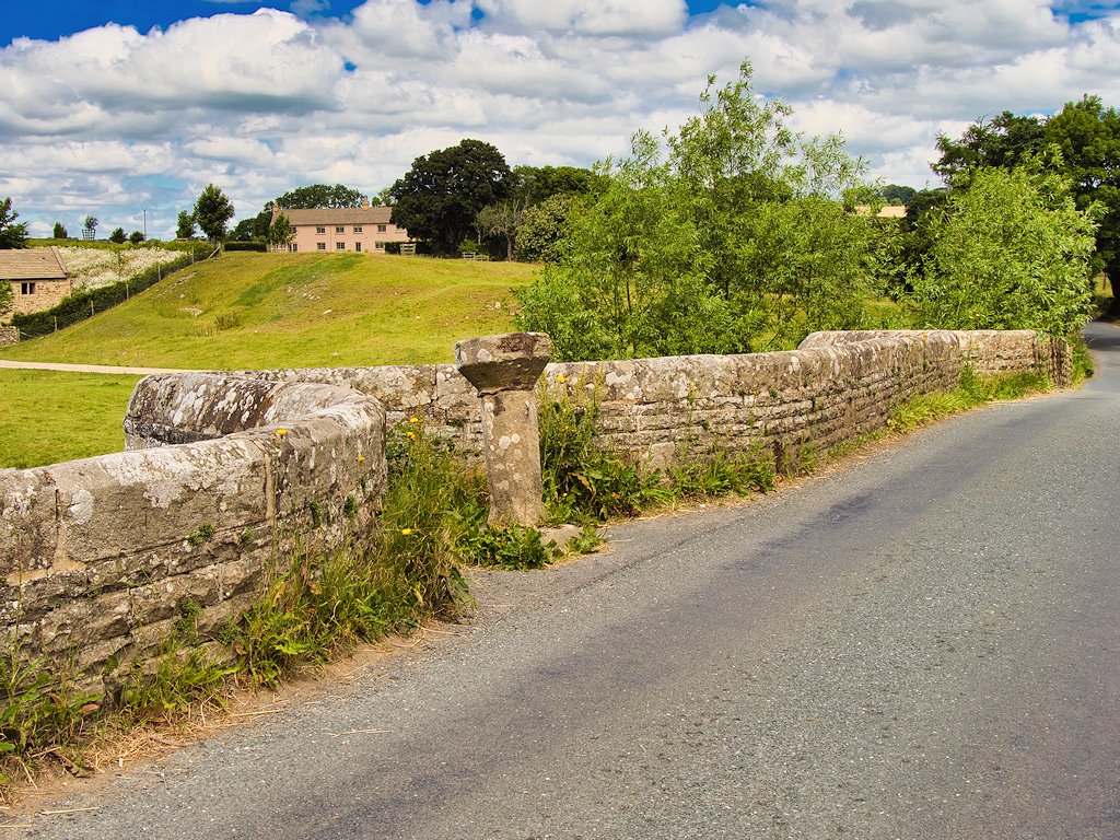
The mound sits on a low river-terrace just north-east of Ulshaw Bridge, about 120 m north-west of Spigot Lodge and roughly 230 m east of the bridge itself (National Grid c. SE 130 878). It overlooks the broad bend where the River Cover leaves its narrow upper dale and flows out towards Middleham and the Ure.
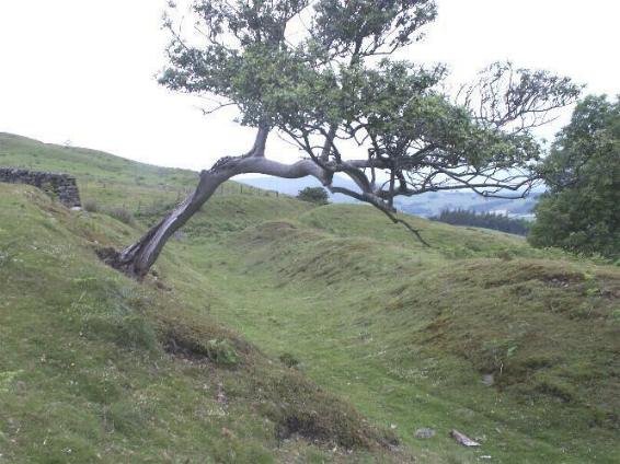
Appearance
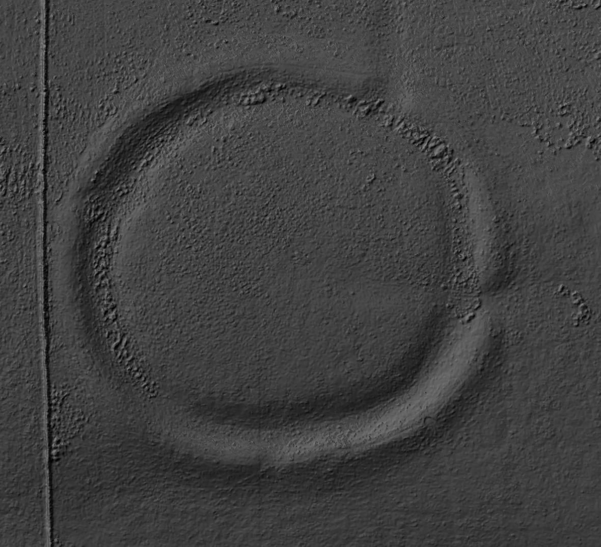
A grass-covered, roughly circular mound, about 17–20 metres in diameter, and just under 1.5 metres high at the crown. a slight surrounding depression marks the buried quarry-ditch from which the builders dug their material.
No structural stones or stones kerbs are visible on the surface, and there is no sign of later disturbance beyond a shallow track scar on the south-east edge caused by stock and farm vehicles.
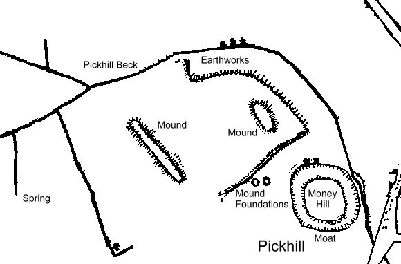
"This egg-shaped mound, possibly one of a pair, is on the north side of the River Ure, just over a kilometre east of Middleham. Like most of the other long mounds identified in Swaledale and Wensleydale it sits above the river flood plain on the landward edge of a natural bank of glacial Moraine which forms a prominent semi-isolated ridge on the north side of Ulshaw Bridge. 750m downstream the River Cover merges with the River Ure - the barrow therefore lies near the junction of a major side valley to the main river system, and shows similarities to Howraine in its landscape position. The bank of glacial moraine on which it sits shows clear traces of multi-period use, particularly in the area between the mounds and the lane." Yvonne Luke - NEOLITHIC LONG MOUNDS OF THE YORKSHIRE DALES
Date and purpose
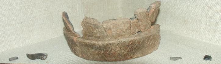
The form and siting match hundreds of other Late Neolithic / Early Bronze-Age Round Barrows (c. 2400–1500 BC) dotted along the flanks of the Yorkshire Dales. No excavation has been carried out, so any grave pit, cremation urns or grave goods that may survive are still sealed inside.
Why the place may have mattered
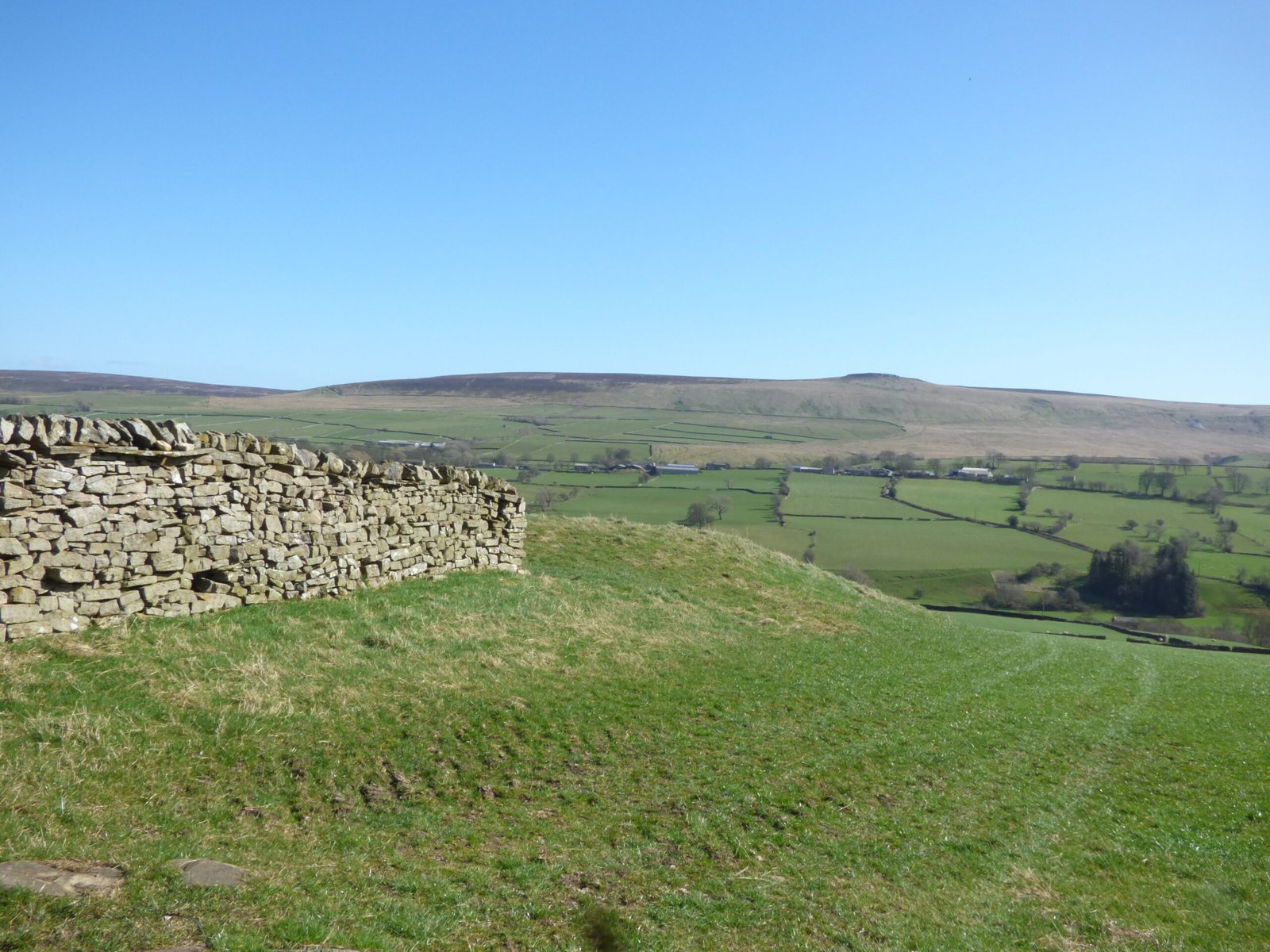
Commanding view: from the mound you can look straight up Coverdale and down towards the crossing of the Cover and the route to Middleham; it would have been a conspicuous marker for travellers and farmers alike.
Route focus: Ulshaw Bridge replaced an earlier ford, and a suspected Roman road from Bainbridge to Catterick passes within 300 m of the barrow line – the mound may have been reused as a way-marker long after its original funerary role was forgotten.
The mound is a Scheduled Monument (Historic England list entry “Round barrow 230 m east of Ulshaw Bridge”) which means ground disturbance, metal-detecting or sample-digging all require consent.
Reading it in the wider Coverdale landscape
This barrow is one of a few solitary markers in the lower dale – the main Bronze-Age cemeteries lie higher up on the Limestone moors, but its presence at the valley mouth shows the whole route was already threaded with burial monuments when later trackways and bridges were laid out.
Its survival helps link the Neolithic/ Bronze-Age ritual story of Coverdale to the medieval and later estate changes around Middleham and Coverham Abbey.
Rethinking the “Ulshaw Bridge barrow” as a possible Neolithic long-mound
Most guidebooks list the mound north-east of Ulshaw Bridge as a Bronze-Age Round Barrow. Yvonne Luke’s long-mound survey (unpubl. MSc, 2013) shows why that label may be wrong and why the site deserves a fresh, ritual-landscape reading.
What makes it look Neolithic rather than Bronze-Age
Shape – the mound is a stretched egg, c. 15 × 10 m, not a true circle. Several confirmed Neolithic long mounds in Wensleydale and Swaledale have exactly this squat, asymmetrical outline.
Orientation – the long axis runs NNW–SSE, matching Luke’s Howraine mound above the Swale and the Shaw Cote Scar mound near Hardraw. Bronze-Age round Barrows, by contrast, have no consistent orientation.
Setting on glacial moraine – the builders chose the inner edge of a natural gravel ridge that already stands above the floodplain. Other Dales long mounds—Howraine, Marrick Moor, Carperby—sit on the same kind of river-edge moraine, suggesting a shared rule of thumb: keep the monument dry, visible and close to water.
View and alignment – from the crest you look straight west to Penhill, the dominant fell in lower Wensleydale. Many early Neolithic mounds in Yorkshire frame a prominent skyline marker (Addlebrough for Shaw Cote; Fremington Edge for Howraine).
Taken together, those clues fit a small, possibly earthen long Cairn or Long Barrow of early Neolithic date (c. 3800-3400 BC).
The “second mound” on the same terrace
Eighty metres to the east Luke notes a broader hump whose summit carries what looks like a later round barrow. The lower bulk could be a natural knoll; if so, the barrow builder has exploited a ready-made rise—another common Neolithic tactic. Alternatively, the two mounds may be a deliberate pair: one elongated “founder” monument, one later round cairn added when the site was already ancient.
Wider parallels in Coverdale and the Dales
Howraine long mound (Swaledale): 20 m long, set above the confluence of the Swale and Arkle Beck—almost the same river-junction logic as Ulshaw at the Cover–Ure meeting.
Shaw Cote Scar (upper Wensleydale): oval, 18 × 12 m, perched on a moraine ledge with a view to Addlebrough; identical lop-sided base where one flank drops away.
Kidstones Pass mounds on Bishopdale Head: a pair of squat long mounds guarding the route between Wharfedale and Wensleydale, showing that Neolithic builders were happy to cluster monuments in twos and threes.
These sites, like Ulshaw, occupy liminal ground—on the edge of floodplains or at valley portals—places where travellers switch from one territory or watershed to another. The pattern hints that long mounds acted as welcome-points or warning beacons as much as tombs.
What this means for the Ulshaw landscape page you are building
Introduce the mound as “Ulshaw long mound 1” rather than “round barrow,” flagging the reinterpretation.
Note the Penhill sight-line and the Cover-Ure confluence to place it in the same ritual grammar as Howraine and Shaw Cote.
Mention the second, possibly modified, mound as an unresolved partner feature that may blend natural and artificial shaping—again a common Neolithic habit.
Emphasise that the multi-period traces on the moraine (field banks, trackways, perhaps later burials) show the ridge stayed important long after the first mound went up—continuity rather than replacement.
With that framing the Ulshaw mounds slot neatly into the emerging picture of early Neolithic route-markers across the Yorkshire Dales, while still leaving room for Bronze-Age or later reuse on the terrace.


 The barrow east of Ulshaw Bridge – what is on record
 Date and purpose


