An oppidum is the name given to a large population centre, with varying levels of fortification. So far, this concept Read more
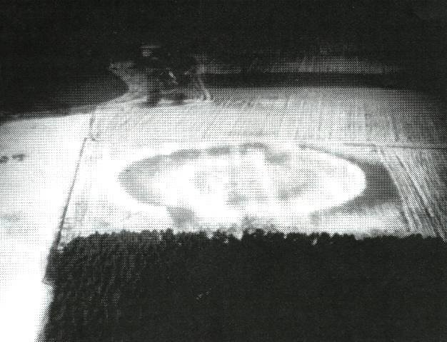
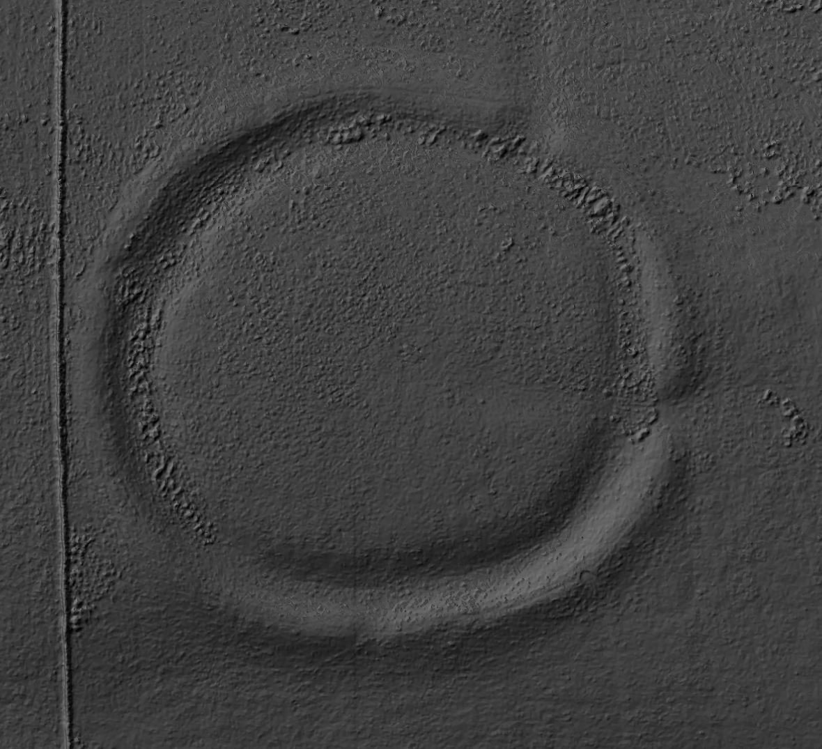
A henge at Nunwick visible both as a low bank and shallow internal ditch and as a cropmark. A berm was originally present between ditch and bank. Maximum external diameter is circa 210 metres. There are two opposed entrances visible on the north and south sides. Limited excavation was undertaken in 1961 by DP Dymond across the ditch and bank in the north-north-west sector. Within the ditch fill was a circular spread of burnt material, including many split and reddened stones. However, no artefacts or any other dating evidence were recovered. The site is scheduled. Three worked flints, two waste flakes and a scraper, all now in Yorkshire Museum, were found in the plough soil in the field to the southwest. This monument is visible as cropmarks and low Earthworks on historic and recent air photos and on LiDAR-derived images.
Images and text supplied by Tony Hunt, YAAMAPPING
Nunwick Henge
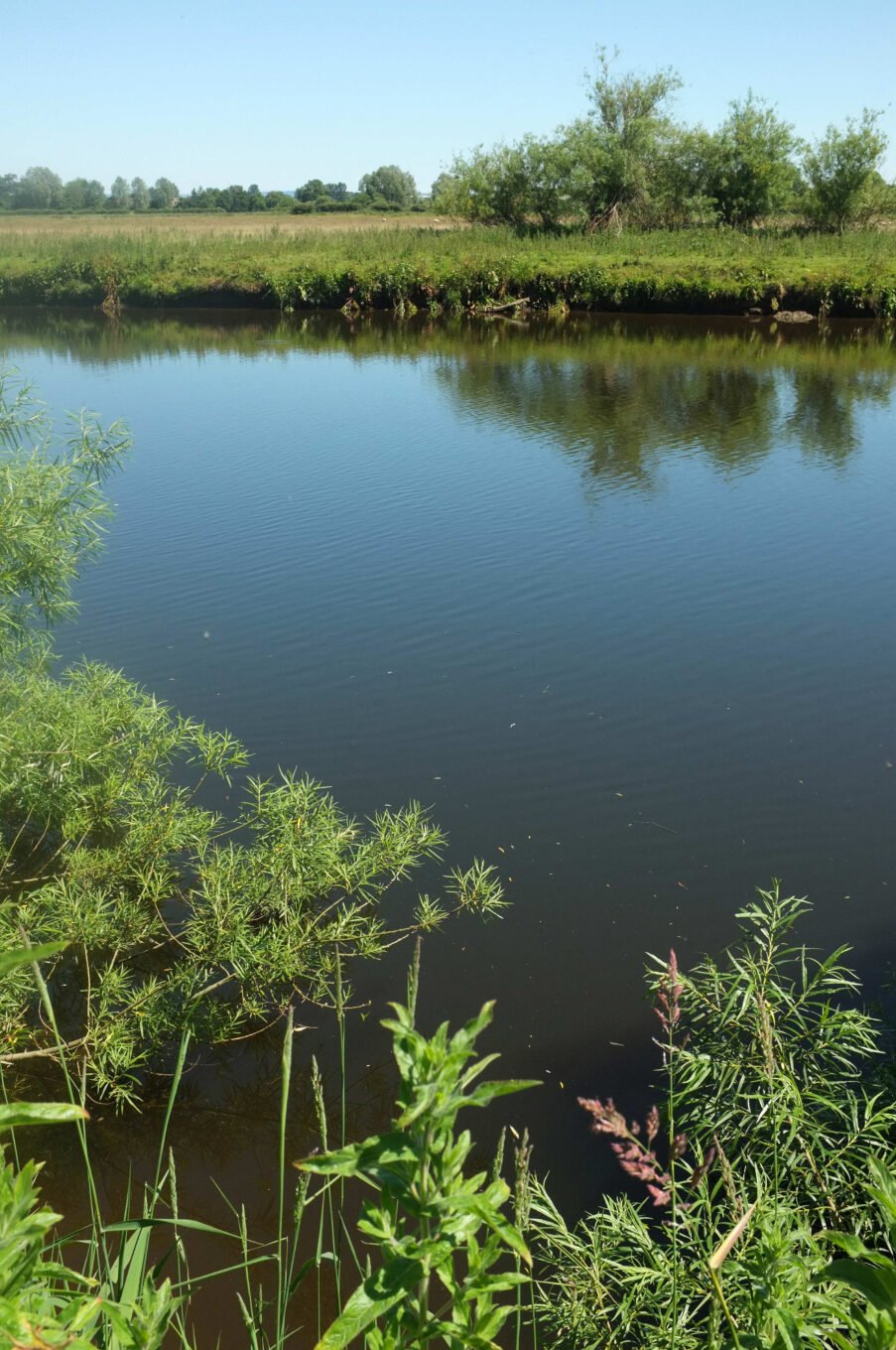
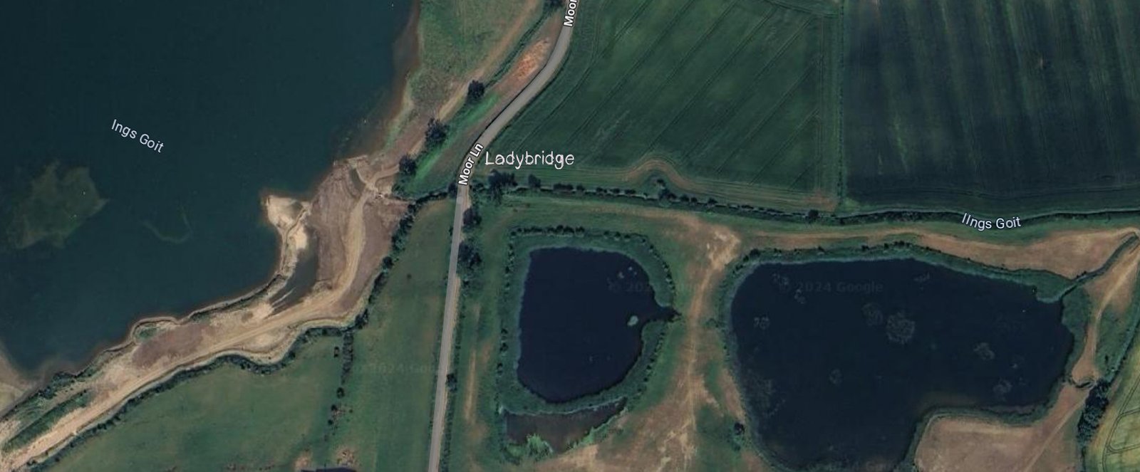
Nunwick Henge lies on a low gravel terrace about 300 m north of the hamlet of Nunwick, Hutton Conyers, beside the River Ure. It is a sub-circular Earthwork a little over 200 m across, whose ditch lies inside its bank— the defining trait of a Class II henge. Ploughing has lowered both features to shallow undulations, but from the air a clean cropmark still shows the bank, a five-metre berm, the ditch and opposed entrances facing almost due north and south. (historicengland.org.uk)
Intrusive Archaeology
The only intrusive work was a narrow trench dug in 1961 by D. P. Dymond across the north-west circuit. That section recorded a V-shaped ditch 4 m deep and about 9 m wide, its lower fills streaked with charcoal and littered with cracked, reddened cobbles—evidence of repeated burning on or near the henge bank. No pottery or bone survived the acidic gravel, but pollen in the primary silts suggested an open grassland setting, consistent with late Neolithic or very early Bronze-Age construction.
Relationship with other henges in the area
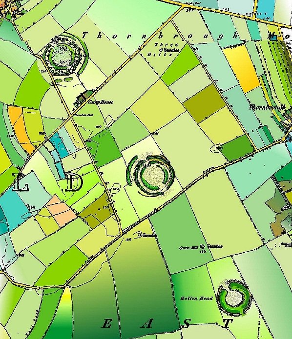
Although smaller than the great Thornborough henges six kilometres to the north-west, Nunwick aligns on the same north-south axis and is often described as the southern element of a longer “processional” line that begins at the Devil’s Arrows standing-stones near Boroughbridge, runs through Nunwick and culminates at Thornborough. Aerial mapping and GIS sight-line studies support the idea that the three groups were laid out in relation to one another across the Vale of Mowbray. (yaamapping.co.uk, en.wikipedia.org)
Limited Modern Attention
Modern attention has been limited to remote-sensing and condition surveys. Historic England lists the monument as at risk because annual ploughing is nibbling the inner edge of the bank, but the overall plan remains legible and geophysics confirms that both entrances and the complete ditch circuit survive below top-soil. No major excavation has yet been proposed, so basic questions—precise dating, evidence for timber settings or internal structures, and the role the burnt stones played in henge ceremonies—are still open. Even so, the cropmark, the 1961 trench data and the clear landscape relationship with Thornborough together make Nunwick one of the key outliers in Yorkshire’s remarkable henge complex. (historicengland.org.uk, heritagegateway.org.uk)
A complete silver Scottish twelve shillings coin of James VI of Scotland and I of England, eighth coinage post-dating accession to English throne, dating to 1603-1625, Lys initial mark. Reverse has a shield with arms of [...]
A silver Post-Medieval shilling of Elizabeth I, third issue with ‘A’ initial mark dating to 1583-1585. Mint of London. As North Vol 2, p.136, no.2014. [...]
A lead alloy pipe tamper dating to the 17th century. The plate has moulded decoration to both sides depicting Charles I (facing right) and Henrietta Maria of France (facing left). Both images are contained in [...]
A damaged lead-alloy Medieval pilgrim's ampulla, 50mm in length and 35mm wide, with a round bodied flask with a flaring open top which is partially complete. One side of the flask body has traces of moulded [...]
An incomplete Medieval cast copper alloy buckle plate, dating to c. AD 1100-1400. The plate is missing its buckle and part of its sprues. The buckle plate is sub-rectangular in plan. Projecting from one long edge [...]
A Roman copper-alloy nummus of the House of Valentinian , dating to AD 364-7 (Reece Period 19), GLORIA RO-MANORVM reverse type depicting the emperor with right hand dragging captive right and holding a labarum in left hand. Mint of [...]
A Post-Medieval copper alloy farthing of Charles I (AD 1625-1649), dating to AD 1636-1644. Rose type 2, with sceptres in saltire through single crown. Mint of London. Unclear initial mark. North (1991: 165) no. 2291. [...]
A clipped and heavily worn Roman copper alloy nummus of Gratian (AD 367-383) dating to the period AD 367-378 (Reece period 19). SECURITAS REI PUBLICAE reverse type depicting Victory advancing left, holding a wreath and palm. Unknown mint. [...]
A silver Roman siliqua of Honorius (AD 393-423) dating to the period AD 397-402 (Reece Period 21) minted in Milan VIRTVS ROMANORVM reverse type depicting Roma seated left on cuirass, holding Victory on globe and spear. Hoxne, p. 145, no. [...]
An incomplete Roman composite plate brooch probably dating to AD 100-200. The brooch is missing it's pin and part of the top and bottom circles. The brooch is flat in cross section and probably originally consisted of [...]
Fragment from a probable buckle frame dating to the Post Medieval period (c.AD 1720-1790). The fragment is broadly rectangular in plan and includes a short section of the corner of the buckle frame. The fragment includes the [...]
Fragment from a buckle frame dating to the Post Medieval period (c.AD 1720-1790). The fragment is broadly C shaped in plan and D shaped in profile. It consists of two corners and one side of a sub-rectangular [...]
A complete copper alloy bovine (bull's head) vessel / bucket mount, dating to the Roman period (c. AD 50-200).The cast copper alloy mount is a sub-inverted triangle with a pointed lower tip and slightly waisted sides to form the nose.The [...]
An incomplete copper-alloy early Medieval stirrup strap mount of uncertain or unclassified type, dating to c.AD 1050-1150. The central part of the object survives with parts of the open work broken off on all sides except [...]
A near complete Medieval-Post Medieval cast copper alloy buckle with integrated plate dating to the period c.AD 1250-1500. The buckle is missing its pin.It has a rectangular frame, which has a sub rectangular cross-section. The integral plate has [...]
A very worn copper-alloy Roman radiate or nummus of unclear ruler dating to AD 260-402. Unclear reverse type, unclear mint.The coin is chipped around its circumference. [...]
A very worn Roman copper alloy radiate of uncertain emperor dating to the period AD 260-275 (Reece period 13). Unclear reverse type depicting. Unclear mint. [...]
An incomplete Medieval cast copper-alloy rectangular buckle with integral looped plate, dating to c. AD 1200-1400. The buckle is missing its pin. The buckle comprises a rectangular loop and an integral plate. The plate is made [...]

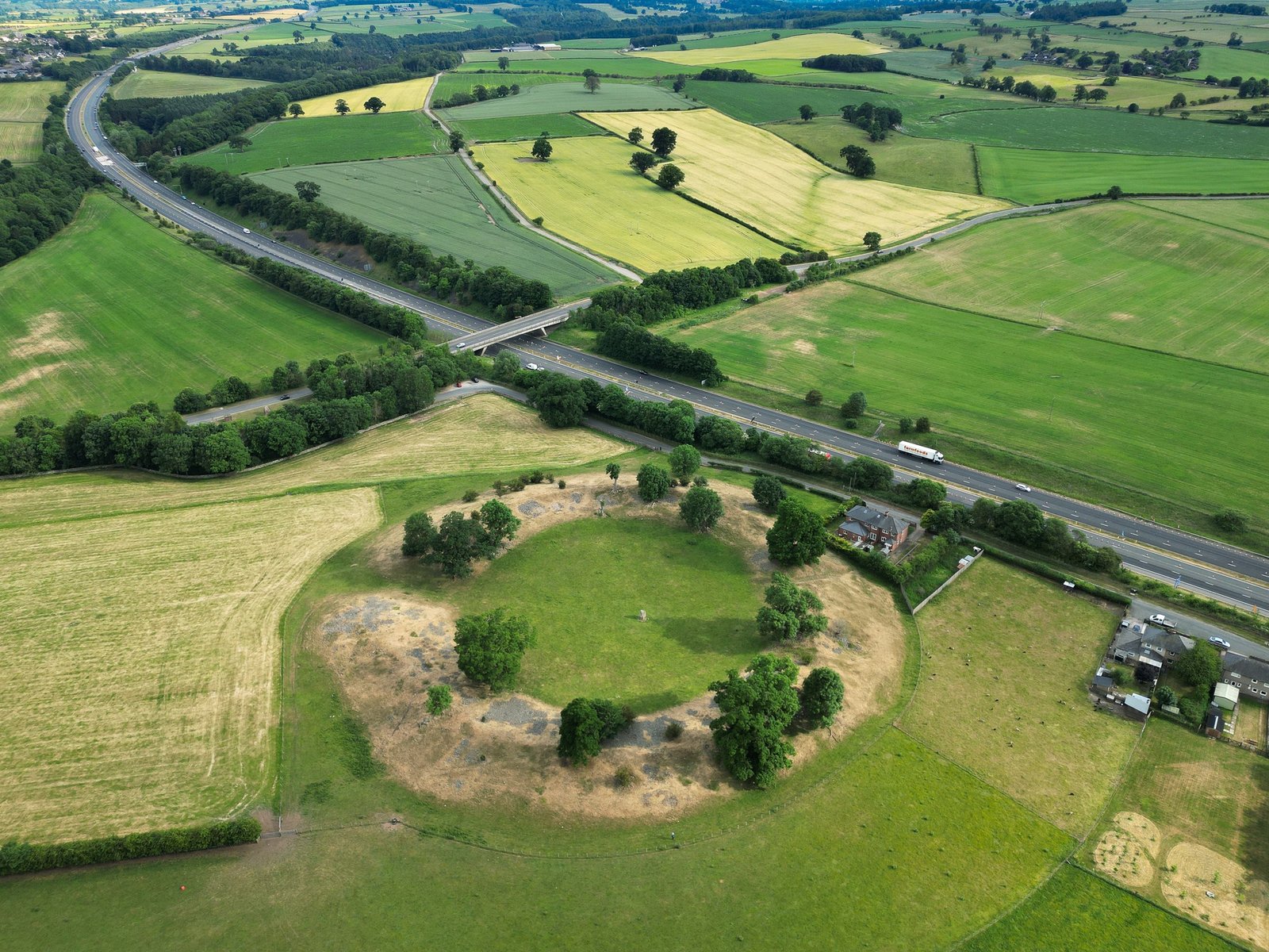


 A henge at Nunwick visible both as a low bank and shallow internal ditch and as a cropmark. A berm was originally present between ditch and bank. Maximum external diameter is circa 210 metres. There are two opposed entrances visible on the north and south sides. Limited excavation was undertaken in 1961 by DP Dymond across the ditch and bank in the north-north-west sector. Within the ditch fill was a circular spread of burnt material, including many split and reddened stones. However, no artefacts or any other dating evidence were recovered. The site is scheduled. Three worked flints, two waste flakes and a scraper, all now in Yorkshire Museum, were found in the plough soil in the field to the southwest. This monument is visible as cropmarks and low Earthworks on historic and recent air photos and on LiDAR-derived images.


