Category: Europe

Coverdale: Nathwaite Bridge river crossing points

Fords and River crossings at Nathwaite Bridge Coverdale - Google satellite - Thanks to National Library of Scotland

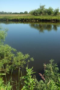
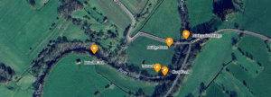
Nathwaite Bridge, over the river Cover in Coverdale, is just about the only way any heavy traffic can easily cross between the key villages of Carlton and West Scrafton.  The importance of the location is perhaps underlined as the last place down the river Cover where it remains reasonably ford-able, and therefore crossable in past times when no closer bridge existed.

Guide – Introduction to the European Ice Age

snow covered field

Antonine Wall Map Gask Ridge Map Roman Military Sites in Scotland English names, Roman names where known, four figure map reference, site type, size, and history, including garrisons and associated military Read more Mystery of Vitrified Forts It was during a trip to.Scotland, in the Summer of 1997, that I first heard of vitrified hillforts. …

Continue reading

Brigantia Espania

The North-West coast of Spain

Brigantia Espania is our name for our Spanish Brigantian research pages and sites. This is the beginning of our journey, and we start at the beginning.

Galicia

A Coruna Bay

The region of Galicia, located in the northwest of the Iberian Peninsula, has a history that stretches back to prehistoric times. Known for its Celtic roots, rolling hills, rugged coastlines, and rich folklore, Galicia is a place steeped in ancient traditions and mystery.

Briefing – Galicia’s Political History and Separatist Sentiment

Castro de Santa Trega Terracing

Galicia’s Celtic origins have long played a significant role in shaping the region’s cultural and political identity. Historically, Galicia was inhabited by Celtic tribes, and this heritage is still celebrated today in Galician culture, language, and folklore.

Iberian Peninsular

Tower of Hercules

Spain, located on the Iberian Peninsula in the southwestern corner of Europe, is a country of rich contrasts—mountains, beaches, valleys, and vast plains. It shares borders with France and Portugal and is surrounded by the Mediterranean Sea to the east and south, and the Atlantic Ocean to the north and west.

Nunwick Henge

River Ure southwest of Nunwick

A henge at Nunwick visible both as a low bank and shallow internal ditch and as a cropmark. A berm was originally present between ditch and bank.

Eileen na Goar Fort

Eilean nan Gobhar

This island, locally termed Eilean na Goar, is the most eastern and is bounded on all sides by precipitous gneiss rocks; it is the abode and nesting place of numerous sea birds. The flat surface on the top is 120 feet from the sea level, and the remains of the vitrified fort are situated on this, oblong in form, with a continuous rampart of vitrified wall five feet thick, attached at the SW end to a large upright rock of gneiss

Dunnideer Fort

The Medieval Castle, the most prominent feature in the hill, stands inside, and is built from the debris of, an oblong vitrified fort, a maximum length approximately 70 m, which crowns the summit. Outworks, most clearly marked on the E, may be associated with this phase.

Clickhimin Broch

Clickhimin Broch, Shetland Islands

This site was occupied in several periods, originally late Bronze age between 700 – 500BC. Firstly a simple farmstead which expanded to a blockhouse (fort) and then by a huge circular broch. A population of around 60 lived in this little fortress. Later, 2nd century occupation is shown when a wheelhouse was added.

Contact Us
close slider