These small, delicate gold objects are highly significant, they offer insight into the social status, trade connections, and cultural practices Read more
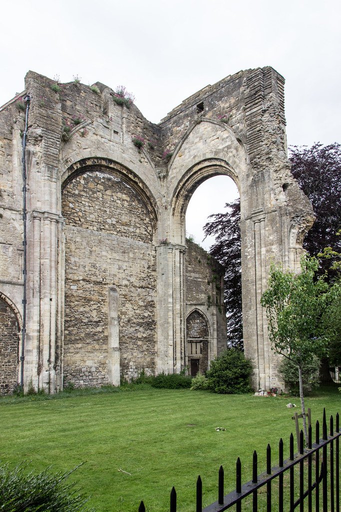
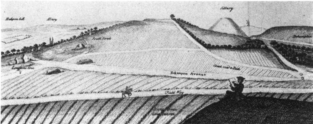
South Street long barrow once lay 1 km south‑west of Avebury village, midway between the Kennet spring‑line and the Windmill Hill plateau (OS grid SU 090 678; Read more
Sitting on the south‑east shoulder of Windmill Hill (grid ref. SU 086 070), 140 ft (43 m) above the Kennet valley, the Horslip long barrow commands Read more
Lying across the spine of southern England, Wiltshire offers a textbook cross‑section of chalk downland, greensand vales and clay lowlands. Its long archaeological record – from 10 000‑year‑old spring‑side camps to modern military landscapes – is inseparable from that underlying geology and from the climatic swing that ended the last Ice Age.
Two‑thirds of the county is Upper, Middle and Lower Chalk, forming the high, dry Salisbury Plain, the Marlborough Downs and the long north‑east Scarp that carries The Ridgeway. Below the scarps the Upper Greensand and Gault Clay create the fertile Vale of Pewsey and a necklace of greensand hills around Warminster and Devizes. (brian-mountainman.blogspot.com)
River incision through the soft Gault produces bold north‑facing escarpments; south‑facing dip slopes roll gently into the clay vales. Minor rivers – Wylye, Nadder, Bourne – converge on the chalk to feed the Hampshire Avon, while the Kennet cuts east to the Thames, its valley enlarged where chalk meets greensand and now followed by the Kennet & Avon Canal. (Wiltshire Council, Wikipedia)
Legacy of the last Ice Age
The Devensian ice front stopped north of the Cotswolds, so Wiltshire was never glaciated, but Periglacial frost‑shatter and seasonal meltwaters sculpted dry valleys across Salisbury Plain, left involution folds in the chalk and laid spreads of wind‑blown Loess on the clay-with‑flints. These Periglacial deposits still dictate where springs rise (e.g. Blick Mead) and where prehistoric engineers sited trackways and monuments. (Geoscience World)
As the climate warmed after 11 700 BP, pioneer birch and juniper colonised the downs, followed by mixed oak–hazel woodland. By 6000 BP much of that cover had been cleared for grazing, giving the classic calcareous grassland that now supports chalkhill blue butterflies, orchids and sheep‑grazed turf.
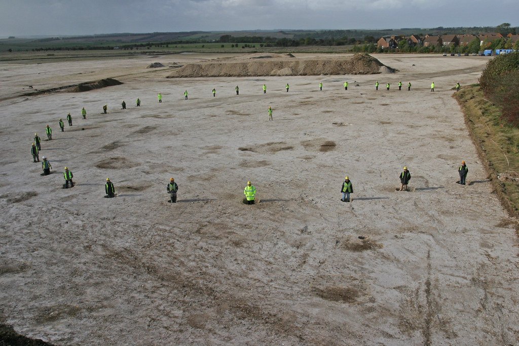
Loose hand‑axes and struck flint show occasional hunter visits before the Ice Age, but the first continuous occupation comes from the Blick Mead spring at Amesbury: butchered aurochs bone, hearths and over 70 000 struck flints testify to repeated gathering between c. 10 000 and 6000 BP – the longest Mesolithic sequence yet found beside any British chalk spring. (Wikipedia, Current Archaeology)
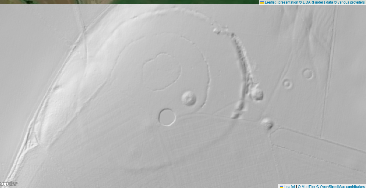
Windmill Hill - 1m LiDAR - LiDAR Finder
Neolithic transformation (c. 4000–2500 BC)
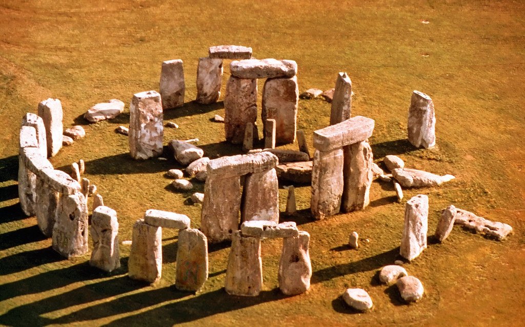
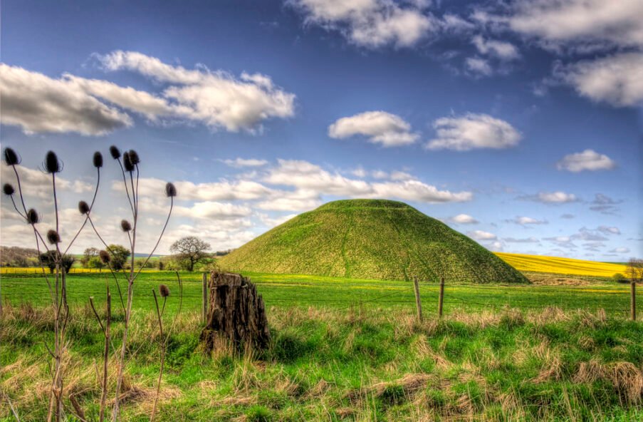
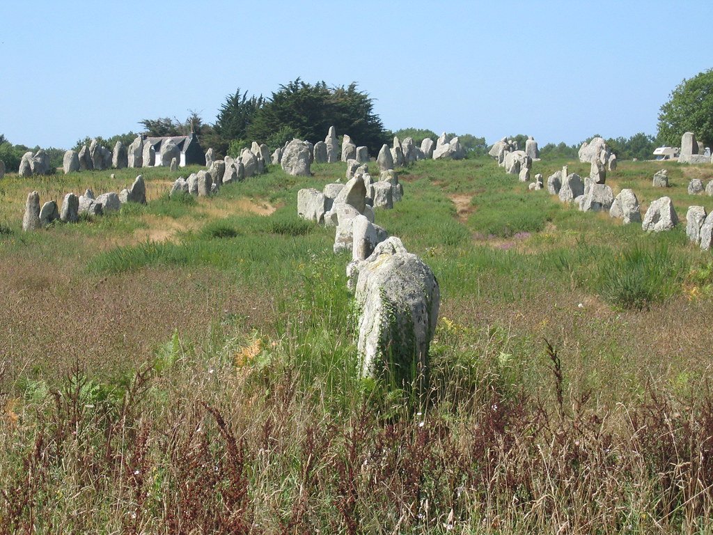
Farming and monuments arrive together: Clearance on the Kennet and Avon Interfluve opens space for cultivation; Long Barrows such as West Kennet, Horslip and South Street line the ridges. At around 3800 BC the great causewayed enclosure on Windmill Hill was dug – the largest in Britain, enclosing 8.5 ha. (Wikipedia) Two millennia later, Stonehenge and the Avebury complex crown the downland, their sarsen and bluestone circles depending on the easy transport and visibility offered by the open chalk.
Intensive arable cultivation continues; linear ditches and cross‑ploughed patches under Round Barrows show fields being taken out of production for burial mounds, marking a shift from sustenance to sanctity. Artefact hoards at Bush Barrow, Upton Lovell and Milton Lilbourne chart the rise of Wessex elites.
Iron Age (c. 800 BC–AD 43)
Iron technology and population growth defend the heights: Barbury Castle on the Ridgeway, Old Sarum, Vespasian’s Camp and numerous smaller hillforts overlook river corridors and trackways. Excavations show round‑house clusters, grain storage pits and evidence of sheep–corn exchange along the downs. (Wikipedia)
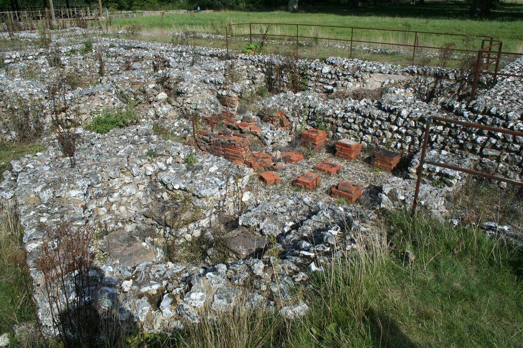
Two Roman roads cross – Ermin Street (Cirencester to Silchester) and the London–Bath route. The walled market town of Cunetio grows beside the Kennet; Verlucio and Durocornovium (modern Swindon) service traffic on Ermin Street. Rich villas at Bradford‑on‑Avon, Littlecote and Box show villa agriculture thriving on the greensand and chalk margins. (Wikipedia)
After Rome, the Upper Wylye valley gives its name to the kingdom of Wilsætan; by the 8th century Wilton is a royal and ecclesiastical centre, while the fortified burh of Malmesbury anchors the north. Christianity spreads from the abbeys; place‑names in ‑ton, ‑ham and ‑worth mark Saxon estate foundations. (hidden-wiltshire)
Norman and medieval landscape
Norman motte‑and‑baileys dot the river crossings (Old Sarum, Ludgershall). 1220 sees the foundation of New Salisbury, with its soaring Early English cathedral built from Chilmark stone. Open‑field agriculture dominates valleys; sheep‑corn husbandry turns the chalkland into one of Europe’s great wool‑producing centres.
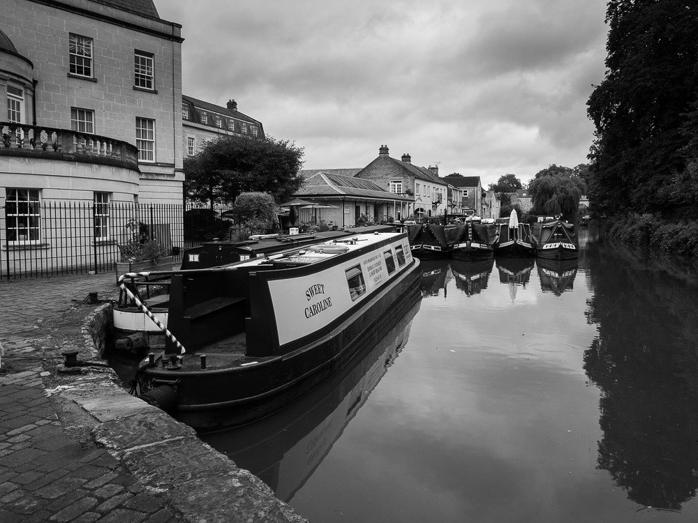
Canals and railways slice through the soft vale floors. The Kennet & Avon Canal (1794–1810) links Bristol to London via Devizes locks; in 1841 the Great Western main line reaches Swindon, whose engineering works shape the town’s modern growth. (Wikipedia)
Since 1897 large tracts of Salisbury Plain have served as army training areas, preserving barrows, field systems and downland flora. Agro‑environment schemes now safeguard surviving chalk grassland fragments and iconic species such as the stone‑curlew.
South Street long barrow once lay 1 km south‑west of Avebury village, midway between the Kennet spring‑line and the Windmill Hill plateau (OS grid SU 090 678;...
An incomplete cast copper alloy double looped trapezoidal buckle of post medieval date. Only one loop remains. The frame is narrow with bevelled edges and a narrowed strap bar. There is no visible decoration. [...]
An incomplete cast copper alloy Roman bow brooch, of plate headed hinged T-shaped type dating to the 2nd century AD. The arms are narrow and cylindrical, enclosing an axis spindle and with a notch at the centre [...]
A worn and corroded post-Medieval copper-alloy Nuremberg Jetton of anonymous 'ship-penny' type (c. 1490-1550). Obverse has a sailing ship, the reverse has four fleur-de-lis in a lozenge. Illiterate legends. Cf. Mitchiner 1152-1165. [...]
Lead token, tally or boardgame piece. Hammered bifacial disc with one side bearing a pattern or device resembling a stylised tree with stocky fringed trunk and an arcing ‘legend’ of dots between faintly defined circles. [...]
Silver coin fragment. Worn long cross round halfpenny, broken to achieve well under one farthing’s weight, issue of 1280-1327Obverse description: worn smoothReverse description: long cross, three pellets in each angleReverse inscription: CIVI/[TAS]/(----)Diameter: 14.3mm, Weight: 0.23gms [...]
Silver coin. Short cross cut halfpenny of John (1199-1216) or Henry III (1216-1272), London mint. Class 6a1 issue of 1208-1218Obverse description: facing bust with sceptre left, hair left of two oval curls, beard of fine [...]
Copper alloy unidentified object fragment. Cast square-section bar with a stepped and rounded end; other end broken. The rounded tip forbids interpretation as a nail shank, which this object otherwise resembles. Suggested date: possibly Roman, [...]
Copper alloy finger ring. Cast oval bezel and tapered/constricting shoulders of a finger ring; the bezel is filled with blue enamel, sunken in the middle and crazed by recent impact; Guiraud type 1. The rest [...]
Silver coin. Penny of Edward I (1272-1307), class 10cf3 issue of 1307-1309, London mintObverse description: facing bust with broad bifoliate crown cf3 with break in band, drapery of angled wedges, initial cross pattee.Obverse inscription: +EDW [...]
A Medieval silver groat of Edward III (AD 1327-1377). Series E (North 1163) dating to AD 1354-5. London mint. North (1991: 51). Edge on the lower right quarter on the obverse has broken away. Coin measures 28.3mm in diameter. [...]
Silver coin. Voided long cross cut halfpenny of Henry III (1216-1272), probably class 3a issue of 1248-1250Obverse description: facing bust no sceptre, legend starts at 12 O’clock, hair comprises two neat curls and pellets left [...]
Copper alloy brooch fragment. A now-cruciform scrap of a cast plate brooch, possibly Mackreth type British Plate [unspecified], comprising the paired U-shaped lugs from the seat for a hinged pin, with a flat front retaining [...]
Silver coin. Denarius of an indeterminate early Roman emperor, cut with the loss of about one fifth of the flan, probably issue of AD14-138.Obverse description: bust laureate draped right, clean-shaven and jowled, lightly tousled hair.Obverse [...]
A worn and corroded Roman copper alloy nummus of the House of Constantine dating to AD 330-340 (Reece period 17). VRBS ROMA type with a reverse depicting Romulus and Remus suckling a wolf, with three stars above. Mint of Trier. Cf. LRBC Vol [...]
Lead and iron possible steelyard weight, as kindly suggested by the finder. An irregular plano-convex lump of cast lead retaining relicts of a heavy iron suspension loop with recent breakage evident; the lead is slightly [...]
A Roman copper alloy nummus of Constantine II (AD 317 - 340) dating to AD 327 (Reece period 16). PROVIDENTIAE CAESS reverse depicting a camp-gate of two towers with a star above. Mint of Arelatum / Arles. [...]
A post medieval, lead human figurine probably dating from the late 18th- 19th century.The figurine is in the form of a standing figure, possibly female holding a baby. Possibly depicting Mary with child. The reverse is flat [...]
A medieval cast copper alloy single looped oval buckle, complete with plate and pin. The frame has a rounded front edge and a recessed strap bar with lobes at either end. The plate is sub triangular [...]


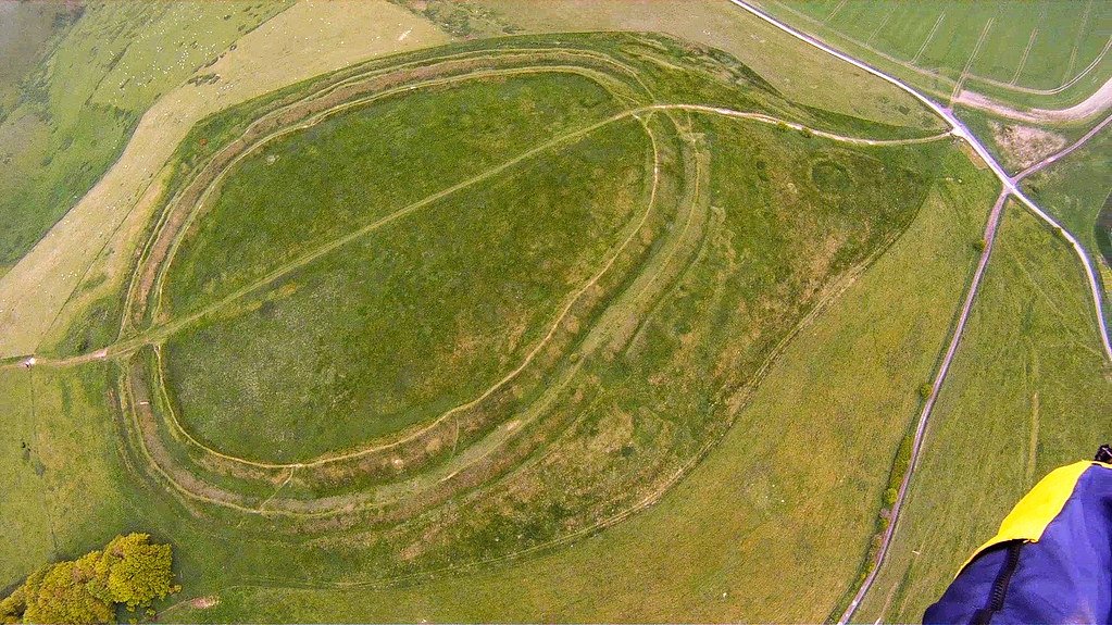 "Birthday Flight: Barbury Castle Closer" by superdove is licensed under CC BY-NC-ND 2.0