The recent discovery at Catterick has unveiled a significant Late Neolithic palisaded enclosure, shedding light on the prehistoric landscape of Read more
Brigantia Espania is our name for our Spanish and Portugese based Brigantian research pages and sites. This is the beginning of our journey, and we start at the beginning.
Spain
Geography
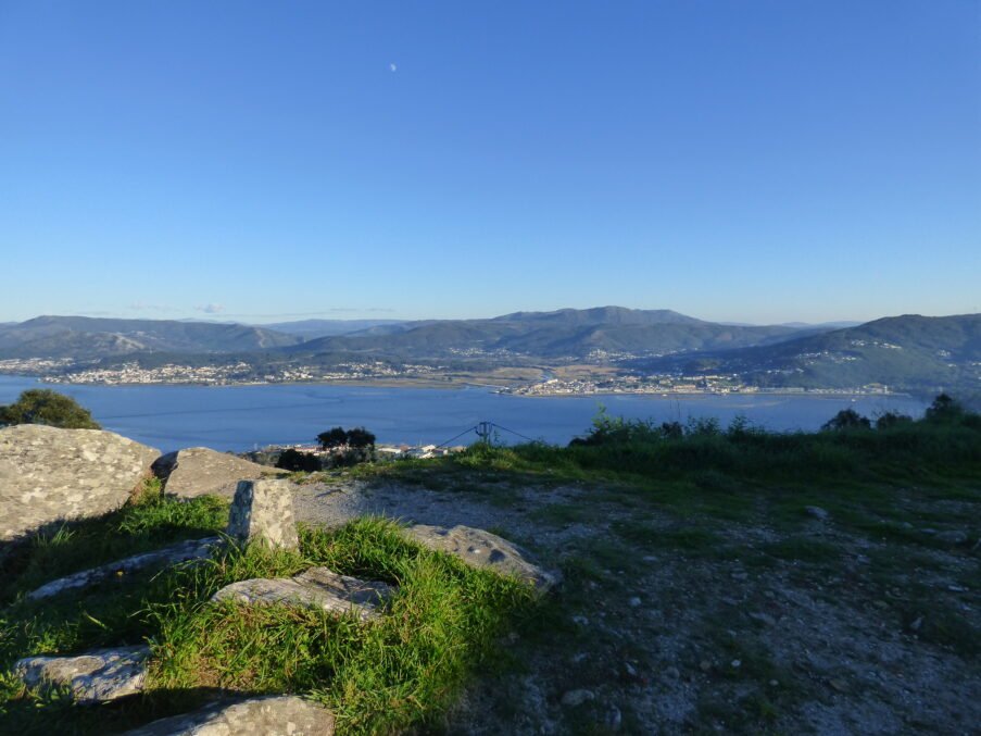
Spain occupies 85 % of the Iberian Peninsula plus the Balearic and Canary archipelagos and the North-African exclaves of Ceuta and Melilla. Mainland Spain is built around the Meseta Central, a high tableland averaging > 600 m that makes Spain the second-highest country in Europe after Switzerland. The plateau is ring-fenced by mountain chains—the Cantabrians and Pyrenees in the north, the Sistema Ibérico and Catalan ranges in the east, and the Sierra Morena/Betic Cordillera in the south—with the Ebro and Guadalquivir depressions forming the only lowland corridors to the Mediterranean and Atlantic respectively (La Moncloa).
Five broad climate domains arise from this relief: humid Atlantic (Green Spain), continental Mediterranean (Meseta), classic Mediterranean (coastal east / south), mountain, and semi-arid steppe in the south-east (La Moncloa). The resulting mosaic of soils, biomes and water regimes has steered human settlement and agriculture since the Palaeolithic.
Geology
Spain is a tectonic patchwork where three orogenic cycles overlap:
Domain
Origin & age
Key features
Iberian Massif (west & centre)
Variscan collision of Gondwana fragments with Euramerica (c. 350 Ma)
Crystalline basement—slates, schists, granites—exposed in Galicia, León and Extremadura (Wikipedia)
Pyrenees & Betics
Alpine convergence of the Iberian microplate with Europe & Africa (65–5 Ma)
Thrust sheets, high-grade metamorphism, active faults; Pyrenean peaks rise to 3,400 m (Encyclopedia Britannica)
Canary Islands
Intraplate hotspot volcanism on Jurassic oceanic crust (20 Ma–present)
Ocean-island shield volcanoes such as Teide (3,718 m), recurrent eruptions (e.g., La Palma 2021) (mantleplumes.org)
Sedimentary wedges fill the Ebro and Guadalquivir foreland basins, while Neogene rifting produced salt-rich depressions such as Almería’s Cabo de Gata. Rich ore belts (Rio Tinto, Linares) and diverse building stones underpin a long mining and architectural tradition.
Archaeology
Early humans
Atapuerca complex (Burgos): tools and hominin fossils from 1.4–0.8 Ma (“Pink” face, 2025 discovery) through Sima de los Huesos (430 Ka) document Europe’s longest human record (The Washington Post, Wikipedia).
Upper Palaeolithic
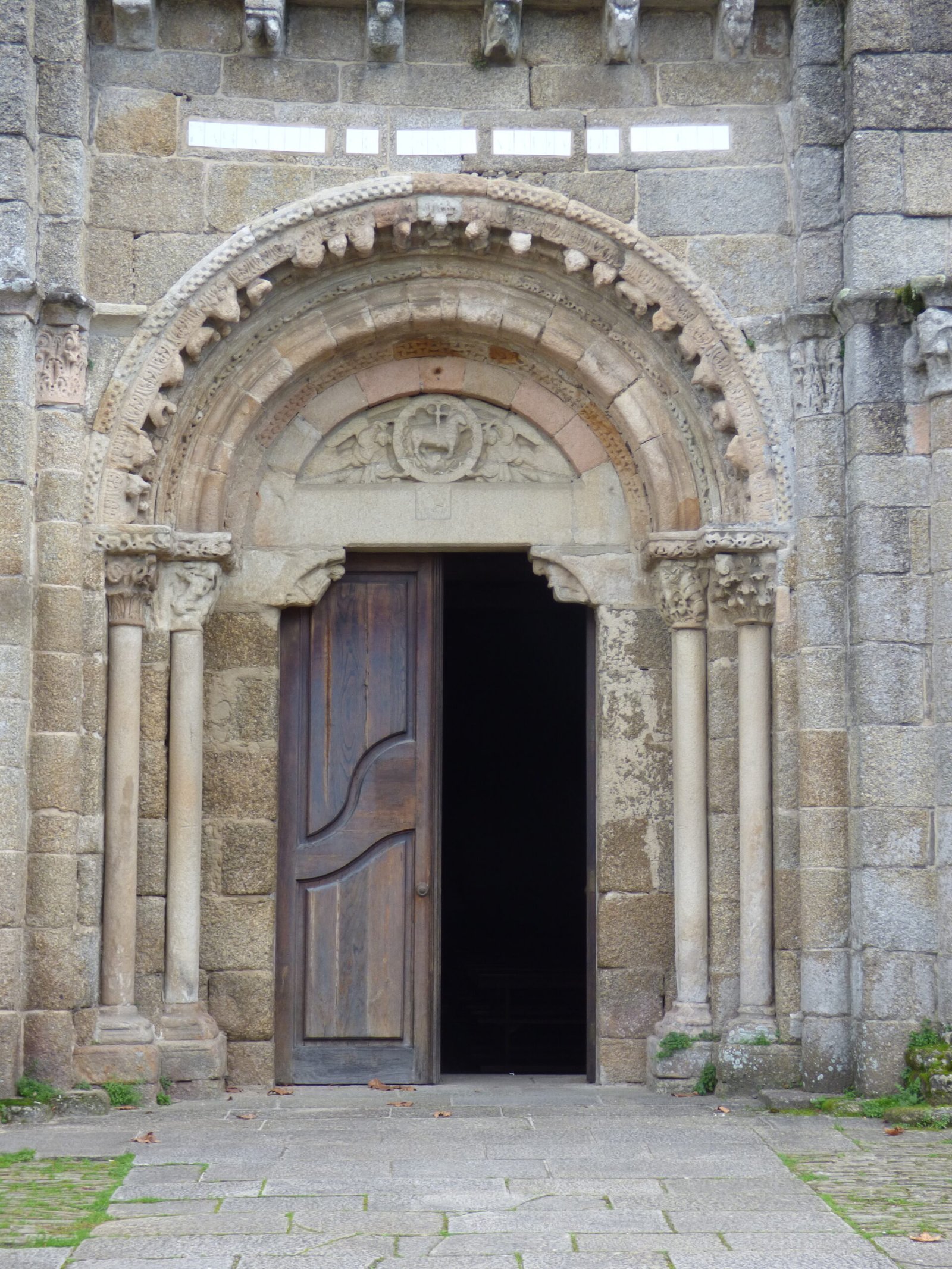
World-famous cave art—Altamira, Tito Bustillo, Ardales—dates 36–14 ka, preserving bison, horses and hand stencils (UNESCO World Heritage Centre).
Neolithic & Copper Age
Megaliths (Los Millares) and ditched villages (La Draga) show farming by 5600 BC.
The “Ivory Lady” at Valencina (≈ 2850 BC) reveals female power in Chalcolithic societies (Archaeology Magazine).
Bronze Age
El Argar culture (2200–1500 BC) in south-east Spain forged Europe’s first class-based state; DNA and grave goods point to patrilineal elites and warrior queens (Wikipedia).
Tartessos (SW Spain, 9th–6th c BC) blended Phoenician trade with indigenous metallurgy; recent digs at Casas del Turuñuelo uncovered mass animal sacrifice and elite ivory seats (Atlas Obscura).
Iron Age to Roman
Celtic groups (Meseta) and Iberians (east) leave sculptures like the Lady of Elche (5th c BC) (Wikipedia).
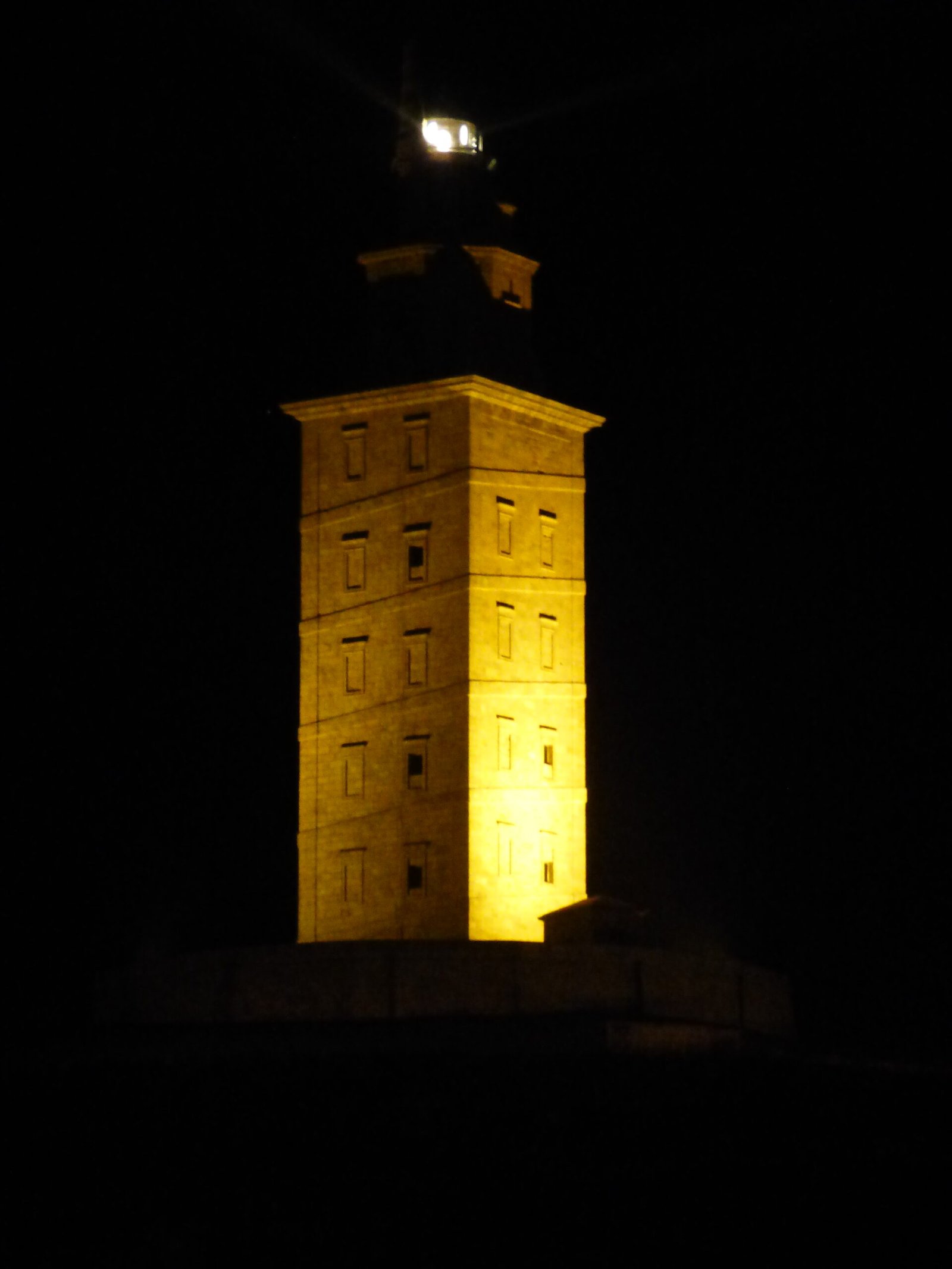
Carthage and then Rome conquer; by 19 BC Hispania is fully provincial, laced with roads, mines (Las Médulas) and cities (Emerita Augusta, Tarraco) (Wikipedia).
Medieval transformations
After the Visigothic Kingdom (5th–8th c) centred on Toledo (Wikipedia), the Umayyads create al-Andalus; the Caliphate of Córdoba (929–1031) becomes Western Europe’s largest city and a scientific beacon (Wikipedia).
The Christian Reconquista culminates in 1492 with the fall of Granada, birthing a united Spain (BBC).
Early-modern & modern Spain
Imperial zenith (16th–17th c), Bourbon reforms, Napoleonic invasion (1808), civil war (1936–39), Franco dictatorship, democratic transition (1975) and EU membership (1986) define Spain’s recent arc (see BBC timeline) (BBC).
Interweaving land and people
Spain’s diverse physiography and geology generated:
Varied biomes that fostered both Palaeolithic hunters (Cantabrian refugia) and Neolithic farmers (Mediterranean lowlands).
Rich ore belts and volcanic soils that underpinned Bronze-Age metallurgy (El Argar, Tartessos) and Roman mining booms.
Mountain barriers (Pyrenees, Meseta rims) that channelled cultural frontiers—Rome vs. Celtiberians, Islam vs. Christian kingdoms—while coastal plains enabled seaborne Phoenician, Greek and later imperial worlds.
Enduring seismic and volcanic activity (Betics, Canaries) that shapes risk and resource management today.
Portugal
Geographical setting
Portugal occupies the western fifth of the Iberian Peninsula plus two Atlantic archipelagos: the Azores (1,500 km W-NW of Lisbon) and Madeira (900 km SW). Mainland relief is dominated by the north-south Atlantic seaboard and a sequence of tilted blocks that fall westwards from the Spanish frontier to the ocean:
North & Centre – dissected Galician–Tras-os-Montes highlands and the granitic Serra da Estrela (mainland high-point 1,993 m).
Meseta fringe – rolling schist‐and-sandstone tablelands drained by the Douro, Tagus and Guadiana; steep river gorges create natural east-west corridors.
South – the Alentejo peneplain and the Limestone/siliciclastic ridges of the Algarve backed by the Serra de Monchique.
These contrasts generate three broad climate belts: wet Atlantic north, continental interior and classic Mediterranean south-coast; the Azores and Madeira add humid subtropical regimes. (Wikipedia)
Geological framework
Tectono-stratigraphic zone
Age & origin
Key resources / hazards
Iberian Massif (NW & centre)
Late-Palaeozoic Variscan basement of granites, slates and quartzites
Tin–tungsten lodes (Panasqueira), gold placers, building granite (Wikipedia)
Rifting after Pangaea breakup (Late Triassic–Early Cretaceous)
Jurassic limestones (cement, lime), salt domes, on-/offshore hydrocarbons (Wikipedia)
Azores & Madeira
Hot-spot shield volcanoes on oceanic crust (< 5 Ma)
Fertile volcanic soils, geothermal power; active eruptions (e.g., La Palma 2021 neighbour) (Wikipedia)
Plate margins
Azores-Gibraltar transform faults
Great earthquakes/tsunamis—most famously the Mw 8.5–9 Lisbon quake of 1 Nov 1755 (NGDC)
The interplay of basement highs, rift basins and volcanic islands has steered mineral exploitation, settlement nuclei and seismic risk through time.
Outline of the archaeological record
Early & Middle Palaeolithic
Aroeira Cave (Tagus valley) yielded a 400 ka Homo heidelbergensis cranium (Aroeira 3), the oldest hominin fossil in Portugal (ScienceDaily).
Acheulean hand-axe scatters occur along the Tagus and Sado terraces, while Middle-Palaeolithic Neanderthal sites rim the Estremadura coast.
Upper Palaeolithic
Rock-shelters such as Lapa do Suão and Escoural Cave preserve Solutrean and Magdalenian occupations; painted-engravings echo Cantabrian cave art.
Open-air kill/processing sites on the Algarve littoral track sea-level oscillations during the Last Glacial Maximum.
Neolithic & Megalithic horizon (c. 5600–3000 BC)
The Évora megalithic province boasts over 100 cromlechs; the Almendres stone circle—95 uprights in concentric rings—grew incrementally between 6000 BC and 3000 BC, structuring ritual landscapes for two millennia (Stetson University).
Impressa/Cardial ceramics attest to pioneer farmers along the Tagus estuary and Sado plain.
Copper & Early Bronze Ages (c. 3000–1500 BC)
Fortified tells such as Vila Nova de São Pedro and Zambujal control estuarine trade in copper, ivory and marine commodities.
Stelae and cist burials of the South-western Iberian Bronze (Algarve–Baixo Alentejo) show Mediterranean contact.
Celtic–Lusitanian tribes minted silver and left warrior stelae across the interior.
Roman Lusitania (c. 138 BC – AD 409)
The province centred on Emerita Augusta (Mérida) and a web of colonies such as Olisipo (Lisbon), Pax Iulia (Beja) and Conimbriga; gold dredging at Las Médulas spilled into northern Portugal’s rivers (Wikipedia).
Early-Medieval mosaics
Suevi (5th c.) and Visigoths (6th–7th c.) ruled from Braga and Toledo, followed by Muslim conquest (AD 714). Gharb al-Andalus (“the west of al-Andalus”) innovated in irrigation, agronomy and urbanism; mudéjar horseshoe-arches still pepper Algarve churches (The Wandering Musulman).
Kingdom, empire & modern state
Date / period
Milestone
1139–1249
Afonso Henriques wins independence; Algarve taken, fixing modern frontiers.
15th–16th c. Age of Discoveries
Sagres school, voyages of Henry the Navigator, Vasco da Gama’s route to India; Lisbon becomes a global hub for spice, gold and slaves.
1755
Lisbon earthquake + Marquis of Pombal’s seismic-resilient rebuild (NGDC)
1807–11
Peninsular War; British-allied defence under Wellington sparks guerrilla heritage.
1910–1926
First Republic, instability → military coup.
1933–1974
Estado Novo authoritarianism (Salazar/Caetano).
25 April 1974
Carnation Revolution – non-violent soldiers’ coup restores democracy, decolonises Africa, writes a progressive constitution (Adst, The Guardian).
1986
EU accession; 1999 eurozone; 21st-c. tech & tourism boom.
Linking land, resources & people
The Iberian Massif’s tin–tungsten drove Bronze-Age metallurgy and later Roman mining.
Who were the Continental ("European") Brigantes and what, if anything, links them to the Brigantes of northern Britain? At first glance the problem looks simple: Classical writers mention Brigantes in both Iberia and Britain, and early Irish legend remembers a people of that name sailing from "Brigantia". However, each line of evidence fragments on close inspection. Below we map the key uncertainties and outline why they matter for any research agenda.
Known (Relatively Firm) Data Points
Evidence cluster
What we know with high confidence
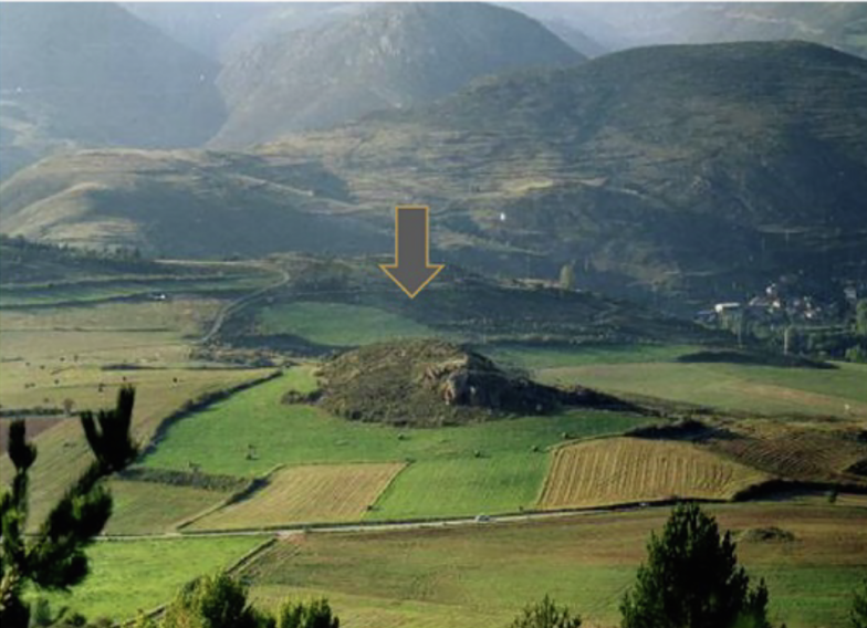
Galician/Iberian Brigantes
‑ Ptolemy (Geog. II, 6) places Βρίγαντες in Gallaecia near modern Bragança/Braga.‑ Epigraphic finds from NW Iberia record ethnonyms BRIGANTICUS, CIVITAS BRIGANTIUM.‑ Late‑medieval Irish pseudo‑history (Lebor Gabála) echoes a voyage from "Brigantia" (Galicia?) to Ireland.
British Brigantes
‑ Tacitus(Agric., Annals) describes the Brigantes as the largest tribe of northern Britain (c. AD 70).‑ Coins (pre‑Conquest), sculptural dedications to Brigantia goddess, and the civitas capital at Isurium (Aldborough) confirm a coherent polity in Yorkshire + Pennines.
Alpine / Upper Rhine toponyms
‑ Settlements called Brigantio/Brigantium: Bregenz (Austria), Briançon (France).‑ These are securely Celtic brigant‑ ('high, elevated') but Classical texts never record an ethnos "Brigantes" here.
Why the Picture Turns Murky
Equivocal Ethnonyms – Brigant‑ is a productive Celtic adjective (“high, noble”); place‑names may not imply a migrating tribe but simply hilltop locations. E.g., Brigantium (Bregenz) crowns a lakeside ridge.
Sparse Classical Sources – Ptolemy lists Iberian Brigantes only once; no detailed territory is given. Later Roman itineraries use the toponym Brigantium near A Coruña, raising debate over continuity.
Mythic Overlays – Irish legends of Milesian voyages conflate multiple Iberian ports; medieval scribes retro‑fitted genealogies to suit political aims, muddying historical migration signals.
Archaeology vs. Text – Material culture in Galicia (Castro culture) and northern Britain (Late Iron‑Age Pennine groups) diverge markedly; no obvious “Brigantian package” links the two.
Genetic & Isotopic Blind Spots – Ancient‑DNA sampling in NW Iberia and northern England is still patchy; isotopic baselines differ, hampering direct mobility tracing.
Key Research Questions to Untangle
Thematic strand
Specific questions
Possible evidence streams
Territorial definition
Where exactly was the Iberian civitas Brigantium? Did it extend inland to Bragança or focus on the Atlantic promontory (A Coruña)?
LiDAR survey of hillfort density; epigraphic GIS; Roman cadastral boundaries
Onomastics & linguistics
Are the British and Iberian ethnonyms cognate innovations (Brigantes) or parallel formations from generic brigant‑?
Comparative Celtic linguistics; inscriptional spelling variants; chronology of Latinised forms
Migration vs. convergence
Do any Iron‑Age artefact types, house forms or burial customs cross the Bay of Biscay corridor?
Bayesian dating of Atlantic La Tène imports; strontium/oxygen isotopes on human remains; network analysis of fibulae typology
Religious markers
Is the goddess Brigantia in Britain cognate with Gallaecian Brigantia Nabia? Shared iconography?
Iconographic catalogues; theonym distribution maps; votive stone petrography
Alpine Brigant‑ toponyms
Were these ever linked to a migratory clan, or are they toponymic coincidences? Could they indicate staging posts en route to Britain/Iberia?
Reappraisal of epigraphic corpus in Raetia & Alpes Cottiae; Landscape Archaeology of Brigantium (Bregenz) shrine precincts
Why These Questions Matter
Ethnogenesis vs. Toponymy – Untangling generic hill‑place naming from real ethnic labels informs how we read Classical texts across Europe.
Atlantic Connectivity – If links exist, they reshape models of Celtic maritime mobility and cultural transmission along the Atlantic façade c. 400–100 BC.
Identity Politics – Modern regional identities (Galicia, Yorkshire) draw on Brigantian heritage; robust scholarship can temper nationalist myth‑making.
Evidence Horizons & Research Priorities
Bayesian Radiocarbon + aDNA Programme – Target Castro hillfort burials and British Brigantian cemeteries (e.g., Stanwick) for genome‑wide comparison.
High‑resolution Toponymic GIS – Map every brigant‑ derivative with terrain parameters to distinguish “high‑place” names from potential ethnonym signals.
Isotopic “Transect” – Strontium/^Pb/^O baselines from Cantabrian, Biscay, Yorkshire chalk and Pennine Gritstone zones to pick out migrants.
Re‑edition of Epigraphy – Create an open database of BRIGANT‑ inscriptions from Iberia, Britain and Alpine regions with 3D scans and petrographic provenancing.
Re‑excavation of Key Sites – Bragança citadel (Portugal) and Aldborough (UK) remain under‑stratified; modern multi‑method digs could refine chronological bridges.
How Did the Brigantes of Britain Get Here?
(The Migration Hypothesis)
We proceed from the working premise that the Brigantes of northern Britain were not a monolithic ethnos arriving in a single sweep but a plural confederation of related clans whose fore‑groups filtered into Britain along different corridors and at different times between the Late Glacial and Middle Iron Age. Climate instability at the close of the Last Ice Age, rising population densities in western Europe and escalating inter‑tribal competition may all have tipped the balance toward outward movement.
Late‑Glacial & Early‑Holocene Constraints
Time‑slice
Ice & sea‑level boundary conditions
Potential migration “gateways”
20 ka BP (LGM)
British–Irish, Fennoscandian and Alpine ice sheets coalesced; Doggerland a polar desert
Atlantic seaways closed by sea‑ice; overland passage blocked N of 50°N. Long‑distance movement limited to Iberian & Aquitanian refugia.
15–13 ka (Bølling–Allerød)
Rapid retreat of British ice margin to Scottish Highlands; Doggerland a tundra grassland with braided rivers
North Sea land‑bridge opens east‑coast ingress; Channel River still a gorge—crossing by fords possible; Atlantic cabotage improves as seasonal ice wanes.
12.9–11.7 ka (Younger Dryas)
Brief re‑advance of Scottish ice lobes; harsh steppic climate
“Gateways” constrict; stress may prompt push‑factor migration from overcrowded refugia south of the Loire & Rhine.
– Atlantic‐style passage graves & hairy‑rim bowls– aDNA kinship links between Gallaecia castros and Irish/British Neolithic– Stable‑isotope signatures of Biscay childhoods in Pennine burials
Did post‑Mesolithic pulses follow the same track legends later preserved in Irish myth? What maritime technologies enabled it?
Doggerland Land‑Bridge
Lower Rhine/Weser plain → Dogger Bank → Humber/Tees mouth
– Reworked artefacts on North‑Sea trawler decks– Submerged palaeo‑river sites via acoustic survey– Comparative lithic chaînes opératoires (Ahrensburgian vs. Pennine Early Mesolithic)
Can we date a north‑east ingress that predates Doggerland flooding (~8 ka), supplying an early substratum later absorbed by “Brigantian” identity?
Rhine–Meuse–Channel Narrows
Upper Rhine graben → Paris Basin → Solent/Channel fords → Wessex → Vale of York
– La Tène C/D weapon styles upstream of Aire Gap– Oxygen‑isotope outliers in Yorkshire chariot‑burials– Place‑name loans of Continental Celtic phonology in Lincolnshire & Holderness
Could an Iron‑Age elite influx (e.g., Arras‑culture square Barrows) represent a late Brigantian wave equipped with superior military gear noted by Tacitus?
Might early Bronze‑Age metallurgists have seeded western Brigantian polities that later fused with Pennine groups?
The Southern Threat Hypothesis
Classical hints of hostile pressure from the south (e.g., Belgic expansion; Roman proxies) invite a working hypothesis: the last Brigantian entrants carried advanced martial packages (chain‑mail, chariotry, long iron swords) gained through contact with Hallstatt/La Tène culture and were forced northwards by Belgic or Romanised neighbours. Testing requires:
Typological seriation of weapon graves south‑to‑north.
Metallurgical provenancing for iron blooms (Alpine vs. Armorican ores).
Isotopic/ancient‑DNA matching of elite burials at Stanwick, Arras and Aisne valley.
Data Streams & Analytical Toolkit
High‑resolution Palaeoglaciology – ice‑margin reconstructions & Isostatic rebound models to map corridor viability decade‑by‑decade 18–8 ka.
Sea‑Level/Coastline Modelling – CETEM North‑Sea palaeogeographies to time the drowning of Doggerland trackways.
Large‑Scale aDNA Transects – Iberian, Armorican, Lower‑Rhine and Pennine datasets to detect serial founder effects or pulse admixture.
Geolocated Artefact Hubs – Bayesian‑dated object clusters (bronze daggers, La Tène swords, enamelled brooches) visualised in a spatio‑temporal GIS.
Agent‑Based Simulation – demographic pressure + climate stress parameters to test how hostility and resource pinch could channel flows northward.
Setting Research Priorities
Priority tier
Rationale
Immediate actions
Tier 1 – Corridor Feasibility
Establish physical possibilities before attributing migrations.
Secure permits for targeted aDNA (Castro hillforts; Pennine Cairns); integrate with pan‑European Isomap baselines.
Tier 3 – Chronology of Conflict Tech
Test “southern threat” driver.
Radiograph & metallographically sample Arras‑culture weaponry; cross‑reference with continental typologies.
Tier 4 – Myth & Memory
Trace how later legend encoded migrations.
Philological re‑analysis of Lebor Gabála Iberian chapters; screen Welsh Triads for Brigantian echoes.
By intertwining palaeo‑environmental reconstruction with biological and artefactual proxies we can move from “plausible routes” to evidence‑backed migratory sequences, clarifying how—and perhaps why—the ancestors of the British Brigantes made their way to the Pennine heartland.
A Late Medieval cast copper-alloy casket key dating to c.1200-1500.Sub-circular bow with a circular 7.4mm aperture, integral with an oval cross-section stem. The stem is solid apart from the tip that is hollow to a depth [...]
A Roman silver siliqua of Constantius II dating to AD 355-364 (Reece period 18). VOTIS XXX MVLTIS XXXX reverse type depicting the legend within a wreath, Mint of Arelatum. As Hoxne 84; RIC VIII 261/91. [...]
A silver threepence of Elizabeth I (1558 to 1603), second coinage and dated to 157(8?), with plain cross initial mark. London Tower mint. As North vol2, (1991) No. 1998. [...]
A silver medieval halfgroat of Henry VII (1485-1509), martlet initial mark dating to 1501-1509. Archiepiscopal mint of Archbishop Savage at York. As North 1714. [...]
A Iron Age silver "concave square" minim of the Regini and Atrebates / Southern region, possibly attributable to Tincomarus and dating to 50-20 BC. Obverse: square with concave sides, central pellet in ring. Reverse: annulet horse [...]
A probably Late Medieval to Post Medieval copper-alloy dagger or sword scabbard chape probably dating to c.1400-1650. Fabricated from copper-alloy 0.6mm sheet, rolled into a cone shape with an untidy/irregular seam at the rear, and an [...]
A post Medieval cast copper alloy discoidal 1/4oz trade weight. The weight has a upstanding rim enclosing a recessed upper surface bearing stamps of a crowned W for William III (1694-1702). [...]
A post-Medieval silver threepence of Elizabeth I (1558-1603). Second issue (1561-1582), probably portcullis initial mark and dated 1566 on the coin. London Tower mint. As North (1991) no. 1998. [...]
A complete silver Scottish twelve shillings coin of James VI of Scotland and I of England, eighth coinage post-dating accession to English throne, dating to 1603-1625, Lys initial mark. Reverse has a shield with arms of [...]
A silver Post-Medieval shilling of Elizabeth I, third issue with ‘A’ initial mark dating to 1583-1585. Mint of London. As North Vol 2, p.136, no.2014. [...]
A lead alloy pipe tamper dating to the 17th century. The plate has moulded decoration to both sides depicting Charles I (facing right) and Henrietta Maria of France (facing left). Both images are contained in [...]
A damaged lead-alloy Medieval pilgrim's ampulla, 50mm in length and 35mm wide, with a round bodied flask with a flaring open top which is partially complete. One side of the flask body has traces of moulded [...]
An incomplete Medieval cast copper alloy buckle plate, dating to c. AD 1100-1400. The plate is missing its buckle and part of its sprues. The buckle plate is sub-rectangular in plan. Projecting from one long edge [...]
A Roman copper-alloy nummus of the House of Valentinian , dating to AD 364-7 (Reece Period 19), GLORIA RO-MANORVM reverse type depicting the emperor with right hand dragging captive right and holding a labarum in left hand. Mint of [...]
A Post-Medieval copper alloy farthing of Charles I (AD 1625-1649), dating to AD 1636-1644. Rose type 2, with sceptres in saltire through single crown. Mint of London. Unclear initial mark. North (1991: 165) no. 2291. [...]
A clipped and heavily worn Roman copper alloy nummus of Gratian (AD 367-383) dating to the period AD 367-378 (Reece period 19). SECURITAS REI PUBLICAE reverse type depicting Victory advancing left, holding a wreath and palm. Unknown mint. [...]
A silver Roman siliqua of Honorius (AD 393-423) dating to the period AD 397-402 (Reece Period 21) minted in Milan VIRTVS ROMANORVM reverse type depicting Roma seated left on cuirass, holding Victory on globe and spear. Hoxne, p. 145, no. [...]
Fragment from a rectangular or trapezoidal buckle frame dating to the Post Medieval period (c.AD 1350-1700). The fragment consists of a corner and a short section of one side of the frame and a short section of [...]


 Archaeology


