Period: Bronze Age

Guide – Agricultural practices through time

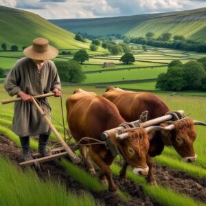
Prehistoric Yorkshire is a landscape rich with history, revealed through various archaeological finds that offer a glimpse into the ancient past. The oldest evidence of human activity in this region dates back to around 125,000 years ago, but it is the later periods, particularly the Iron Age, that have yielded significant discoveries related to ploughing and farming.

The use of the word Lady in relation to water related structures

Lady Bridge in Tamworth is a historical structure with medieval origins, serving as a testament to the town’s rich past. Initially constructed to span the River Tame, the bridge has undergone several transformations throughout the centuries. The original wooden bridge dates back to 1294.

Chapter 5 – The Later Neolithic Explosion

The one thousand years between 3,000 and 2,000 BC saw the Vale of Mowbray’s most significant period of development. It is at this time that the area between Boroughbridge and Catterick became the Sacred Vale, a premier ritual landscape, with Thornborough as its heart.

Carperby in Wensleydale

Carperby, nestled in the heart of Wensleydale, North Yorkshire, is a village steeped in history and archaeological significance.

Newton Kyme Henge

With kind permission of YAAMAPPING

Newton Kyme Henge occupies a slight rise on the south bank of the River Wharfe immediately west of the village of Newton Kyme (OS grid SE 45945 44982), its maximum external diameter extending to around 250 m (heritagegateway.org.uk). The monument is best understood as a Class IIa henge of Late Neolithic–Early Bronze Age date, defined by three concentric ditch circuits with a turf-and-earth bank wedged between the inner and middle ditches.

Uffington White Horse

The horse was dated to between 1400–600 BC by the Oxford University Research Unit in 1995 using optical stimulated luminescence dating, its age is probably late Bronze Age.

Finavon Fort

Finavon Hill has attracted a great deal of archaeological interest from antiquarians and archaeologists over the years especially since it displayed traces of vitrified rock.

Eileen na Goar Fort

Eilean nan Gobhar

This island, locally termed Eilean na Goar, is the most eastern and is bounded on all sides by precipitous gneiss rocks; it is the abode and nesting place of numerous sea birds. The flat surface on the top is 120 feet from the sea level, and the remains of the vitrified fort are situated on this, oblong in form, with a continuous rampart of vitrified wall five feet thick, attached at the SW end to a large upright rock of gneiss

Dunnideer Fort

The Medieval Castle, the most prominent feature in the hill, stands inside, and is built from the debris of, an oblong vitrified fort, a maximum length approximately 70 m, which crowns the summit. Outworks, most clearly marked on the E, may be associated with this phase.

Dundon Hill Fort

Dundon Hill from Lollover Hill

Dundon Hill rises as a freestanding limestone knoll above King’s Sedgemoor near Compton Dundon in central Somerset. A single earth-and-stone rampart, now anywhere between half a metre and a couple of metres high, encloses roughly five hectares on the summit.

Contact Us
close slider