Category: Brigantia

Henge Capital of Britain

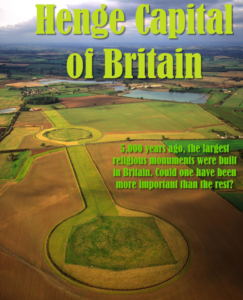
This is the cover page for the book, Henge Capital of Britain, written by George. It reviews the larger henges in the UK and proposes that Thornborough is worthy of greater consideration when it comes to our ideas of which ancient places of power have historic importance.
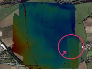
Newton Kyme Henge

With kind permission of YAAMAPPING

Newton Kyme Henge occupies a slight rise on the south bank of the River Wharfe immediately west of the village of Newton Kyme (OS grid SE 45945 44982), its maximum external diameter extending to around 250 m (heritagegateway.org.uk). The monument is best understood as a Class IIa henge of Late Neolithic–Early Bronze Age date, defined by three concentric ditch circuits with a turf-and-earth bank wedged between the inner and middle ditches.

Elslack Roman Fort

With kind permission of YAAMAPPING

← West Yorkshire Castle Hill, Almondbury Castle Hill’s imposing silhouette hides a great prehistoric fort, Norman castle and Victorian tower. Thanks to Varley’s trenches and the Read more West Yorkshire North Yorkshire The County of North Yorkshire is a small part of what was once a much larger collection of tribes in Read more Greta …

Continue reading

Whitley Castle Roman Fort (Epiacum)

With kind permission of YAAMAPPING

Those of you who are fans of Bernard Cornwell will know Whitley castle from his latest book: those of you who know their Roman stuff will know it as Epiacum Fort: and those who really know their stuff will know it’s the most complex set of defenses in the Roman world

Hardnott Roman Fort

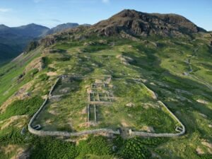
An aerial photo of Hardknott Roman Fort in Cumbria, part of a site report on brigantesnation.com

Hardknott Roman Fort, laying strewn like a discarded child’s toy on the high mountain side, impossibly canted to the east and perched precariously on a rugged cliff edge. Known to its builders as Mediobogdum, the fortress is square, as opposed to the usual rectangular shape. It is 115m to a side, and we have the traditional four gates. These are even today over head height.

Maidens Grave – Burton Fleming, North Yorkshire

With kind permission of YAAMAPPING

A henge located north of Rudston,The henge was discovered as a cropmark on an aerial photograph in the early 1960s, although subsequent field investigation showed it to survive as an earthwork, albeit badly plough-damaged.

The Brigantes of Lancashire

An image illustrating an article about The Brigantes of Lancashire on thealicesyndrome.com

An interesting heading in Robert Morden’s map of Lancashire (1695) places “The Brigantes” in Lancashire. Worth investigating to try to understand exactly what Robert Morden was trying to portray here.

Nunwick Henge

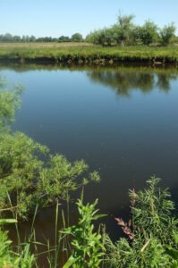
River Ure southwest of Nunwick

A henge at Nunwick visible both as a low bank and shallow internal ditch and as a cropmark. A berm was originally present between ditch and bank.

Sutton Common Fort

Sutton Common is an early Iron Age fort/enclosure site just north of Doncaster, A key feature of this “marsh fort” is that it seems to use the surrounding marsh land as part of its defence – a twist on the more common hill fort.

Castle Naze Hill Fort

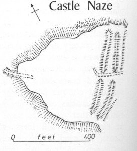
This is a promontory fort of probable Iron Age date. It uses the natural cliffs of the hill that it stands to protect its northern and western sides. It is triangular in form, and to protect its south-eastern face, a very impressive double rampart of possibly later Iron Age construction has been thrown up.

Contact Us
close slider