English names, Roman names where known, four figure map reference, site type, size, and history, including garrisons and associated military Read more
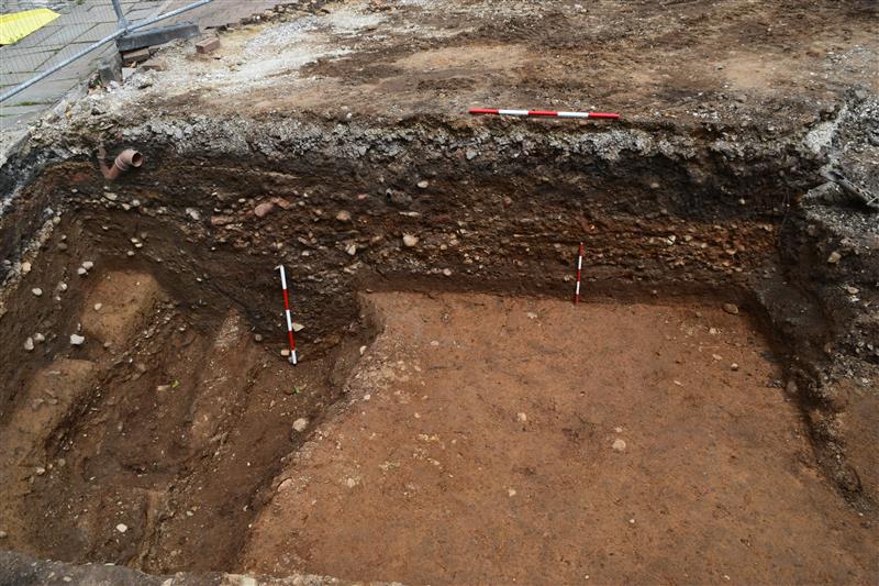
Section of Roman road in an excavation trench, Manchester, England (BBC Manchester)
What has (just) been found
Archaeologists have exposed a well-preserved cambered Roman road surface in Manchester’s Castlefield area (Liverpool Road/Liverpool Street reporting), astonishingly only c. 15 inches (≈38–40 cm) below modern tarmac, with an assemblage of Romano-British pottery and other small finds broadly dating its active use to the 1st–3rd centuries AD. (Archaeology Magazine, All That's Interesting, frontpagedetectives.com)
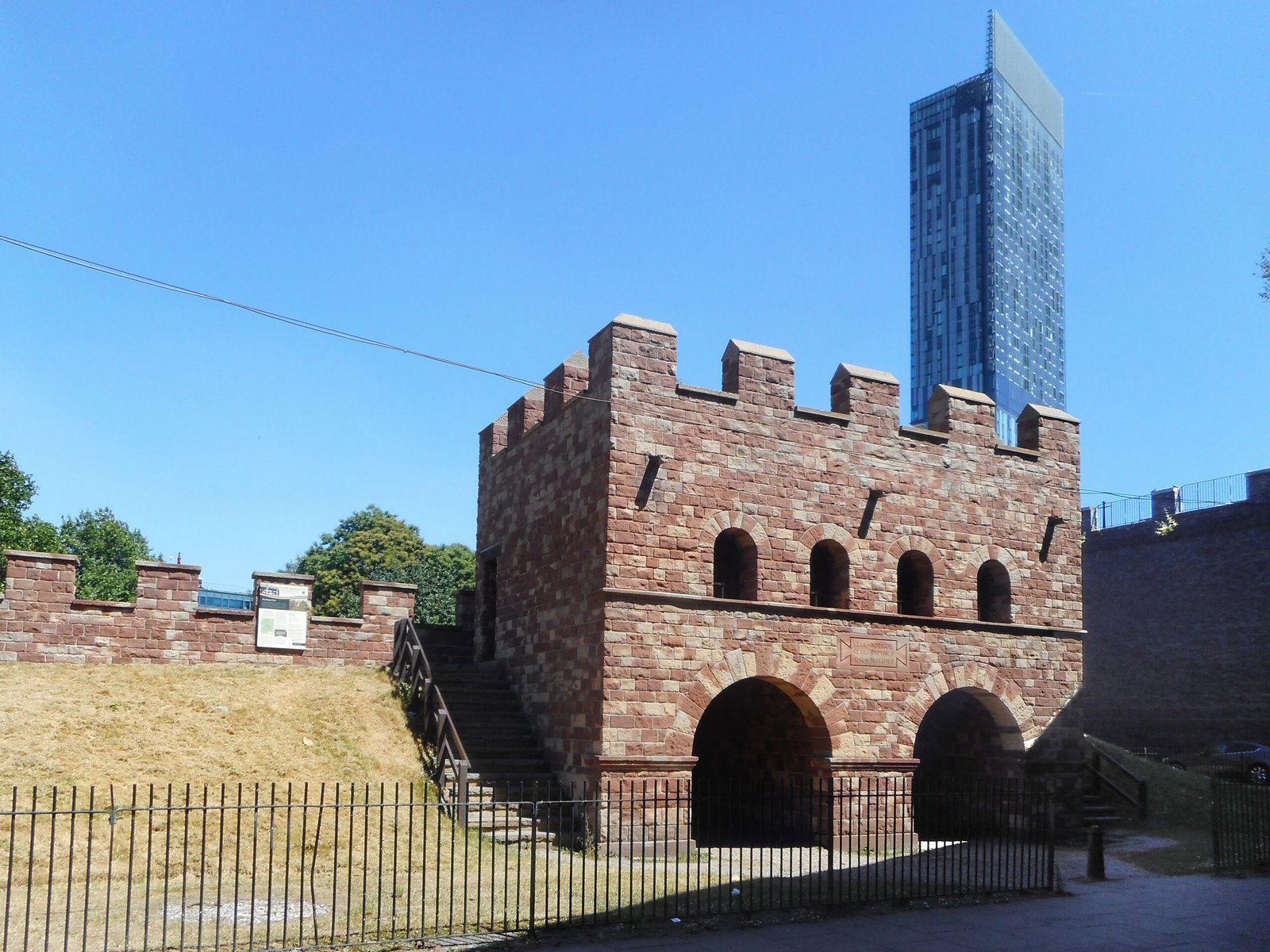
Multiple reports describe the discovery as the most significant Roman archaeology seen in Manchester city centre in two decades, underscoring its state of preservation and clarity of stratigraphic context near the fort of Mamucium. (Wikipedia)
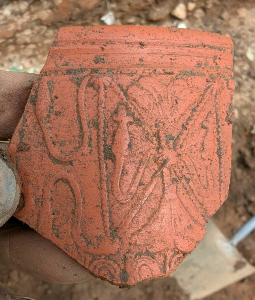
Fragment of decorated Samian ware recovered during excavations (Manchester University)
Network context: which road is this likely to be?
Mamucium (founded c. AD 79 during Agricola’s northern campaigns) sat at a junction: (1) an east-west arterial between the legionary fortresses of Deva Victrix (Chester) and Eboracum (York); (2) a route branching north/north-west toward Bremetennacum (Ribchester); and (3) a route east toward Castleshaw and onward to Slack (Cambodunum). (Roman Britain)
The newly exposed surface is being interpreted locally as a principal northern (or north-westerly) exit from the settlement’s vicus, consistent with the documented road alignment toward Ribchester and with earlier observations that Deansgate follows, in part, a Roman line. (Wikipedia)
It also appears spatially related to the vicus that grew on several sides of the fort (notably north), with new images/posts noting civilian settlement traces between diverging road alignments in Castlefield.
Iter distances (18 Roman miles from Mamucium to both Slack/Cambodunum and Condate/Northwich) highlight its role as an intermediate nodal hub rather than an isolated outpost; the rediscovered road surface supplies a tangible segment of that itinerary framework.
Construction & preservation factors (why so shallow and intact)
Typical Roman road engineering in Britain employed a prepared sub-grade, drainage ditches, successive aggregate/metalling layers and sometimes a crowned camber for water runoff; while the current press summaries emphasise preservation rather than detailed stratigraphy, the intactness so near the surface likely reflects later industrial truncation which stripped off intervening post-Roman soils, leaving only minimal overburden before modern resurfacing. (This inference aligns with documented 18th–19th-century levelling and canal/rail interventions that removed parts of the fort and its environs.)
The extremely slight overburden (≈15 inches / ~400 mm) is corroborated by multiple reports and on-site social media; one source gives “about a foot,” another “15 inches,” and posts give “400 mm,” all consistent; industrial redevelopment probably planed down earlier strata, inadvertently preserving the compact Roman road fabric as a hard working surface under later yards/streets.
Associated artifacts: dating & activity
Domestic and imported pottery plus glassware from 1st–3rd century contexts provide a use‐phase spanning the fort’s timber foundation phase (late 1st c.), through second and early third-century refurbishment and vicus activity (including the period around the stone defensive enhancements c. AD 200). (Kiddle)
The chronological spread of these finds dovetails with known construction and rebuilding phases of Mamucium (initial turf & timber c. 79; later strengthening c. 160; stone facing c. 200), supporting interpretation that the road remained a primary circulation axis across successive occupational horizons.
Presence of both locally made coarse wares and imported forms (per reports referencing mixed assemblages) is consistent with vicus commerce servicing auxiliary troops (c. 500 in early garrison estimations) and regional traffic between major legionary centres.
Reporting discrepancies & source quality notes
One secondary outlet appears to have a unit error listing depth as “400cm” (4 m) whereas all primary/other reports specify c. 15 inches / ~1 foot / 400 mm; internal consistency of the majority indicates the “400cm” figure is a typographical mistake. (infrastructure-now.co.uk)
Terminological variation (“Liverpool Street” vs “Liverpool Road”) occurs across pieces; local historical context (Liverpool Road railway station; Castlefield Bowl address) confirms “Liverpool Road” is the accurate present street name, suggesting “Street” is an occasional journalistic slip—important for precise geo-referencing in future reporting.
Wider comparative & strategic context
Compared with other urban Roman road survivals in Britain, the Manchester segment’s combination of preservation quality and minimal overburden is notable—many city-centre exposures elsewhere (e.g., York, London) lie deeper due to longer, less-truncated medieval stratigraphic build-up; here, aggressive Industrial Revolution modifications paradoxically reduced later stratigraphy while sparing subsurface Roman engineering layers. (Comparative depth inference based on Castlefield industrial levelling history.)
Strategically, Mamucium functioned as a junction fort overseeing river crossings (Medlock/Irwell) and interlinking trans-Pennine and north–south corridors between legionary centres and secondary forts (Castleshaw fortlet sequence, Slack, Ribchester); an in situ section of outbound roadway refines our on-the-ground understanding of junction geometry and vicus spatial organisation. (Blipfoto)
The find also intersects present heritage narratives in Castlefield—an area later repurposed as canal terminus and early railway hub—providing a stratified Palimpsest from Roman logistical infrastructure to industrial transport revolutions in a single horizontal slice. (Wikipedia)
Fragment of a copper alloy drilled buckle frame with a separate spindle, which is now missing, c. 1760-1790AD.Measurements: Length: 44.2mm; Width: 10.7mm; Thickness: 6.0mm; Weight: 3.64g [...]
A probable copper alloy Roman stylus dating to c.AD 43-410.The object comprises a shaft which is circular in cross section. At one end the shaft narrows to a pointed terminal. At the other, the shaft [...]
Everted and thickned rim sherd of a medieval to post-medieval cast copper alloy cooking vessel in quite fresh condition but with old breaks. There are slight traces of sooting on the exterior. The diameter is [...]
Five small fragments of fired clay, reduced with oxidised margins and surfaces, profuse chalk inclusions, and on two larger pieces withy impressions on smoothed surfaces. Weight 56g. Daub from stud walling or from a hearth or kiln [...]
A fragmentary and incomplete Roman silver Radiate of Gallienus, dating to c. AD 258-259 (Reece period 13). GERMANICVS MAX V reverse or similar depicting a trophy between two captives. Possibly mint of Lugdunum. Cf. RIC V Gallienus [...]
An extremely corroded Roman copper alloy Sestertius of uncertain 1st or 2nd century ruler. Uncertain reverse type depicting a standing figure. Probably mint of Rome. [...]
An incomplete uninscribed Iron Age silver unit of the Southern Region, probably of the East Wiltshire group and dating to c. 50-20 BC. Obverse: unclear, possibly a moon head, right. Reverse: Annulate horse, left. [...]
Thirteen sherds of medieval to post-medieval Late Medieval and Transitional pottery (Jennings 1981, 61-2), all body apart from 2 pancheon rim and 2 basal, weight 128g, mid 15th - 16th century. [...]
Two hundred and eighteen sherds of medieval pottery, body unless otherwise stated, weight 1.212kg, 12th - 15th century:- 216 unglazed including sixteen everted jar rim (cf. Jennings 1981 fig. 14 nos. 285-92), twenty-one bowl and [...]
A small oval tertiary flake of pale brown flint, probably of Neolithic date. The left lateral side has been refined with semi abrupt retouch struck from the dorsal side and there is a small amount [...]
A copper alloy fragment, probably from one end of a purse bar of late Medieval to early post Medieval date (cf. Williams Class C). The arm has a rounded cross section, 4.8mm in diameter and ends [...]
An incomplete medieval cast copper alloy oval buckle, with an expanded and thickened front edge. Any decoration has been lost to corrosion. The strap bar has small lobes at either end, but has broken away [...]
A complete copper alloy seal matrix of Medieval date (c. AD 1250-1300).The matrix is flat and pointed-oval or vesica-shaped. On the reverse is a central rib with a perforated lug at the top of the seal. The front [...]
Copper alloy jetton. Hammered French jetton, Late Medieval issue of 1350-1400Obverse description: box-like structure of bars ending on annulets – probably Chatel Tournois.Obverse inscription: [---]*E[-]I[-]SVReverse description: long cross, with short bars at ends of arms [...]
An Iron Age gold quarter stater of the East Wiltshire region, dating to c. 50-35 BC. Savernake Wheel type. Obverse: wreath, crescents below, pelleted spike. Reverse: horse, wheel below, solar spiral above. As ABC p.107, no.2101; BMC 546. [...]
An incomplete copper-alloy imitation of a Roman radiate, probably of Tetricus I (AD 271-274) or Tetricus II (AD 272-274) dating to the period c.AD 275-285 (Reece Period 14). Probably PIETAS AVGG / AVGVSTOR reverse type depicting sacrificial instruments. Unclear [...]
An incomplete silver Penny of James I (AD 1603-1625). First Coinage. Squared shield. Thistle or Lis initial mark. AD 1603-1605.Diameter: 13.44mm, Thickness: 0.38mm, Weight: 0.28gThe coin is missing minor portions of its outer flan.North Vol II, P 144, [...]
An incomplete silver Threepence of Elizabeth I (AD 1558-1603). Second coinage. Long cross fourchée over squared shield reverse, with date above. Sword initial mark. AD 1582.Diameter: 18.64mm, Thickness: 0.68mm, Weight: 1.41gThe coin is missing portions of its outer [...]
An incomplete copper alloy nummus of the House of Constantine dating to the period AD 354-361. Reece period 18. Probably SPES REIPVBLICE reverse type depicting the emperor standing left, holding globe and spear. Unclear mint.Diameter: 13.62mm, Weight: [...]