The Nosterfield Quarry excavation sits at the heart of one of Britain’s most enigmatic prehistoric landscapes—the Thornborough Henges Complex.
Wellhill Neolithic Farm
The village of Dunning in Perthshire, Scotland, has been revealed through excavation as having traces of human activity dating back 10,000 years. This included evidence of what could be the earliest farming activity recorded in Scotland so far, and also remains of hunter-gathering activity dating back to the Mesolithic period.
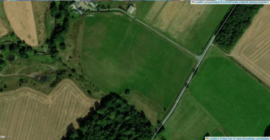
Wellhill lies on gently undulating ground just south of the village of Dunning, in the heart of Strathearn, Perth and Kinross (OS grid NN 830 142; c. 50–60 m OD). Geologically, the site sits on glacial sands and gravels derived from the Highland boundary, overlain by a thin veneer of fertile alluvial silts in a low-lying basin. Today the fields are bounded by medieval strip-farming rigs and later stone walls, but beneath the plough soil a rich sequence of prehistoric activity has been revealed (University of Glasgow).
Excavation Results
As part of the excavation of a large series of pits, the archaeologists discovered faint plough marks dating back to 3800 – 3700BC, which were most likely made by a hand-held scratch plough known as an ard, which does not turn over the soil.
Early Neolithic pottery (from almost 6000 years ago) was also found, with hundreds of pot shards recovered close to the plough marks.
“Evidence for ploughing and fields in Neolithic Britain is incredibly rare and so the excavation of the ard marks at Wellhill is a very significant discovery that suggests a farming economy had taken hold in this location only a few generations after farming began in Britain around 4000BC. This is an amazing insight into the lives of Scotland’s first farmers”. Dr Kenneth Brophy from the University of Glasgow
Wellhill Prehistoric Settlement - Dunning - OS Series 1 - National Museum of Scotland
Excavation and Methodology
SERF Phase 2 (2014): As part of the Strathearn Environs and Royal Forteviot project, two adjacent cropmark areas (WH14.1 & WH14.2) were trenched in May–June 2014 by the University of Glasgow’s Archaeological Research Services.
Techniques: Natural-soil profiles were recorded in section; all pit and furrow features were half-sectioned; bulk sediment samples were taken for radiocarbon, Micromorphology and environmental analysis; pottery was spot-dated by sherd types.
Key Features and Phases
Early Neolithic Field Boundaries
In WH14.1 a linear bank-slot and paired pits define an earliest enclosure, likely a banked boundary for small plots. Two small ard-mark ruts cut through one boundary pit, demonstrating early plough use.
Early Neolithic pottery sherds (Horizon I Plain ware) from pit fills date this phase to c. 3800–3600 BC .
Secondary Pit Aligned “Field” (WH14.2)
An arc of tightly-spaced quarry-pits (Features 38–42) runs for 12 m, aligned NW–SE. These may have provided stone for ephemeral earthen banks that have since been ploughed away.
One of these pits (Feature 40) cuts an earlier cremation deposit—radiocarbon /AMS dating of charcoal from the cremation returned 2470–2200 BC, placing it in the Late Neolithic–Early Bronze Age transition .
Two ard-mark furrows cut across this pit alignment, showing that scratch-plough technology was still in use in the 3rd millennium BC.
Wellhill - Furrow -Dene Wright 2014
Later Activity
A series of stakeholes and postholes around the pit arc may represent a small Neolithic or Bronze-Age enclosure or animal pen.
No medieval ridge-and-furrow survives in these trenches, but local walls and hedges indicate extensive later agrarian re-use of the same soils.
Environmental & Micromorphological Insights
Soil thin sections from furrow fills show a sharp boundary between cultivated loam and undisturbed subsoil, confirming that the ard marks represent genuine cultivation rather than natural cracks.
Pollen from pit fills contains cereal indicators (Hordeum-type) and ruderal weeds (Chenopodiaceae), attesting to active crop cultivation in the Neolithic phase.
Mesolithic Activity
Further radiocarbon dating of the dig sites showed that the pits actually dated back even further, to the late 8th millennium BC, meaning that they provide evidence of the first Mesolithic events in the lowlands of Perth and Kinross. It would be good to cross compare these Mesolithic Pits with those found at Nosterfieldin North Yorkshire.
Mesolithic activity at Wellhill is represented by an alignment of ten small pits—often termed “halo pits” because of their roughly circular plan—that have produced some of the earliest securely dated hunter-gatherer features in lowland Scotland. Radiocarbon dates on charcoal from these pits span 8205–7525 cal BC, placing them firmly in the Early Mesolithic (pkht.org.uk).
These pits occur in a gentle hollow at the edge of the gravels, inter-visible with the later Neolithic and Bronze-Age features. Excavators noted:
Pit morphology: Each pit is sub-circular, c. 1–1.5 m in diameter and 20–30 cm deep, with sharply cut edges showing minimal post-depositional disturbance.
Associated features: A shallow L-shaped ditch, interpreted as a fragile windbreak or screening feature, lay just upslope of the pit line.
Lithic remains: Occasional micro-debitage (tiny bladelet chips) within the pits suggests they were cache-holes, perhaps for storing tools or seasonal supplies that were never retrieved (pkht.org.uk).
Environmental context: Pollen and charcoal fragments indicate a lightly wooded environment of birch and hazel, with patches of open grassland—ideal for mixed foraging and early-season hunting.
Taken together, these Mesolithic pits at Wellhill appear to mark a short-lived encampment or series of visits by mobile hunter-gatherers exploiting the Strathearn gravels. Their alignment—ten pits in a linear array—may have structured hearth placements or food caches along a seasonal trackway. Crucially, they pre-date the Neolithic field boundaries and ard-marks by millennia, demonstrating an unbroken sequence of landscape use from Mesolithic foragers through to medieval farmers in this same locale.
Significance in Context
Wellhill provides rare direct evidence of the transition between Mesolithic hunter gatherer type human activity, to Early Neolithic fixed settlement with ploughed fields using ards. The juxtaposition of Late Mesolithic seasonal use, with Early Neolithic field boundaries and Late Neolithic–Early Bronze Age cremation and clearance pits shows a continuity of land-division and cultivation over nearly two millennia.
This multi-phase agricultural sequence, set in the fertile yet well-drained gravels of Strathearn, demonstrates that:
A settled pattern of late hunter gatherer seasonal use of the site.
Scratch-plough (ard) technology was adopted early, possibly as soon as the first farmers arrived;
Land-clearance and boundary construction went hand-in-hand with funerary rites, embedding social memory in the very fields they farmed;
Later medieval rig systems rest directly above these prehistoric features, continuing the same fundamental land-use traditions into the modern era.
Wellhill thus provides a most needed bridge for the gap between paleoenvironmental proxies and hands-on evidence for prehistoric agriculture, offering a template for identifying and dating early ploughing in other parts of Scotland and beyond.
A complete silver Scottish twelve shillings coin of James VI of Scotland and I of England, eighth coinage post-dating accession to English throne, dating to 1603-1625, Lys initial mark. Reverse has a shield with arms of [...]
A silver Post-Medieval shilling of Elizabeth I, third issue with ‘A’ initial mark dating to 1583-1585. Mint of London. As North Vol 2, p.136, no.2014. [...]
A lead alloy pipe tamper dating to the 17th century. The plate has moulded decoration to both sides depicting Charles I (facing right) and Henrietta Maria of France (facing left). Both images are contained in [...]
A damaged lead-alloy Medieval pilgrim's ampulla, 50mm in length and 35mm wide, with a round bodied flask with a flaring open top which is partially complete. One side of the flask body has traces of moulded [...]
An incomplete Medieval cast copper alloy buckle plate, dating to c. AD 1100-1400. The plate is missing its buckle and part of its sprues. The buckle plate is sub-rectangular in plan. Projecting from one long edge [...]
A Roman copper-alloy nummus of the House of Valentinian , dating to AD 364-7 (Reece Period 19), GLORIA RO-MANORVM reverse type depicting the emperor with right hand dragging captive right and holding a labarum in left hand. Mint of [...]
A Post-Medieval copper alloy farthing of Charles I (AD 1625-1649), dating to AD 1636-1644. Rose type 2, with sceptres in saltire through single crown. Mint of London. Unclear initial mark. North (1991: 165) no. 2291. [...]
A clipped and heavily worn Roman copper alloy nummus of Gratian (AD 367-383) dating to the period AD 367-378 (Reece period 19). SECURITAS REI PUBLICAE reverse type depicting Victory advancing left, holding a wreath and palm. Unknown mint. [...]
A silver Roman siliqua of Honorius (AD 393-423) dating to the period AD 397-402 (Reece Period 21) minted in Milan VIRTVS ROMANORVM reverse type depicting Roma seated left on cuirass, holding Victory on globe and spear. Hoxne, p. 145, no. [...]
An incomplete Roman composite plate brooch probably dating to AD 100-200. The brooch is missing it's pin and part of the top and bottom circles. The brooch is flat in cross section and probably originally consisted of [...]
Fragment from a probable buckle frame dating to the Post Medieval period (c.AD 1720-1790). The fragment is broadly rectangular in plan and includes a short section of the corner of the buckle frame. The fragment includes the [...]
Fragment from a buckle frame dating to the Post Medieval period (c.AD 1720-1790). The fragment is broadly C shaped in plan and D shaped in profile. It consists of two corners and one side of a sub-rectangular [...]
A complete copper alloy bovine (bull's head) vessel / bucket mount, dating to the Roman period (c. AD 50-200).The cast copper alloy mount is a sub-inverted triangle with a pointed lower tip and slightly waisted sides to form the nose.The [...]
An incomplete copper-alloy early Medieval stirrup strap mount of uncertain or unclassified type, dating to c.AD 1050-1150. The central part of the object survives with parts of the open work broken off on all sides except [...]
A near complete Medieval-Post Medieval cast copper alloy buckle with integrated plate dating to the period c.AD 1250-1500. The buckle is missing its pin.It has a rectangular frame, which has a sub rectangular cross-section. The integral plate has [...]
A very worn copper-alloy Roman radiate or nummus of unclear ruler dating to AD 260-402. Unclear reverse type, unclear mint.The coin is chipped around its circumference. [...]
A very worn Roman copper alloy radiate of uncertain emperor dating to the period AD 260-275 (Reece period 13). Unclear reverse type depicting. Unclear mint. [...]
An incomplete Medieval cast copper-alloy rectangular buckle with integral looped plate, dating to c. AD 1200-1400. The buckle is missing its pin. The buckle comprises a rectangular loop and an integral plate. The plate is made [...]


 Wellhill Neolithic Farm


