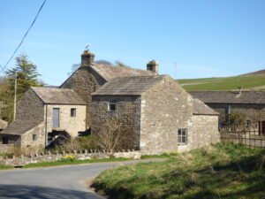
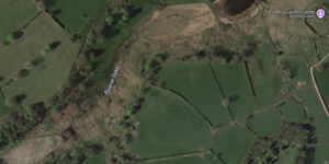
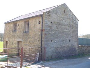
Analysis of air photography has revealed the almost complete plan of a feature. Thought to be a henge of similar nature to those elsewhere in the Swale-Ure valley. The bank of the earthwork was composed of river cobble and gravel dump construction. The cropmark remains appear to be the henge bank of some 140m in diameter.
Location: north-yorkshire
Castle Dykes Roman Villa
This earthwork was partially excavated in 1870, these revealed the foundations for a Roman villa of obvious opulence. It’s final Roman owners were believed to have suffered a grisly death as the villa burnt around them. It is likely that future excavations will reveal that the villa was built over of an earlier tribal centre. Probably replacing the shrine to the “Light Water” with a more Mediterranean alternative.
Tor Dyke
Tor Dyke appears to have been attributed to Venutius which dates it of the period AD 52 – 70. The presence of a legionary size marching camp a few miles to the southwest at Malham certainly indicates an active role in the Roman advance of AD 70. However, given the lack of published research so far a clear picture has yet to emerge.
Pickhill Mound
A large artificial mound here, apparently raised for defensive purposes, bears the name of Picts’ Hill, and an improbable belief prevails that the Picts defeated the Romans in battle at a spot, not far off, called Roman Castle. This mound is also known as Money Hill, but, though partially cut away for the construction of the railway, the traditionary hidden treasure was not found
Malham Roman Marching Camp
← North YorkshireSite Details: Around 70 AD Cerialis the new Governer of Britain ordered two of his legions advance on the Brigantes of Yorkshire. From the South west (North Wales?) came the XX legion commanded by Agricola. Their mission was to meet the IX legion at Stanwick to attack King Venutius. Was this legionary marching …
Live Moor Hill Fort
“Whorlton, Live Moor, (NZ 496012) A previously unrecorded promontory fort was identified by D. Smith on air photographs and later surveyed by him and G. W. Goodall. A single rampart with external ditch extends across the west-facing spur of Live Moor to enclose an area of approximately 2 acres known as Knolls End.