Venutius

Author's posts

Nathwaite Bridge – Coverdale

Nathwaite Bridge, Carlton Yorkshire Dales

Nathwaite bridge over the River Cover is a strategically placed river crossing, for centuries it has been the only crossing point over the river Cover, and with a fortified barn right next door to it, this is an enigmatic site worthy of closer attention.

Bridge Barn just south-east of Nathwaite Bridge – Coverdale

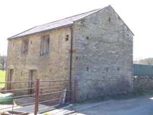
Bridge Barn - Carlton in Coverdale

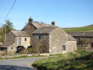
The barn that is located closest to Nathwaite Bridge seems important, but is poorly understand and recorded. It’s position, in close proximity to the bridge, together with three arrow-slot style defensive features indicate it may have served to protect the Carlton side of the river from raiders, and is in a perfect position, strategically. Yet, it is not recorded as such, and may be later in its creation, as it does not appear on some earlier maps.

A short history of coal-mining in Coverdale

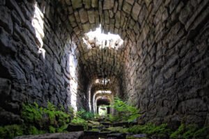
Mine Flue Tunnel

Coverdale never possessed the thick, profitable seams that powered the great Yorkshire coalfield; instead it sat on the very feather-edge of the Yoredale Series where thin coal bands (18 – 50 cm) lie between the well-known limestone, sandstone and shale rhythms.

The Geology of the Iberian Peninsular

This report intends to provide an understanding of the major geological landscape of the Iberian Peninsular. We can understand Iberia as having five tectonic provinces – zones of underlying tectonic activity, caused by two plates, or distinct bodies of earth mass, are moving towards, or away from each other. This, combined with the geology of the earth at that point: the rock, etc, that forms the basic structural profile for the peninsular overall.

Farley Moor Stone Circle, Derbyshire

Farley Moor Standing Stone, now part of Farley Moor Stone Circle, thanks to Time Team. Image taken from their video, below.

Geophysics and three hand-excavated trenches uncovered ten further uprights, in addition to the known standing stone at Farley Moor Woods, lying just below the leaf-litter, defining a ring c. 18 m in diameter around the visible stone. A low stone-built platform or ā€œkerb cairnā€ occupies the circle’s south-eastern arc; charcoal lenses and a smashed Collared-Urn sherd in its make-up gave an early Bronze-Age radiocarbon estimate of c. 1700 BCE (3,700 cal BP).

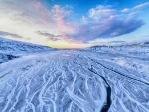
Guide – Introduction to the European Ice Age

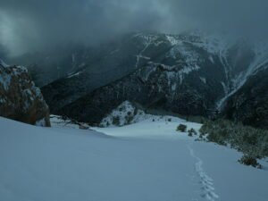
snow covered field

Antonine Wall Map Gask Ridge Map Roman Military Sites in Scotland English names, Roman names where known, four figure map reference, site type, size, and history, including garrisons and associated military Read more Mystery of Vitrified Forts It was during a trip to.Scotland, in the Summer of 1997, that I first heard of vitrified hillforts. …

Continue reading

Brigantia Espania

The North-West coast of Spain

Brigantia Espania is our name for our Spanish Brigantian research pages and sites. This is the beginning of our journey, and we start at the beginning.

Hutton Rudby

Hutton Rudby

Hutton Rudby was once known as Hutton-juxta-Rudby, or Hutton-nigh-Rudby, because it is really two villages: Hutton and Rudby, separated from each other by the River Leven. How old is the village? There have been people living here for thousands of years. Stone Age tools have been found in North End.

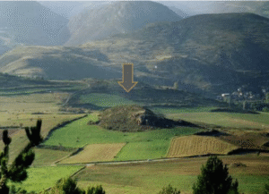
Montlleó, Cerdanya, Pyrenees – Lithics Study

Montlleó sits at 1,144 m a.s.l. on a low knoll in the high, east–west Cerdanya valley of the eastern Pyrenees, a natural corridor between the Bay of Biscay and the Gulf of Lion. Excavated since 2000, the open-air site preserves a 23,000 – 17,000 cal BP occupation sequence that spans the harshest part of the Last Glacial Maximum (LGM) through early deglaciation. Because mountain ice in the Pyrenees retreated earlier than the global LGM, Montlleó shows that hunter-gatherers could exploit altitudes that were once thought permafrost-bound.

West Scrafton – Coverdale

West Scrafton

West Scrafton is a village located in Coverdale in the Yorkshire Dales. It sits on the southern upward slops of Coverdale, and had its most recent heyday in the 19th century when coal mining took over the village.

Contact Us
close slider