Notice: Function WP_Scripts::add was called incorrectly. The script with the handle "datatables-responsive" was enqueued with dependencies that are not registered: datatables. Please see Debugging in WordPress for more information. (This message was added in version 6.9.1.) in /home/u621095157/domains/brigantesnation.com/public_html/wp-includes/functions.php on line 6131
Archaeologists now recognise a true Neolithic henge lying immediately south-west of Moulton village, roughly midway between the Swale and Dere Read more
The recent discovery at Catterick has unveiled a significant Late Neolithic palisaded enclosure, shedding light on the prehistoric landscape of Read more
A gazetteer of probable prehistoric mounds, cairns and boundary earthworks in Coverdale. It is not complete and is still being Read more
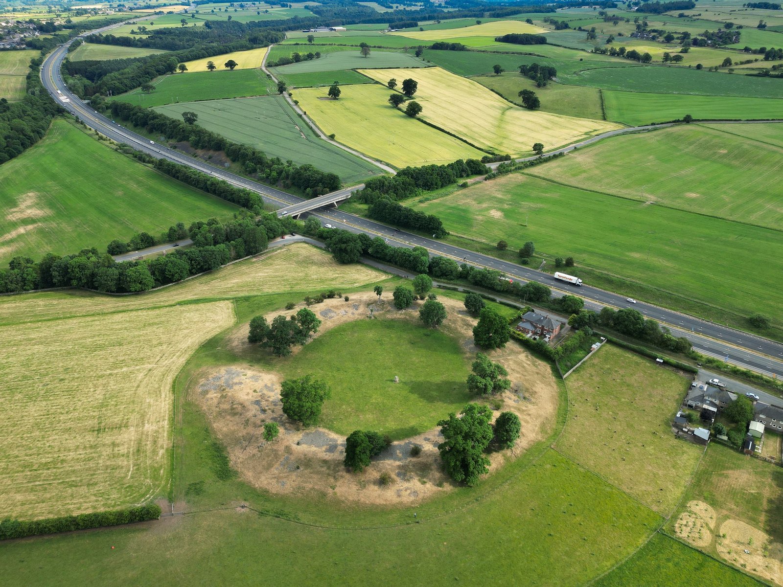
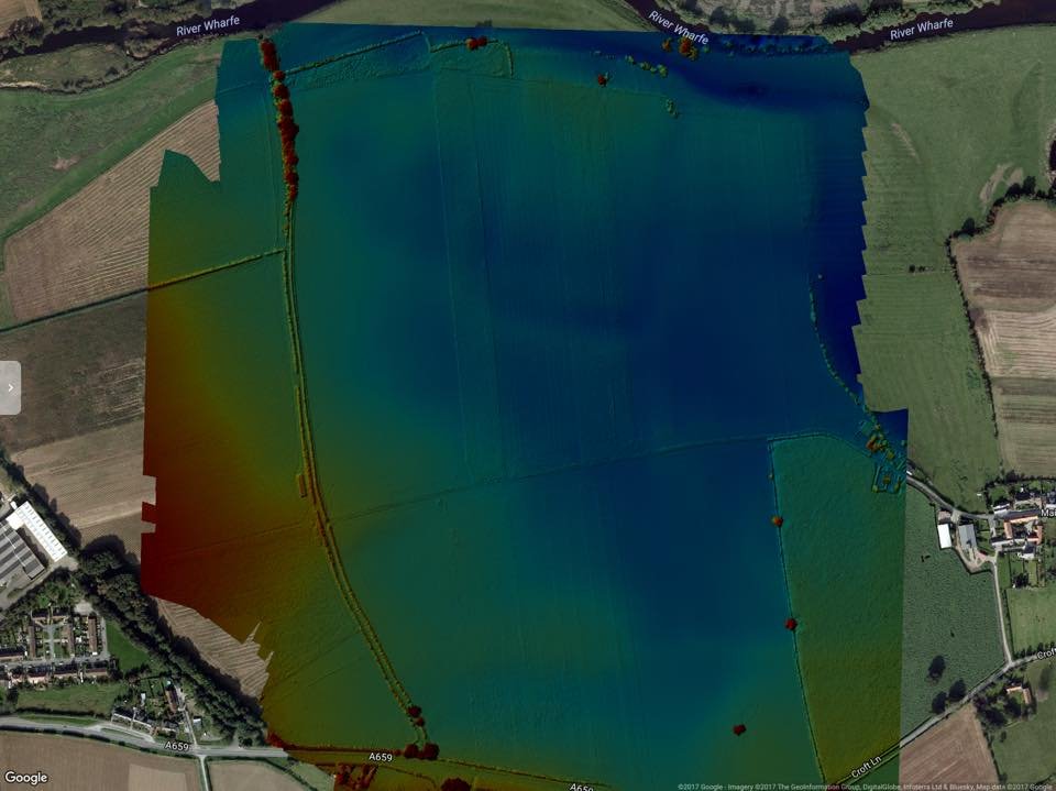
Newton Kyme hosts the site for what was once a 200m henge of the Thornborough variety. Images provided by YAAMAPPING with thanks
Summary of Archaeological Work
Introduction
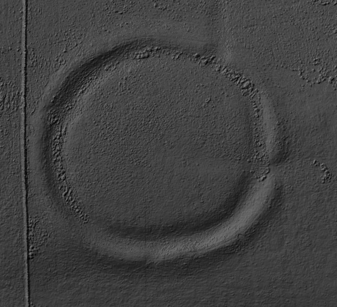
Newton Kyme Henge occupies a slight rise on the south bank of the River Wharfe immediately west of the village of Newton Kyme (OS grid SE 45945 44982), its maximum external diameter extending to around 250 m (heritagegateway.org.uk). The monument is best understood as a Class IIa henge of Late Neolithic–Early Bronze Age date, defined by three concentric ditch circuits with a turf-and-earth bank wedged between the inner and middle ditches.
Discovery from Cropmarks
The henge first emerged as a cropmark feature on St Joseph aerial photographs of 1967, but it was not until deep ploughing in 1976 that its full three-ring form—inner, middle and segmented outer ditches—became clear (heritagegateway.org.uk). The innermost ditch, broad and regular, presents slight Earthwork remains on the ground, including opposing entrances at roughly 170° and 350°, while the middle and outer ditches survive only as interrupted cropmarks.
Photographic Investigations
In 1979, Ordnance Survey field investigators confirmed on-site what the photographs had shown: the inner ditch survives as a shallow hollow up to 1 m deep, flanked outwardly by a low bank nearly a metre high; vestiges of quarry-pits lie just beyond the outer ditch (heritagegateway.org.uk). That same year the RCHME (Royal Commission on the Historical Monuments of England) evaluated the site as part of its “Industry and Enclosure in the Neolithic” project, concluding that despite the segmented outer circuit—which superficially resembles a causewayed enclosure—all three ditches formed a single henge monument with parallels among other Yorkshire examples (e.g. the Thornborough circles) (heritagegateway.org.uk).
Subsequent air-photo interpretation under the Vale of York Project (1994–2000) reaffirmed the monument’s plan at 1:10,000 scale and found no evidence of Roman-period reuse as an amphitheatre or training ground, despite its proximity to the Roman forts and vicus at Newton Kyme (heritagegateway.org.uk). No extensive excavations have been carried out, though limited trial-trenches noted a firm chalk base to the inner ditch and lack of significant later disturbance. A small programme of field observation in 1985 recorded slight bank-and-ditch relief, while later Heritage-at-Risk inspections have monitored erosion around the entrances (heritagegateway.org.uk).
Broader Context
Beyond the henge itself, the broader complex of earthworks west of Newton Kyme includes two Roman marching camps, a vicus settlement with trackways and rectangular enclosures, an Iron-Age enclosure, plus Bronze-Age Barrows clustered on the terrace edge . These were mapped in detail through aerial photography by the York Archaeological Trust and YAAMapping, but—with the exception of the henge—have not been explored by modern excavation.
Taken together, the archaeological work at Newton Kyme has been almost entirely non-invasive: cropmark and air-photo survey (1967–98), targeted fieldwalking and evaluation trenches (1979–85), and documentary transcription under successive national projects. These investigations have firmly dated the henge to c. 2500–2000 BC and clarified its three-ditch form, while situating it within a multi-period ritual and settlement landscape that spans the Neolithic through Roman periods.