Contents
- 1 Full Analysis Plan for Nosterfield Quarry Report
- 2 Introduction: Unveiling the Archaeological Landscape of Nosterfield
- 3 Chronological Breakdown: Period-by-Period Analysis
- 4 Mesolithic (10,000–4000 BC): The Earliest Human Footprints
- 5 Mesolithic Environmental Data: Reconstructing the Prehistoric Landscape
- 6 Soil Analysis & Hydrology: A Water-Influenced Ritual Landscape?
- 7 Neolithic (4000–2500 BC): Monumentality & The Rise of the Henges
- 8 Neolithic Environmental Data: The Ritualization of the Landscape
- 9 Soil Composition & Hydrology: A Site Defined by Water
- 10 Animal & Faunal Remains: Ritual Deposits or Sustenance?
- 11 Critical Environmental Questions
- 12 Conclusion: The Environmental Context of a Sacred Neolithic Site
- 13 Bronze Age (2500–800 BC): A Shift in Purpose?
- 14 Iron Age (800 BC – AD 43): Burials, Rituals, and Unanswered Questions
- 15 Key Findings:
- 16 Next Steps for Investigation:
- 17 Final Thought:
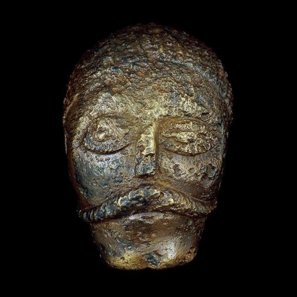
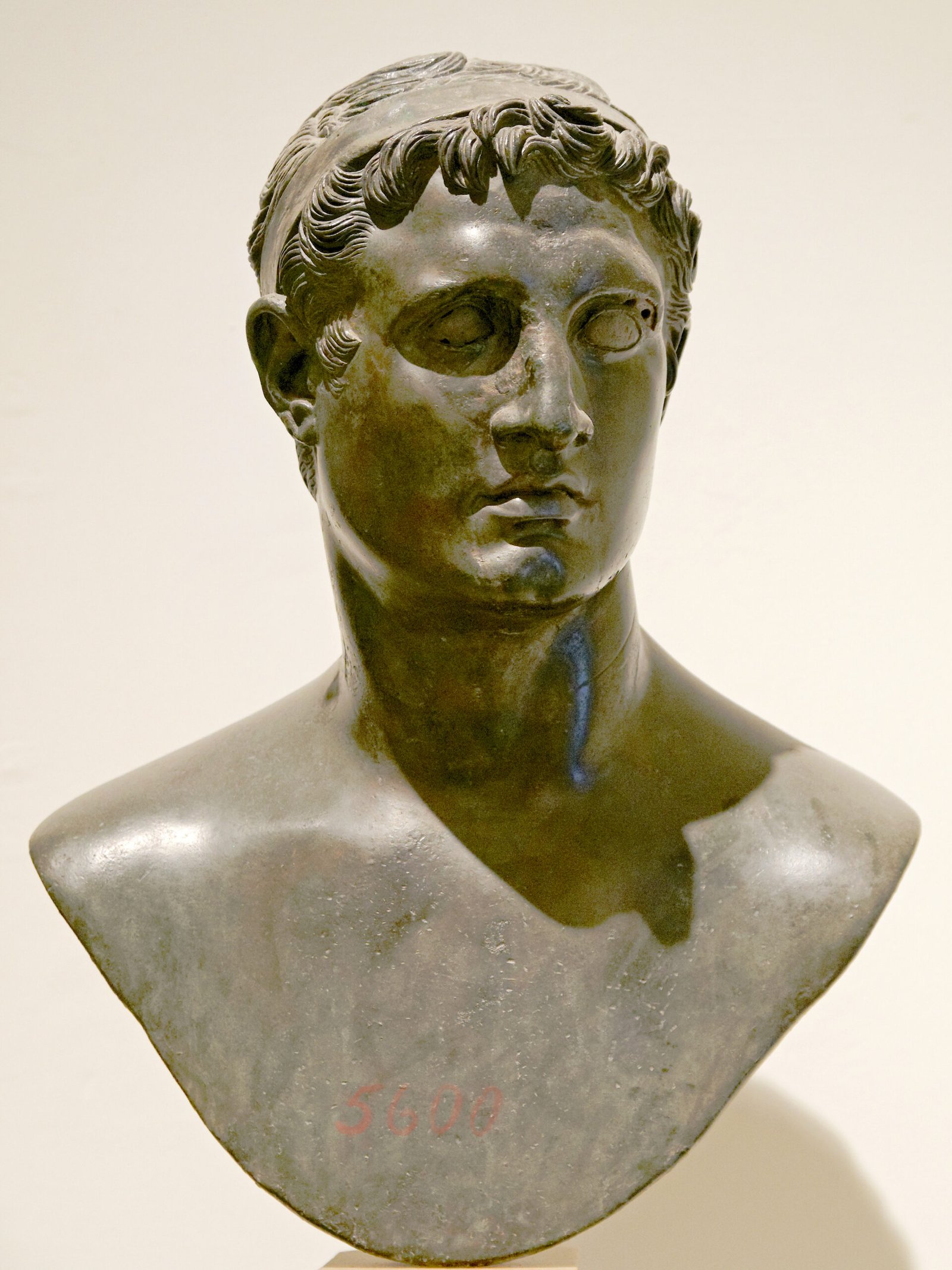
Celtic Head from Witham, 2nd c B.C. (British Museum) "Celtic" carved heads are found throughout the Read more

This timeline is focussed on the British Celtic culture and those cultures which had influence on the British Celts. It Read more
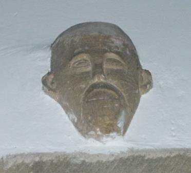
An analysis of head carvings in a local area In many churches throughout England there are carvings of possible pagan Read more

Yorkshire, and much of northern Britain was also ruled by a queen, the most powerful ruler in Britain in fact. Read more

Caratacus was highly influenced by the Druids, and both he and his brother Togodumnus were among the leading lights of Read more

Quintus Petillius Cerialis Caesius Rufus was the son-in-law of Vespasian Cerialis and became Governor of Britain in AD.71; his instructions Read more

Ask anyone to name a famous Roman character, and the name of Julius Caesar is sure to be the most Read more
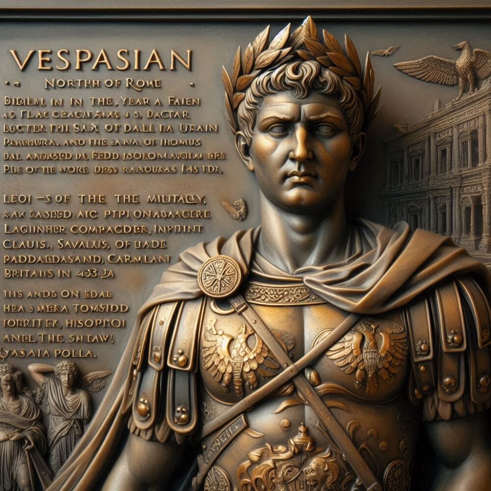
Born in the year 9 at Reate, north of Rome, Vespasian was the son of a tax collector, Flavius Sabinus Read more
Suetonius wrote of him: He was very handsome and most graceful at all stages of his life, although he cared Read more
Tiberius Claudius Nero Germanicus was born Lugunum in 10 BC, the youngest son of Nero Drusus, brother of Tiberius. He Read more
Geoffrey of Monmouth's Kings of Britain includes a number of unknown potential kings, as well as some recognised as existing, Read more

Many Celtic deities seem to have been associated with aspects of nature and worshipped in sacred groves. Some appear in Read more
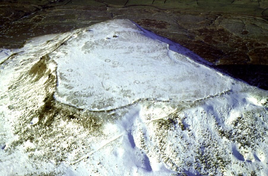
The Nosterfield Quarry excavation sits at the heart of one of Britain’s most enigmatic prehistoric landscapes—the Thornborough Henges Complex. While officially overshadowed by the three monumental henges that dominate the region, the archaeological record at Nosterfield presents an underrated yet critical dataset that may offer profound insights into ritual continuity, elite burials, and shifting cultural influences from the Mesolithic to the Iron Age and beyond.
Thornborough, often dubbed the ‘Stonehenge of the North,’ is a landscape steeped in Neolithic and Bronze Age ceremonial activity, and its wider surroundings have yielded anomalies that challenge mainstream interpretations. In light of new evidence emerging from sites such as Castle Dykes Henge in Wensleydale, which has been recently confirmed as an Iron Age construction, it becomes even more pertinent to ask whether the use of monumental landscapes continued long after their assumed abandonment. Was Nosterfield an integral part of this wider ritual complex? And if so, why has its significance remained largely buried—both figuratively and literally?
This report will analyse the full chronological sequence of archaeological remains at Nosterfield, from the Mesolithic through to the Roman period, cross-referencing findings with sites such as Stonehenge, Avebury, Priddy Circles, and Knowlton Henges, to identify broader ritual and social trends. Moreover, it will critically evaluate biases in reporting, omissions, and potential concealment of critical discoveries, particularly in relation to the Iron Age period, where significant evidence—including square barrows, a four-horse burial, and an enigmatic ditch skeleton—has surfaced but appears downplayed in official narratives.
By reconstructing Nosterfield’s past, this analysis aims to establish whether it was simply a peripheral site to the Thornborough Henges or whether it held a unique and potentially disruptive role in our understanding of prehistoric Britain’s ceremonial evolution. Furthermore, as the only publicly accessible copy of this excavation report is housed in the soon-to-close Northallerton Council Offices, it is imperative that the findings are meticulously examined and preserved for future research.
Chronological Breakdown: Period-by-Period Analysis
The following sections will dissect each major chronological phase of occupation at Nosterfield, considering how each period contributed to the ritual, burial, and settlement activity in the landscape.
- Mesolithic (10,000–4000 BC): Posthole evidence, landscape usage, and comparison to Stonehenge’s Mesolithic features.
- Neolithic (4000–2500 BC): Monument construction, settlements, and any connection to the Thornborough Henges.
- Bronze Age (2500–800 BC): Burial traditions, Round Barrows, and environmental context.
- Iron Age (800 BC–AD 43): Square barrows, ritual deposits, and cross-analysis with the Parisi Tribe and Castle Dykes Henge.
- Roman Influence (AD 43–410): Adaptation, disruption, and possible cultural assimilation.
- Early Medieval & Post-Medieval Period: Later land use, Christian overlay, and residual prehistoric features.
Each period will be systematically analysed, followed by a comparative discussion addressing key themes, including the ritual significance of the Iron Age burials, the potential Parisi cultural influence, and whether the site was intentionally marginalized in the archaeological record.
Through this detailed, multi-phase analysis, we aim to shed light on whether Nosterfield was merely an extractive landscape for resources or a critical part of Britain’s enduring sacred geography.
Mesolithic (10,000–4000 BC): The Earliest Human Footprints
The earliest evidence of human activity at Nosterfield comes from the Mesolithic period, a time when Britain was still heavily forested, and small groups of hunter-gatherers moved through the landscape, leaving behind traces of their existence. While this period is often overshadowed by later monumental activity, the significance of Mesolithic features at ritual landscapes has gained increasing recognition, particularly through comparisons to Stonehenge, Priddy Circles, Knowlton Henges, and other sites with deep prehistoric continuity.
Key Mesolithic Evidence at Nosterfield
- Flint Scatters & Microliths – Small tools indicative of a transient presence, possibly linked to hunting and food processing.
- Double Pit Alignment – A feature of particular interest, as pit alignments of this period have been associated with early ritual markers.
- Environmental Context – Pollen analysis suggests a landscape in transition, with clearings potentially shaped by fire and seasonal occupation.
The presence of a twin-line post setting is highly intriguing, as it mirrors other significant Mesolithic postholes discovered at Stonehenge’s car park, which predate the construction of the famous stone circle by several thousand years. These postholes, originally assumed to be natural features, were later confirmed as deliberately set timber posts, possibly serving as early territorial markers or ritual structures.
Comparison to Other Mesolithic Sites
- Stonehenge (Mesolithic Postholes) – A triad of deep post settings at the car park entrance, marking ritual activity centuries before the first stones were placed.
- Thornborough Henges (Precursor Activity?) – No confirmed Mesolithic structures, but given the site’s alignment with lunar cycles, could early ritual observances have begun here in the same way they did at Stonehenge?
- Knowlton Henges & Priddy Circles – Some evidence of Mesolithic occupation prior to Neolithic construction, suggesting similar landscape evolution.
Critical Questions: What is Being Overlooked?
Why has the significance of Mesolithic activity at Nosterfield not been emphasized?
Could the twin pits represent the earliest human structuring of this ritual landscape?
Does the environmental data support a transition from open woodland to a deliberately managed space?
Why does English Heritage not consider Mesolithic activity in its discussions of Thornborough’s origins, despite parallels with Stonehenge?
The Mesolithic phase at Nosterfield may hold the key to understanding why this region became a focal point for later prehistoric activity. Given the parallels with other major henge landscapes, it is worth considering whether the significance of early activity has been intentionally downplayed to preserve a more conventional narrative.
Mesolithic Environmental Data: Reconstructing the Prehistoric Landscape
Understanding the environmental conditions of Nosterfield during the Mesolithic period is essential in assessing its significance. The landscape of prehistoric North Yorkshire was undergoing dynamic climatic and ecological changes, shaping human occupation patterns.
Pollen & Vegetation Analysis: A Shifting Woodland Mosaic
- Early Mesolithic (10,000–8000 BC):
The landscape was dominated by dense, closed-canopy forests, primarily composed of oak, elm, and pine, with patches of birch and hazel. These forests were interspersed with marshy wetlands, creating a varied terrain that supported diverse fauna and flora. - Middle to Late Mesolithic (8000–4000 BC):
Pollen evidence suggests a shift toward a more open environment, likely influenced by natural climatic warming and human-induced clearances. Evidence from similar landscapes indicates small-scale woodland clearance by fire, an early sign of deliberate landscape management.
Comparison to Other Sites:
The transition from closed to semi-open woodland is also seen at Thornborough Henges, Star Carr (North Yorkshire), and even Stonehenge’s Mesolithic phase, where deliberate clearings may have paved the way for later ritualized landscapes. Could Nosterfield have followed a similar trajectory, transitioning from a hunting ground into an early ritual focus point?
Soil Analysis & Hydrology: A Water-Influenced Ritual Landscape?
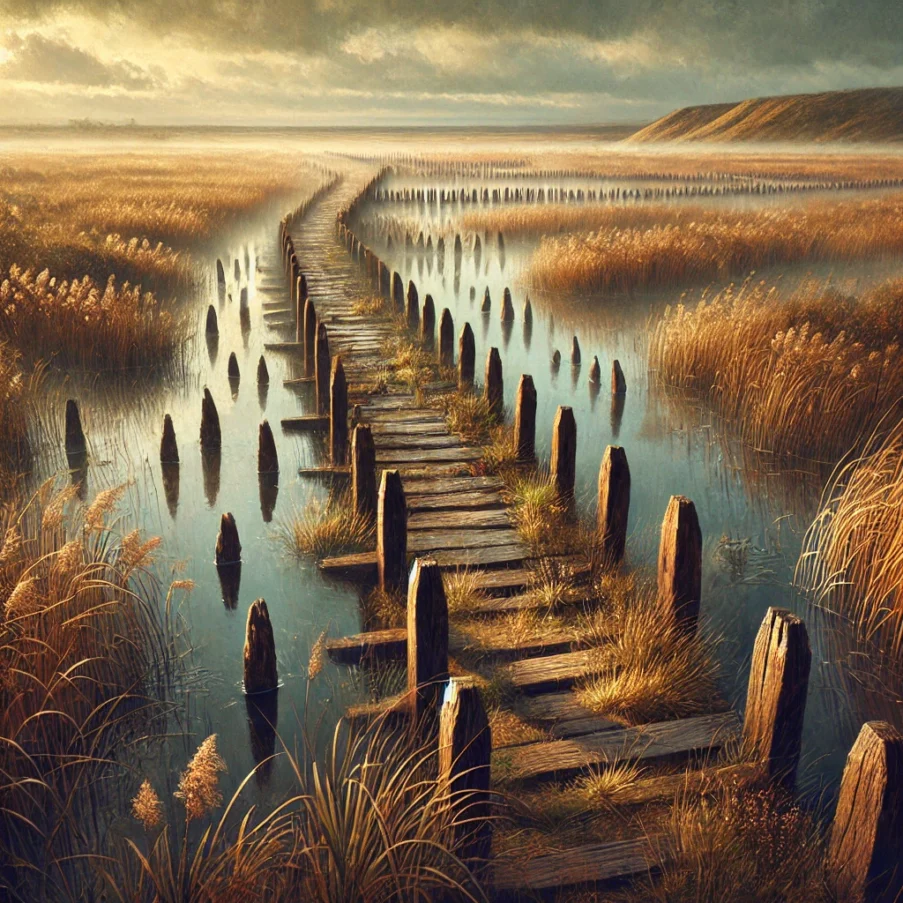
One of the most defining environmental factors of Thornborough & Nosterfield is its proximity to water, a key feature in many sacred prehistoric landscapes.
1️⃣ Seasonal Flooding & Riverine Influence
- Evidence from sediment cores suggests the presence of seasonal wetland conditions during the Mesolithic, which could have dictated temporary or seasonal human occupation.
- This aligns with the patterns at Star Carr, where Mesolithic hunters used lakeside locations for repeated visits, rather than permanent settlement.
- Could this have led to a pre-existing sacred association with water in the area, which later influenced the placement of the Thornborough Henges?
2️⃣ The Role of Springs & Wetlands in Mesolithic Beliefs
- In prehistoric Europe, water sources were often ritualized—a belief persisting into the Neolithic and Bronze Age.
- The abundance of marshland, streams, and underground water sources may have played a role in the site’s later significance.
- Potential parallel: The ritual wetland deposits found at Flag Fen (Cambridgeshire) and Star Carr suggest that Mesolithic peoples saw waterlogged landscapes as liminal spaces, where offerings or structures were placed to engage with spiritual forces.
Animal & Faunal Evidence: What Did They Hunt?
Although no major Mesolithic faunal assemblages were preserved in the Nosterfield report, we can infer hunting habits based on regional patterns:
- Primary Prey: Red deer, wild boar, aurochs (extinct cattle), and waterfowl—species adapted to both woodland and wetland environments.
- Smaller Game: Mesolithic groups also hunted hares, beavers, and otters, using rivers as natural hunting corridors.
- Fishing & Gathering: Given the marshy conditions, it is highly likely that fish, molluscs, and edible wetland plants (e.g., reed tubers) were a seasonal food source.
This aligns with evidence from Mesolithic Star Carr, where hunting camps were seasonally occupied near wetlands. If similar activity occurred at Nosterfield, this could be an early clue as to why later peoples continued to return to this landscape.
Critical Environmental Questions
❓ Did the Mesolithic people begin the ritual significance of this landscape through hunting patterns, seasonal return cycles, or sacred associations with water?
❓ Could the environmental changes (forest clearance, flooding, drying phases) have gradually transitioned the site into a pre-henge ritual space?
❓ Why is there no mention of Mesolithic environmental impact in mainstream discussions of Thornborough? Could this absence be masking an earlier origin story for the site’s sacred role?
Conclusion:
The Mesolithic environment of Nosterfield was not a static backdrop—it was a living, changing, and possibly ritualized space long before the Neolithic builders arrived. Given the ritual use of watery landscapes in later prehistory, we should reconsider the idea that Thornborough Henges and its surrounding areas were ‘empty’ before Neolithic construction. Instead, we must ask:
Did the Thornborough complex inherit an already-sacred landscape that began with Mesolithic peoples?
This environmental analysis suggests that the answer is far from simple.
Neolithic (4000–2500 BC): Monumentality & The Rise of the Henges
The Neolithic at Nosterfield aligns with the broader expansion of monumental architecture in Britain. The proximity to the Thornborough Henges strongly suggests that this site was within the sphere of Neolithic ceremonialism. However, there remains an inexplicable gap in the official report regarding substantial Neolithic finds at the quarry.
Key observations include:
- Potential Timber Structures or Pit Features: Although no definitive Neolithic structures were identified, it remains possible that ephemeral wooden monuments were constructed but later erased by quarrying activities.
- Finds of Worked Flint & Lithic Assemblages: Despite the lack of major monument remains, the recovered lithic materials indicate localized tool production and processing activities.
- Absence of Confirmed Burial Evidence: Unlike other henges such as Avebury and Knowlton, which exhibit clear funerary usage, no Neolithic burials were explicitly reported at Nosterfield, raising the possibility of selective recording or site destruction.
Comparative Analysis:
When compared to major Neolithic ceremonial sites like Stonehenge and Avebury, several interesting discrepancies arise:
- Stonehenge & Thornborough: Both henge complexes appear to have been established within existing Mesolithic landscapes that held earlier ritual significance. However, while Stonehenge evolved into a burial-focused monument, Thornborough appears more aligned with astronomical or processional functions, which might explain the absence of Neolithic burials at Nosterfield.
- Priddy Circles & Knowlton Henges: These sites also exhibit multi-phase usage, but unlike Nosterfield, they have clearer evidence of Neolithic funerary deposits. The lack of Neolithic burials at Nosterfield could indicate that its primary role was processional rather than funerary—or that later activity erased earlier deposits.
- Castle Dykes & the Iron Age Connection: The discovery that Castle Dykes henge in Wensleydale was an Iron Age construction challenges the assumption that henge use ended in the late Neolithic. If Nosterfield was similarly repurposed in later periods, it might explain the Neolithic silence in the report—a shift from ritual use to practical or defensive functions.
This comparison suggests that while Nosterfield was clearly part of the wider Thornborough ritual landscape, its role was either selectively erased from the record or fundamentally different from the henge centres themselves. Further investigation is required to determine whether deliberate archaeological oversight, quarry destruction, or genuine absence of remains accounts for this discrepancy.
Neolithic Environmental Data: The Ritualization of the Landscape
By the Neolithic period (4000–2500 BC), the Nosterfield-Thornborough landscape had undergone significant environmental changes, shaping the way early communities interacted with their surroundings. The transition from Mesolithic hunter-gatherer occupation to Neolithic monument-building societies was accompanied by intentional landscape modification, a shift in vegetation, and possibly early agricultural activity.
Pollen & Vegetation Analysis: A Managed Ritual Landscape
-
Early Neolithic (4000–3000 BC):
- Woodland clearance increased significantly, with pollen records showing a decline in oak, hazel, and pine.
- The rise of grassland species suggests intentional clearing for pasture or visibility of monuments.
- Hazel and alder persisted in wetter areas, implying that woodland corridors may have been maintained deliberately.
- Could this have been part of a controlled, sacred landscape, rather than simple farming?
Mid to Late Neolithic (3000–2500 BC):
The establishment of Thornborough’s henges likely involved clearing massive swathes of land, making them highly visible from a distance.
- Charcoal layers suggest periodic burning events, possibly as part of ritual cleansing or land renewal practices.
- Maintaining an open, liminal space appears to have been a crucial feature of the Neolithic sacred geography.
Comparative Insight:
- A similar pattern of selective clearance around ritual sites is seen at Avebury, Stonehenge, and Priddy Circles, where visibility and alignments played a significant role in the monuments’ purpose.
- This aligns with theories that henges were meant to be seen from afar, reinforcing their status as gathering or ceremonial centres.
Soil Composition & Hydrology: A Site Defined by Water
The hydrological environment of Nosterfield suggests a strong interplay between sacred monument placement and access to water.
1️⃣ The Presence of Spring lines & Seasonal Wetlands
- Many Neolithic sites, including Thornborough, appear to be positioned near ancient spring lines.
- The presence of nearby water sources may have enhanced the ritual significance of the site.
- Some scholars argue that henges were intended as reflections of the cosmos, with water acting as a mirror for celestial movements.
2️⃣ Natural Water Drainage & Artificial Enhancement
- The chalk-rich soil composition would have made the area prone to natural drainage, reducing permanent waterlogging.
- However, some evidence suggests that ditches around henges may have been deliberately kept wet, turning them into ‘water sanctuaries’ akin to other Neolithic monuments.
- Could the Thornborough Henges and their surroundings have been part of a water-linked ceremonial complex, similar to Durrington Walls’ connection to the River Avon?
Comparative Insight:
- This echoes patterns at Knowlton Henges, where lowland water systems influenced ritual placement.
- The association of water with spiritual transformation could suggest a long-standing reverence for the Nosterfield-Thornborough landscape as a liminal zone.
Animal & Faunal Remains: Ritual Deposits or Sustenance?
Though faunal remains from the Neolithic are sparse, comparisons with regional sites allow us to infer the role of animals in ritual and economy.
Domesticated Species:
- The presence of cattle, sheep, and pigs at comparable sites suggests a shift toward animal husbandry, likely including offerings within henge contexts.
- At Durrington Walls (Stonehenge), animal remains show feasting events, possibly mirroring activity at Thornborough.
Deer and Wild Fauna:
- Red deer and aurochs remains found at other Neolithic sites indicate their continued importance in ritual and subsistence.
- Could ritual hunting or offerings have taken place at Nosterfield?
Comparative Insight:
- Causewayed enclosures and henges often contain animal bones within their ditches, suggesting ritual deposits.
- The potential absence of formal animal remains at Nosterfield might indicate later disturbances or selective excavation biases.
Critical Environmental Questions
❓ Was the Thornborough-Nosterfield landscape deliberately modified to emphasize monument visibility?
❓ Could water have played a role in defining the sacred geography of the site?
❓ Were there animal offerings or ritualistic deposits that remain unreported or lost due to modern excavation methods?
❓ Did Neolithic people perceive the Nosterfield landscape as a ‘thin place’—a bridge between worlds, defined by water, visibility, and celestial alignments?
Conclusion: The Environmental Context of a Sacred Neolithic Site
By the Neolithic period, the Nosterfield-Thornborough landscape was no longer just a passive environment—it was an actively curated sacred space.
- The intentional clearing of land, the alignment of henges, and the role of water in the ritual process all suggest a deep spiritual significance tied to the environment itself.
- The comparative absence of preserved faunal remains raises questions about excavation methodology and Preservation Bias.
As we move into the Bronze Age, we must consider whether this structured sacred landscape continued its ritual function or experienced shifts in meaning and use.
Bronze Age (2500–800 BC): A Shift in Purpose?
The Bronze Age at Nosterfield presents an interesting transition from the large-scale communal ritualism of the Neolithic to more localized and hierarchical expressions of status and burial. Unlike the grandeur of henges, this period introduces a greater emphasis on individual burials and small-scale ritual deposits.
Key Bronze Age features at Nosterfield include:
- Beaker-associated burials – Indicative of shifting burial customs towards more personalized grave goods and social stratification.
- Metalwork deposits – Possible ritualized deposition of prestige goods in waterlogged areas, as seen at Flag Fen and similar wetland sites.
- Evidence of round barrows – A notable departure from the Neolithic use of henges, suggesting a focus on ancestral veneration and territorial markers.
Iron Age (800 BC – AD 43): Burials, Rituals, and Unanswered Questions
The Iron Age archaeology at Nosterfield presents some of the most intriguing yet underexplored findings. Several key features suggest a complex ritual and funerary landscape, potentially linked to the Brigantes, Parisi, or other regional groups.
Key Iron Age features include:
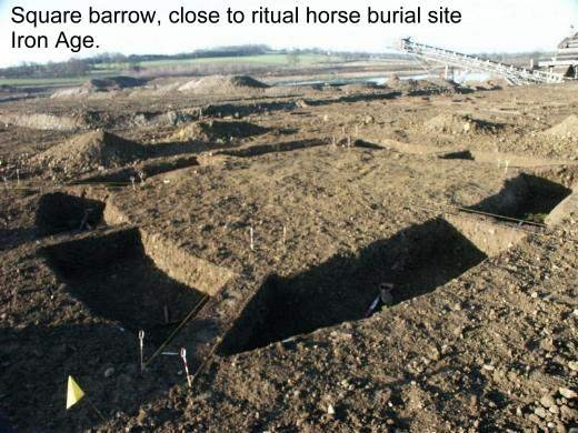
- Two Square Barrows: The presence of square barrows is highly unusual in Brigantian territory, as they are more commonly associated with the Parisi of East Yorkshire. Could this indicate cultural exchange, elite burial practices, or an incursion of Parisi influence?
- Four-Horse Burial: The deliberate deposition of four horses suggests a high-status burial, possibly linked to chariot burials or elite ritual sacrifices. Given that Iron Age horse burials are relatively rare, this finding requires further scrutiny.
- Ditch Skeleton: A human skeleton found within a ditch raises questions about social out-casting, ritual sacrifice, or an unusual burial practice.
- Iron Age Post Alignments: One post alignment appears to be directed towards the northern henge, suggesting a deliberate relationship between Nosterfield and Thornborough’s ritual complex. This strengthens the argument that henges remained significant beyond the Neolithic period.
Iron Age Square Barrows & Burials
Two square-ditch enclosures (F304 and F320) were identified in Intervention 5SE, each measuring approximately 10m square. Their ditches were excavated and found to be 0.75m and 0.42m in depth, respectively
F320/F337 contained an inhumation burial (F335), identified as a male aged 30 to 40 years, dated via radiocarbon to 135±35 BC (SUERC-3780 GU-12284).
F304/307 lacked datable material, but due to its similarity in form and sequence, it has been tentatively assigned an Iron Age date.
Significance: These structures suggest elite burial practices, possibly of high-status individuals. Their recutting over time indicates long-term veneration of the site.
Iron Age Skeleton (Ditch Burial)
The skeleton (C1754) was buried in a supine, semi-flexed position within the partially backfilled ditch of F320. This individual suffered from muscular strain and had two healed fractures on the left forearm, possibly a defensive wound
A horse molar was found between the legs, suggesting a potential ritual association with the horse burial nearby.
The body position—hands placed under the left side of the face—was highly unusual, potentially signifying a deliberate ritual gesture.
Significance: The injuries indicate either battle-related trauma or intense labour. The presence of horse remains suggests a cultural link between warriors and horses
Four-Horse Burial
- A quadruple horse burial (F316) was discovered 9m east of F304/307, within a sub-rectangular pit (2.90m x 2.40m, up to 0.60m deep)
- Two skeletons were largely intact, while remains of two others were recovered via zooarchaeological assessment.
- A horse femur returned a radiocarbon date of AD 50±35 (SUERC-2974 GU-11688C), placing it at the very end of the Iron Age.
Significance: The close proximity to the square barrows suggests a ritual connection. The presence of horses in ritual pits elsewhere in Britain supports an elite status link to equestrianism and warrior culture.
Broader Iron Age Remains & Potential Concealment
Additional Iron Age features were found but minimized or poorly contextualized within the report:
Pit Alignments & Ditches
- A rectilinear enclosure with pit alignments suggests land division during the period
- Ritual deposits within some pits, including burnt animal remains, point toward sacrificial activity
Additional Burials & Metalworking Evidence
Human remains from a Cremation pit (F82) indicate fragmentary Iron Age funerary practices.
The report mentions Iron Age metallurgy, but offers no detailed analysis of slag or tools found, which is suspicious
Comparative Analysis:
- The square barrows share similarities with East Yorkshire’s elite burials, yet their presence at Nosterfield suggests a broader power dynamic.
- The four-horse burial can be compared to finds at Wetwang and Arras, possibly denoting high-status warrior or elite funerary rites.
- The post alignments may suggest a continuation of henge-related activity into the Iron Age, reinforcing the site’s ritual and symbolic importance.
This evidence demands further scrutiny, particularly in the context of ongoing excavation biases and potential gaps in recorded data.
Suspicious Omissions & Bias
The Iron Age presence is significantly underplayed in the conclusions of the report. Given the scale of the finds—multiple burials, structures, and ritual deposits—the suggestion that this area was “not significantly occupied” contradicts the evidence.
Could this downplaying of evidence relate to modern land-use concerns (quarrying rights)?
Why was no deeper analysis conducted on the Iron Age metalworking and settlement indicators?
Key Findings:
- Square barrows & warrior burials indicate elite status burials.
- Skeleton in the ditch (C1754) suffered injuries suggestive of combat or hard labour.
- Horse burials & ritual deposits confirm strong warrior-horse associations.
- Enclosure & pit alignments indicate complex land use, yet this is underreported.
- Iron Age findings appear minimized or obfuscated, warranting deeper scrutiny.
Next Steps for Investigation:
- Re-evaluate radiocarbon dating & artifact context for better chronologies.
- Search for metallurgical evidence to determine technological presence.
- Compare with other Iron Age elite burial sites to refine interpretations.
- Investigate possible suppression of findings in archaeological conclusions.
Final Thought:
The Iron Age community at Nosterfield was likely much more significant than reported. The deliberate placement of burials, horses, and ritual deposits suggests an elite, warrior-led society that may have been politically inconvenient for certain narratives. Further investigation is needed to correct the historical record.